
Natural History of the Kaeng Krachan Forest Complex
Kaeng Krachan Forest Complex
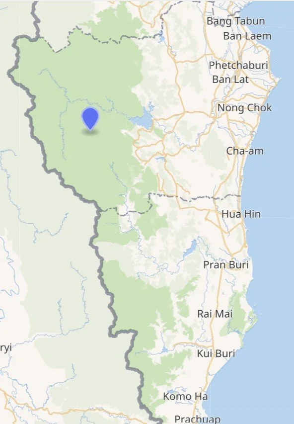
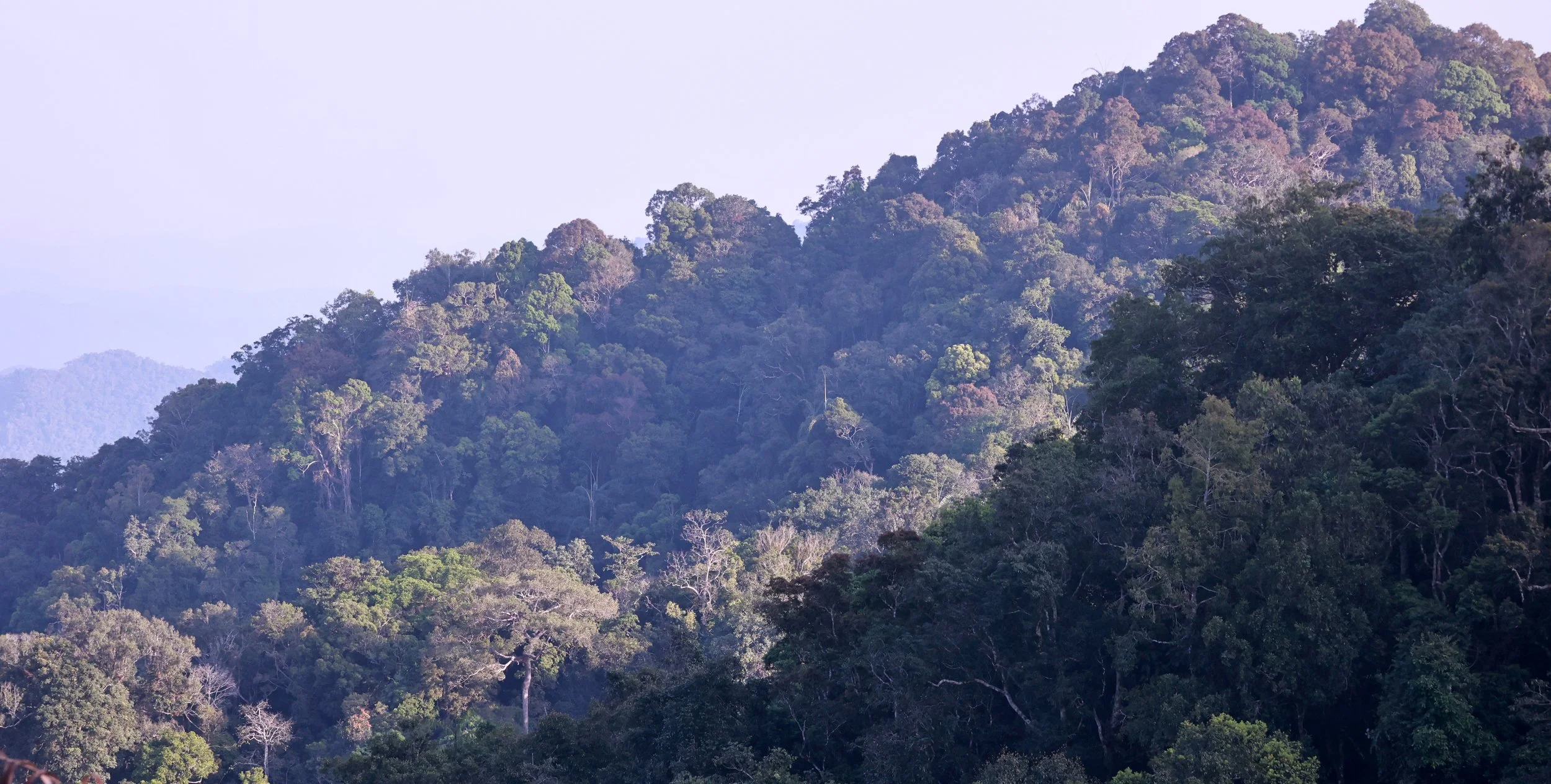
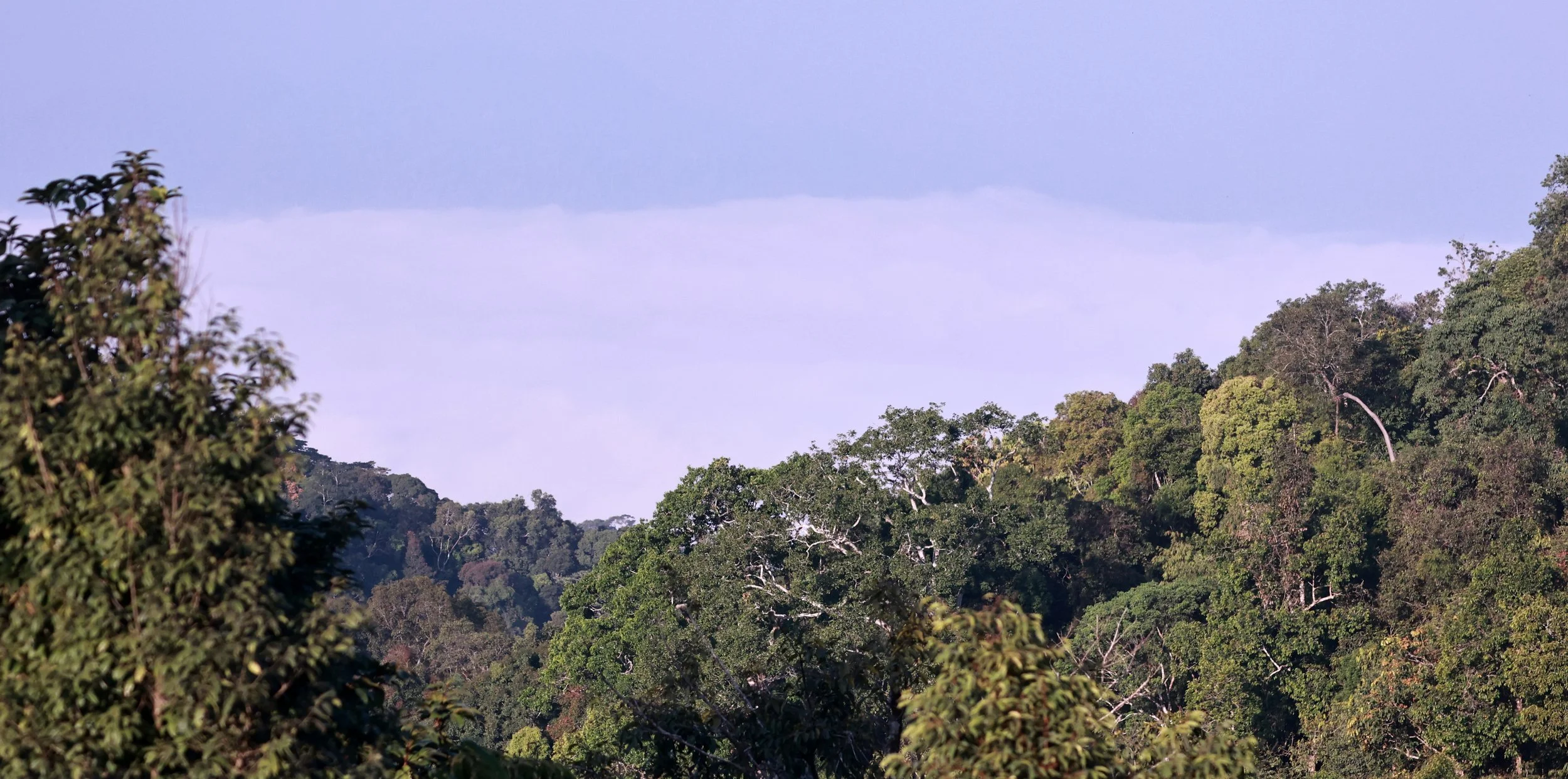
Satellite view of the northern portion of the KKFC highlighting the unbroken forest cover. So sweet!
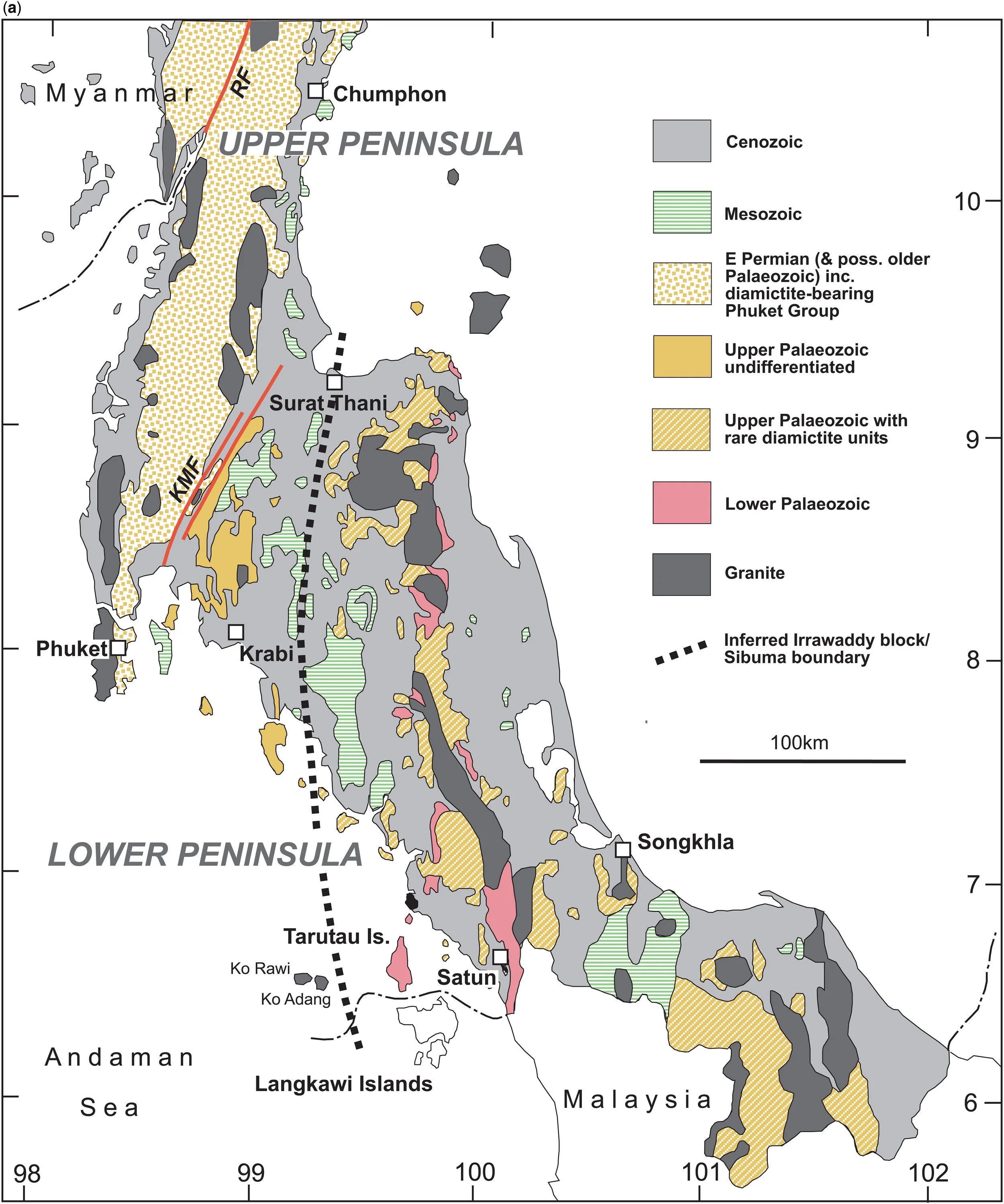
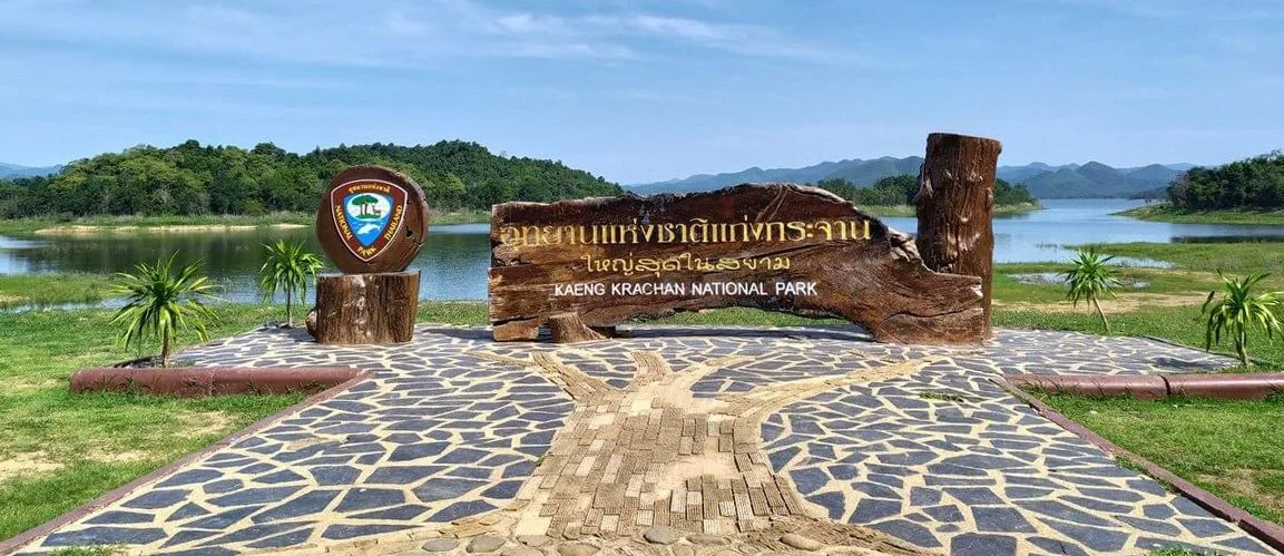
Hidden along the rugged Tenasserim Mountain Range and stretching across Thailand’s western frontier lies one of Southeast Asia’s most precious wilderness areas: the Kaeng Krachan Forest Complex (KKFC). Covering an impressive 4,702 km², this UNESCO World Heritage Site stands as the largest national park system in Thailand and a sanctuary for some of the region’s most iconic and endangered wildlife.
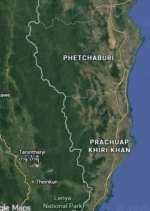
Designated a UNESCO Natural World Heritage Site in 2021, the KKFC holds “outstanding universal value” for biodiversity conservation. Its sprawling landscape spans the provinces of Phetchaburi, Prachuap Khiri Khan, and Ratchaburi, forming a critical ecological bridge between Thailand and Myanmar.
The complex is made up of four protected areas:
Kaeng Krachan National Park
Kui Buri National Park
Chaloem Phrakiat Thai Prachan National Park
Maenam Phachi Wildlife Sanctuary
Khao Sam Roi Yod (not officially part of the KKFC but connected via geology and floristic aspects and I have added it to this case study)
Together, they form a vast green corridor of semi‑evergreen and moist evergreen forests, shrouded in humidity and fed by the headwaters of the Pranburi and Phetchaburi rivers.
Home to more than 490 documented wildlife species, the KKFC is a sanctuary for some of Southeast Asia’s most elusive animals. Among the remarkable creatures living here and pictured in the galleries of this case study:
Endangered Indochinese tigers
Melanistic Indochinese Leopards
Asian elephants
Eight species of wild cats
Rare hornbills, reptiles, amphibians, and an immense variety of insects
This dynamic ecosystem is one of Thailand’s last remaining bastions for apex predators and large mammals, making it a cornerstone of conservation efforts in the region.
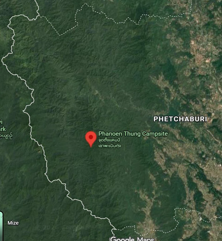
One of the forest complex’s most famous viewpoints, Khao Phanoen Thung is renowned for its breathtaking “sea of fog”—a surreal morning layer of clouds that rolls over the mountain peaks like a living ocean.
Much of the KKFC is rugged and requires 4WD vehicles. Some zones have restricted access to protect sensitive habitats, so visitors should check regulations before traveling.
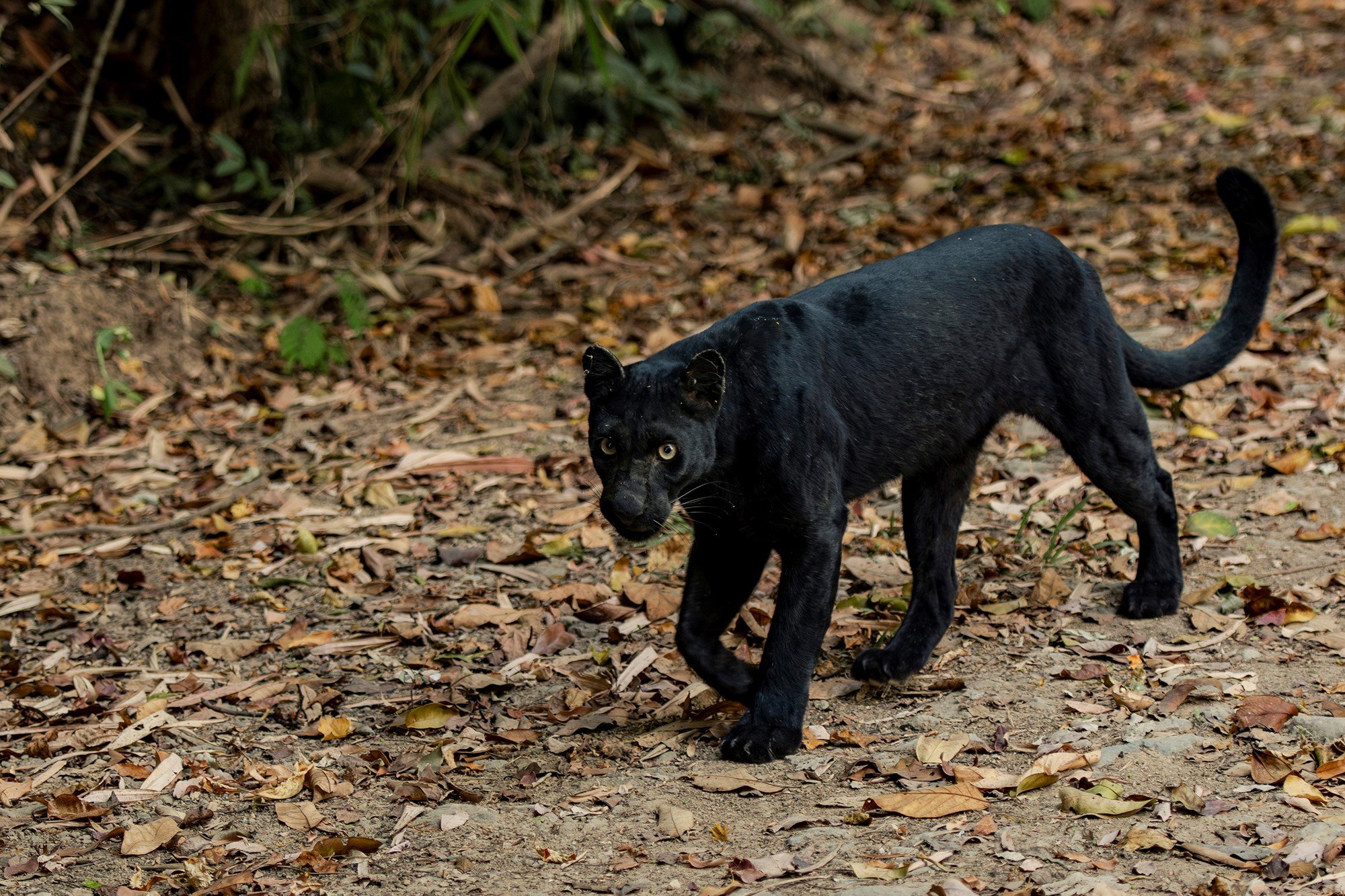
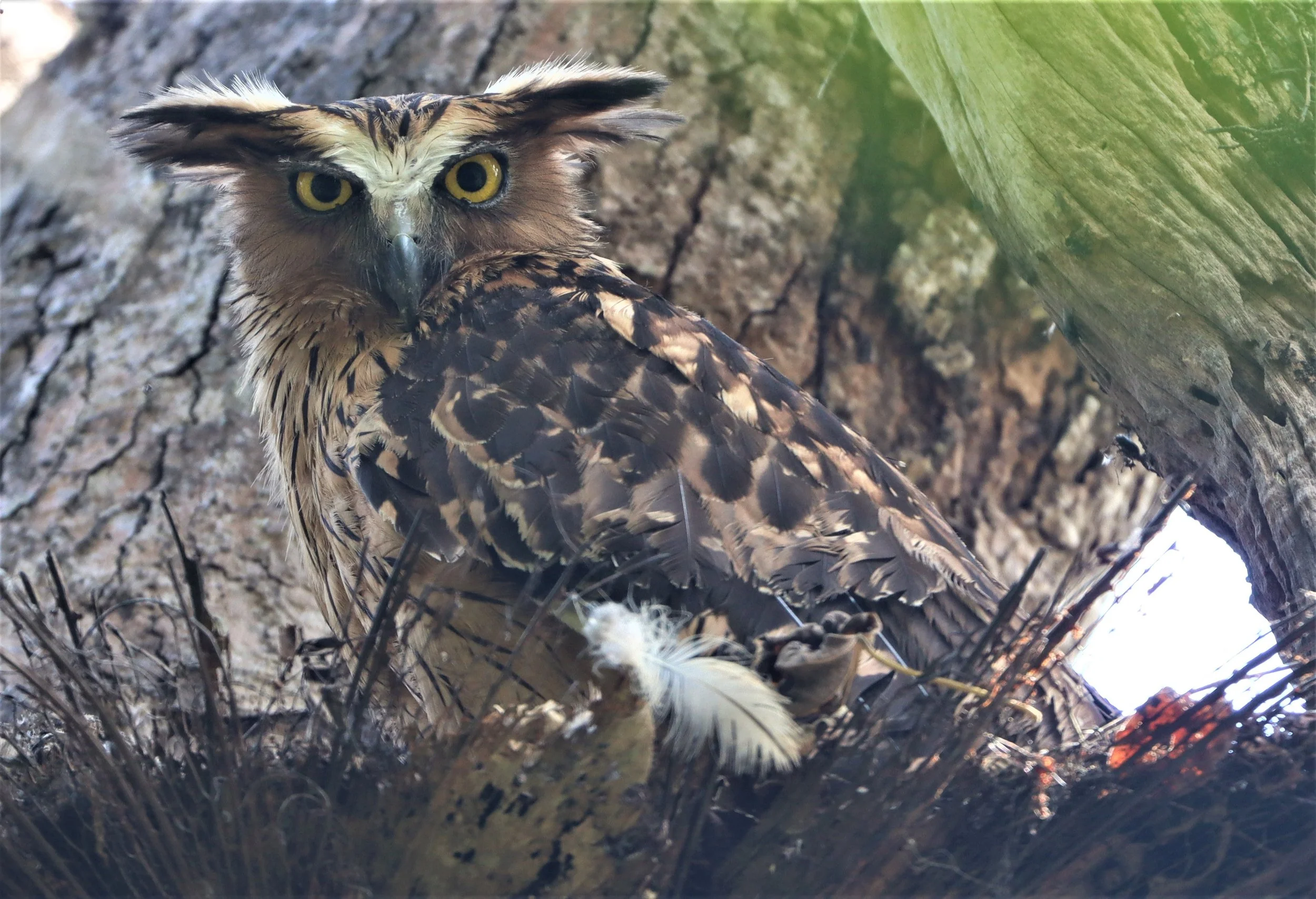
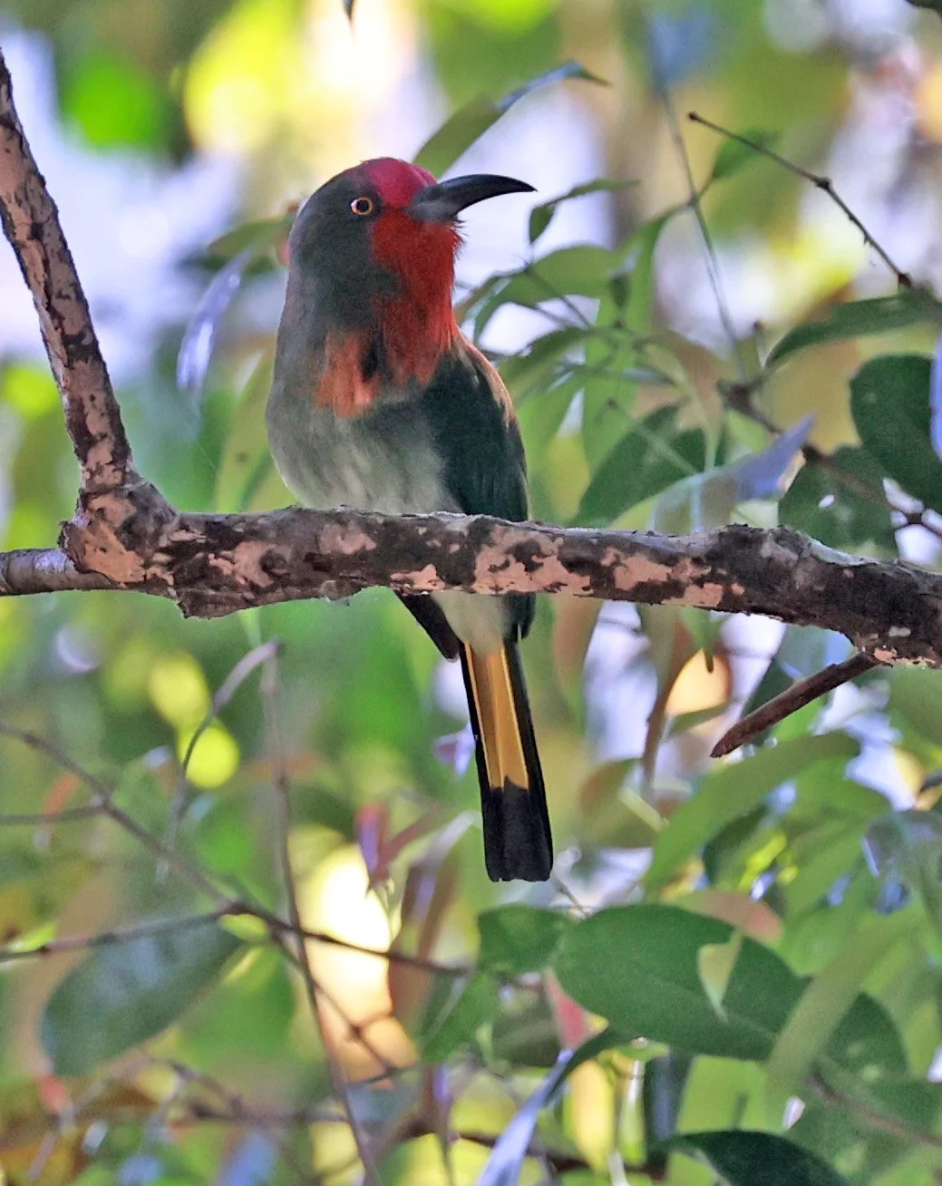
Indochinese Leopard (Panthera pardus delacouri) Photo by Jon Hall and Jirayu Ekkul
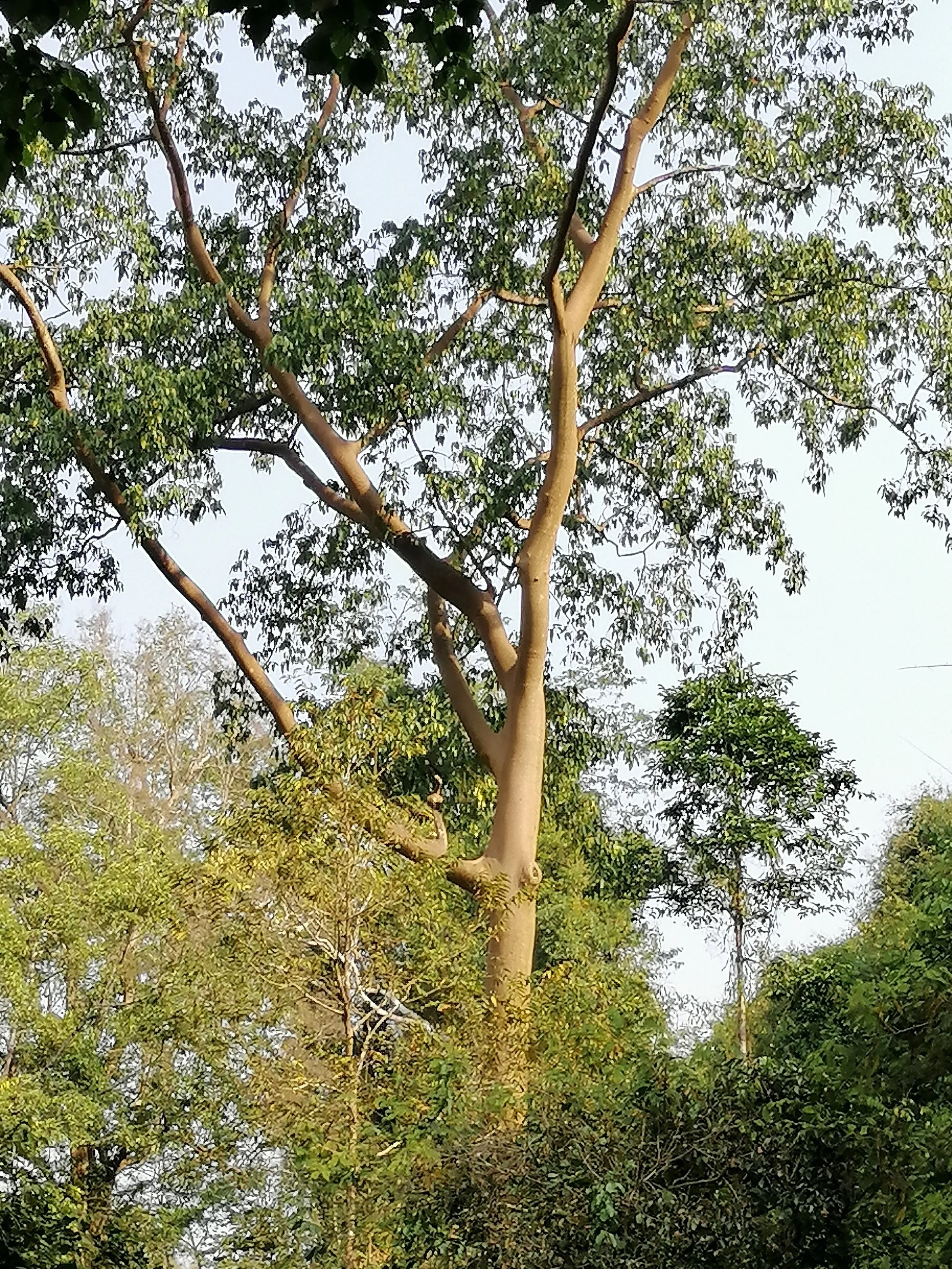
Kaeng Krachan National Park is the largest national park in Thailand and is the cornerstone of the KKFC, covering 2,915 km² (1,125 sq mi) of forested terrain along the border between Phetchaburi and Prachuap Khiri Khan provinces. It forms the eastern slopes of the Tenasserim Range, a long north–south mountain system that runs along the Thai–Myanmar border. The park also contains the headwaters of two major rivers—the Phetchaburi and Pran Buri Rivers—both originating in its mountainous interior. [huahintoday.com][alchetron.com]

Kaeng Krachan’s famous Thale Mog - “Sea of Fog”
The terrain is dominated by dense evergreen rainforest, steep mountain peaks (including a summit reaching about 1,513 m near the Myanmar border), valleys, streams, karst formations, and cloud forest zones at higher elevations. The park’s vast forest forms part of the internationally recognized Kaeng Krachan Forest Complex, designated a UNESCO World Heritage Site due to its ecological richness. [huahintoday.com]
Kui Buri National Park,the second largest unit of the KKFC, is located in Prachuap Khiri Khan Province along Thailand’s Tenasserim Hills, is one of the country’s most celebrated wildlife destinations and forms part of the broader Kaeng Krachan Forest Complex. Established in 1999 and covering 969 km², the park’s landscape consists of mixed terrain—rolling hills, savannas, and dense evergreen forests—that support rich biodiversity. [thaination...lparks.com], [nationalpa...iation.org]
The park is best known for its remarkable wildlife, particularly its thriving population of wild Asian elephants—one of the healthiest in Thailand—as well as large herbivores such as gaur, sambar deer, and banteng, and predators like leopards and occasionally tigers. Over 260 bird species have been recorded here, alongside reptiles, primates, and smaller mammals, making Kui Buri one of the most biodiverse forest ecosystems in the region. The mosaic of open grasslands and lush forests provides ideal feeding grounds for elephants and gaurs, contributing to the reliability of wildlife sightings for visitors. [thaination...lparks.com], [nationalpa...iation.org]
Local farmers at Kui Buri supplementing their income by taking tourists on “Elephant Safaris”
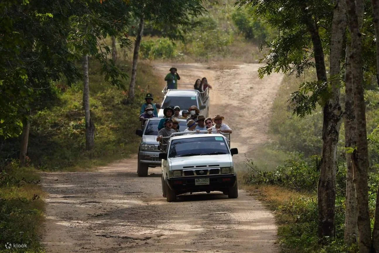
Perhaps the most innovative aspect of Kui Buri’s conservation story is its community‑driven elephant‑viewing program, designed both to support sustainable tourism and to reduce human–elephant conflict. Local communities, in collaboration with park authorities, manage designated wildlife‑watching zones such as the Huai Luek viewpoint, where controlled 4x4 tours take visitors to see elephants safely from a distance. By providing an alternative income stream for nearby villages, this initiative helps offset agricultural losses from elephant crop‑raiding and encourages locals to participate in habitat protection. As a result, the project has both reduced conflict and strengthened conservation outcomes, turning Kui Buri into a model for wildlife‑friendly community development in Thailand.
Much of this case study will be highlighting the various units of the KKFC where I have spent considerable time over the past decades. Kaeng Krachan National Park proper is where I have both worked and played countless times and without fail, every time I visit I see something new and unexpected. I have added one chapter to this case study that may not make sense initially. Khao Sam Roi Yod is a nearby national park just minutes from Kui Buri and after a bit of research, I learned that it is geologically connected and the plant communities are an excellent compliment to the KKFC for areas long ago lost due to human intrusion. I realize this is controversial position and I am not prepared to defend it more than simply stated above. I have therefore left this segment to be a final note of sorts.
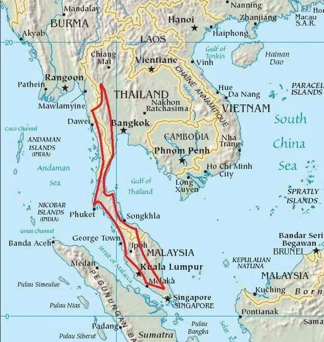
Satellite view of the KKFC highlighting the transboundary issue with Burma who actually has more forest cover than Thailand protected. (Well, protected on paper)
Biomes of Kaeng Krachan and the Surrounding Region
The Tenasserim Mountain range in the red zone. One of the most significant “Bio Hotspots” on the planet.
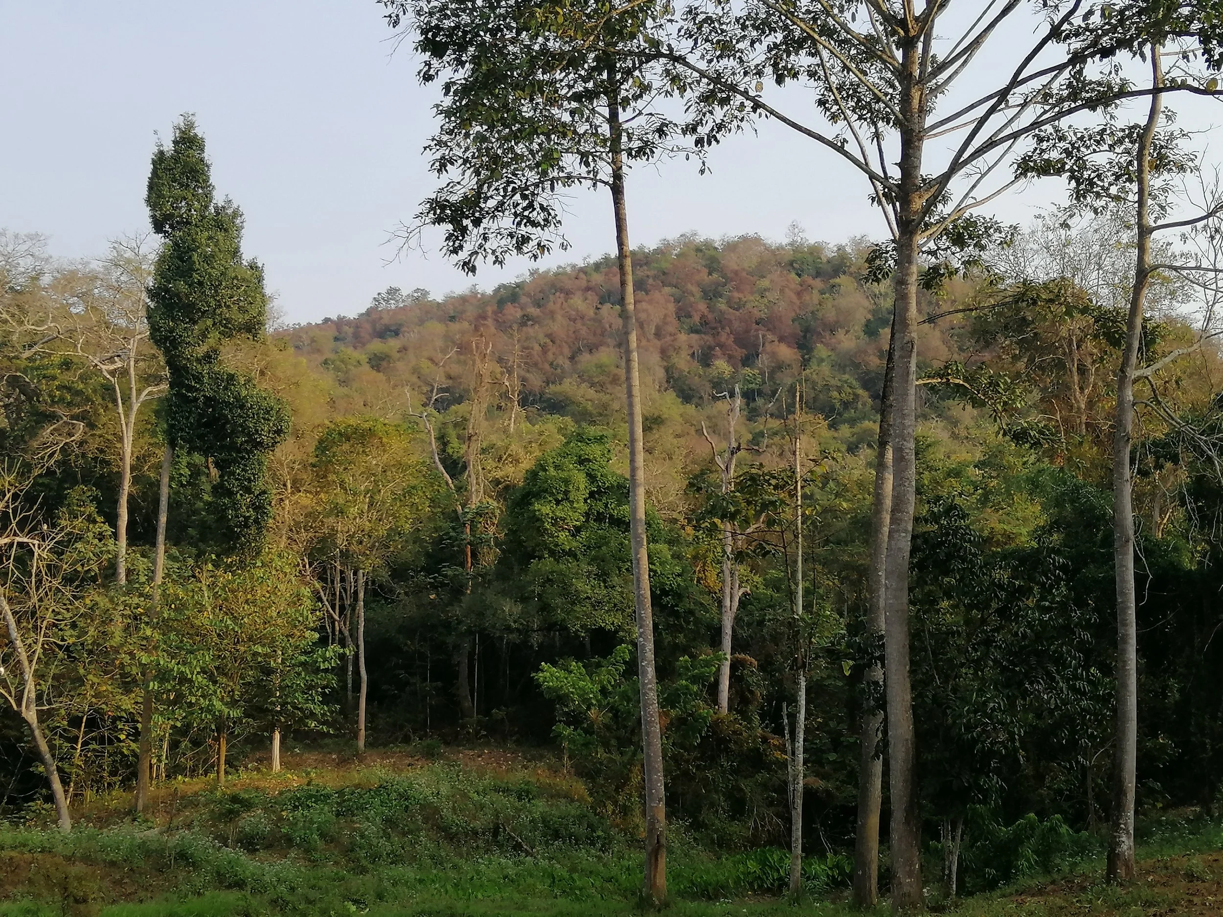
Kaeng Krachan lies within one of the most biodiverse forest landscapes in Southeast Asia, shaped by the climatic and geological gradients of the Tenasserim Mountain Range. The region hosts a mosaic of tropical forest biomes, largely dominated by semi‑evergreen/dry evergreen forests, moist evergreen forests, mixed deciduous forests, montane forests, and deciduous dipterocarp forests. These biomes reflect the interplay of altitude, rainfall, and soil conditions across the steep eastern slopes of the Tenasserim range. Semi‑evergreen and moist evergreen forests prevail in lower to mid‑elevation zones with high year‑round humidity, while mixed deciduous and deciduous dipterocarp formations appear in areas with more pronounced dry seasons. At higher elevations, the vegetation transitions into montane forest communities associated with cooler temperatures.
Kui Buri’s vegetation includes dry and moist evergreen forests dominated by species such as Dipterocarpus tuberculatus, Hopea odorata, Terminalia chebula, palms, bamboo, and teak, creating varied habitats across its valleys and slopes.
Rainfall patterns also shape the ecological mosaic. The region receives abundant moisture, particularly from May to October, feeding a dense year‑round green canopy where evergreen biomes dominate. This supports one of Thailand’s major watershed systems, with protected slopes maintaining intact hydrological regimes. Evergreen forests along the Tenasserim corridor form part of a larger transboundary continuum, linking Thai and Myanmar ecosystems, and help sustain the biological richness for which the Kaeng Krachan Forest Complex is internationally recognized. [whc.unesco.org]
Plant Communities and Floristic Composition

The vegetation of Kaeng Krachan is exceptionally diverse, containing species from Himalayan, Indochinese, and Sumatran floristic realms due to its biogeographical crossroads. Evergreen forests exhibit a multilayered structure with dense canopies, lianas, epiphytes, and shade‑tolerant understory shrubs. Mixed deciduous forests contain more open canopies with seasonal leaf fall, while deciduous dipterocarp forests consist of fire‑adapted, drought‑tolerant species in nutrient‑poor soils. Moist evergreen areas, especially in valleys and riparian corridors, host tall emergent trees and plant communities dependent on consistent water availability. These communities collectively contribute to the forest complex’s designation as a biodiversity hotspot, supporting both high plant endemism and vegetation types rare in mainland Southeast Asia. [whc.unesco.org], [aseanbiodi...ersity.org]
Montane plant communities are particularly distinct. At higher altitudes, forests transition into cooler, cloud‑influenced zones dominated by smaller‑crowned evergreens, moss‑laden trunks, and dense understories. The mix of evergreen and deciduous elements across elevation gradients highlights the region’s ecological complexity and the influence of microclimates formed by the Tenasserim topography. Such vertical zonation contributes to high habitat heterogeneity and supports a wide spectrum of plant species that change with altitude, slope orientation, and soil type. [whc.unesco.org]
Important and Notable Plant Species

Rama's Spittoon (Sapria ram) Kaeng Krachan National Park
Kaeng Krachan’s flora includes numerous valuable, ecologically significant, and culturally important tree and plant species. Among the notable taxa are several continental hardwood genera, such as oaks (Quercus), chestnuts (Castanopsis), and maples, particularly in upland evergreen zones where cooler microclimates allow these typically temperate species to thrive. These plants underline the region’s biogeographical connections to the Himalayan and Indochinese floras. [aseanbiodi...ersity.org]
In addition, the forests support several economically or culturally important tropical timber species. These include Makhamong (Afzelia), Takhian (Hopea), Chanthana (Tarena), Yang (Dipterocarpus), Tabak (Lagerstroemia), Pradu (Pterocarpus), and Kritsana (Aquilaria), the latter being the source of highly valued agarwood. Such species represent core components of the dipterocarp‑dominated forest communities, which form a major biome type within the forest complex. Dipterocarps, in particular, define much of the canopy structure, influence nutrient cycles, and provide key habitat resources for wildlife. [aseanbiodi...ersity.org]
These plant species collectively shape the ecological character of Kaeng Krachan, forming the foundation for a forest system that supports rich faunal diversity, including large mammals, rare birds, and endemic species. The presence of ecologically sensitive tree species—many of which occur only in intact old‑growth forests—highlights the importance of continued conservation efforts within this globally significant biogeographical corridor. [whc.unesco.org]
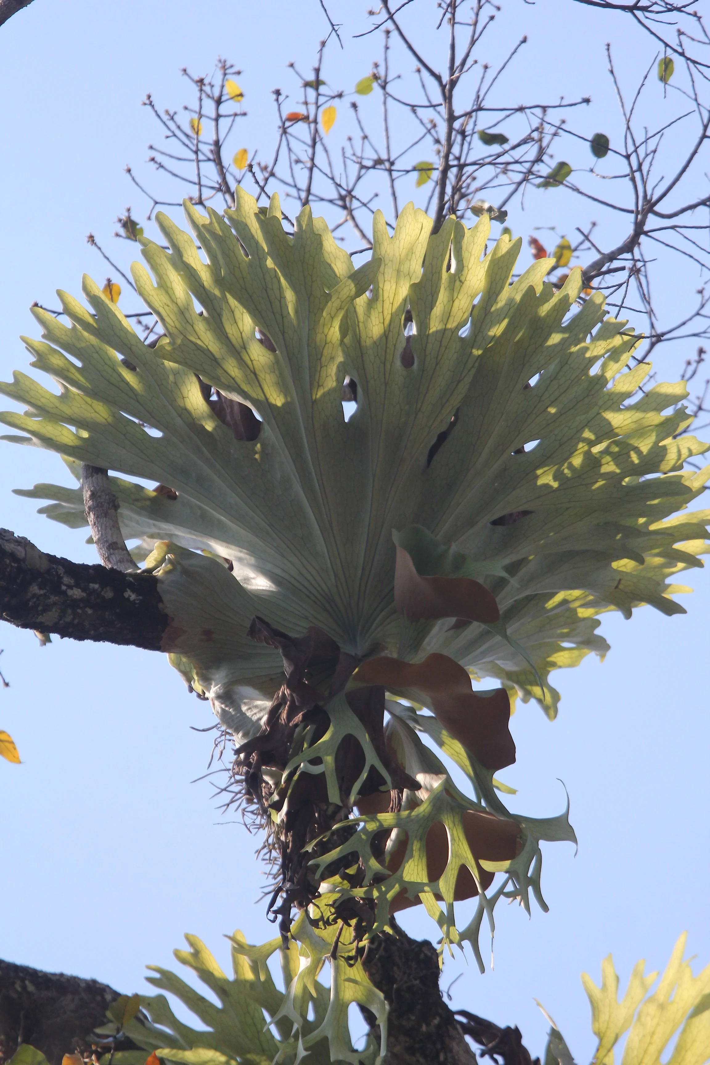
Staghorn Fern (Platycerium superbum), a large epiphytic fern that grows on trees rather than in the ground. It consists of broad, sterile shield fronds that hug the tree to collect organic matter and deeply lobed, antler-like fertile fronds that hang downward. They are native to tropical and temperate rainforests in Australia and Malaysia. These ferns can become massive, with shield fronds reaching up to a meter in width.
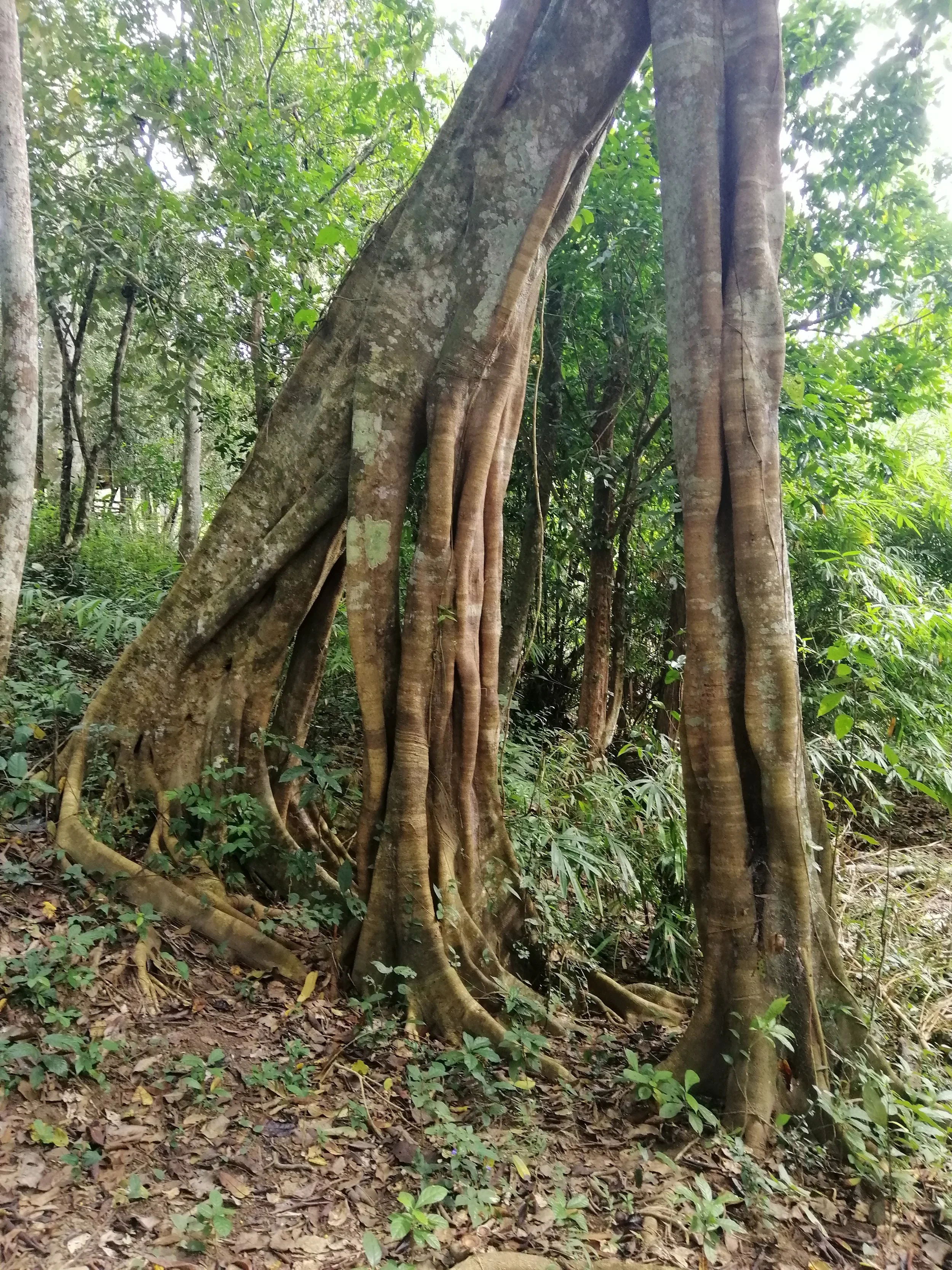
Strangler Fig (Ficus species) known for its complex root system that envelopes other trees or structures. This leaning tree is famous and well photographed at Bang Krang Campsite in Kaeng Krachan NP.
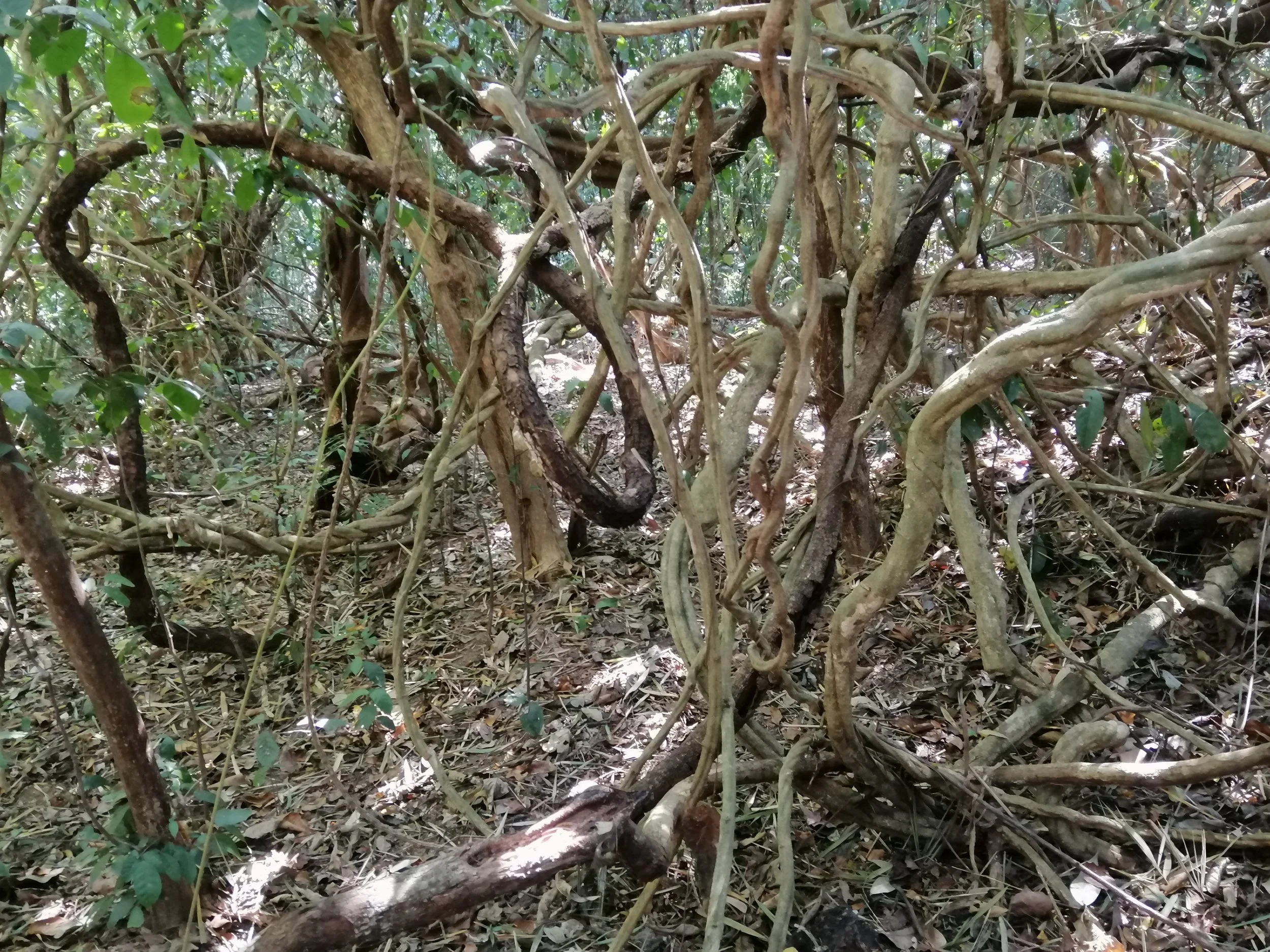
A thicket of lianas, which are long-stemmed, woody vines rooted in the soil that climb up trees to reach the canopy.
Entada rheedii (often spelled Entada rheedei) is a massive woody climber known locally as Saba Mon (สะบ้ามอญ) or simply Saba (สะบ้า). This liana is famous for producing some of the world's largest seed pods, which can reach up to 2 meters in length.
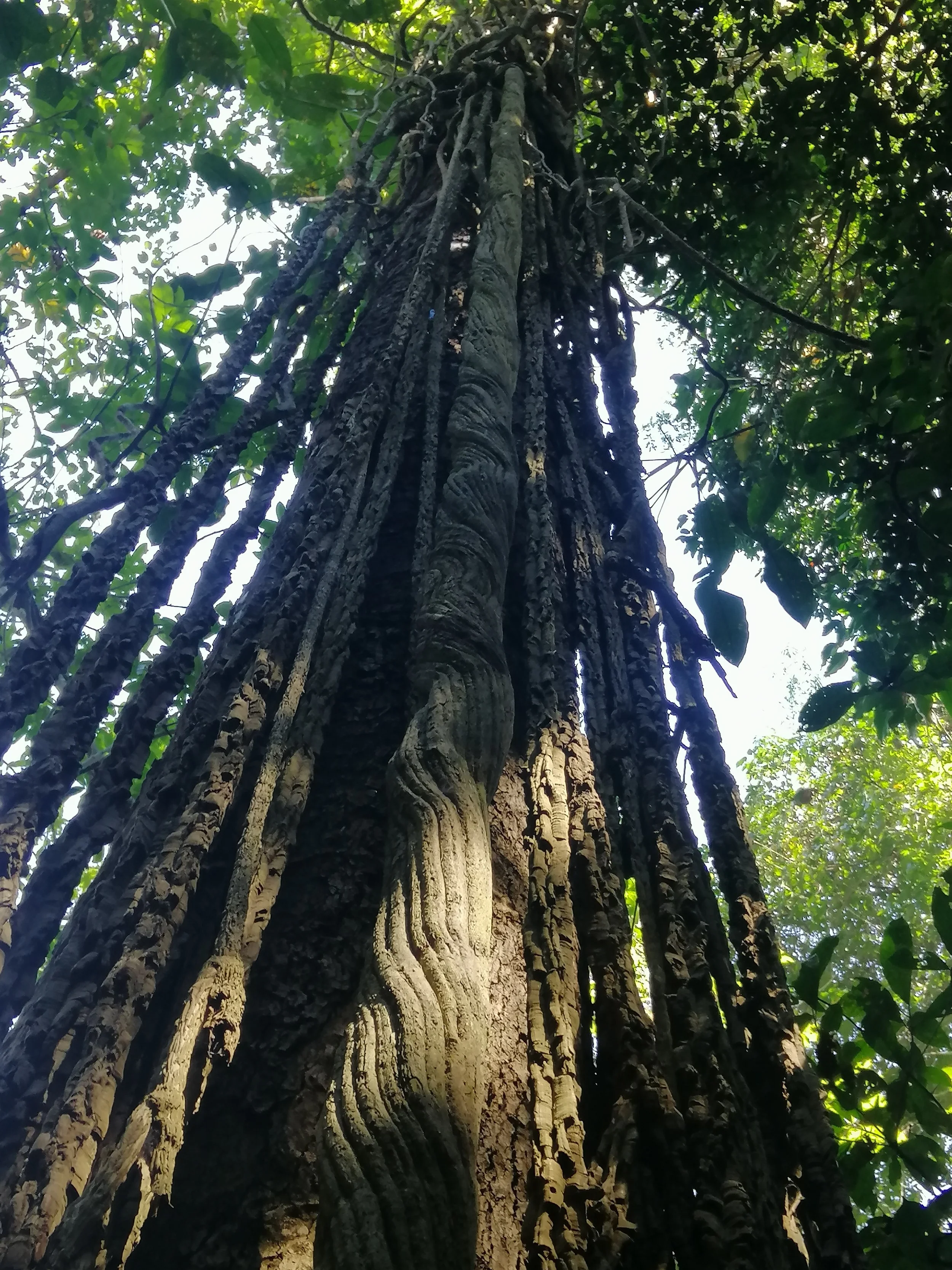
This tree is near Bang Krang Campsite and is actually an exhibit on lianas even though these seem like aerial roots of a strangler fig. My assumption is these lianas attached to this tree when it was young and grew up with the tree over the years. The main liana in the middle of the image is clearly very old.
This is a famous Ficus species tree along the main road (km 6-8) in Kaeng Krachan. This tree is exemplifies the "grocery store of the jungle" phenomenon in that it attracts dozens of species of birds and mammals when it bares fruit. One of my highpoints with this tree was watching a large troop of Stump-tailed Macaques (Macaca arctoides) with nearly 35 individuals feasting on the ripe figs and causing the fruit to literally rain down on my kids.
This tree is Ficus albipila, which is a rare species of fig tree found in parts of Southeast Asia. It is known to grow in flood plains and forested areas.The tree can reach significant heights and has distinctive branching patterns.
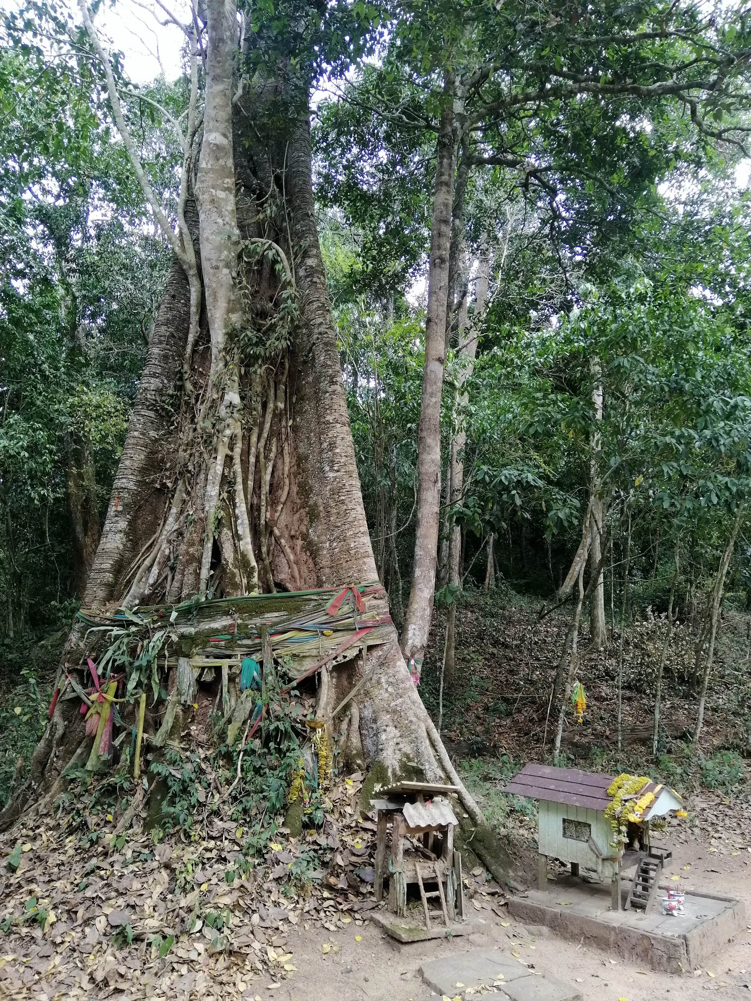
Makka Tree (Tetrameles nudiflora). The namesake tree for Baan Maka, the premier eco-resort for Kaeng Krachan. The colorful cloths wrapped around the base indicate that local Thai people consider the tree spiritually significant, believing it is inhabited by a guardian spirit.
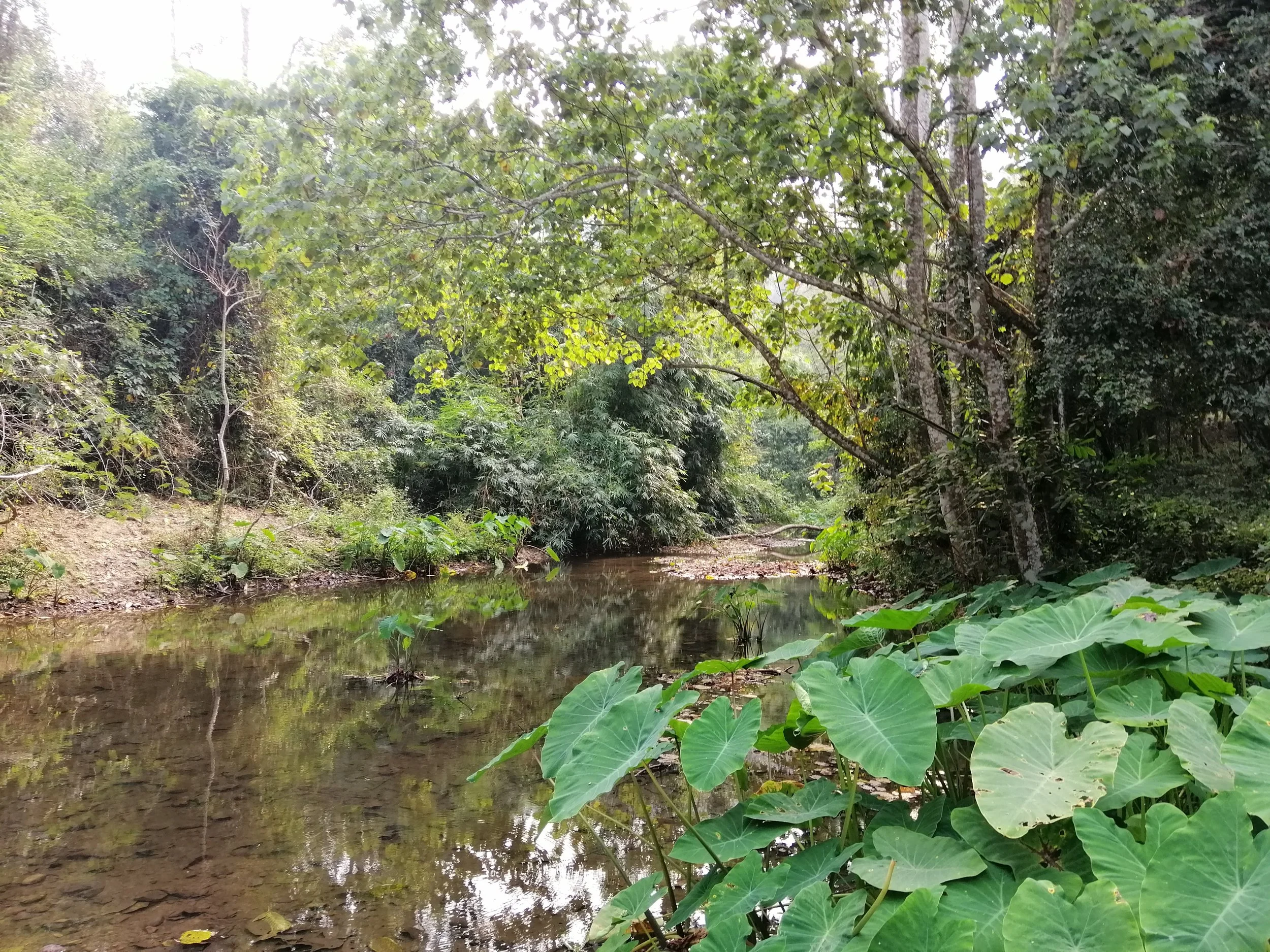
There are two main rivers in the park; Phetchaburi and Pran Buri Rivers. Both rivers originate from the Tanaosri Mountain Range. In the north, Phetchaburi River flows into Kaeng Krachan Dam and flows further east all the way out to the Gulf of Thailand. Pran Buri River flows south to Prachuap Khiri Khan Province, into Pran Buri Reservoir and out to the Gulf of Thailand. This creek is a tributary to the Petchaburi River and is easily accessed in the Bang Krang Campsite
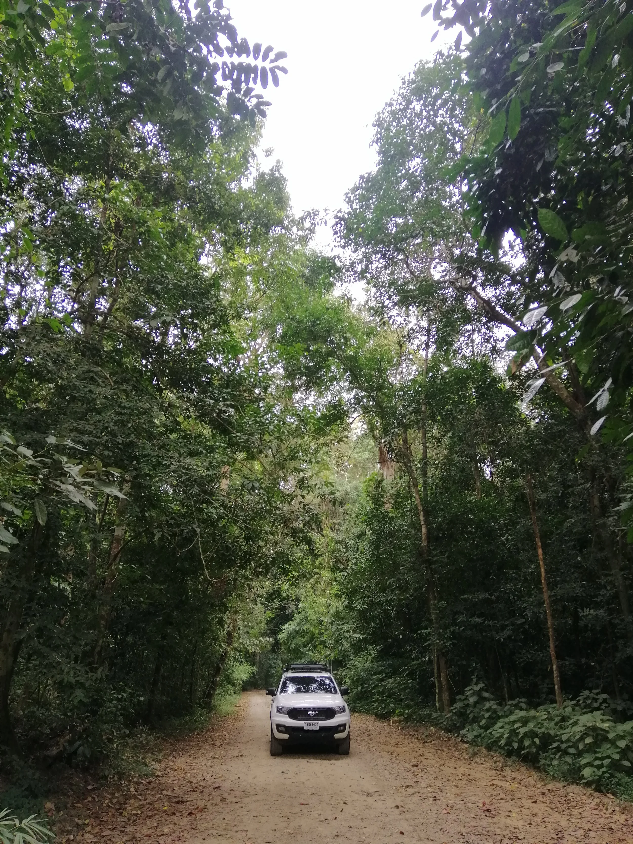
My rig making its way through the second-growth forest of Kaeng Krachan between stream 2 and 3.
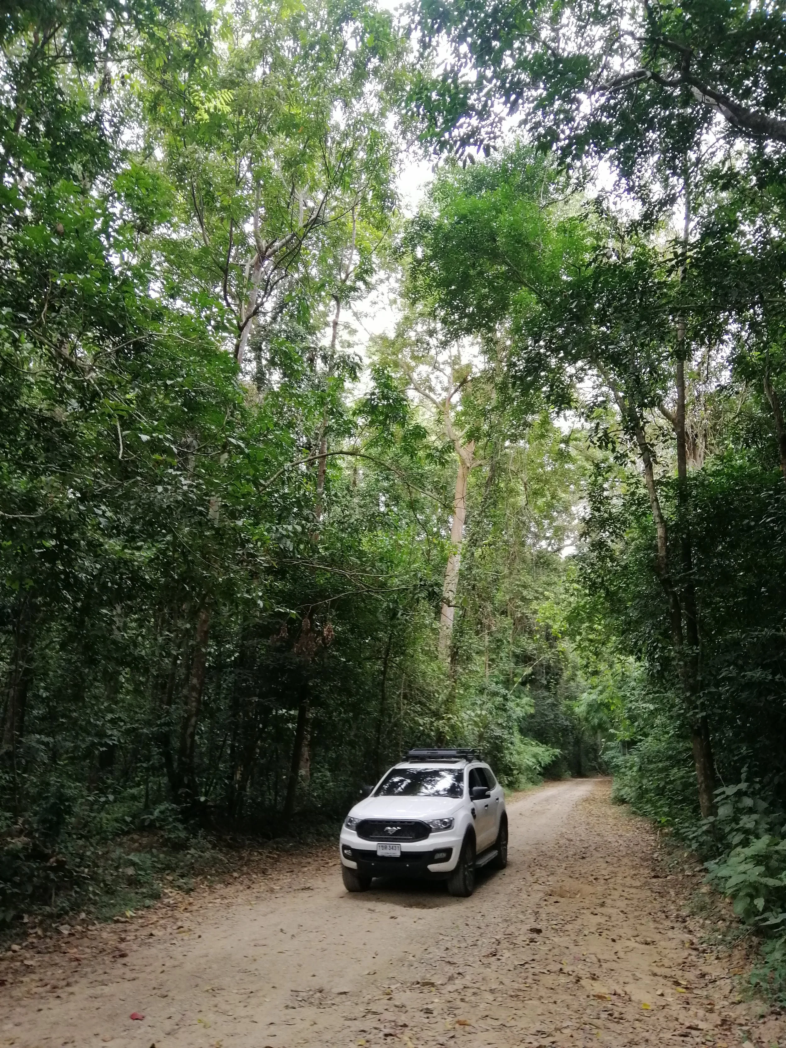
This is the main and only road to the core area of Kaeng Krachan
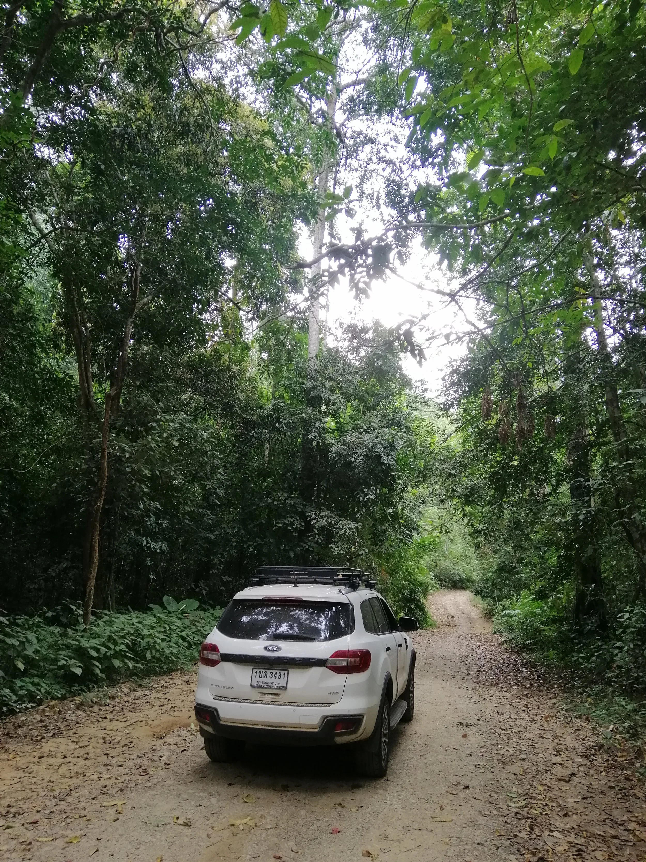
This road is an easy all-vehicle capable dirt track until km 18-19 where it because a 4x4 only track that has specific hours for going up and returning down.
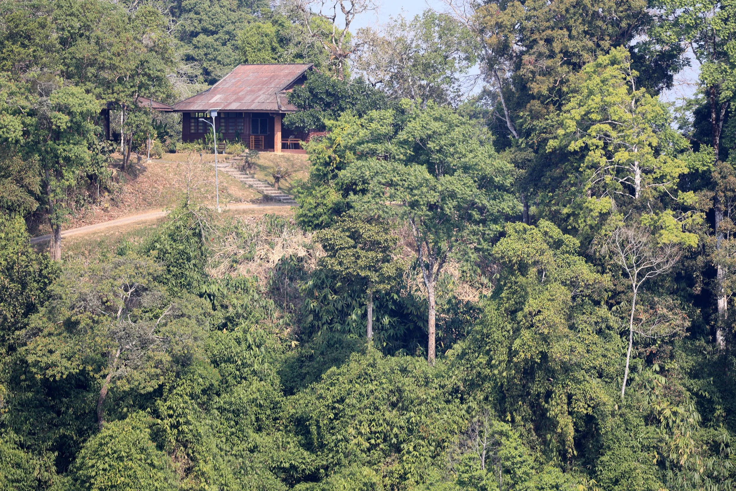
Chalet at Phanoen Thung
Kaeng Krachan's Tropical Evergreen Forest. At altitudes up to 1500 m, this dense, humid jungle.
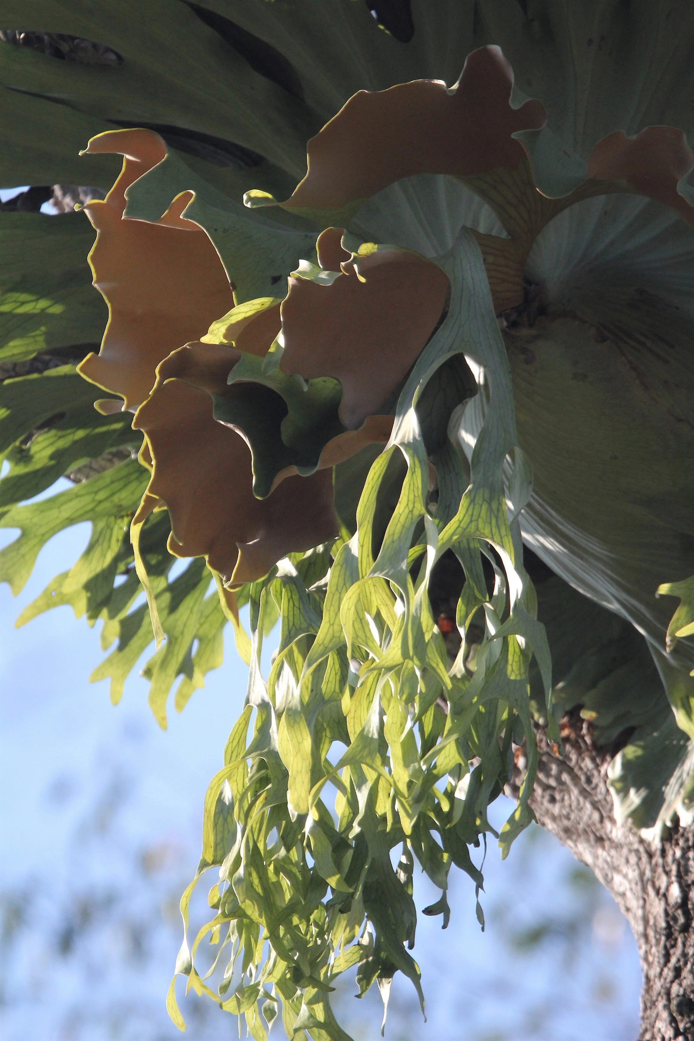
Staghorn Fern (Platycerium superbum) are native to tropical and temperate rainforests in Australia and Southeast Asia. These ferns can become massive, with shield fronds reaching up to a meter in width.
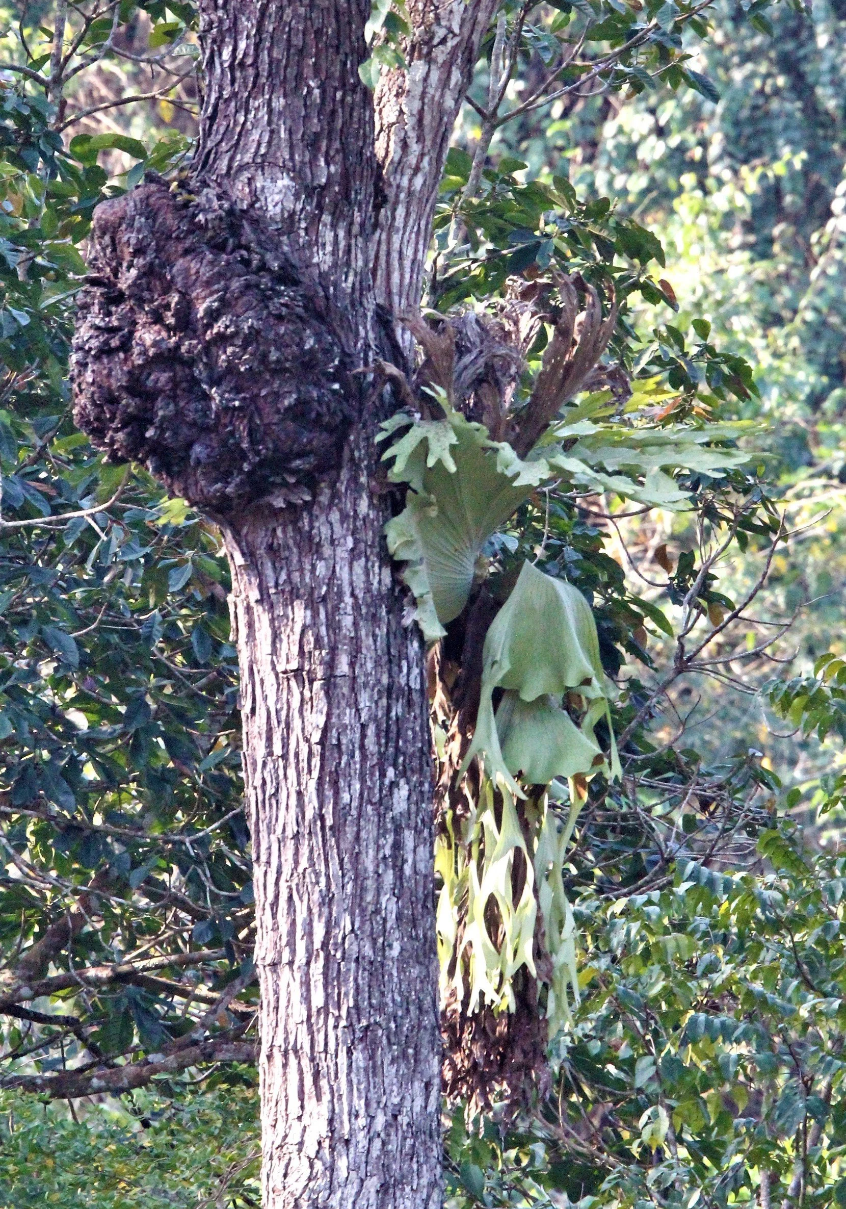
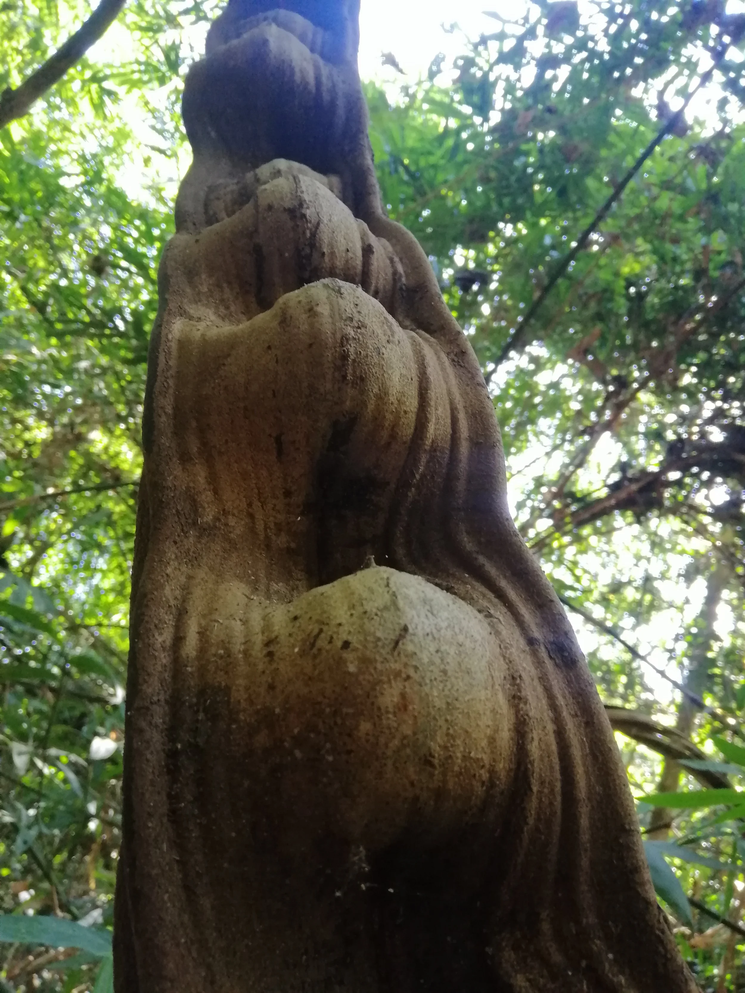
Tree burl, a type of growth on a tree where the grain has grown in a deformed manner. Burls are often caused by stress factors such as injury, infections, or insect infestations. They consist of deformed dormant buds that grow into characteristic knots and swirls. While they may not directly kill the tree, they can reduce its overall vigor.
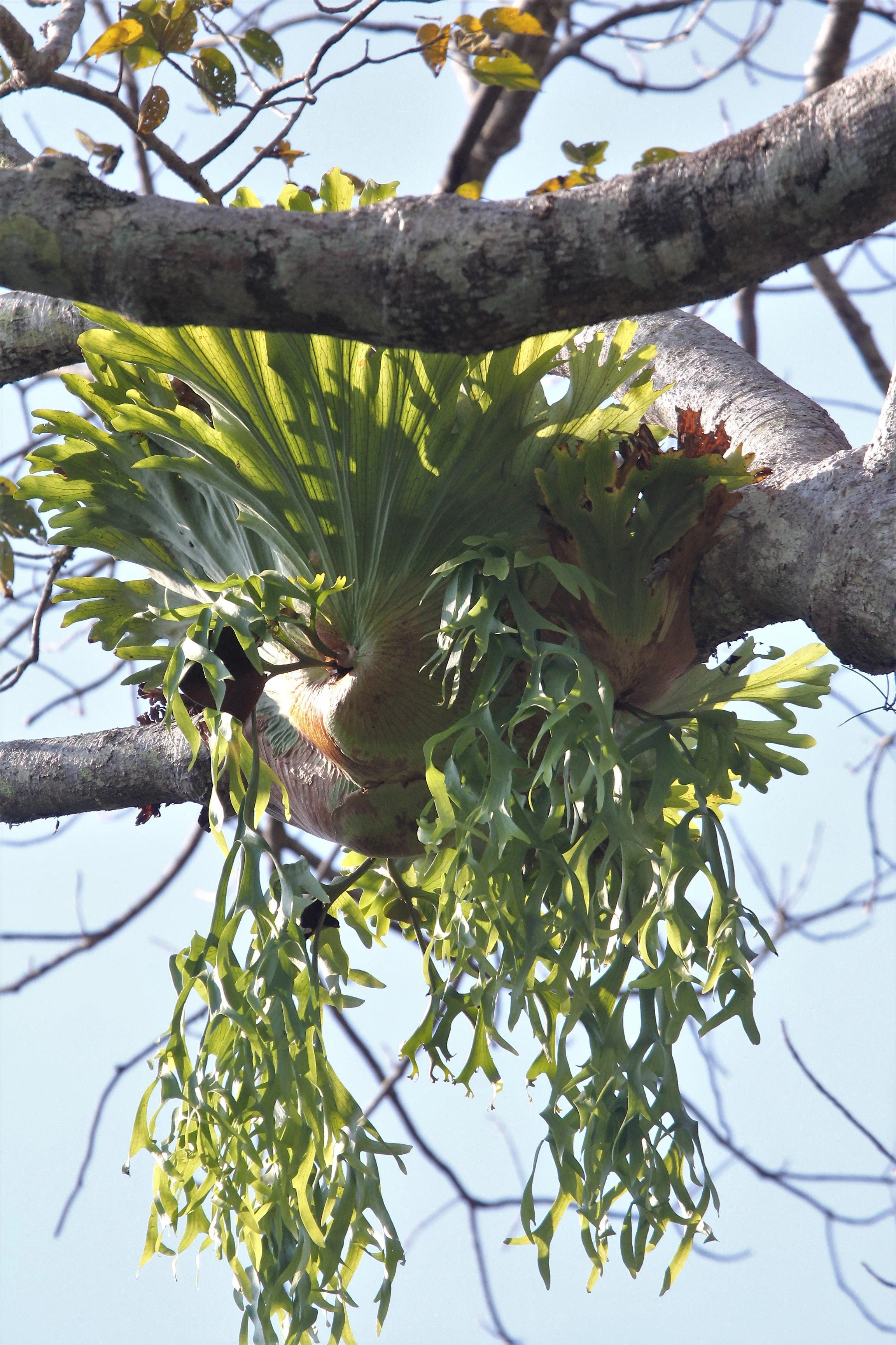
Staghorn Fern (Platycerium superbum) can become massive, with shield fronds reaching up to a meter in width.
Thale Mog - "Sea of Fog" as seen from Phanoen Thung above 1500m
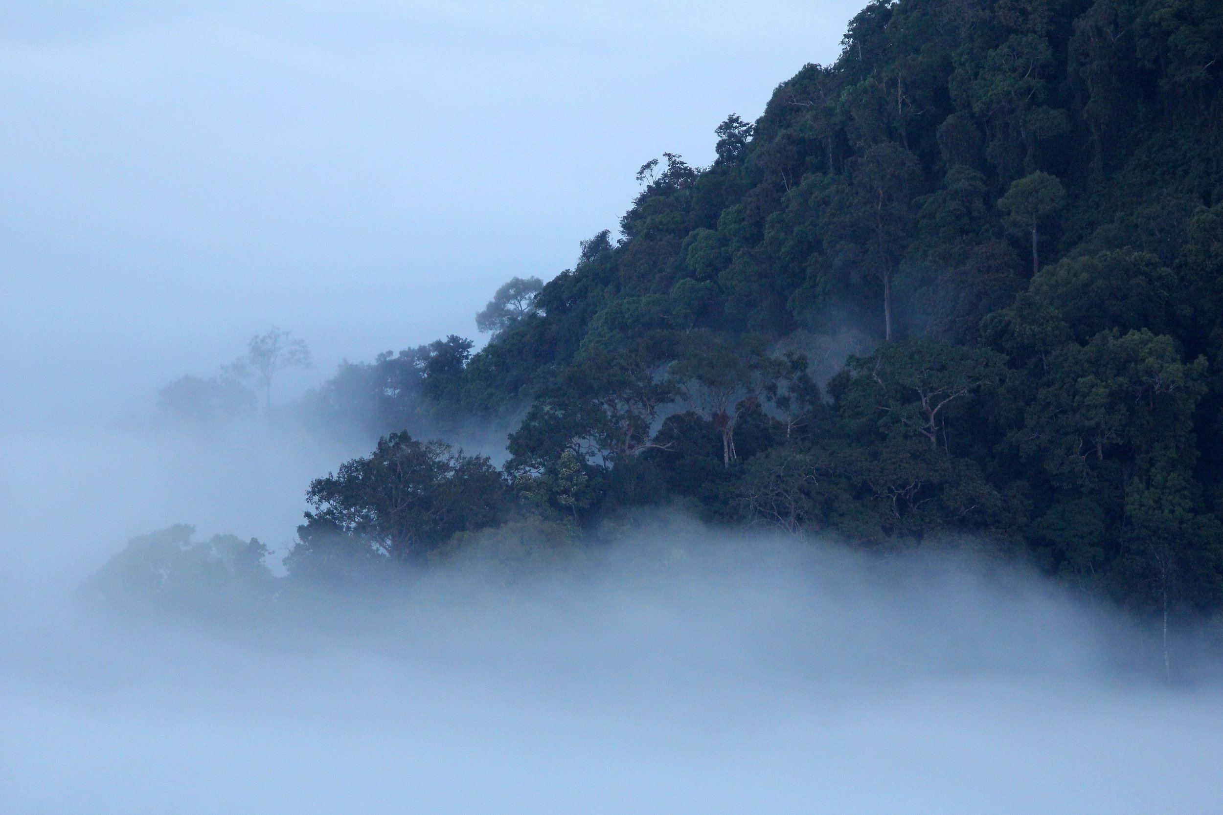
Spectacular Thale Mog in the morning at Phanoen Thung.
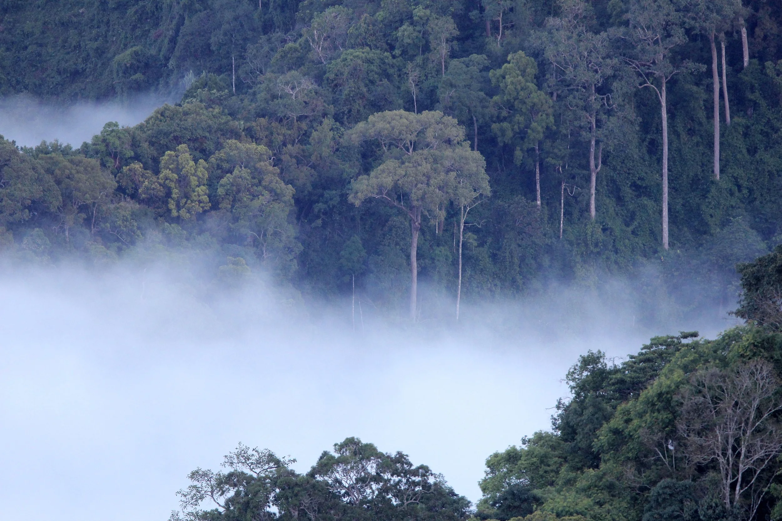
Thale Mog (sea of fog/mist) and similar dense, low-lying morning fogs are primarily caused by thermal inversion (also known as a temperature inversion). A thermal inversion creates the perfect conditions for fog to form and stay trapped in low-lying areas, such as valleys, basins, or coastal areas


Thermal Inversion Causes Fog (Thale Mog) During clear, calm nights, the ground loses heat rapidly through radiation. The ground cools the air directly above it, creating a layer of cold, dense air trapped at the surface. A layer of warmer air moves in or remains above this cold air, acting as a lid that prevents the cooler, lower air from rising. Because the cold air is trapped, its temperature drops to the dew point, causing moisture in the air to condense into water droplets, forming a "sea of fog".

If the inversion is strong and the sun is weak (common in winter), the fog can last for several days.

"Thale mog" is frequent in valleys or hilly areas where cold, dense air drains down from higher elevations and gathers in low spots, trapped by the warmer air above.

Sapria ram, commonly known as "Rama's spittoon" (Thai: กระโถนพระราม), is a rare, parasitic flowering plant endemic to Thailand, belonging to the Rafflesiaceae family. It is known for its striking, fleshy, and vibrant pink-red to maroon, cup-shaped flowers that bloom on the forest floor.

Sapria ram, commonly known as "Rama's spittoon"
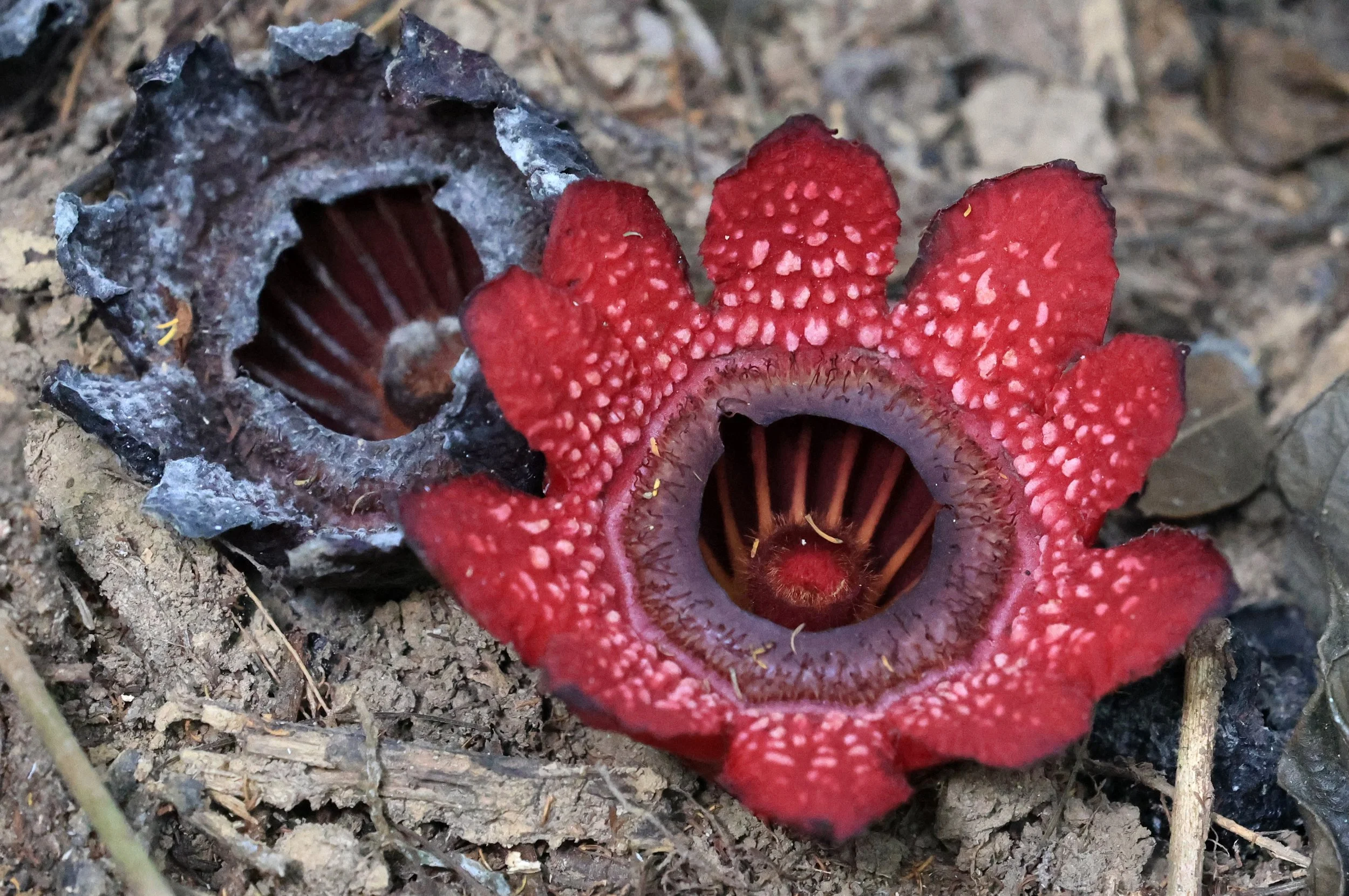
Sapria ram, commonly known as "Rama's spittoon" with an older flower that is in the process of dying.
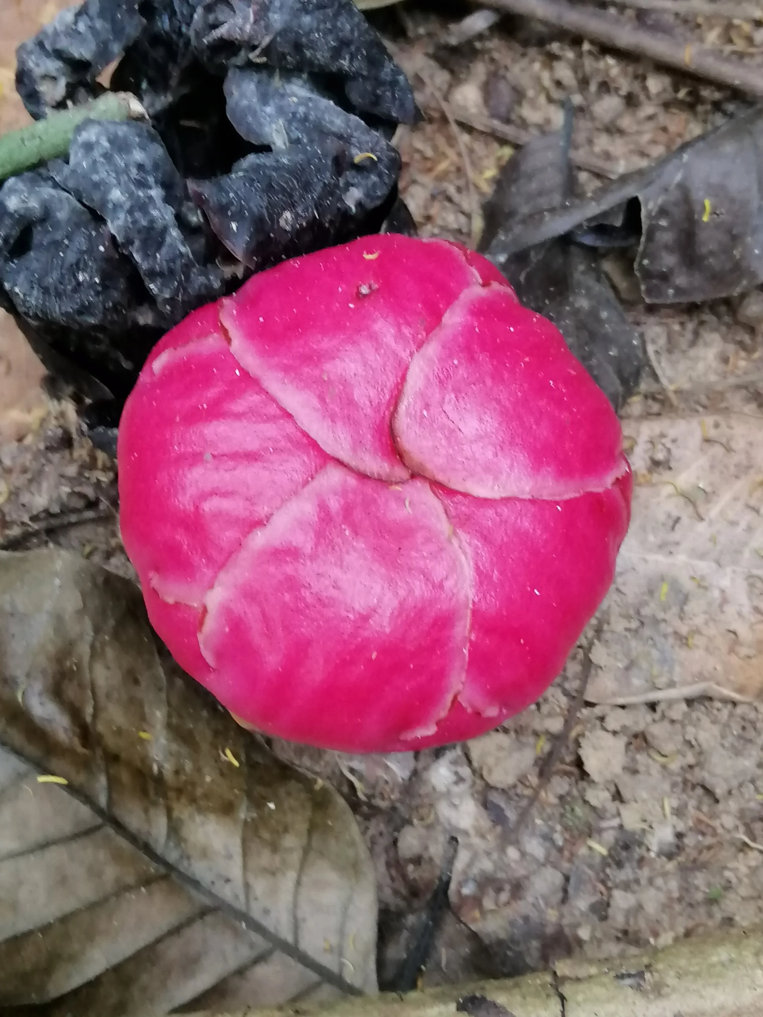
This is a flower bud of the rare, parasitic flowering Sapria ram, commonly known as "Rama's spittoon". It is a holoparasitic plant, meaning it depends entirely on a host plant (specifically vines in the genus Tetrastigma) for nutrients. The buds are large, bright pinkish-red, and circular before opening into small flowers about 8-10 cm in diameter. It is found on the forest floor in Thailand, particularly in national parks like Kaeng Krachan.


Lovely views toward the west. Burma is in this image

Between Myanmar and Thailand, is bounded by the Tanintharyi Nature Park along Myanmar's border to the west.
The Animals of Kaeng Krachan: A Biodiversity Stronghold of Southeast Asia
Kaeng Krachan, spanning the eastern slopes of the Tenasserim Range, is renowned for being one of Thailand’s richest wildlife refuges. Its vast and continuous forest cover—ranging from lowland evergreen to upland montane biomes—creates ideal conditions for exceptional faunal diversity. The region is part of a major Southeast Asian biodiversity corridor that connects the forests of Thailand with Myanmar’s Tanintharyi region, producing an ecological crossroads where Himalayan, Indochinese, and Sundaic species overlap. This biogeographical intersection underpins the remarkably high number of mammals, birds, reptiles, and amphibians found within the park and its surrounding protected areas. [whc.unesco.org], [aseanbiodi...ersity.org]
Large Mammals: Flagship Species of the Forest

Kaeng Krachan is famed for its impressive assemblage of large mammals, many of which are globally threatened. The park supports populations of Asian elephants (Elephas maximus), gaurs (Bos gaurus), banteng (Bos javanicus), sambar deer, serow, Malayan tapir, and wild boar, forming one of Thailand’s most complete large‑mammal communities. These species rely on the park’s extensive evergreen and mixed deciduous forests, which provide forage, migration routes, and water sources. [aseanbiodi...ersity.org]
Predators are equally well represented. The Kaeng Krachan–Tenasserim landscape is home to tigers (Panthera tigris), clouded leopards (Neofelis nebulosa), leopards (Panthera pardus), and dholes (Cuon alpinus). Remarkably, the wider Kaeng Krachan Forest Complex contains eight species of wild cats, making it one of the most carnivore‑rich regions in Asia. These include the endangered tiger and fishing cat, the vulnerable marbled and clouded leopards, and the widespread leopard cat and jungle cat. Their presence indicates intact trophic systems and relatively undisturbed habitat continuity from lowland valleys to montane heights. [whc.unesco.org]
In the lower forests and riparian zones, primates are also abundant. White‑handed gibbons, dusky langurs, banded langurs, and stump‑tailed macaques occupy different niches within the complex canopy structure. These species depend on mature forests for fruiting trees and arboreal pathways, making them highly sensitive to habitat fragmentation—further highlighting the park’s importance as a large, continuous refuge. [aseanbiodi...ersity.org]
The gallery below has images of animals actually photographed in the KKFC. Rather than simply post images of these species that are better quality but photographed elsewhere, I’ve simply posted images that were from the various units of the complex.
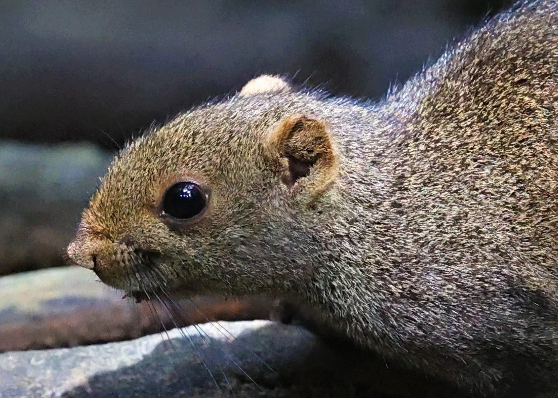
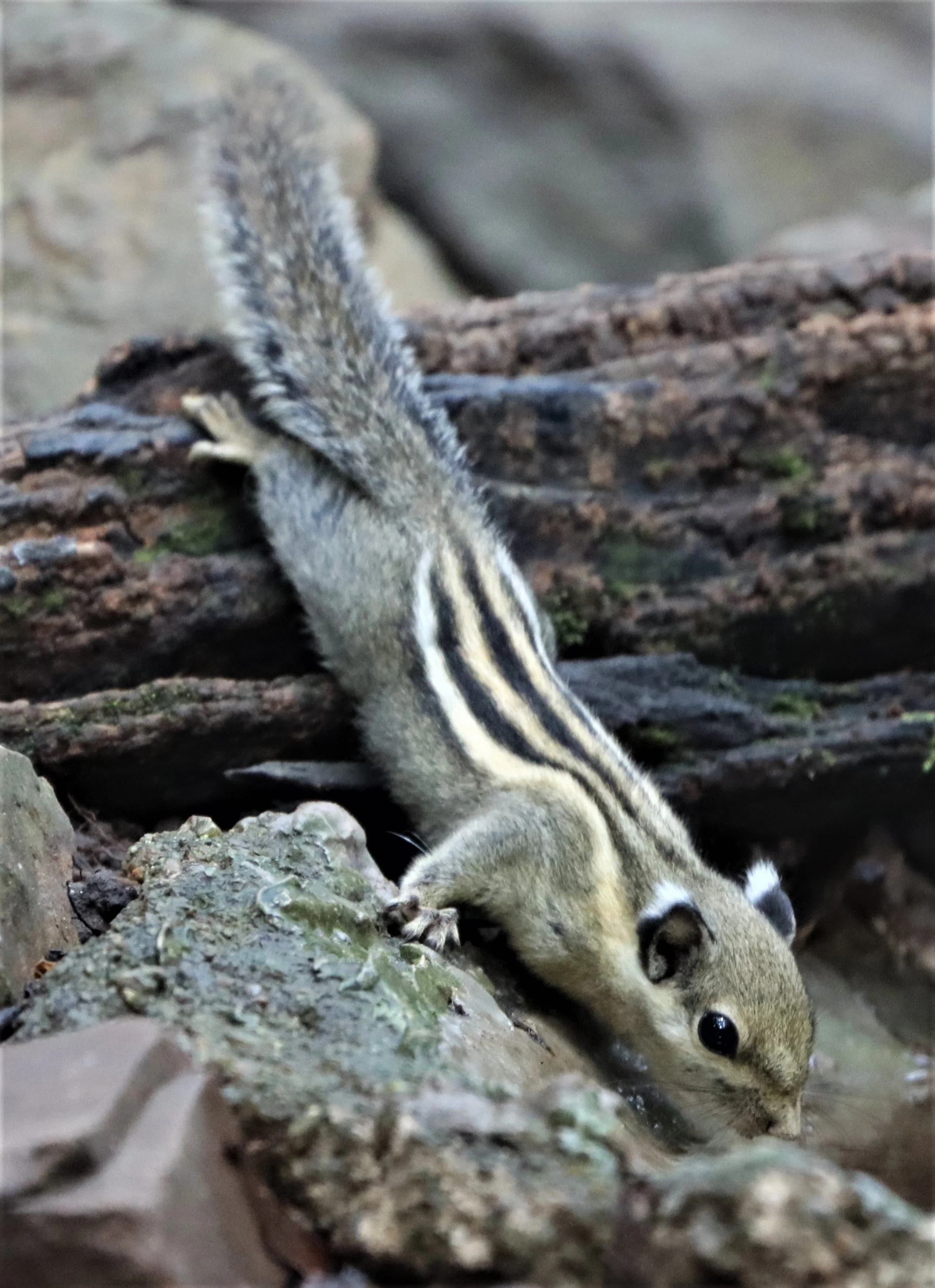
The Grey-bellied squirrel (Callosciurus caniceps), also known as the Northern grey-bellied squirrel, is a common rodent species native to the forests and gardens of Southeast Asia.
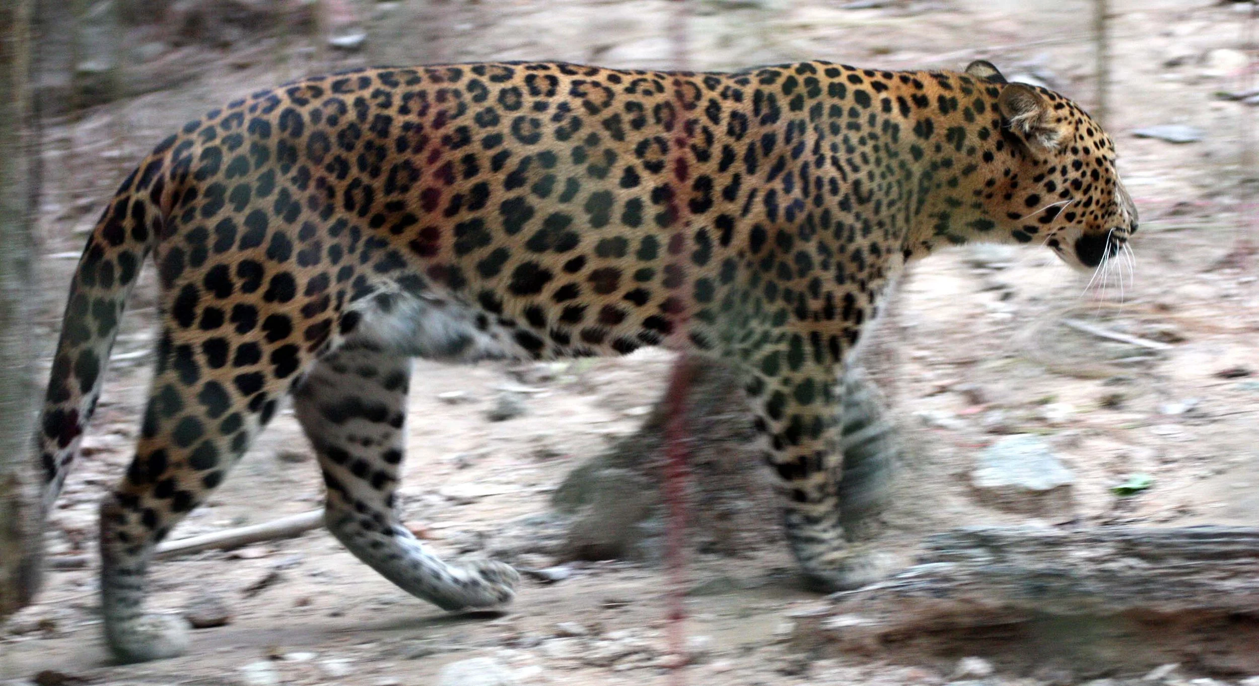
My first Indochinese Leopard at Kaeng Krachan. Seems these days the normal color form is the melanistic form.
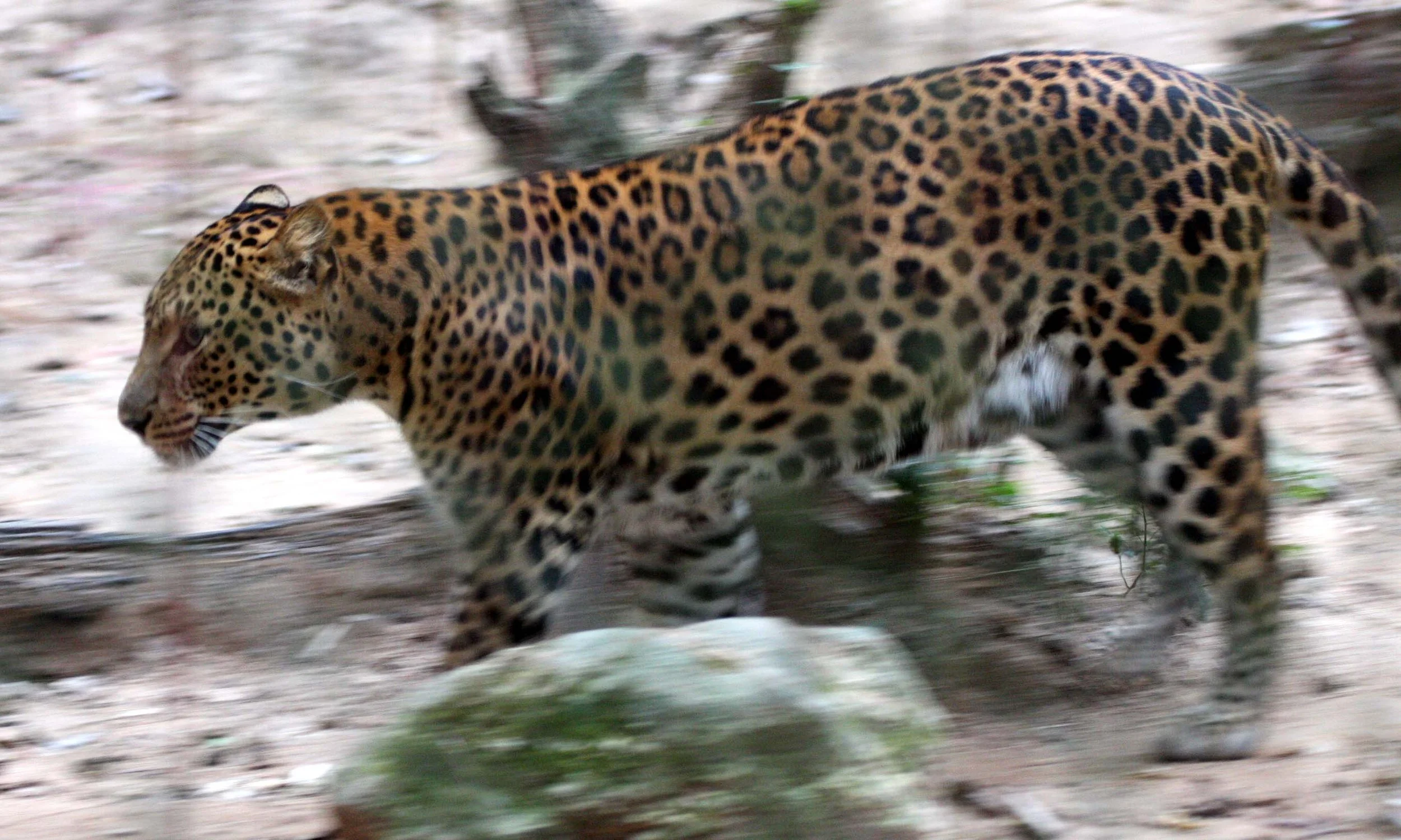
Indochinese leopard (Panthera pardus delacouri) at Phanoen Thung

The binturong (Arctictis binturong), also known as the bearcat, is a viverrid native to South and Southeast Asia. It is uncommon in much of its range, and has been assessed as Vulnerable on the IUCN Red List because of a declining population. It is estimated to have declined at least 30% since the mid-1980s. The binturong is the only species in the genus Arctictis.

I've seen Binturongs in Kaeng Krachan in a number of locations ranging from Bang Krang Camp in lower elevations to Phanoen Thung at approximately 1200m.
I enjoyed watching this Binturong all afternoon snoozing and stretching.
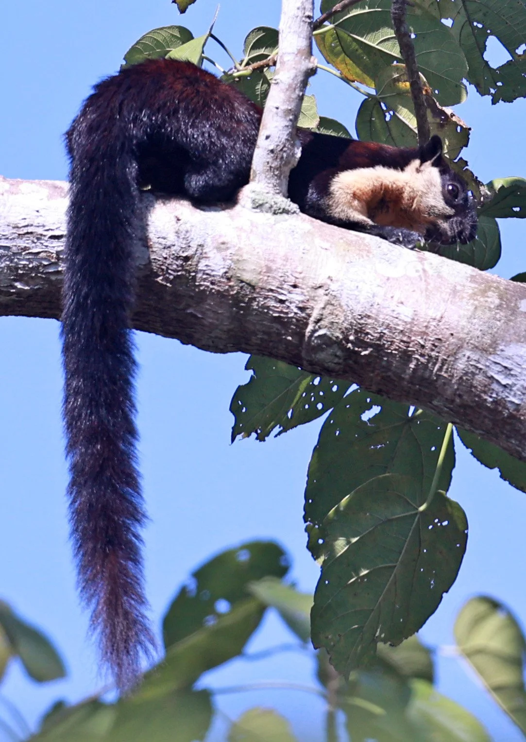
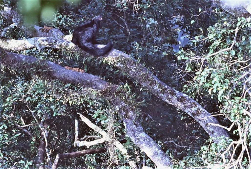
Black Giant Squirrel or Malayan Giant Squirrel (Ratufa bicolor) can reach lengths of nearly 1 meter!

Black Giant Squirrel or Malayan Giant Squirrel (Ratufa bicolor) are commonly seen in Bang Krang Campsite
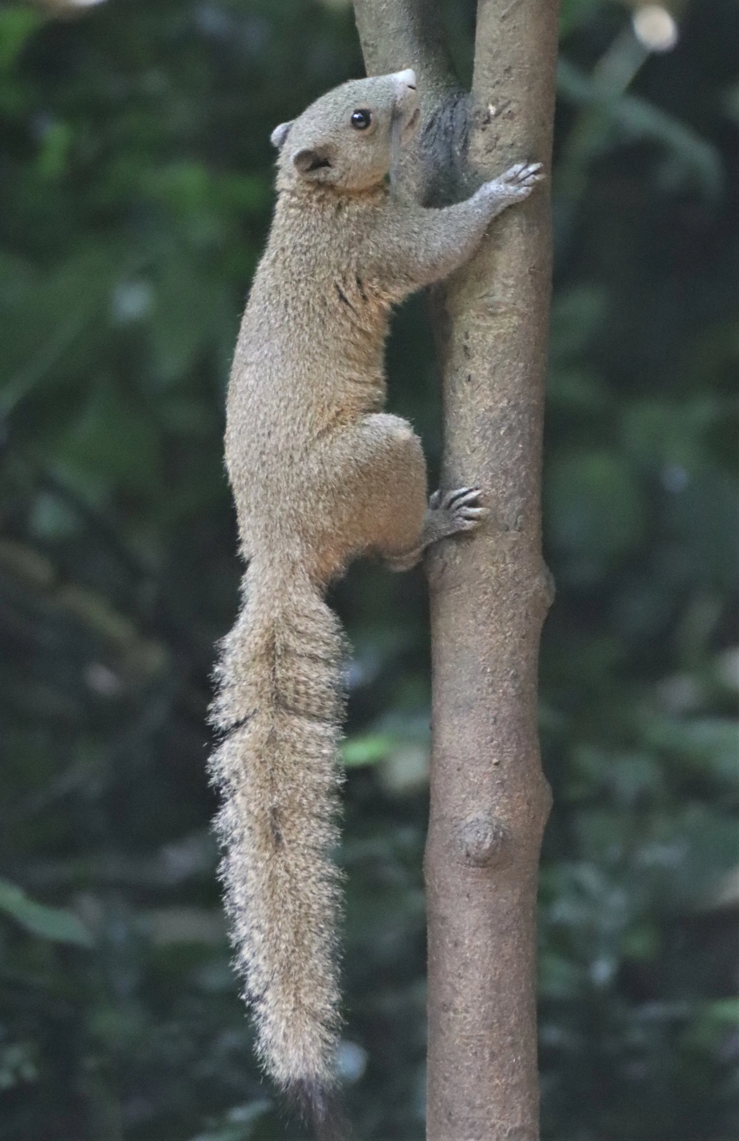
The Grey-bellied squirrel (Callosciurus caniceps)

The Grey-bellied squirrel (Callosciurus caniceps). Note the black tip on the tail - a good field character that can be used to distinguish this specie from the others in the forest.
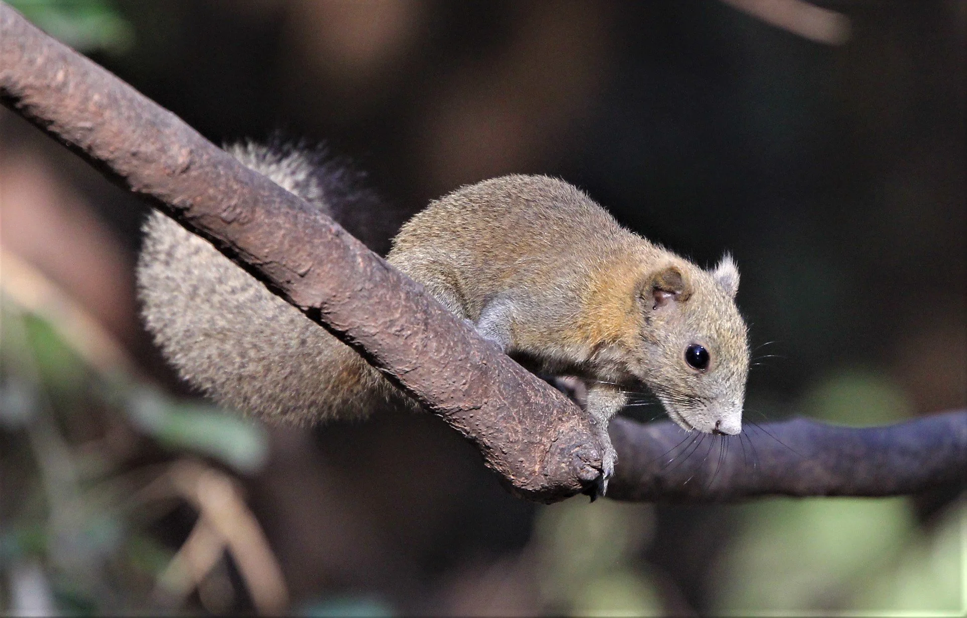
The Grey-bellied squirrel (Callosciurus caniceps)

The Grey-bellied squirrel (Callosciurus caniceps) feasting on ripe figs.
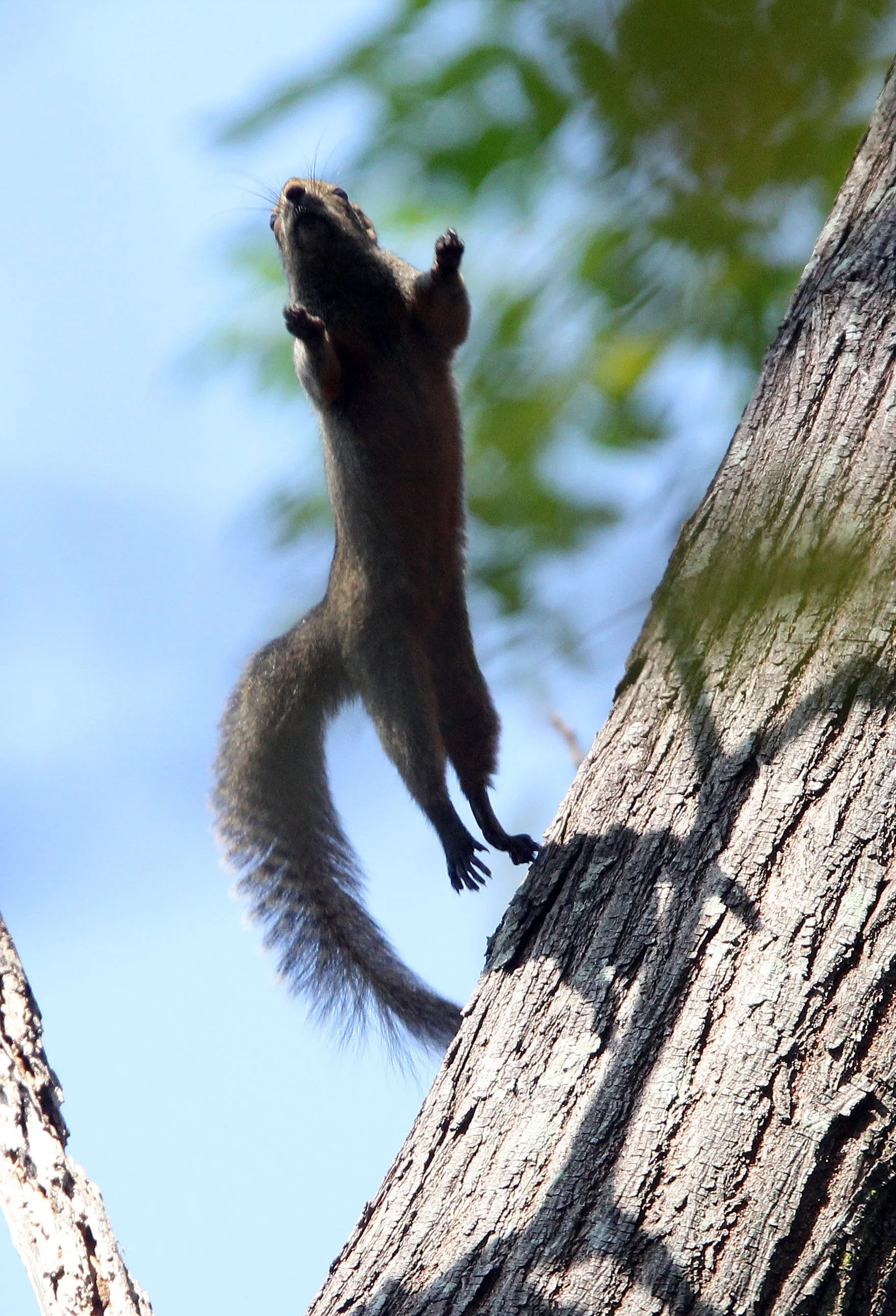
Leaping Grey-bellied Squirrel!

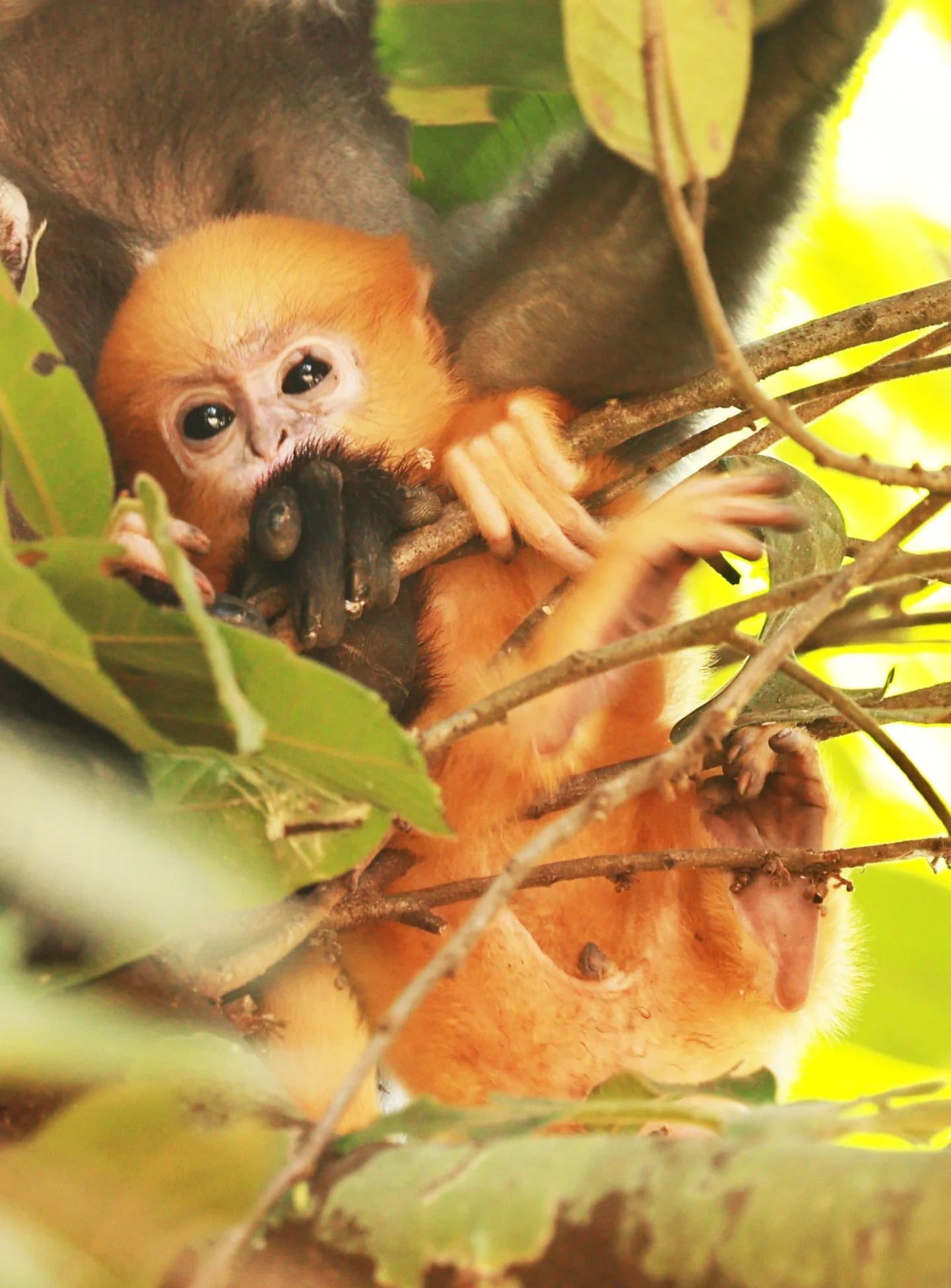
Distant Dusky Langur giving a warning grimace
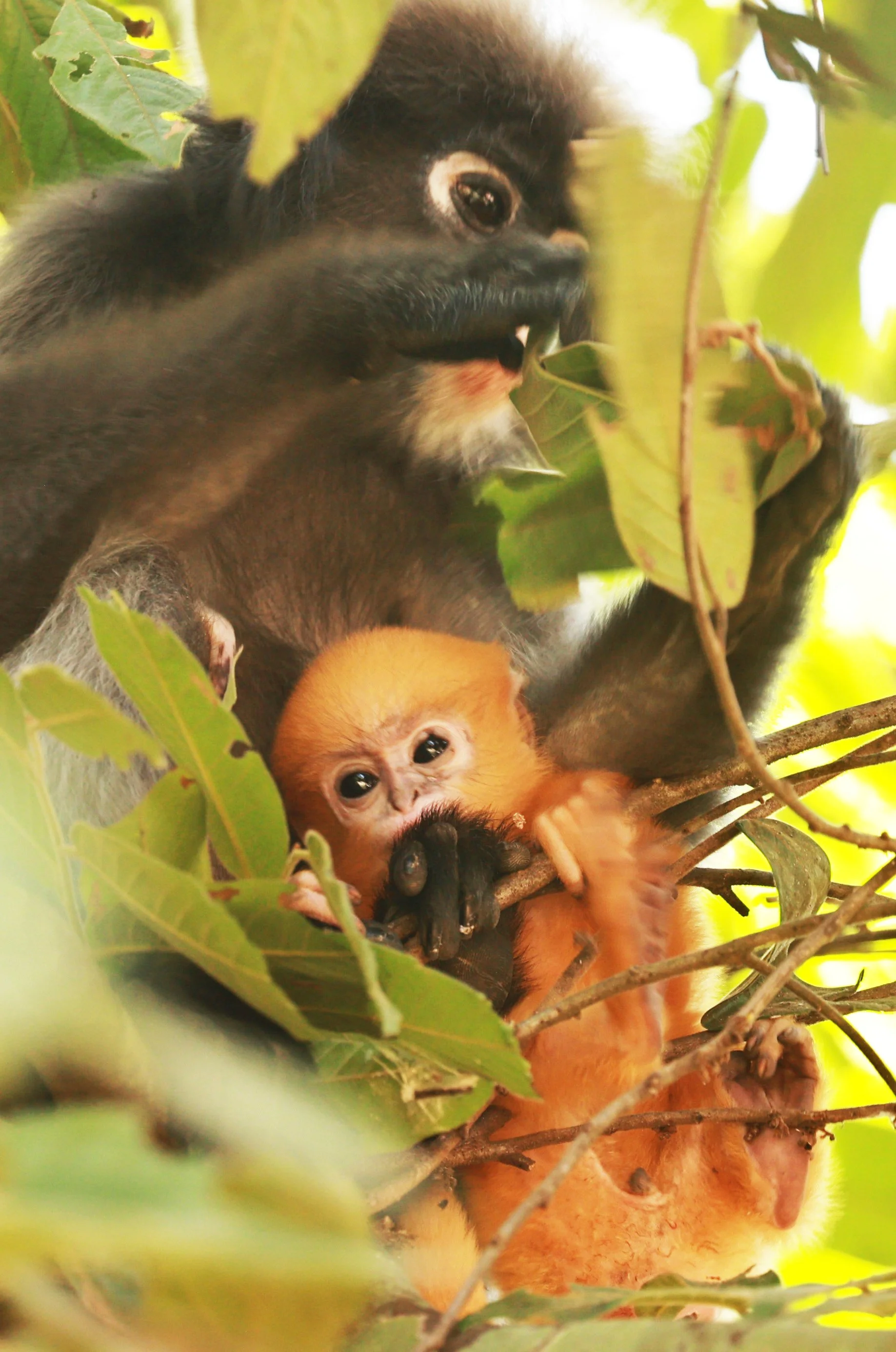
Baby langurs are born orange because their bright coloration serves important social and survival functions within their species. Research on François’, dusky, and silvered leaf langurs shows that the vivid orange coat makes infants highly visible to other members of the troop, encouraging alloparenting—a cooperative care system in which multiple females help look after the young. This social cue helps adults easily identify and protect infants in the dense forest canopy.
Lovely little tangarine

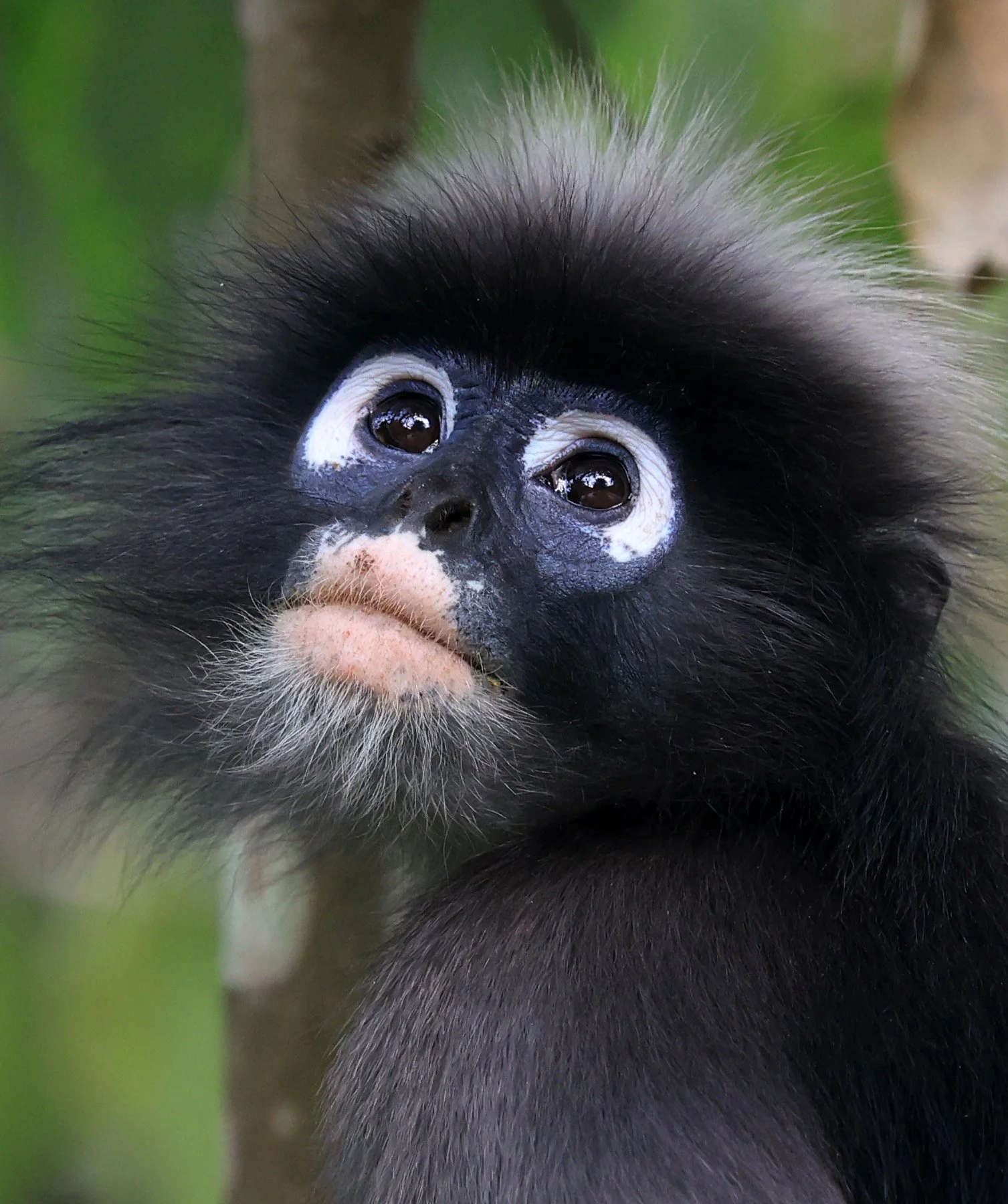
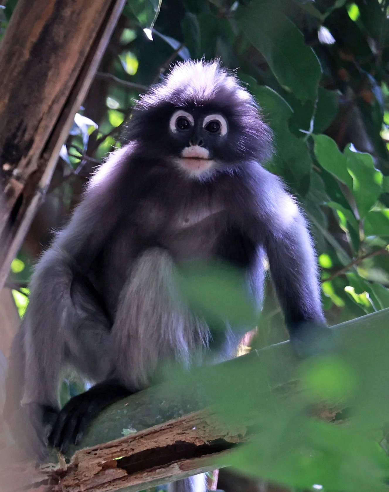
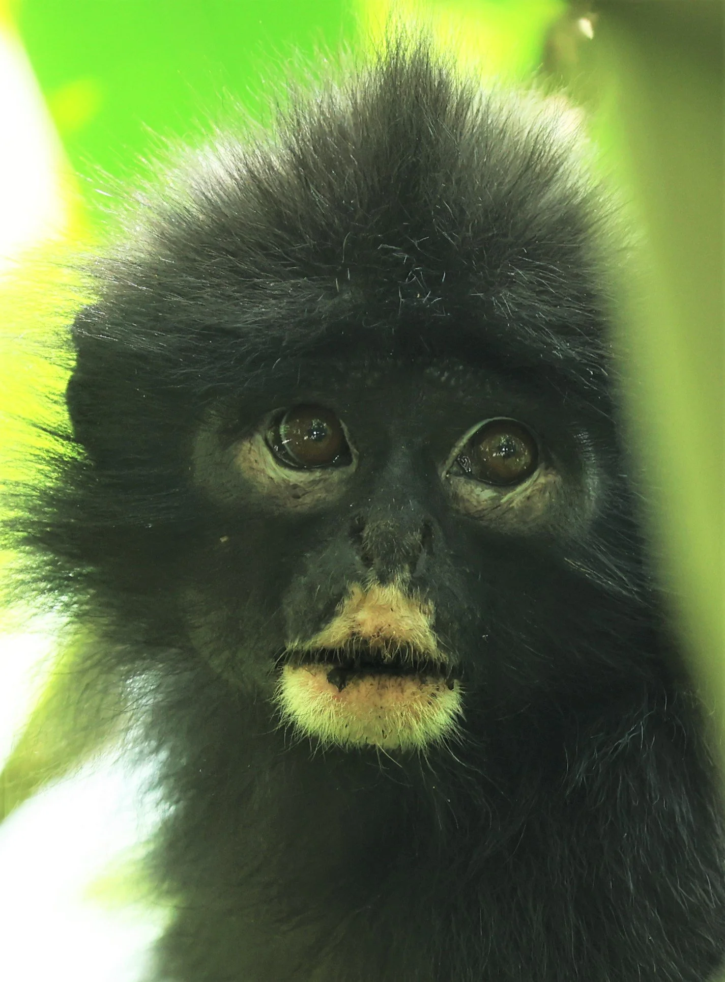
The Dusky Leaf Monkey (Trachypithecus obscurus), also known as the spectacled langur or the spectacled leaf monkey, is a species of primate in the family Cercopithecidae. It is found in Peninsular Malaysia, Myanmar and Thailand.

The Dusky Leaf Monkey (Trachypithecus obscurus) relaxing in the oppressive heat of the dry season.

The Dusky Leaf Monkey (Trachypithecus obscurus) drinking from a stream at Bang Krang Campsite.

The Dusky Leaf Monkey (Trachypithecus obscurus) in amazing light!

Mommy The Dusky Leaf Monkey (Trachypithecus obscurus) with her little orange tangerine drinking from a stream.

Mommy The Dusky Leaf Monkey (Trachypithecus obscurus) with her little orange tangerine drinking from a stream. Notice how she cups her hand to drink only drops.

Langur babies are born bright orange to make them easily visible to their mothers and the troop, encouraging protection and social grooming. This vibrant color stands out against adult coats, aiding in identifying infants during alloparenting (shared care) and helping mothers locate them.

It's easy to understand why they are given the name, "Spectacled" Langur.
Dusky Leaf Monkey (Trachypithecus obscurus)

Dusky Leaf Monkey (Trachypithecus obscurus)
Dusky Leaf Monkey (Trachypithecus obscurus)

One of my first images of this extremely beautiful langur.

It is theorized that the orange coloration thereby encouraging alloparenting, the bright color signals to the troop that the infant needs attention and protection, prompting other females to help care for them.

Robinson's banded langur (Presbytis robinsoni) was formerly considered a subspecies of the Raffles' banded langur Presbytis femoralis, but genetic analysis revealed that it is no more related to Raffles' banded langur than it is to several other Presbytis species.

Robinson's banded langur (Presbytis robinsoni), also known as Robinson's banded surili, is a species of monkey in the family Cercopithecidae.

Robinson's banded langur (Presbytis robinsoni) lives in the northern Malay Peninsula, including southern Burma and Thailand. It is listed as near threatened by the IUCN
Robinson's banded langur (Presbytis robinsoni)

Robinson's banded langur (Presbytis robinsoni)

Robinson's banded langur (Presbytis robinsoni). This image was taken before the were given full species status.

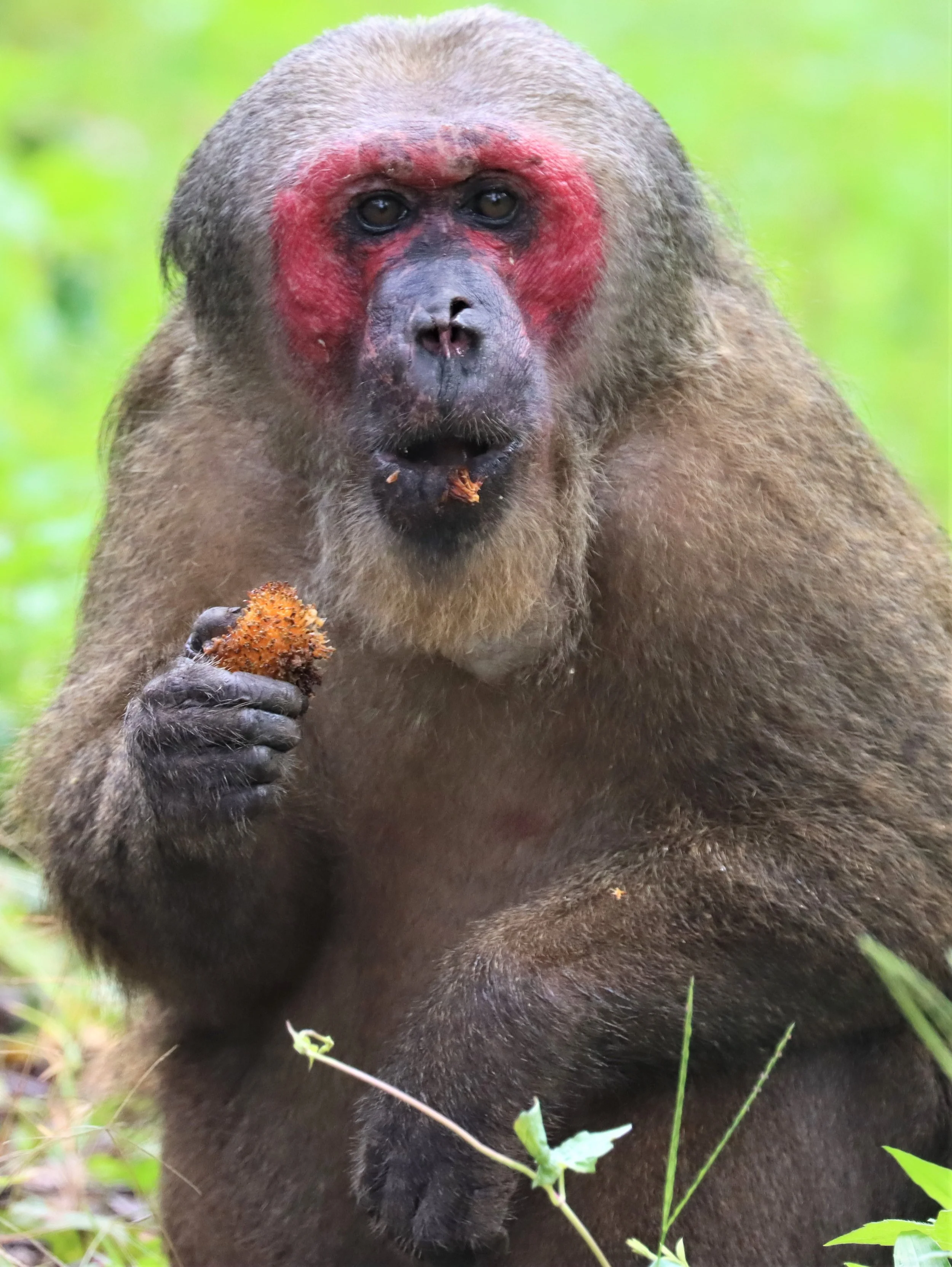
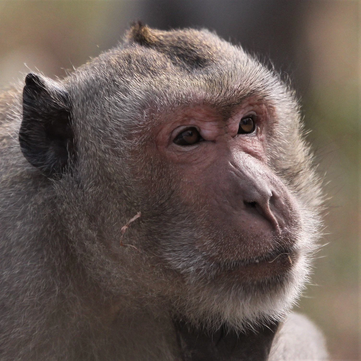
Stump-tailed Macaque (Macaca arctoides), also called the bear macaque, is a species of macaque native to South Asia and Southeast Asia.

Baby Stump-tailed Macaque (Macaca arctoides) hanging on to mommy's belly.

Stump-tailed macaques (Macaca arctoides) have red faces primarily as a result of blood flow beneath their hairless skin, which serves as a vital social and physiological signal.
Stump-tailed macaque (Macaca arctoides)

So handsome
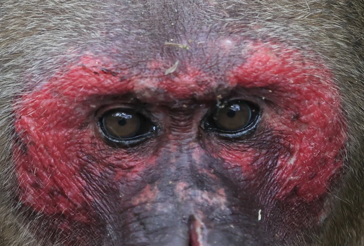
Eye contact

Stump-tailed macaques (Macaca arctoides) have red faces that only a mother could love.

Stump-tailed macaques (Macaca arctoides) have stubby barrel-shaped bodies.
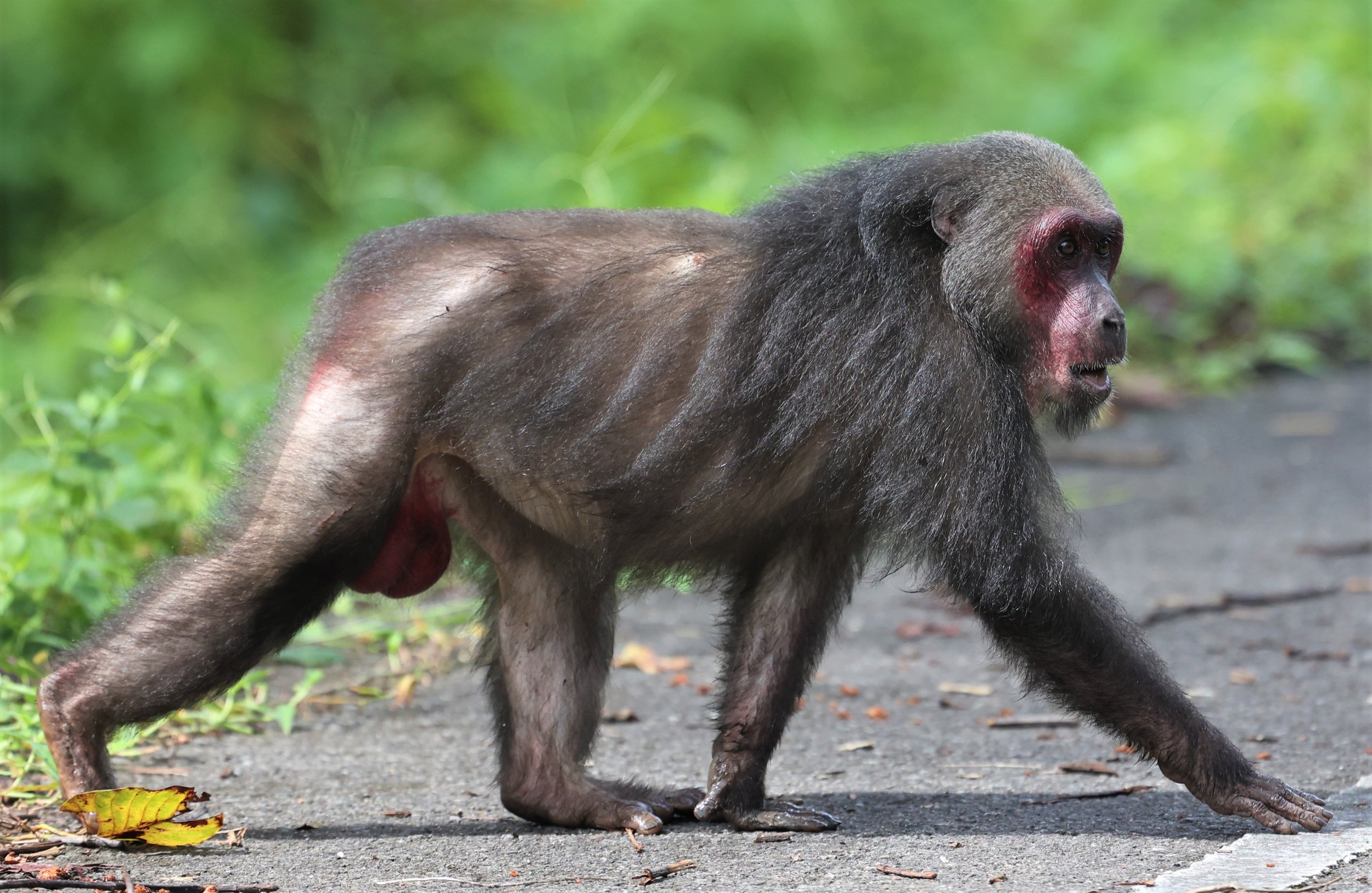
Stump-tailed macaques (Macaca arctoides) have no visible tail.
Although I have never seen Long-tailed Macaques in Kaeng Krachan, they are common in areas around the complex. This individual was seen at Khao Sam Roi Yod, where they are very common. Their tail is notably long, typically measuring 50–60 cm, which is often equal to or longer than their head and body length combined. Coat and Face: They have greyish-brown to reddish-brown fur with a paler underbelly. Adults often have white markings on their eyelids and prominent cheek whiskers or "beards". They exhibit sexual dimorphism, with males (4.7–8.3 kg) being significantly larger and heavier than females (2.5–5.7 kg).

The Long-tailed Macaque (Macaca fascicularis), also known as the Crab-eating Macaque, is an intelligent and highly adaptable primate native to Southeast Asia. As of 2022, the species is listed as Endangered on the IUCN Red List due to habitat loss, hunting, and high demand for biomedical research.

Curious Long-tailed Macaque
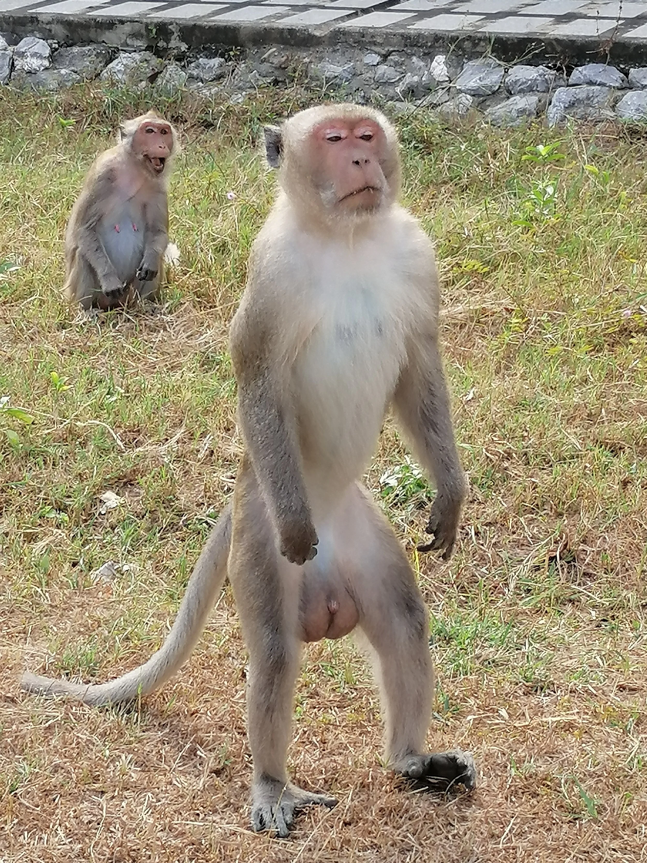
Note the long tail and the ability to become bipedal very easily.

Newborns are born with a distinct black natal coat that begins to lighten and turn brown after about three months.
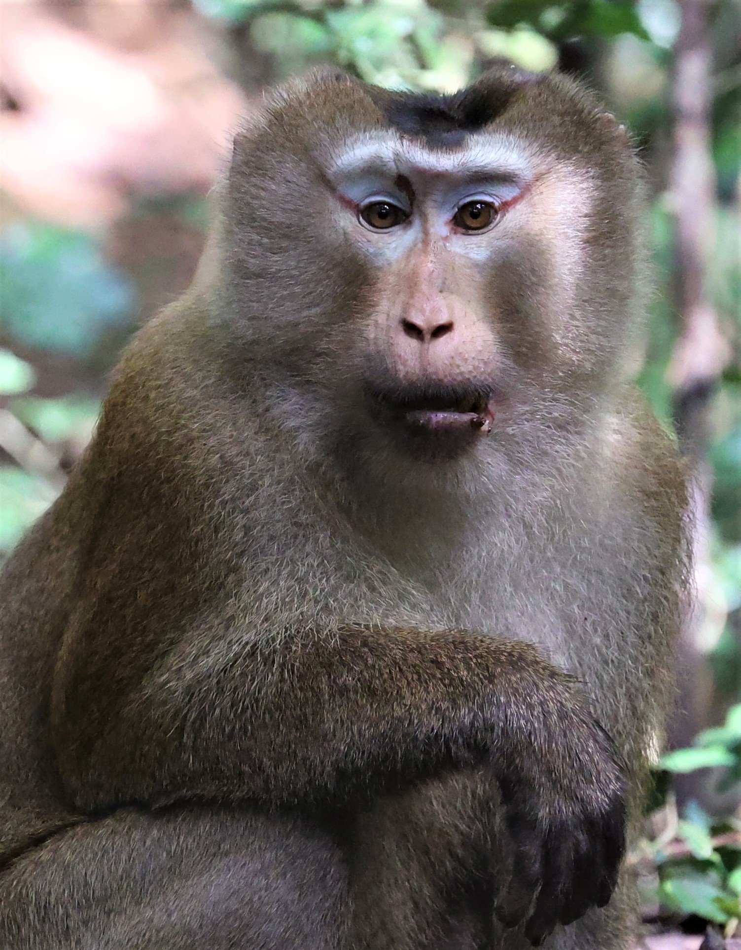
Northern Pig-tailed Macaque (Macaca leonina) seen near Baan Macaca in a local bird blind. Evidently this species if rarely if ever seen in this region.

The Sunda Short-nosed Fruit Bat (Cynopterus brachyotis) is a small, widespread megabat (family Pteropodidae) found in South and Southeast Asia. It acts as a key seed disperser and pollinator, particularly for mangos, and adapts well to disturbed habitats, with specific Sunda and forest-dwelling clades.

Sunda Short-nosed Fruit Bat (Cynopterus brachyotis)
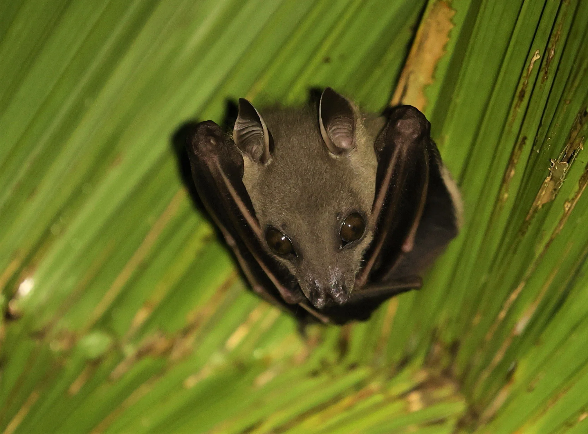
Sunda Short-nosed Fruit Bat (Cynopterus brachyotis) is one of the few bat species outside the Americas that constructs "tents" for roosting (Note the crimped leaf of the palm). Unlike most bats that simply find existing shelters, these bats actively modify their environment to create a protective home.

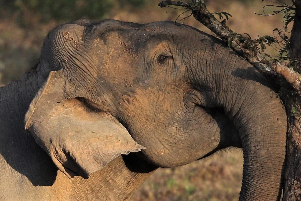
Although Asian Elephants (Elephas maximus indicus) are common in the Kaeng Krachan Forest Complex, they are rarely seen mainly due to the closed-in nature of the reserve. I've seen them a dozen times or so over the years.
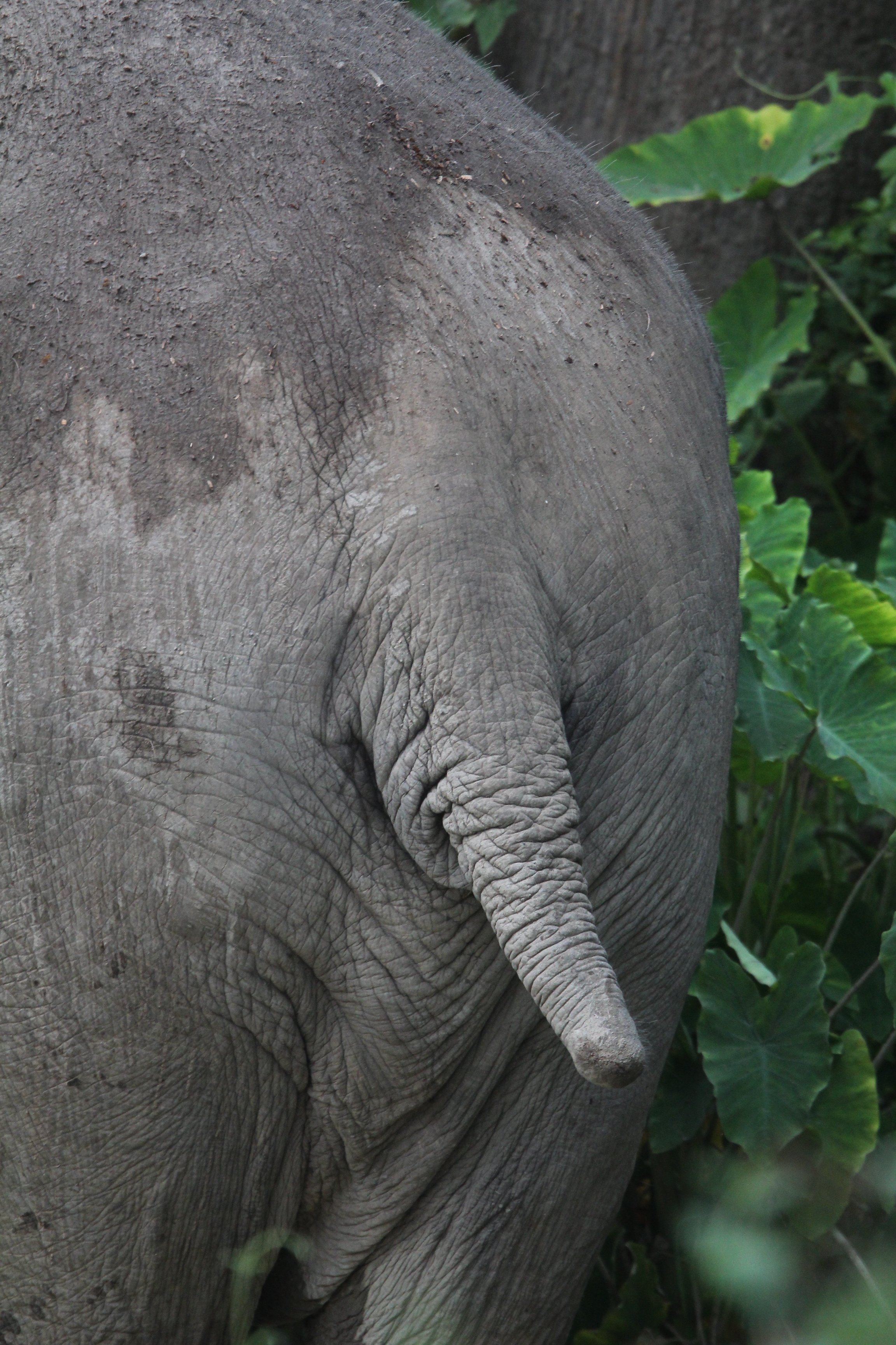
An old friend - 2024 Image of our tailless Asian Elephant
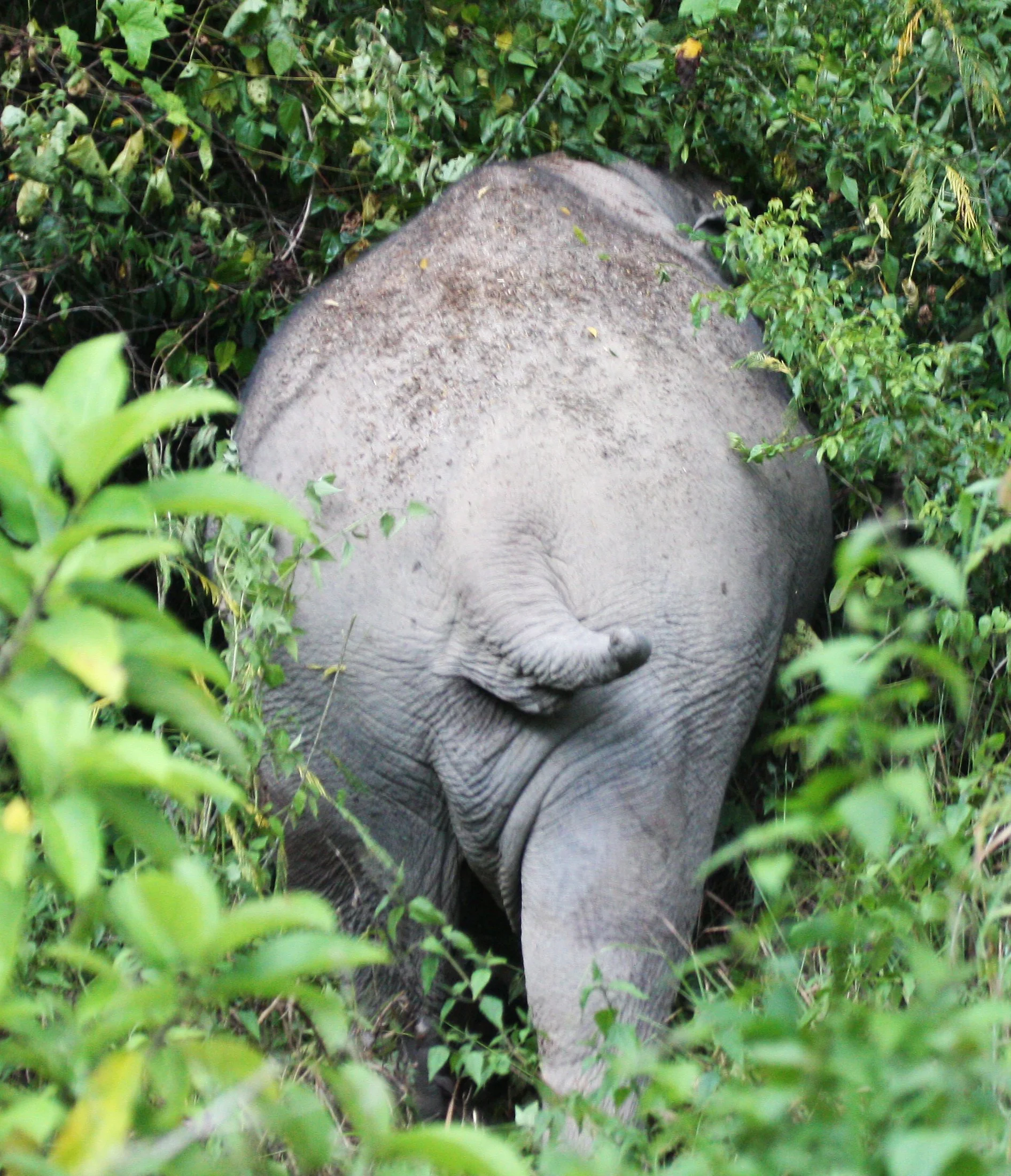
Same old friend with an image taken in 2006!
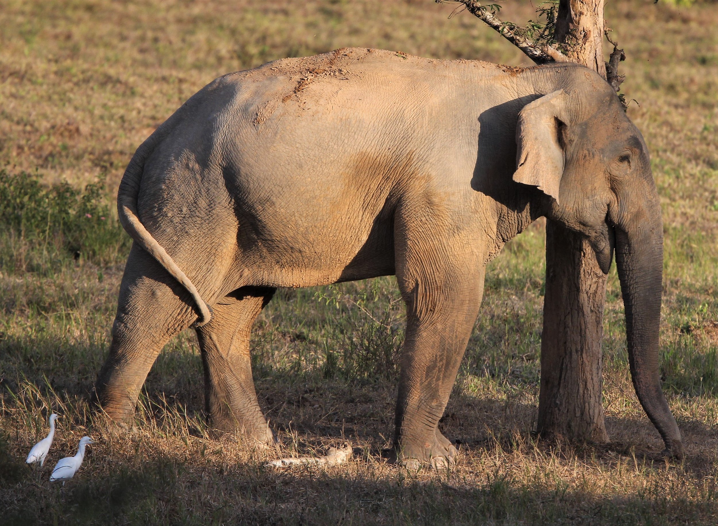
Perhaps the only location in Thailand to have a nearly guaranteed chance to see an Asian Elephant (Elephas maximus indicus) in Thailand is Kui Buri National Park.

A magnificent Asian Elephant shaking a tamarind tree in Kui Buri NP. A sweet treat in the afternoon.
Elephants (Elephas maximus indicus) love the tamarind fruit. Kui Buri is a great example of a community based tourism venture where local farmers who have had their farms raided by elephants over the years are able to make money by taking tourists in to the reserve to see these magnificent pachyderms.
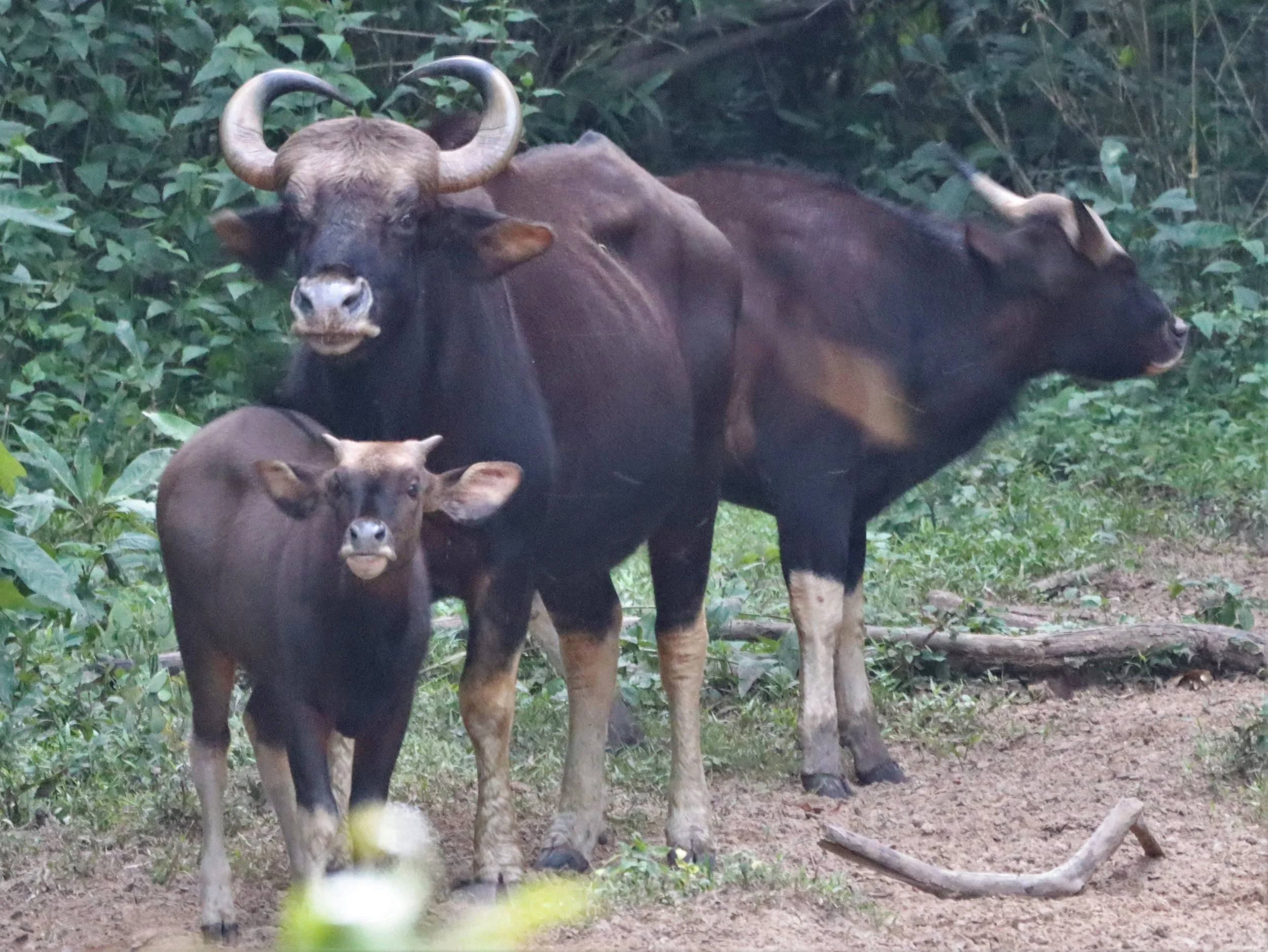
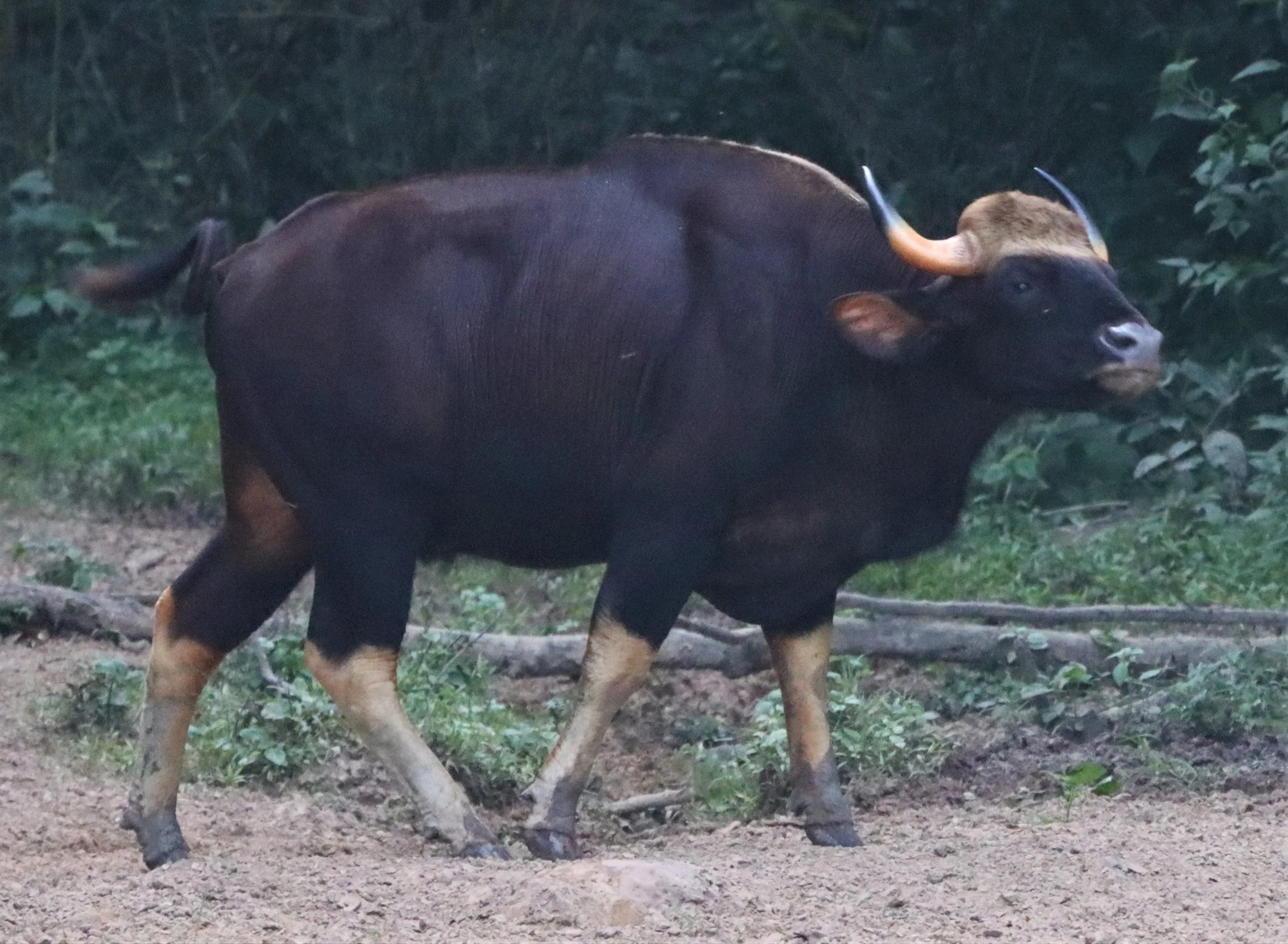
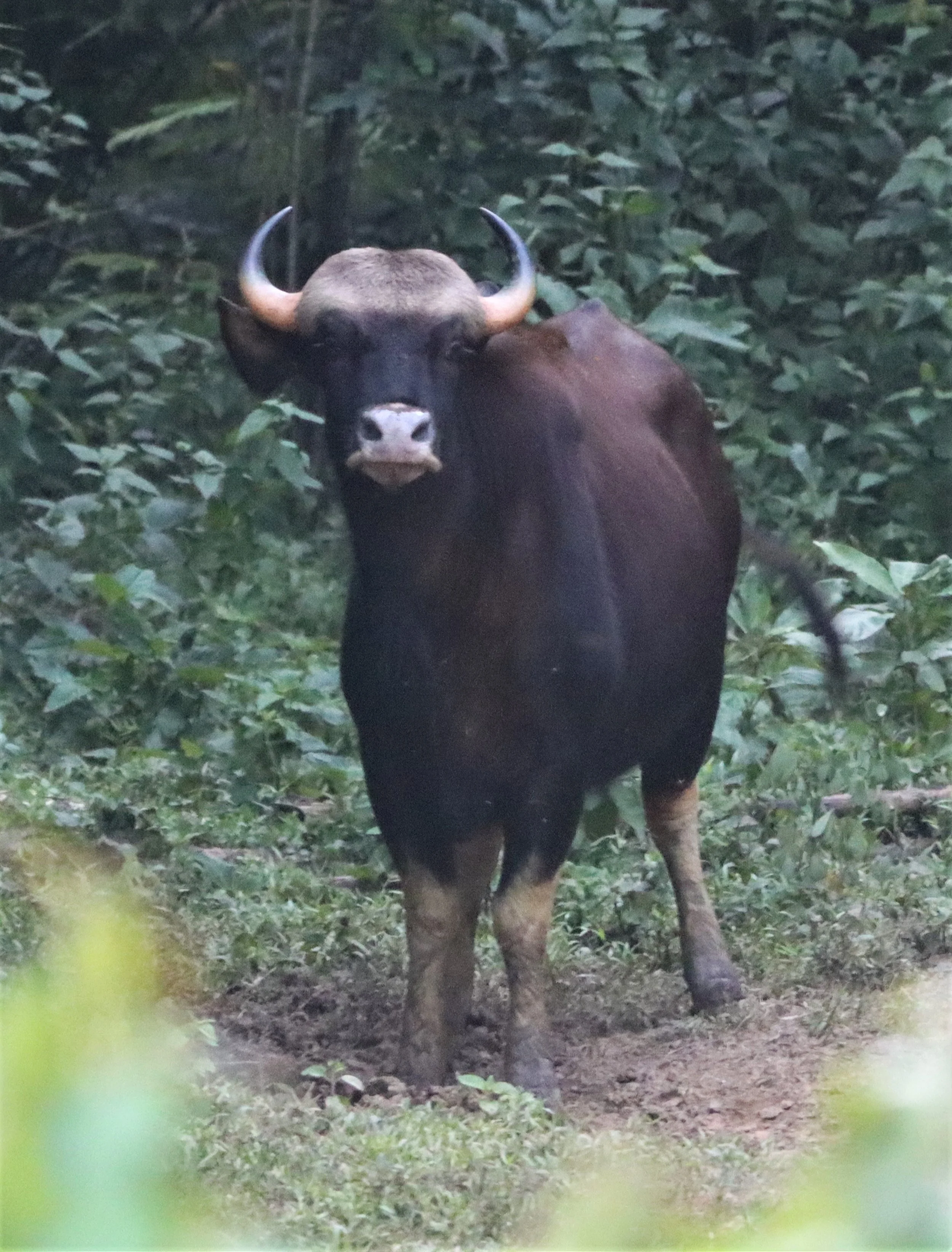
The gaur (Bos gaurus), also known as the Indian bison, is a large bovine native to the Indian subcontinent and Southeast Asia, and has been listed as Vulnerable on the IUCN Red List since 1986. The global population was estimated at a maximum of 21,000 mature individuals in 2016, with the majority of those existing in India
Other older park estimates of Gaur population cited around 100–150 individuals following a population recovery from a bacterial outbreak in 2013. As of 2025, the 450-500 in the overall KKFC.
Gaur can be seen in any of the units of the Kaeng Krachan Forest Complex. However Kui Buri has potentially as many as 500.
![The gaur is the largest living bovid.[14] It is a strong and massively built bovine with a high convex ridge on the forehead between the horns that protrudes anteriorly, causing a deep hollow in the profile of the upper part of the head.](https://images.squarespace-cdn.com/content/v1/6321260b6fee0034161f44da/fc6046b5-c5ab-4b65-8bf6-491c8955c1e8/GAUR+-+SOUTHEAST+ASIAN+GAUR+-+Bos+gaurus+laosiensis+-+KAENG+KRACHAN++JUNE+2021+%2843%29.jpg)
The gaur is the largest living bovid.[14] It is a strong and massively built bovine with a high convex ridge on the forehead between the horns that protrudes anteriorly, causing a deep hollow in the profile of the upper part of the head.

Good-Practice-Story.pdf Green Destinations Report on Gaur, etc (https://www.greendestinations.org/wp-content/uploads/2025/09/Kuiburi-2025-Top-100-Good-Practice-Story.pdf)


Malayan Sun Bears (Helarctos malayanus), the world's smallest bear species, are found in Thailand's tropical rainforests, particularly in protected areas like Khao Sok National Park and Khao Yai National Park. They are elusive, arboreal, and considered vulnerable due to hunting for bile and habitat loss.

Malayan sun bears (Helarctos malayanus) are frequently spotted in Thailand's Kaeng Krachan National Park, particularly around the Ban Krang and Phanoen Thung campsites, where they are known to scavenge for food.
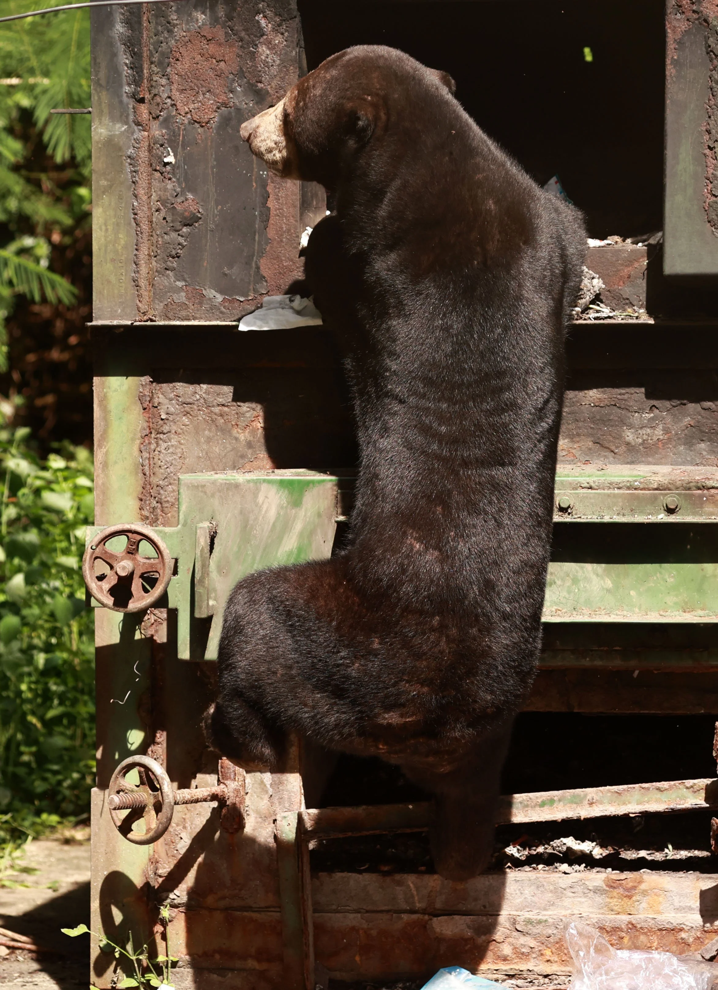
While it is certainly entertaining to see such a rare ursid up close scavenging like this, I find it troubling as well.

The bears make a daily trip inside the incinerator at Bang Krang Campsite. I can only imagine they get burned by embers often.

All the way in!

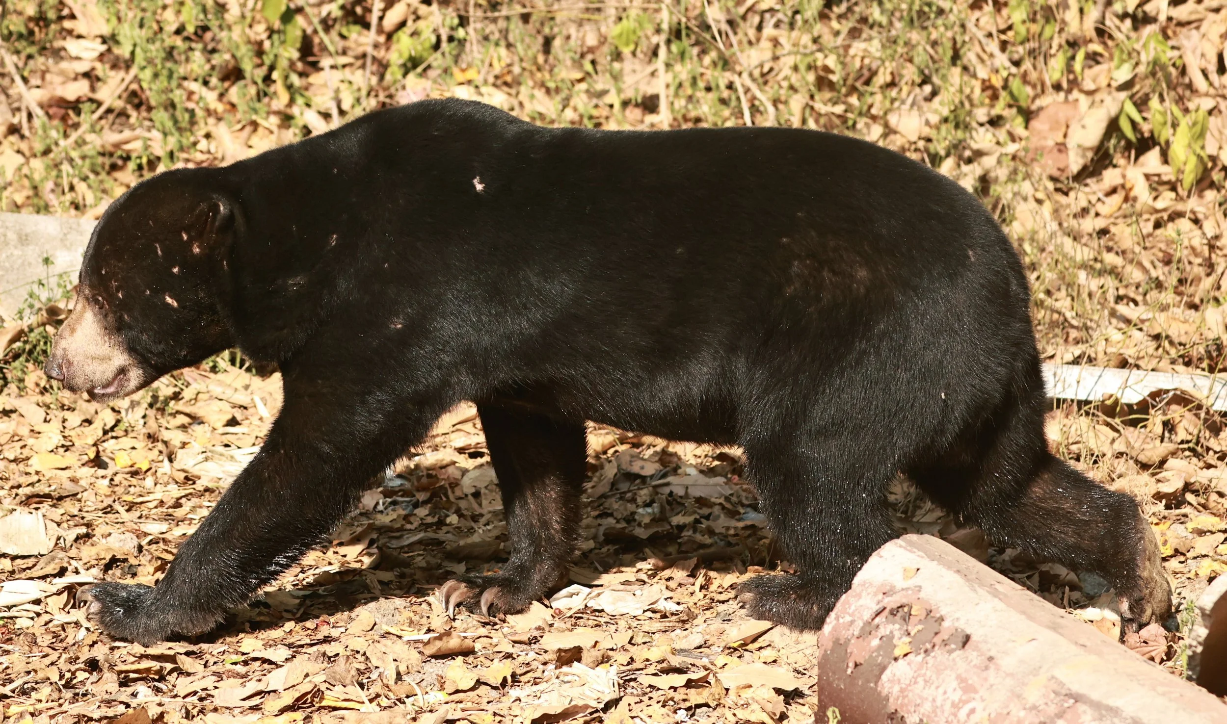


The Malayan sun bear (Helarctos malayanus) is characterized by a distinctive, often white or cream-colored, patch on its chest, which sometimes extends up toward the neck. This patch is a key identifying feature, varying in shape and size for each individual, similar to human fingerprints.
Malayan sun bear (Helarctos malayanus)

Malayan sun bear (Helarctos malayanus) - scars from previous encounters with competitors can help identify individuals,

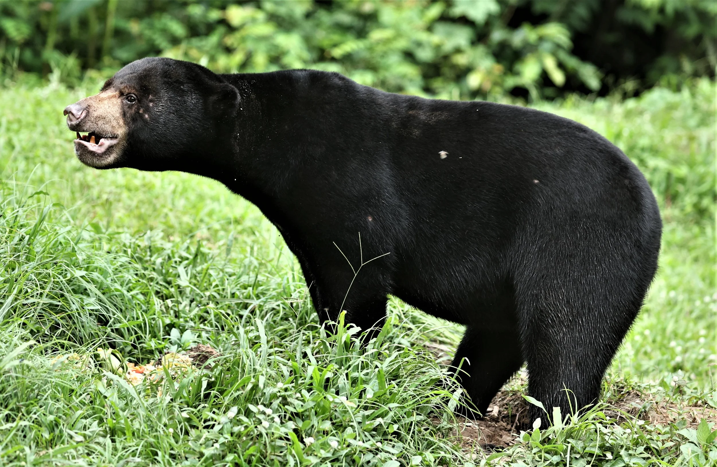
Here we see two Sun Bears. We see them but they do not see each other. Their eyesight is very poor.

Malayan sun bear (Helarctos malayanus)

Malayan sun bear (Helarctos malayanus) showing aggression to me.

The Lar Gibbon (Hylobates lar), also known as the white-handed gibbon, is an endangered primate in the gibbon family, Hylobatidae.

The Lar Gibbon (Hylobates lar) watching me and my students doing work in Kaeng Krachan.

Watching The Lar Gibbon (Hylobates lar) leaping between trees is spectacular.

The Lar Gibbon (Hylobates lar) coming in for a landing.
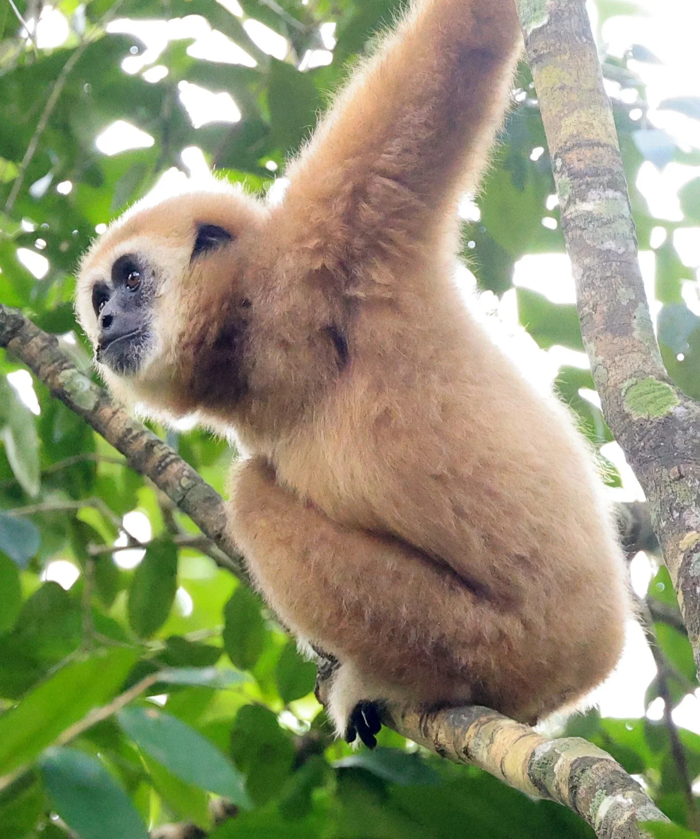
The Lar Gibbon (Hylobates lar)

The Lar Gibbon (Hylobates lar) eye contact!
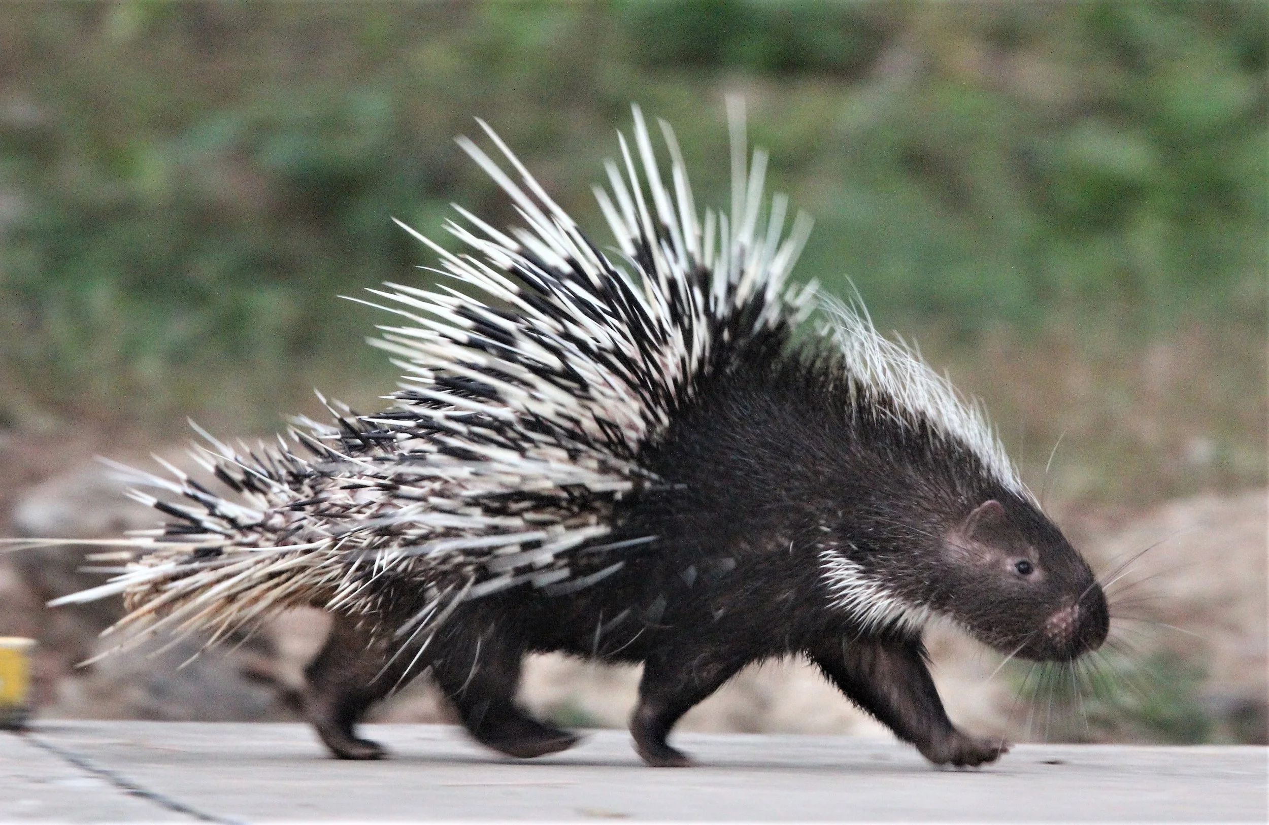
The Malayan porcupine or Himalayan porcupine (Hystrix brachyura) is a species of rodent in the family Hystricidae. Three subspecies are extant in South and Southeast Asia.
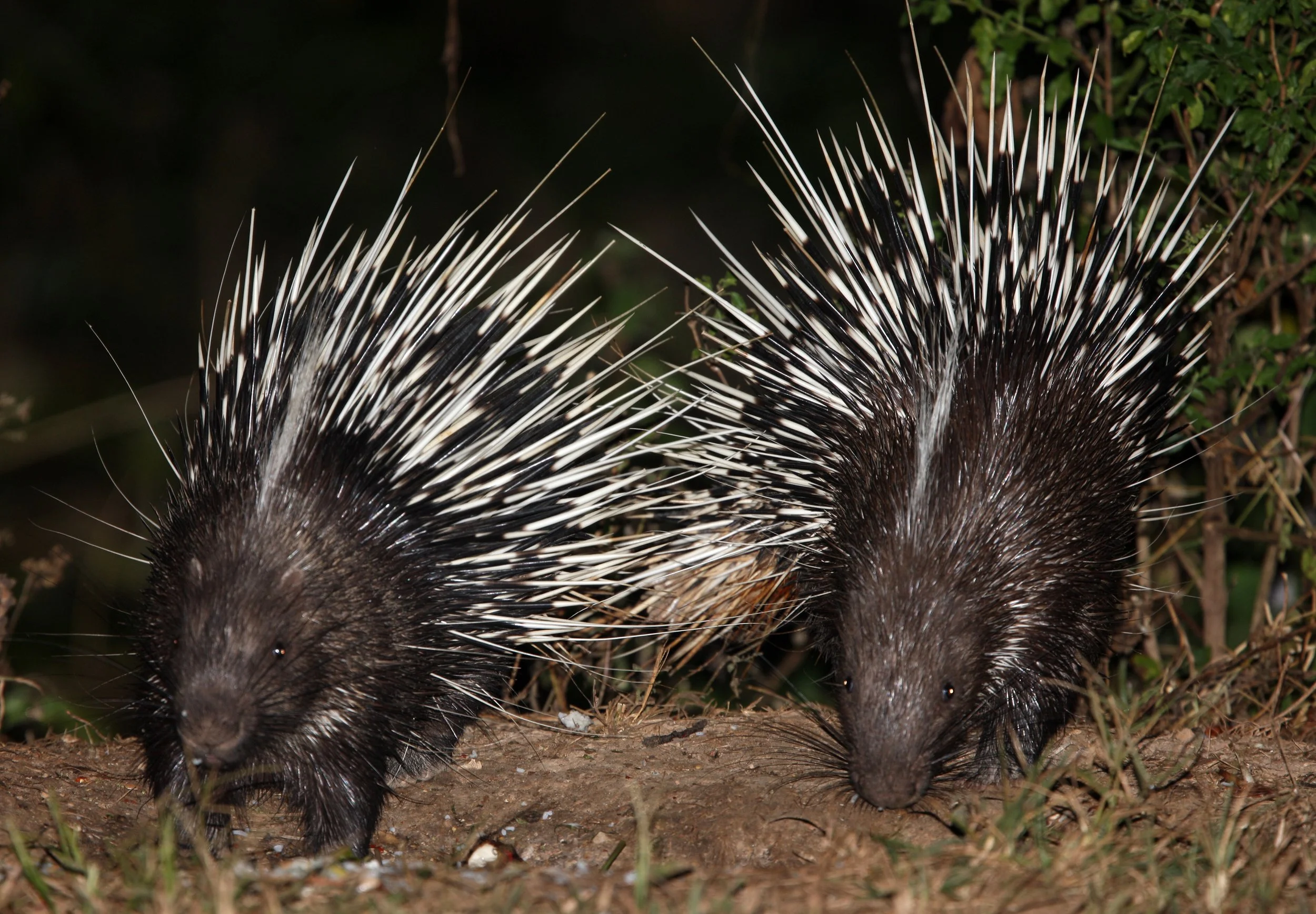
A pair of Malayan porcupine or Himalayan porcupine (Hystrix brachyura) are common in Bang Krang Campsite where once I saw 13 at one time at the canteen!

The melanistic Indochinese leopard (Panthera pardus delacouri), or "black panther," is a rare, critically endangered color variant found primarily in the dense tropical forests of Southeast Asia, particularly the Malay Peninsula. These cats possess a genetic mutation causing excess pigment, yet their signature rosette patterns remain visible in certain lighting. This image is from Jon Hall & Jirayu Ekkul.

Kerivoula hardwickii- Hardwicke's woolly bat - Kaeng Krachan National Park, Oct 2023

Kerivoula hardwickii- Hardwicke's woolly bat -found in open-ended bamboo spikes along the main road near stream #2.

Indomalayan long-tailed giant rat (Leopoldamys sabanus). These rodents are known for their exceptionally long tails, which often exceed their body length, and their relatively large size compared to common house rats. This one was caught for viewing only on private land near Kaeng Krachan.

Little Indochinese Field Rat (Rattus sakeratensis) Kaeng Krachan National Park
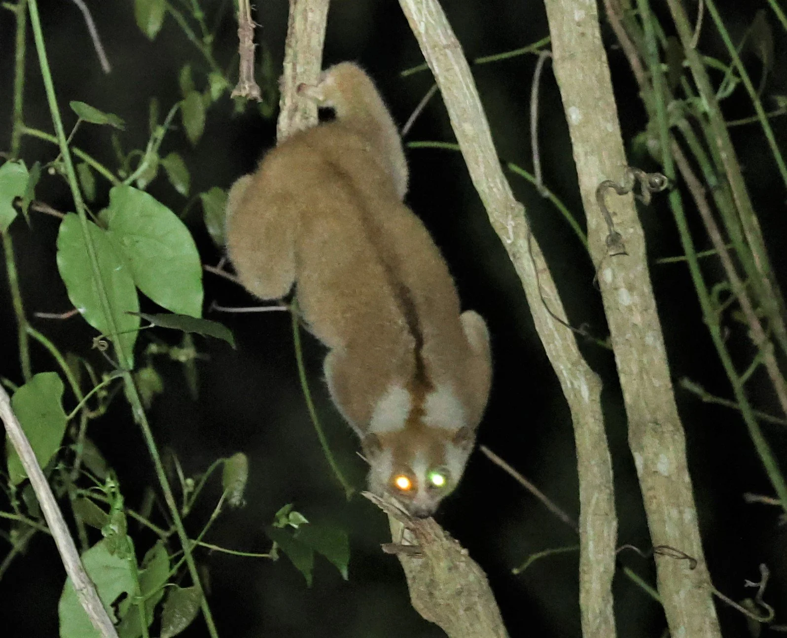
The Bengal slow loris (Nycticebus bengalensis) is a nocturnal, tree-dwelling primate native to the Indian subcontinent and Indochina. It is the largest of the nine recognized species of slow loris.

As the world's only known venomous primate, it produces a toxin from a gland near its elbow. When threatened, it licks this gland, mixing the secretion with saliva to deliver a toxic bite that can cause severe allergic reactions or even anaphylactic shock in humans.

Strictly nocturnal, it spends its days curled up in a ball in dense vegetation or tree holes. It moves slowly and deliberately to remain inconspicuous to predators, though it can move quickly if threatened.

Berdmore's ground squirrel, Indochinese ground squirrel, or Berdmore's squirrel (Menetes berdmorei) is a ground squirrel found in Southeast Asia, from the east of Myanmar and Yunnan (southern China) to Vietnam and Cambodia.
As a ground squirrel, it is rarely found on trees, but spends most of the time in the thick underwoods of the rainforests. However, it is also found in fields or villages, especially in rice fields it is sometimes omnipresent.

Despite it being quite common only very little is known about the life of this squirrel. Despite its name, it is not a close relative of the ground squirrels of the tribe Marmotini

Fea's muntjac (Muntiacus feae) or the Tenasserim muntjac, is a rare species of muntjac native to southern Myanmar and Thailand.

Fea's muntjac (Muntiacus feae) can be seen normally at Phanoen Thung and surrounds. There was a period before the long term road closure that I would see this individual every time we visited the area.

Red Muntjac (Muntiacus muntjak), widely known as the "barking deer" or "Fan" (ฟาน) in Thai, is one of the most common and easily spotted deer species.

In Thailand, the Red Muntjac (Muntiacus muntjak) gets its nickname from its distinctive, dog-like bark used as an alarm call when it senses predators like tigers or leopards.
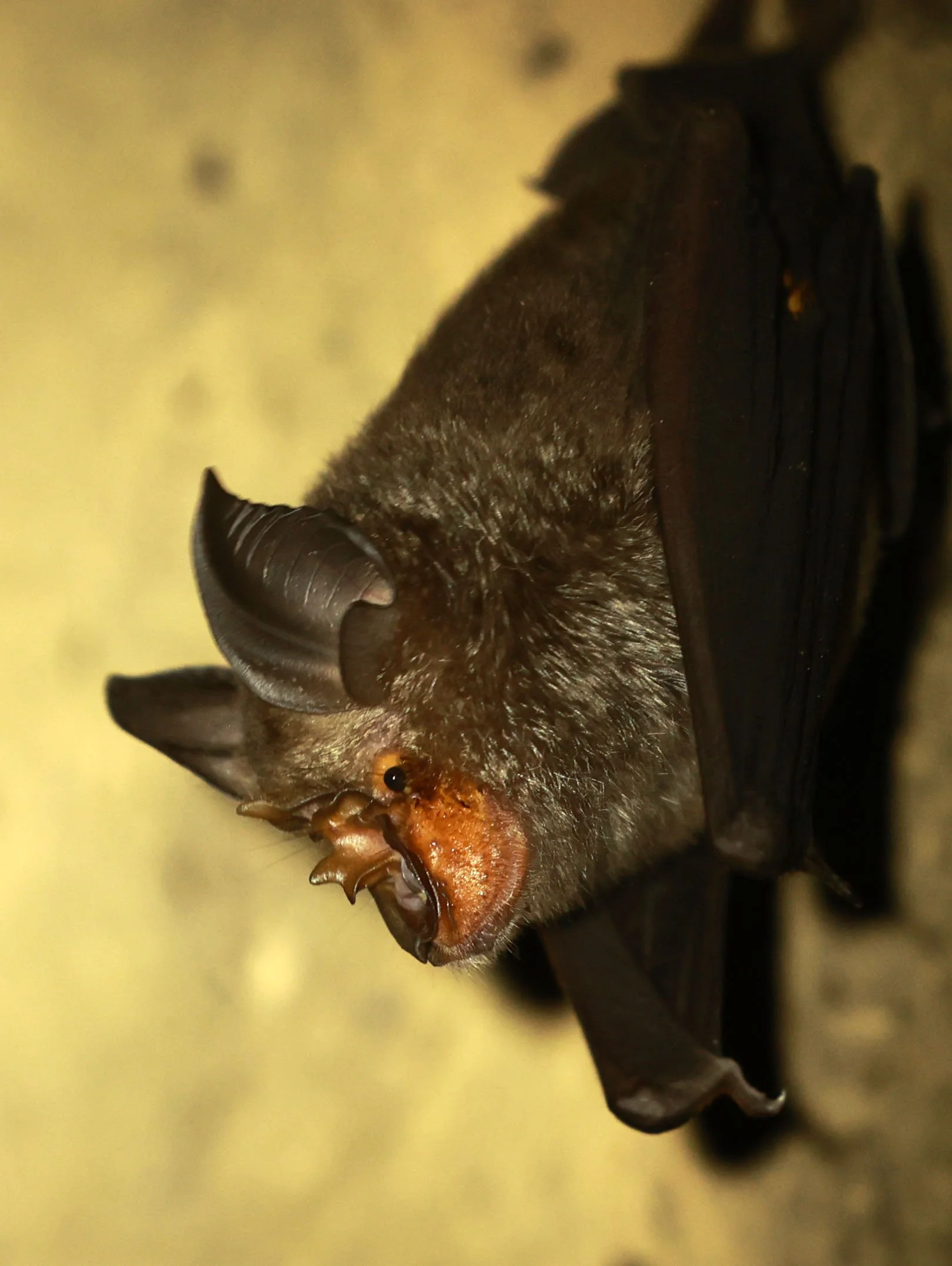
Northern Woolly Horseshoe Bat (Rhinolophus perniger) seen in an abandoned outhouse in Jan 2025

Northern Woolly Horseshoe Bat (Rhinolophus perniger) Kaeng Krachan National Park Thailand,

Malayan Slit-faced Bat (Nycteris tragata) seen in a culvert in Kaeng Krachan NP, Phanoen Thung Camp

Malayan Slit-faced Bat (Nycteris tragata) seen in a culvert in Kaeng Krachan NP, Phanoen Thung Camp
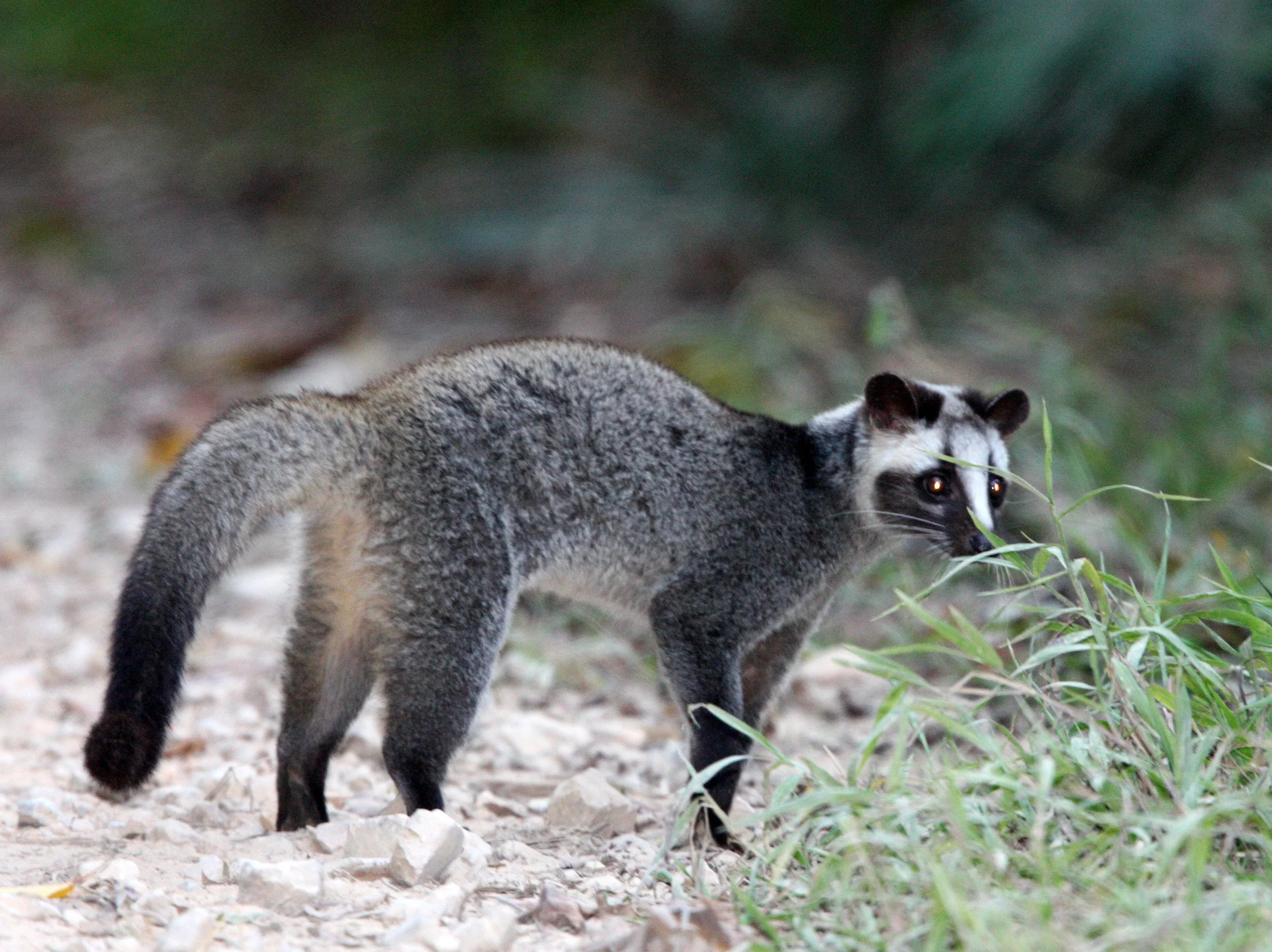
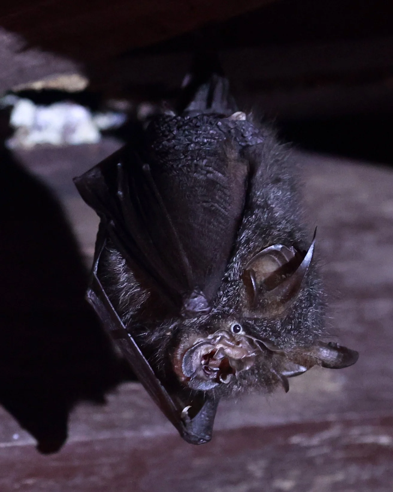
The masked palm civet (Paguma larvata), also known as the gem-faced civet or Himalayan palm civet, is a small, agile mammal native to South and East Asia. Named for the distinctive white and black "mask" on its face.

This masked palm civet (Paguma larvata), was seen at Phanoen Thung in the daylight hours - strange for a mainly nocturnal species.

The masked palm civet (Paguma larvata), is a member of the Viverridae family, making it a close relative of the mongoose and binturong rather than a true cat.

Masked palm civet (Paguma larvata)

Masked palm civet (Paguma larvata)
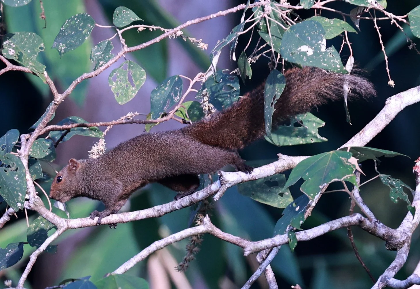
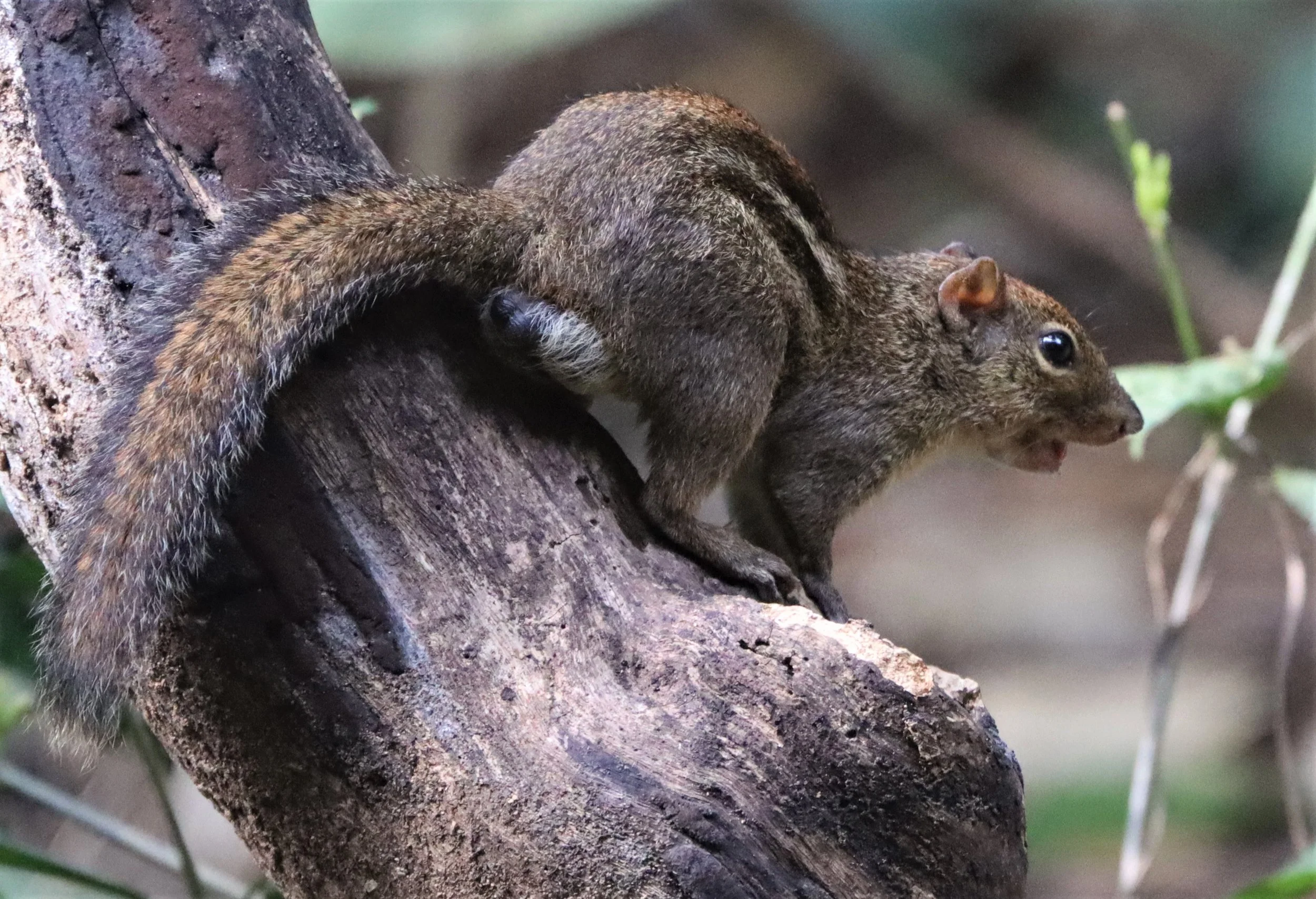
Pallas's squirrel (Callosciurus erythraeus), also commonly known as the red-bellied tree squirrel, is a medium-sized arboreal rodent native to Greater China, India, and Southeast Asia. It belongs to the genus Callosciurus, a name that translates to "beautiful squirrels".

Pallas's squirrel (Callosciurus erythraeus)

Woolly Horseshoe Bat (Rhinolophus luctus). This lovely bat was a resident in Neung's Bird Hide before the national park destroyed the hide.

Woolly Horseshoe Bat (Rhinolophus luctus)

The taxonomic classification of the mainland serow has undergone significant changes in recent decades, shifting from a single, broad species (Capricornis sumatraensis) to a species complex, multi-species model. Recent revisions based on total mitochondrial genome analysis have broken down the "mainland serow" group, recognizing distinct species previously treated as subspecies.

Mainland Serow (Capricornis sumatraensis). Som's father spotted this "bird" and it blew my mind to see this amazing Indochinese Serow (the name at the time). Upon showing this image to the rangers, they informed me that this was the first photo-documentation of serows in this sector of the karst mountain range.

Split of C. sumatraensis: Historically, Chinese (now C. milneedwardsii), red (now C. rubidus), and Himalayan (now C. thar) serows were considered subspecies of the mainland serow (C. sumatraensis). Modern revisions generally treat them as distinct species. Recent studies now generally recognize four distinct species of serow, including the Sumatran serow (C. sumatraensis) and the Burmese red serow (C. rubidus) as distinct mainland types.

The Southeast Asian Striped Squirrel (Tamiops barbei), formerly considered a subspecies of the Himalayan Striped Squirrel (T. mcclellandii), is a small, arboreal rodent found in Southeast Asia, including Thailand, Malaysia, and Myanmar.
The Southeast Asian Striped Squirrel (Tamiops barbei), ), is a small, arboreal rodent found in Southeast Asia, including Thailand, Malaysia, and Myanmar. It is distinguished by thick, bold, alternating cream and dark brown stripes running from the head to the tail, typically inhabiting tropical/subtropical forests, and is active during the day.

Recent studies (Hinckley et al., 2024) split Tamiops barbei from T. mcclellandii, recognizing it as a distinct species in Southeast Asia, distinct from the Himalayan form.
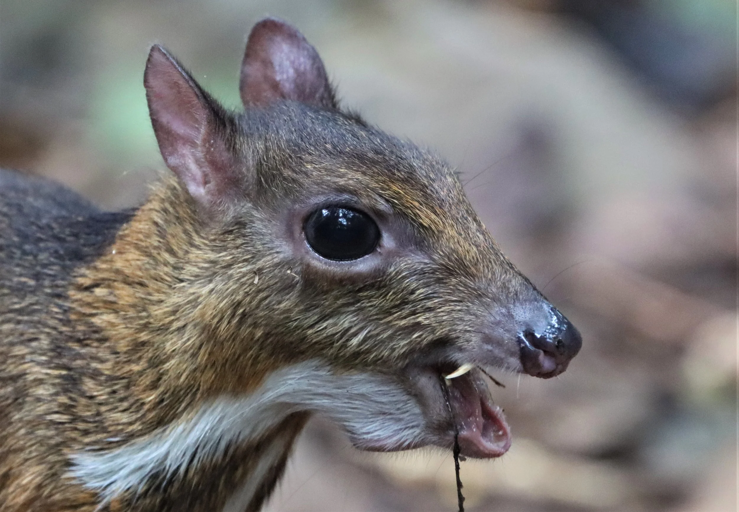
The lesser mouse-deer (Tragulus kanchil), also known as the kanchil or lesser Malay chevrotain, is the world’s smallest known hoofed mammal. Despite its name, it is neither a true mouse nor a true deer.

Lesser mouse deer (chevrotains) possess long, tusk-like canine teeth that protrude from their upper jaws, often referred to as vampire fangs. These teeth are prominent in males and are used for territorial defense and fighting, replacing the need for antlers, which this species lacks.

The lesser mouse-deer (Tragulus kanchil) belongs to the family Tragulidae, a primitive group of even-toed ungulates often referred to as "living fossils" because they have remained largely unchanged for over 30 million years.

Lesser mouse-deer (Tragulus kanchil) enjoying a cool drink on an oppressively hot dry season day.

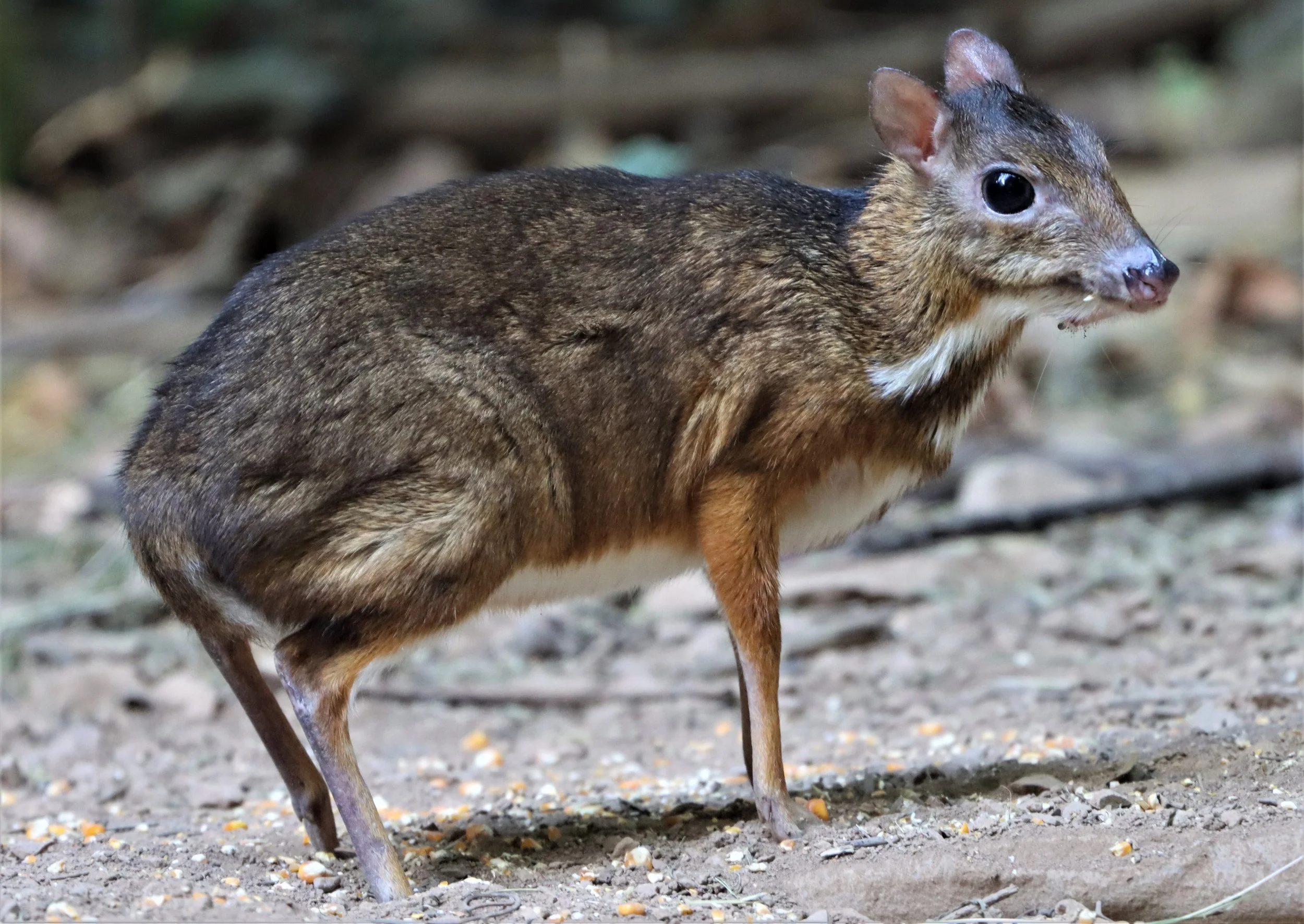
Lesser mouse-deer (Tragulus kanchil) are actually very common in the forests in and around the Kaeng Krachan Forest Complex. However the only way to reliably see them is in the local bird blinds where they come with the birds for water and corn.

Lesser mouse-deer (Tragulus kanchil) peeking around a bush at me,

Lesser mouse-deer (Tragulus kanchil) with its identifying breast pattern, the main field character used to distinguish between the lesser and greater mouse deer.
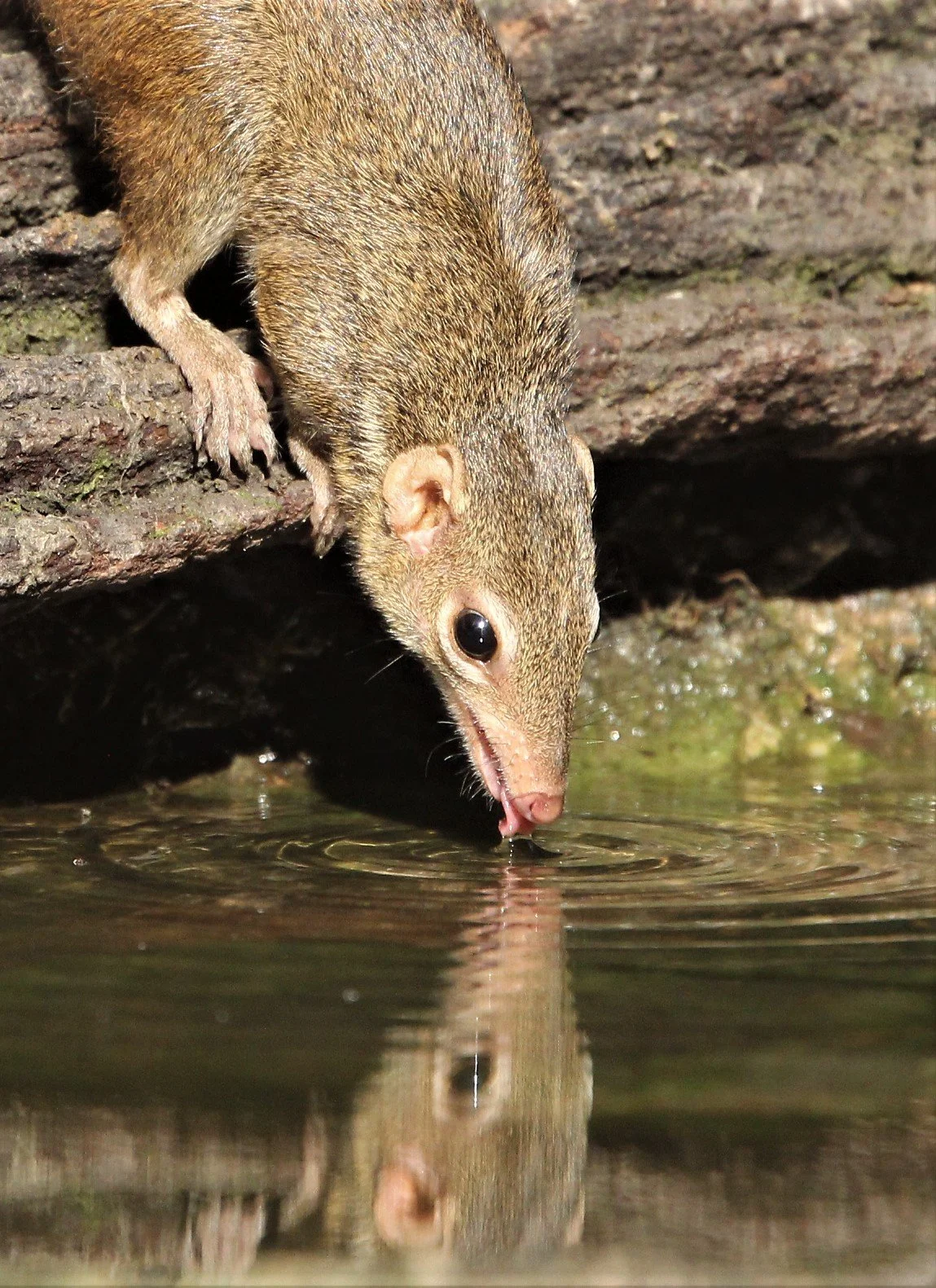
The northern treeshrew (Tupaia belangeri) is a small, squirrel-like mammal native to the tropical and subtropical forests of Southeast Asia. Despite their name, they are not true shrews and are actually closer relatives of primates.

Treeshrews, including the Northern treeshrew (Tupaia belangeri) and Northern smooth-tailed treeshrew (Dendrogale murina), are frequently described as "living fossils" because they have changed very little morphologically over the past 60 million years. As members of the order Scandentia, they are considered excellent "living models" for ancestral primates.

Evolutionary "Living Fossil" Status: Studies, including findings from Early Oligocene fossils, indicate that treeshrews are slowly evolving creatures that have maintained primitive anatomical features for tens of millions of years. Despite their squirrel-like appearance, treeshrews are closely related to Primates and Dermoptera (colugos), sharing a common ancestor in the superordinal group Euarchonta. Because they retain early primate-like traits, they are often used to study the evolution of primate traits, including vision and complex behaviors.

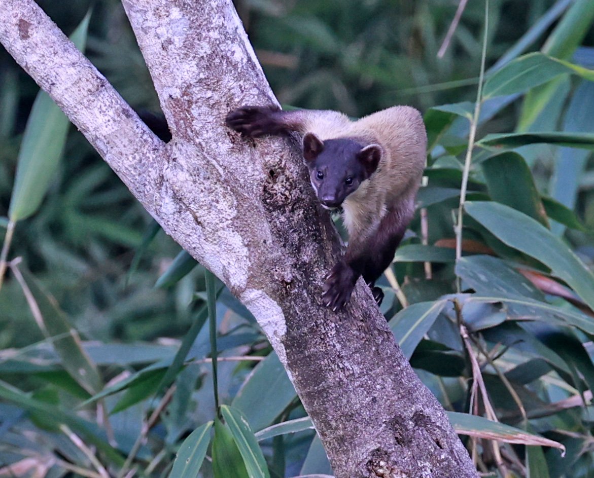
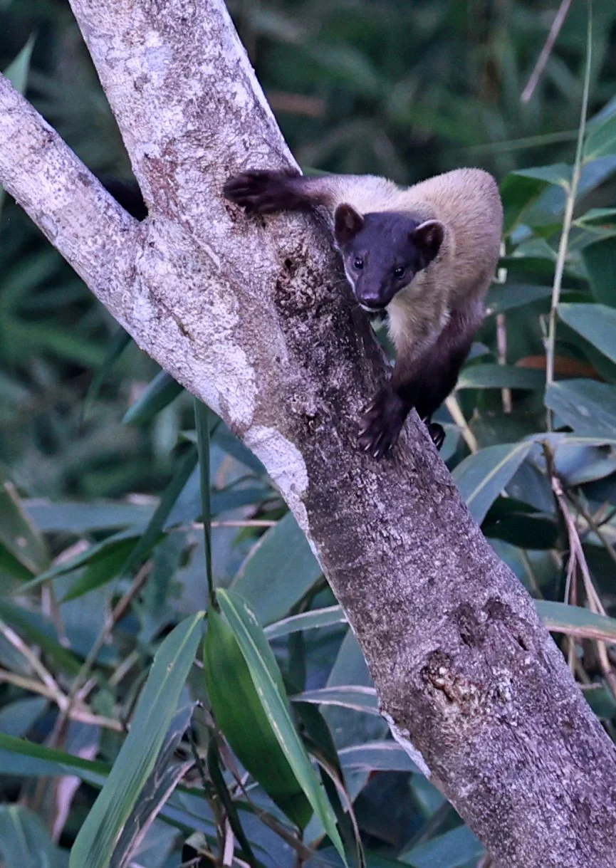
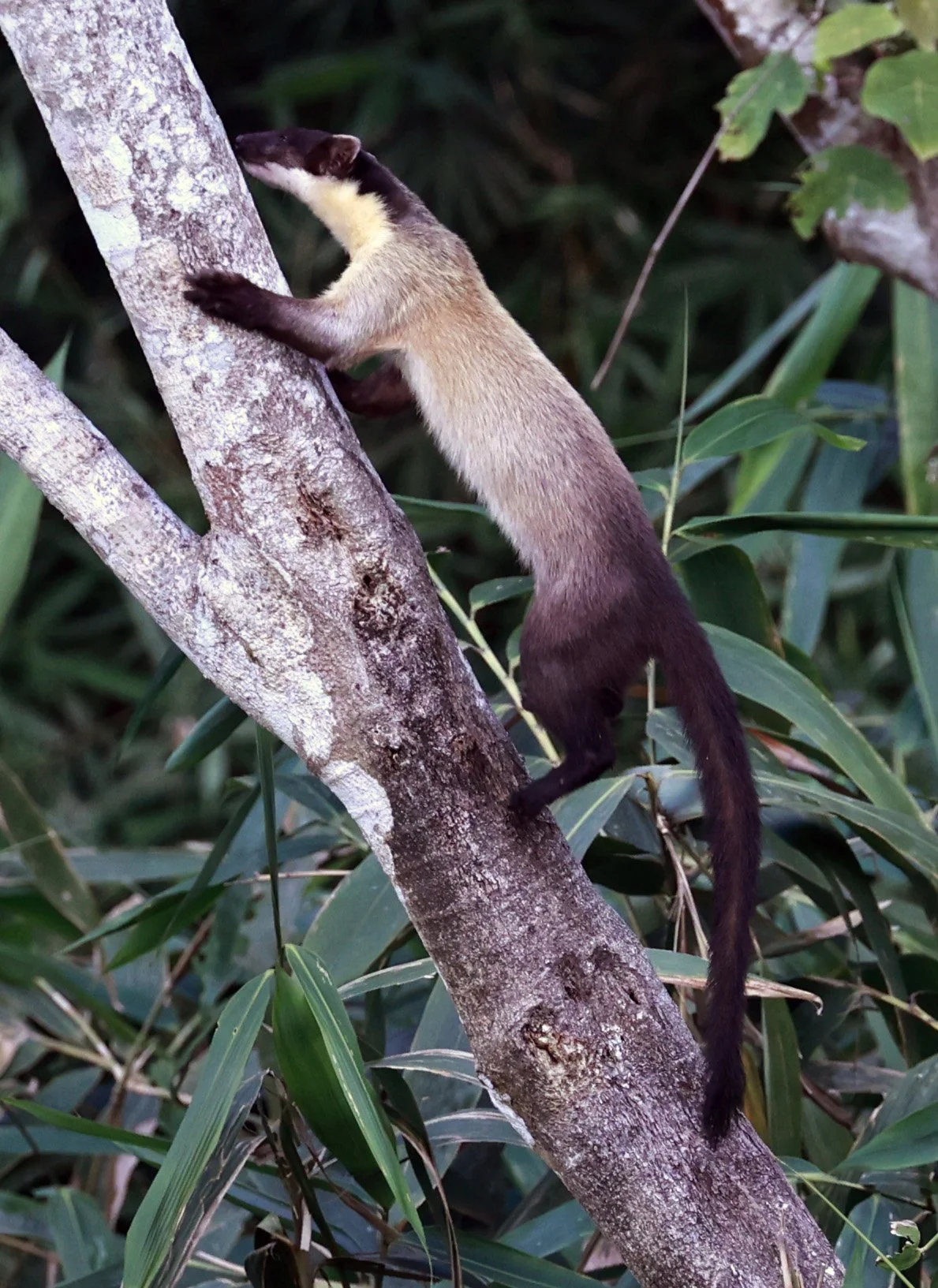
The yellow-throated marten (Martes flavigula), also known as the kharza, is a colorful and bold member of the weasel family (Mustelidae) native to South, Southeast, and East Asia. It is the largest marten in the Old World and is easily recognized by its vibrant orange-yellow throat and chest.
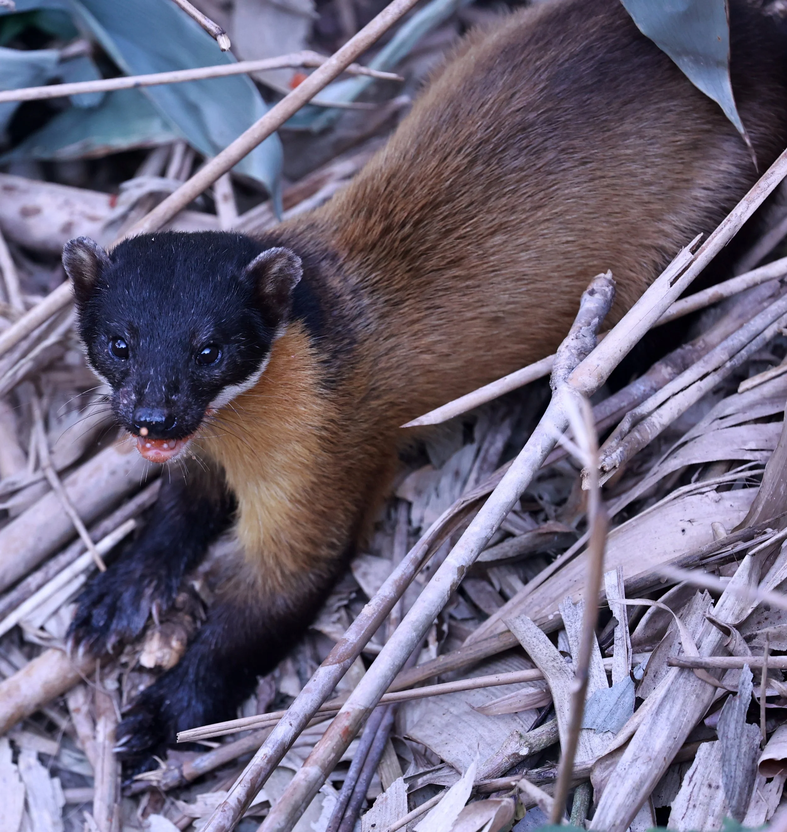
The yellow-throated marten (Martes flavigula) can be found from the Himalayas and eastern Russia down to the Malay Peninsula and the islands of Borneo, Sumatra, and Java. They inhabit a variety of landscapes, including temperate mixed forests, tropical rainforests, and alpine meadows up to 4,500 meters in elevation.


Yellow-throated martens are very common in the greater Kaeng Krachan Forest Complex and can be seen with luck in many locations.

The yellow-throated marten (Martes flavigula) seen behind the kitchen at Phanoen Thung where they are commonly seen.


THREE Yellow-throated martens (Martes flavigula) on Phanoen Thung!

Yellow-throated marten (Martes flavigula)

Yellow-throated marten (Martes flavigula)
Birdlife: One of Thailand’s Richest Avian Regions
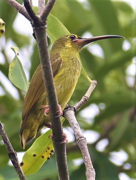
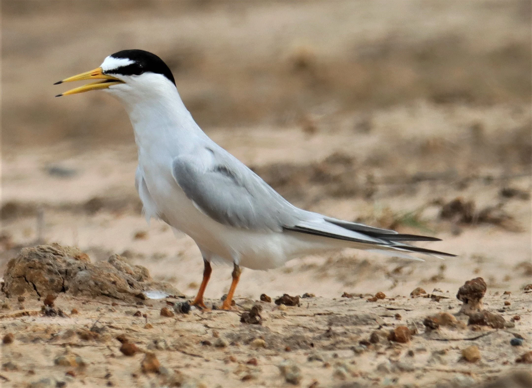
Kaeng Krachan is celebrated among ornithologists for having extraordinary bird diversity, owing to its mixture of habitats, altitudes, and continental floral zones. The Kaeng Krachan Forest Complex overlaps with two Important Bird Areas (IBAs) and hosts numerous endemic and globally threatened bird species. Birdlife includes broadbills, hornbills, raptors, pittas, sunbirds, and an exceptional array of forest songbirds. [whc.unesco.org]
The park is particularly known for easy birdwatching opportunities along open forest roads, especially during the dry season when birds gather at water sources. While specific species lists vary by season, Kaeng Krachan is widely regarded as one of the best sites in Thailand for encountering rare forest birds, due in part to its elevation gradient and extensive feeding grounds in evergreen zones. [thaination...lparks.com]
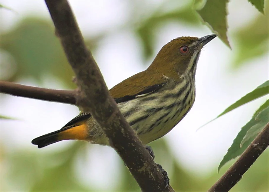
Orange-bellied Flowerpecker (Dicaeum trigonostigma)
Orange-bellied Flowerpecker (Dicaeum trigonostigma)
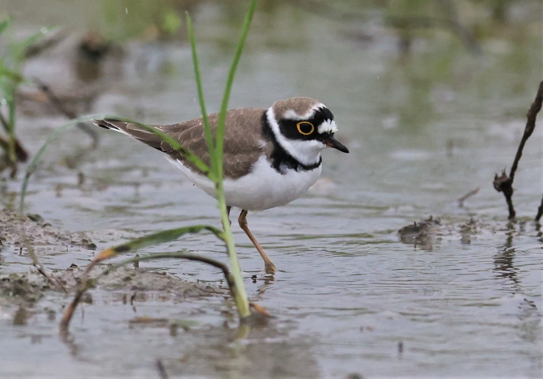
Common Ringed Plover (Charadrius hiaticula)
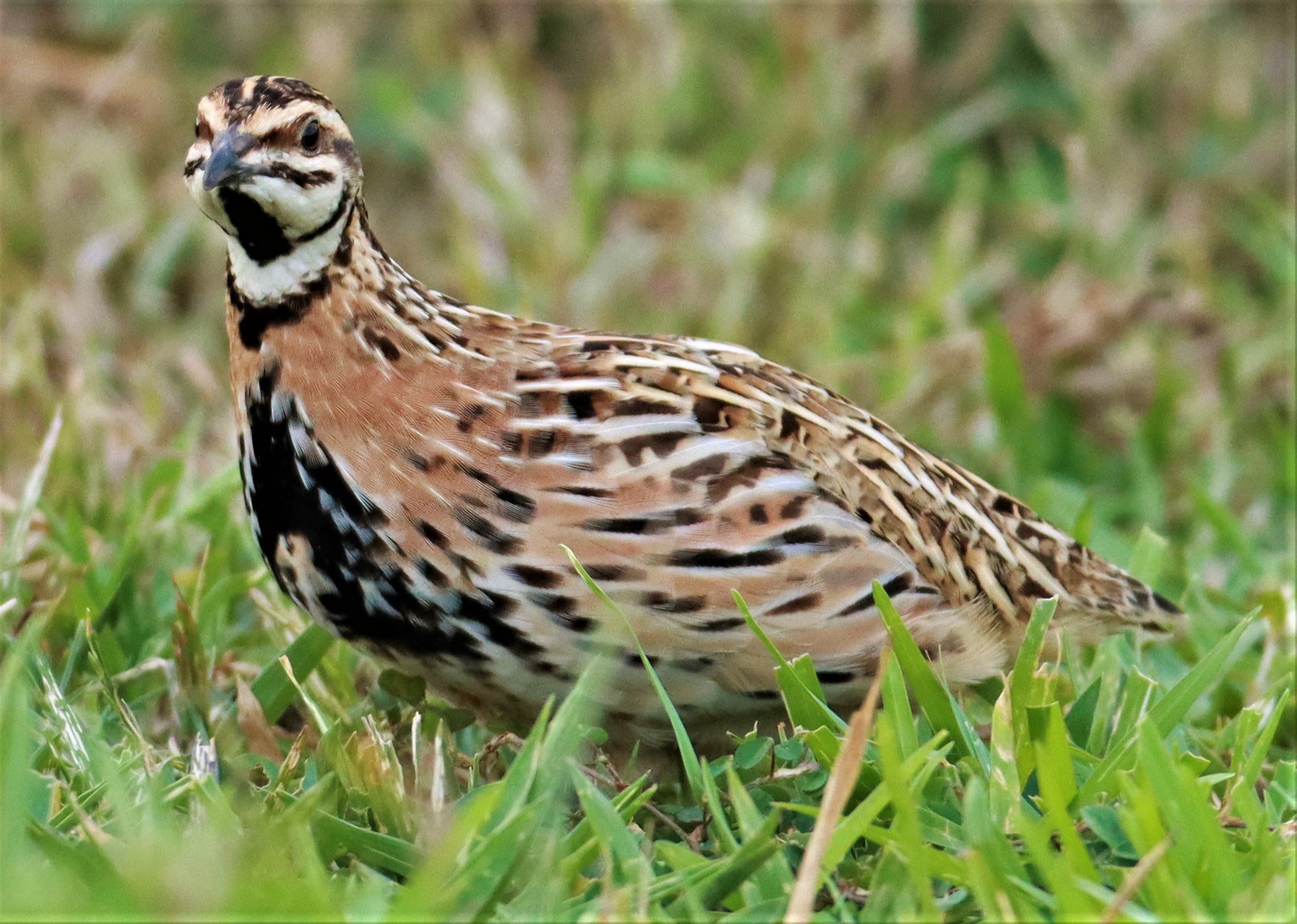
Chinese Francolin (Francolinus pintadeanus)
Chinese Francolin (Francolinus pintadeanus) can still be found in the scrublands surrounding the lowlands of the complex although the species is becoming increasingly rare due to insane tax laws and habitat destruction.
Ashy Minivet (Pericrocotus divaricatus)
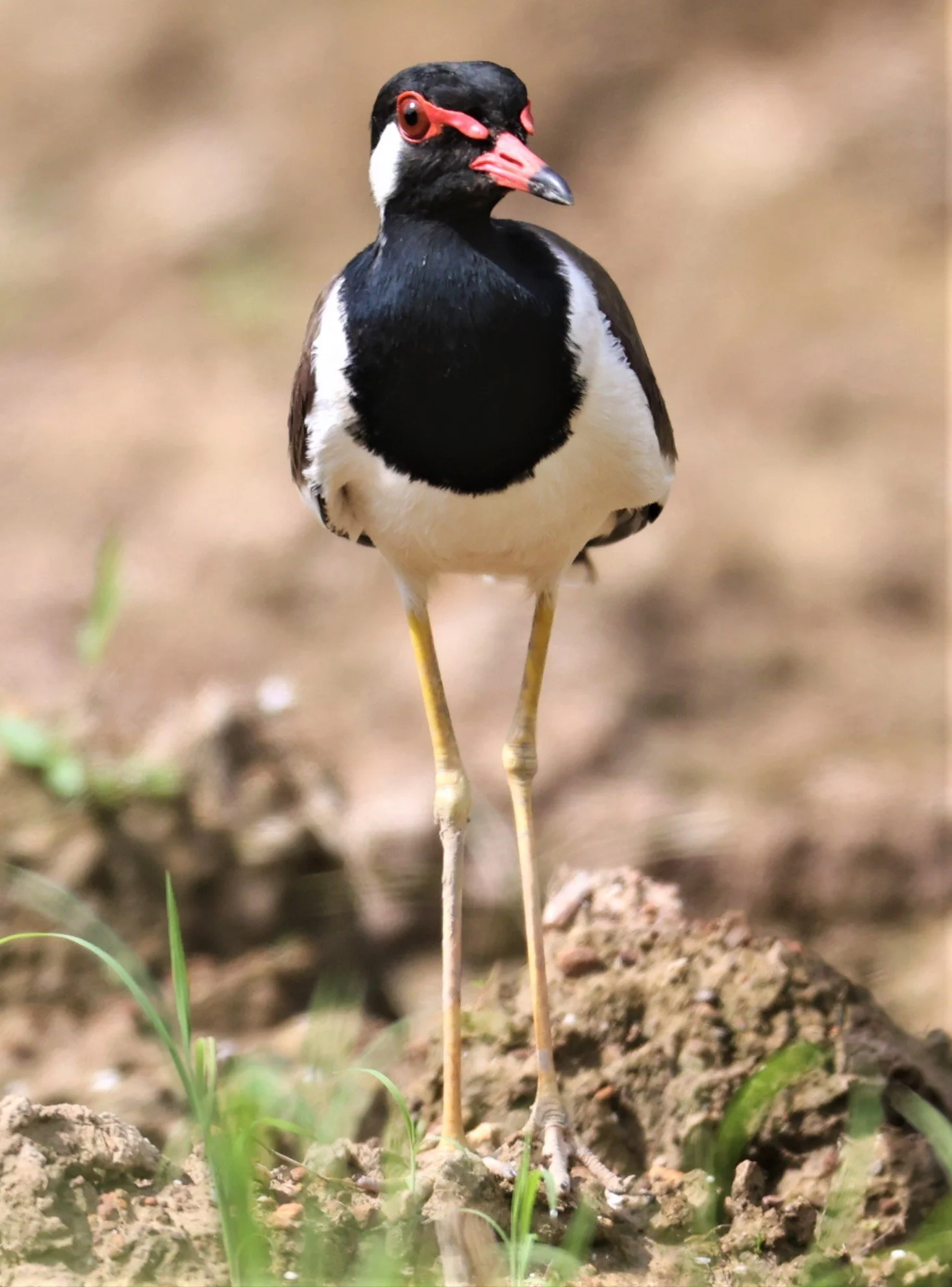
Red-wattled Lapwing (Vanellus indicus) produce the ubiquitous warning call in and around fields and water features throughout the region
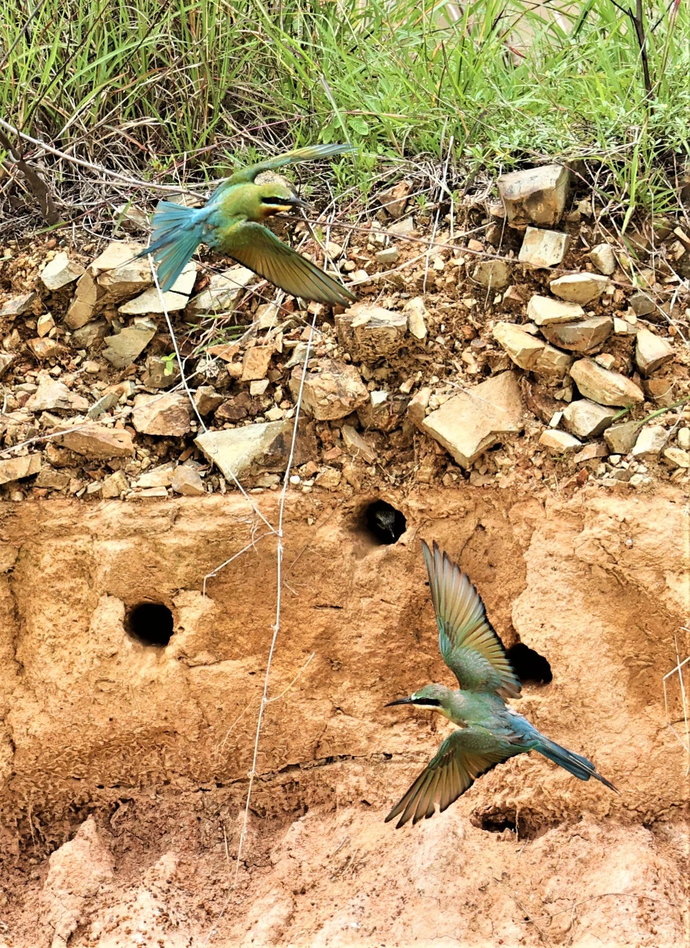
Blue-tailed Bee-eater (Merops philippinus) taking care of young in their cliffside nests.
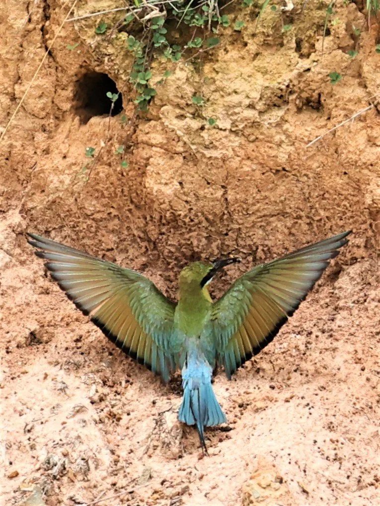
Blue-tailed Bee-eater (Merops philippinus)

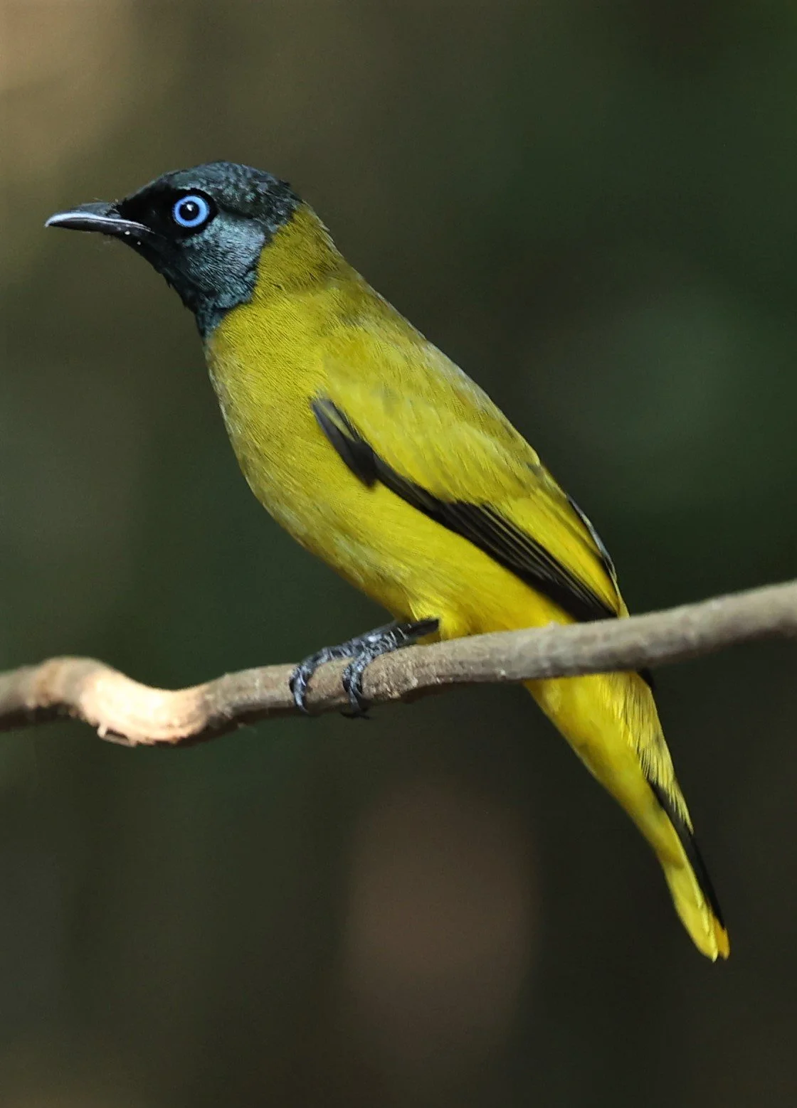
Ashy Bulbul (Hemixos flavala)
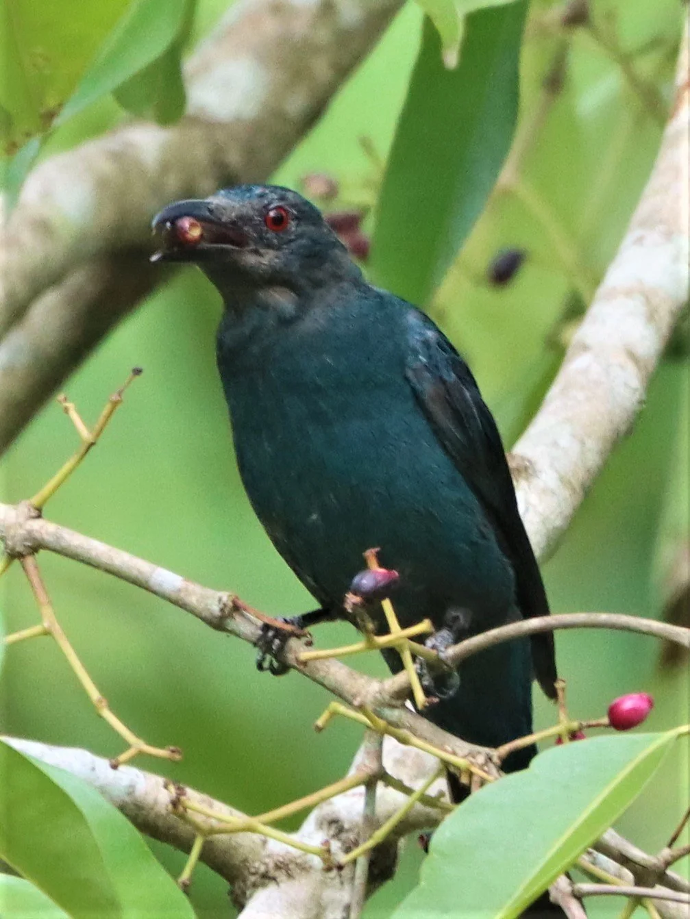
Asian fairy-bluebird (Irena puella) female

Asian fairy-bluebird (Irena puella) male

Black Baza (Aviceda leuphotes)
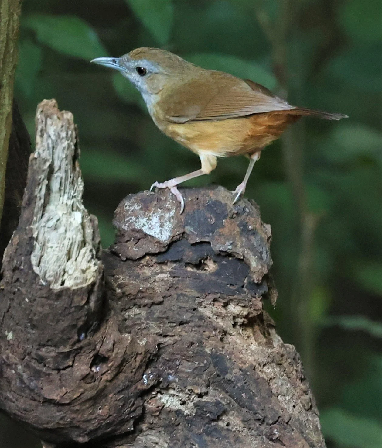
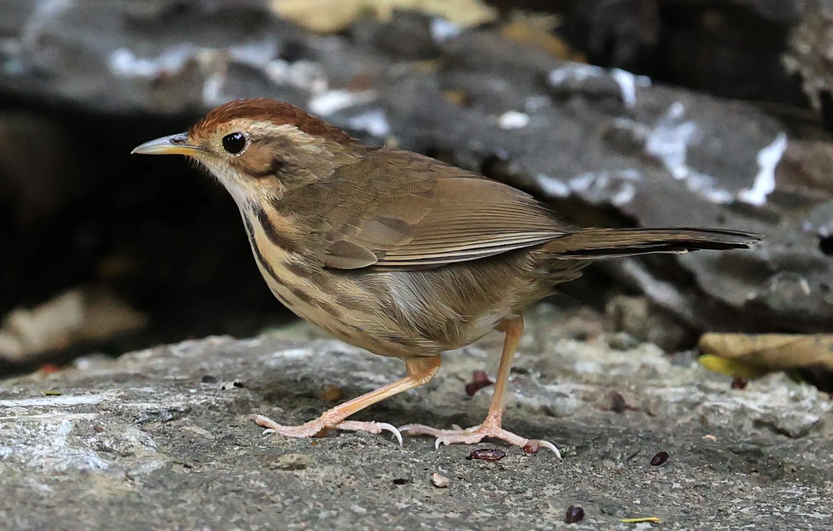
Abbott's Babbler (Malacocincla abbotti)

Chestnut-capped Babbler (Timalia pileata)

Puff-throated Babbler (Pellorneum ruficeps) Kaeng Krachan National Park

Blue-eared Barbet (Megalaima australis)

Blue-throated Barbet (Megalaima asiatica)

Blue-throated Barbet (Megalaima asiatica)

Coppersmith Barbet (Psilopogon haemacephalus) and the producers of another ubiquitous sound in the forests of the complex. Once you hear their sound you understand their name better.
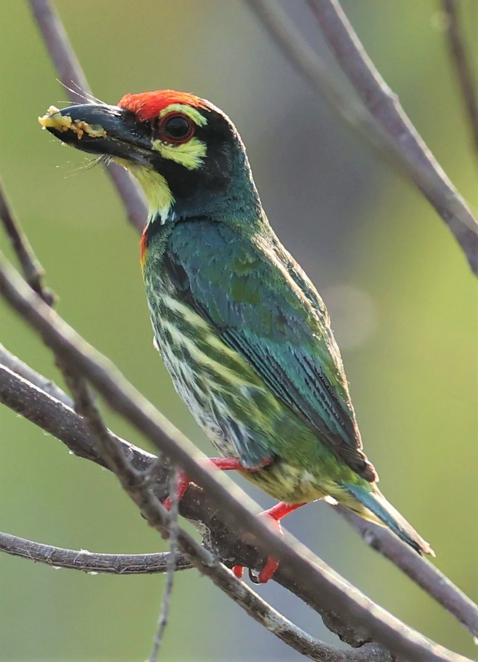
Coppersmith Barbet (Psilopogon haemacephalus)

Green-eared Barbet (Megalaima faiostricta)
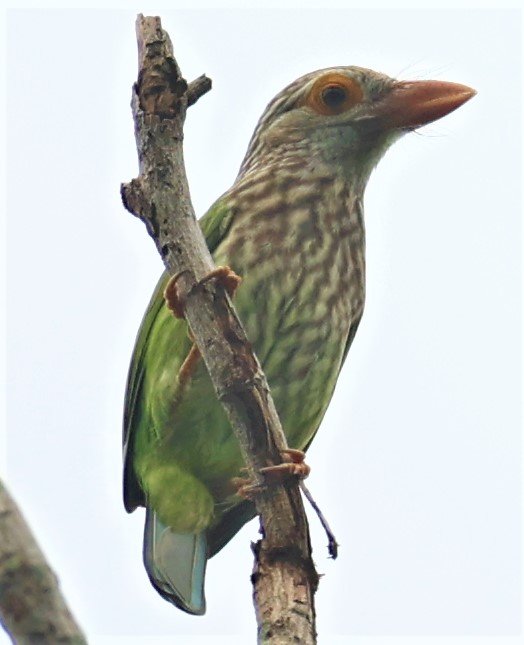
Lineated Barbet (Megalaima lineata)

Jerdon's Baza (Aviceda jerdoni) chick

Blue-tailed Bee-eater (Merops philippinus)

Blue-tailed Bee-eater (Merops philippinus)

Asian Green Bee-eater (Merops orientalis) Khao Sam Roi Yod

Blue-bearded Bee-eater (Nyctyornis athertoni)
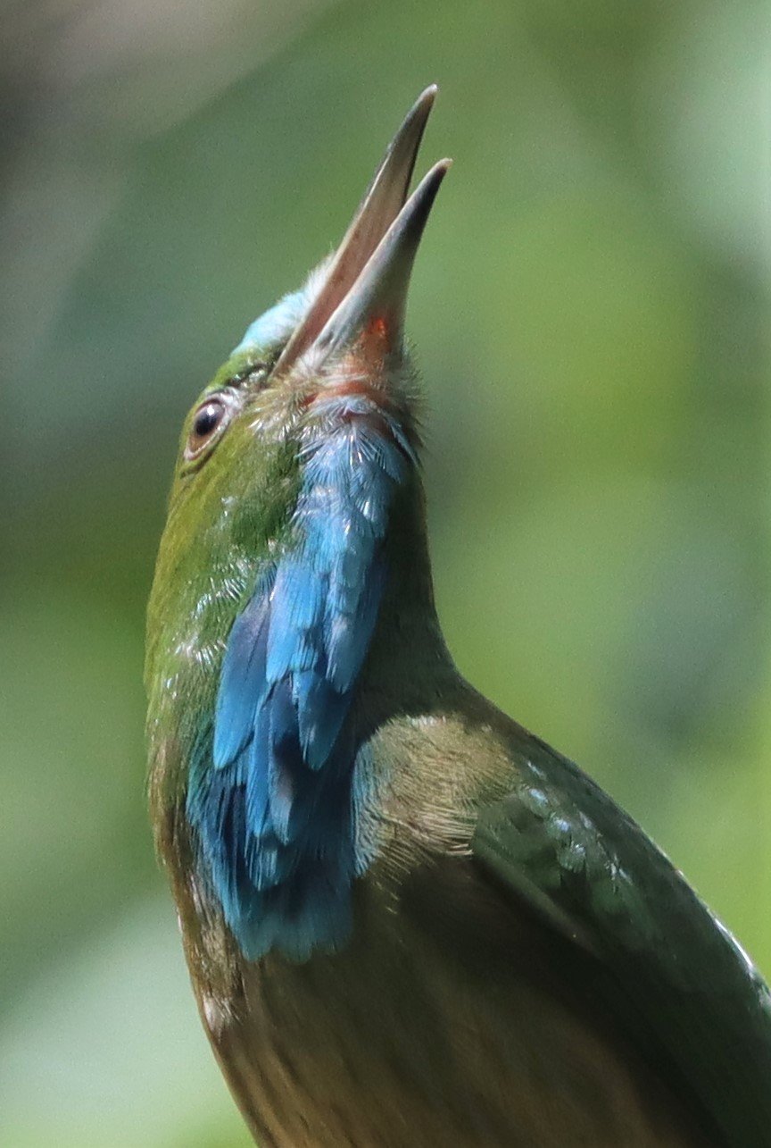
Blue-bearded Bee-eater (Nyctyornis athertoni)

Asian Green Bee-eater (Merops orientalis)
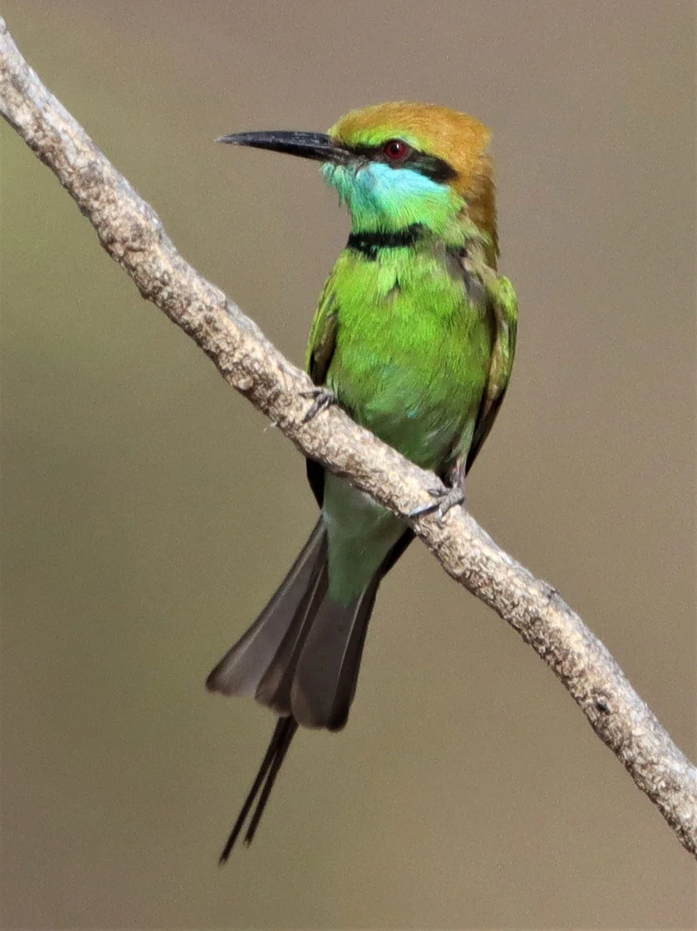
Asian Green Bee-eater (Merops orientalis)

Black-hooded Oriole (Oriolus xanthornus) Baan Maka Nature Resort Petchaburi
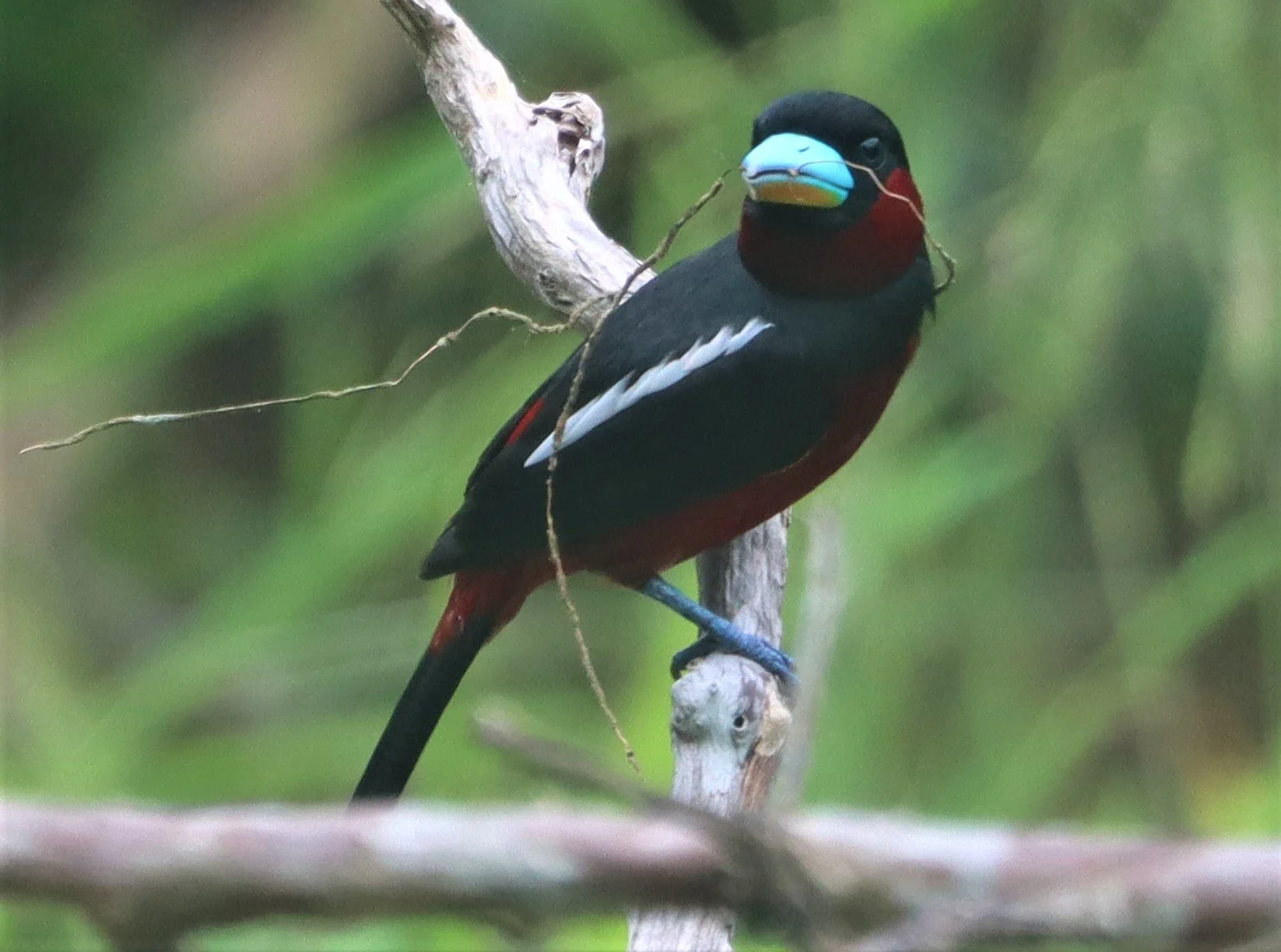
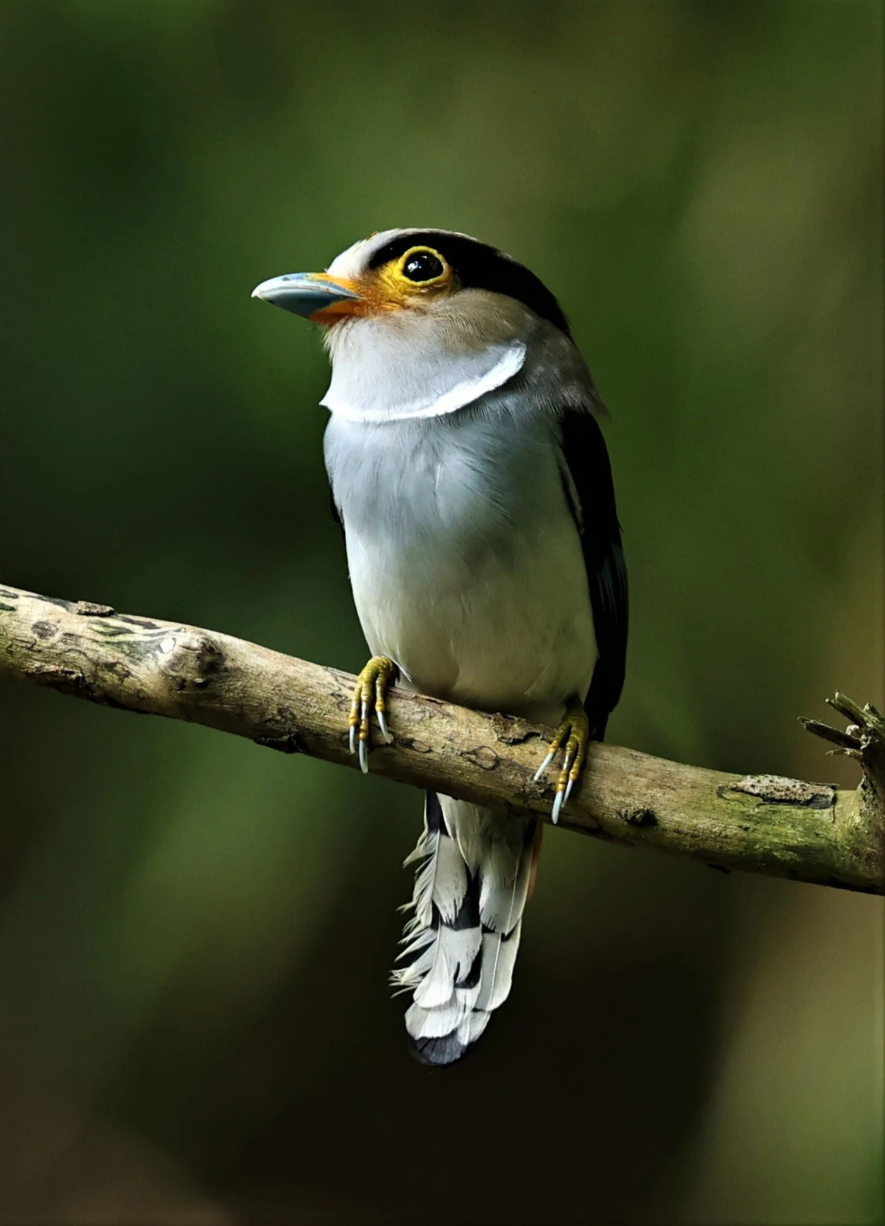
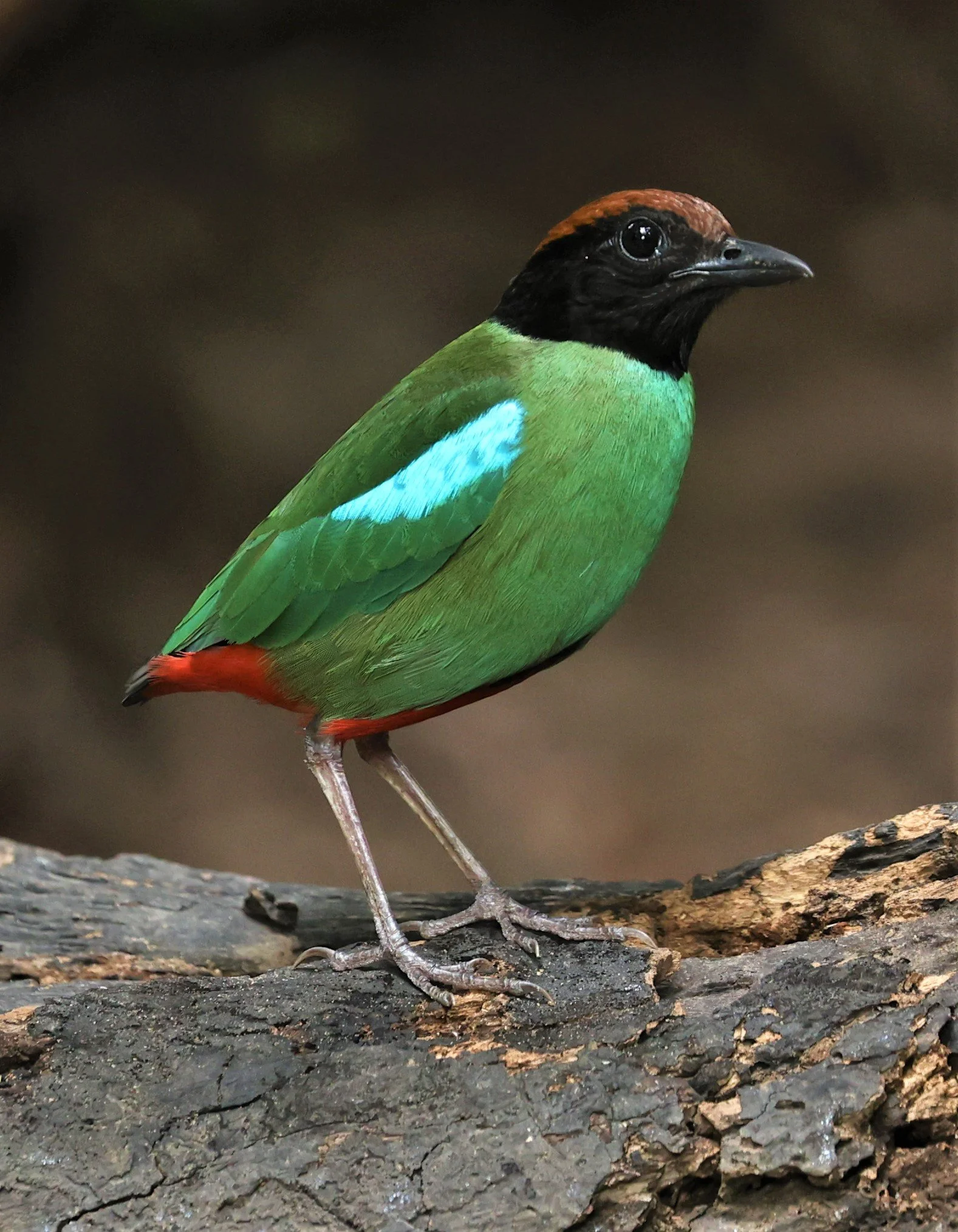
Red & BlackBroadbill (Cymbirbynchus macrorhynchus)

Banded Broadbill (Eurylaimus javanicus)

Black & Yellow Broadbill (Eurylaimus ochromalus)
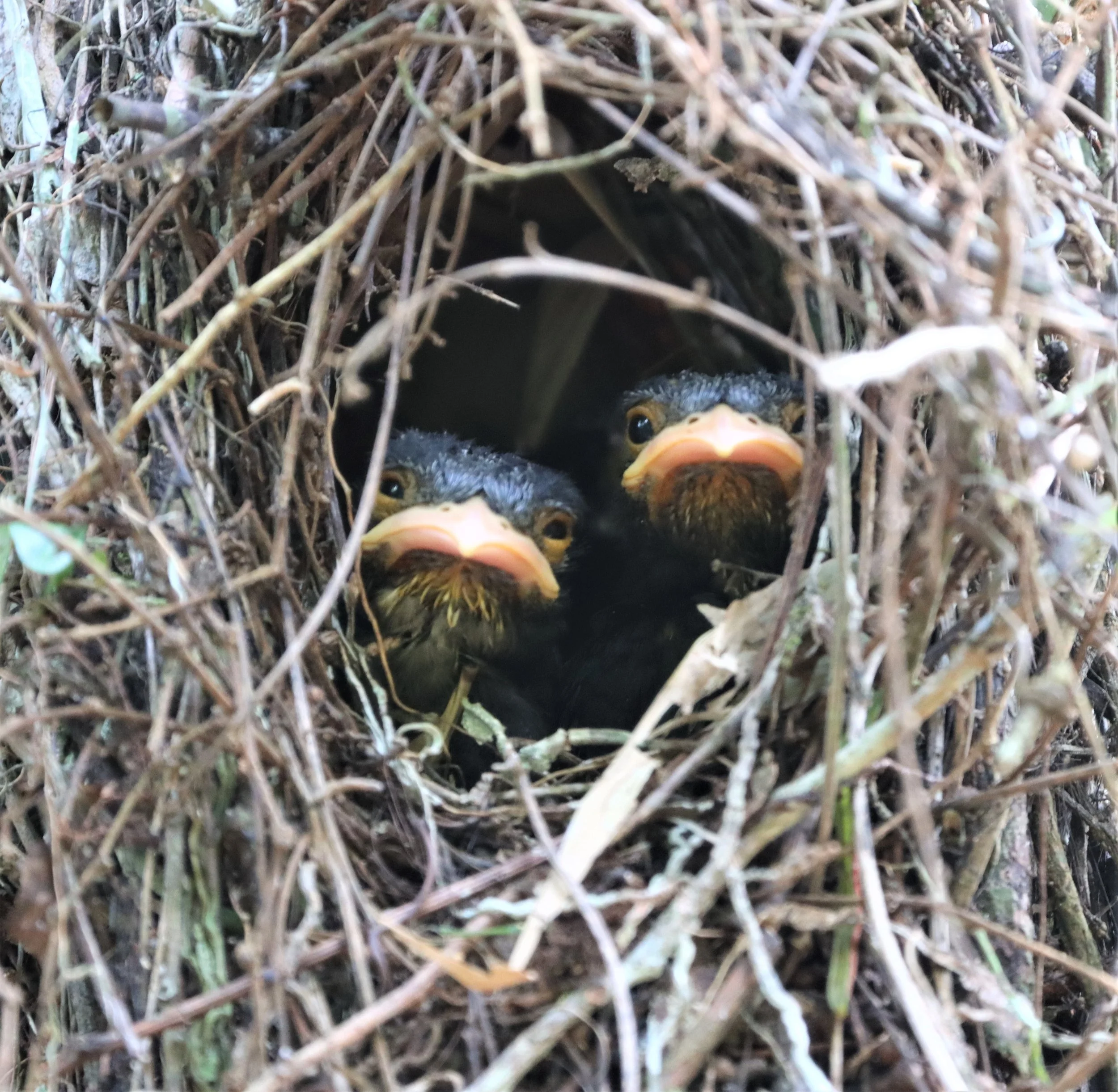
Dusky Broadbill (Corydon sumatranus) chicks
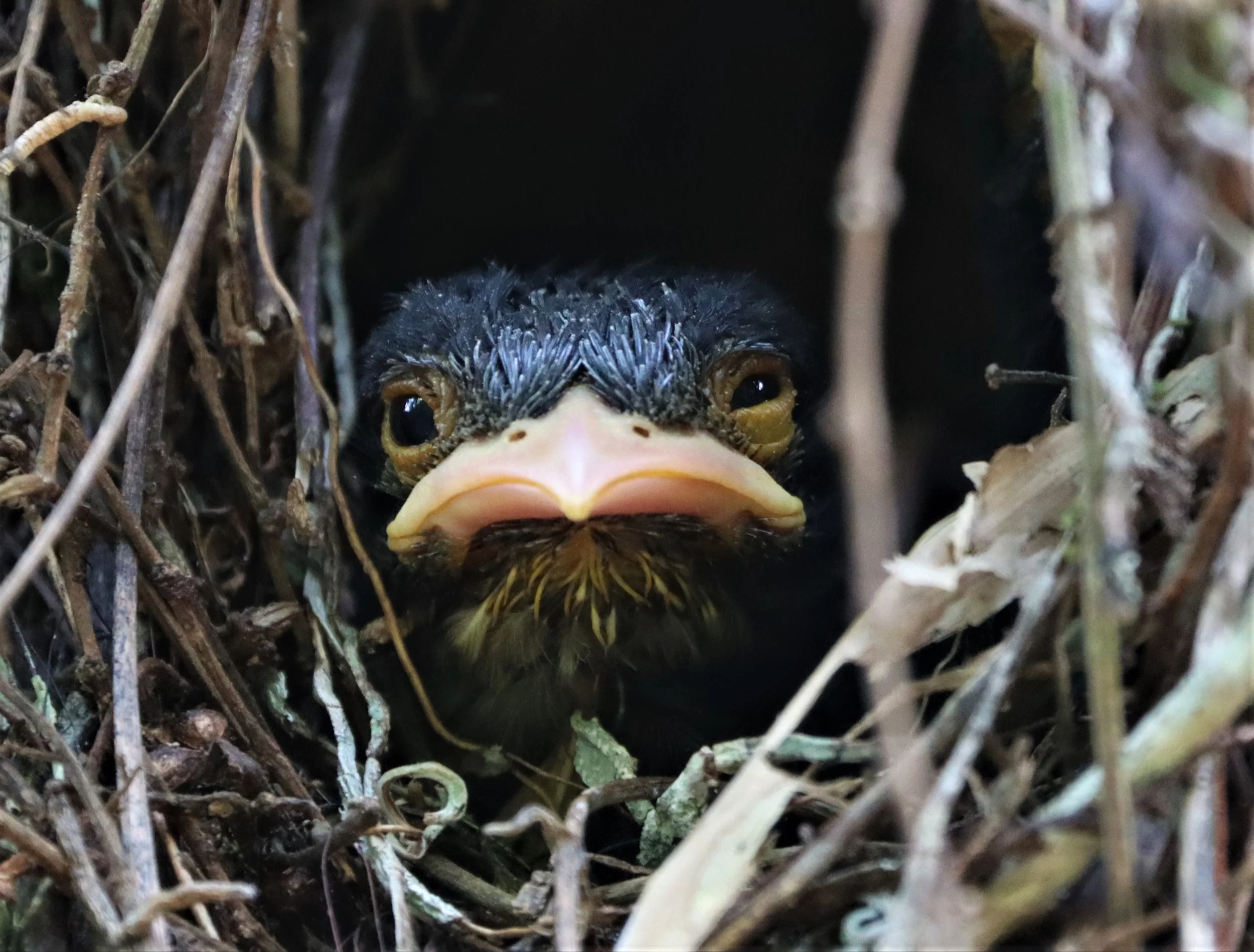
Dusky Broadbill (Corydon sumatranus) chick

Dusky Broadbill (Corydon sumatranus) nest. When you find an active nest of the Dusky Broadbills, you are likely to find several adults caring for the young. This species practices multi-generational offspring care.
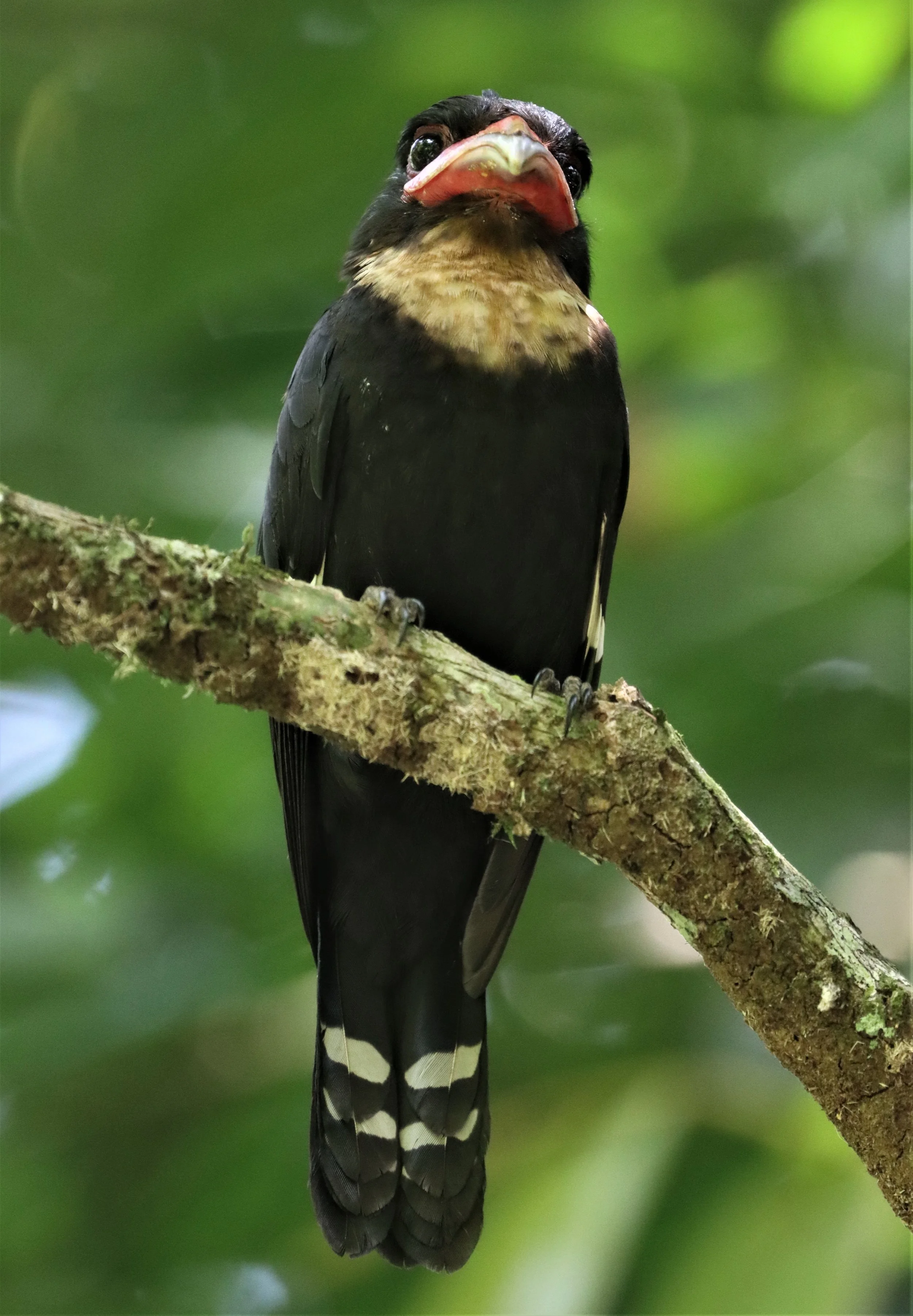
Dusky Broadbill (Corydon sumatranus)
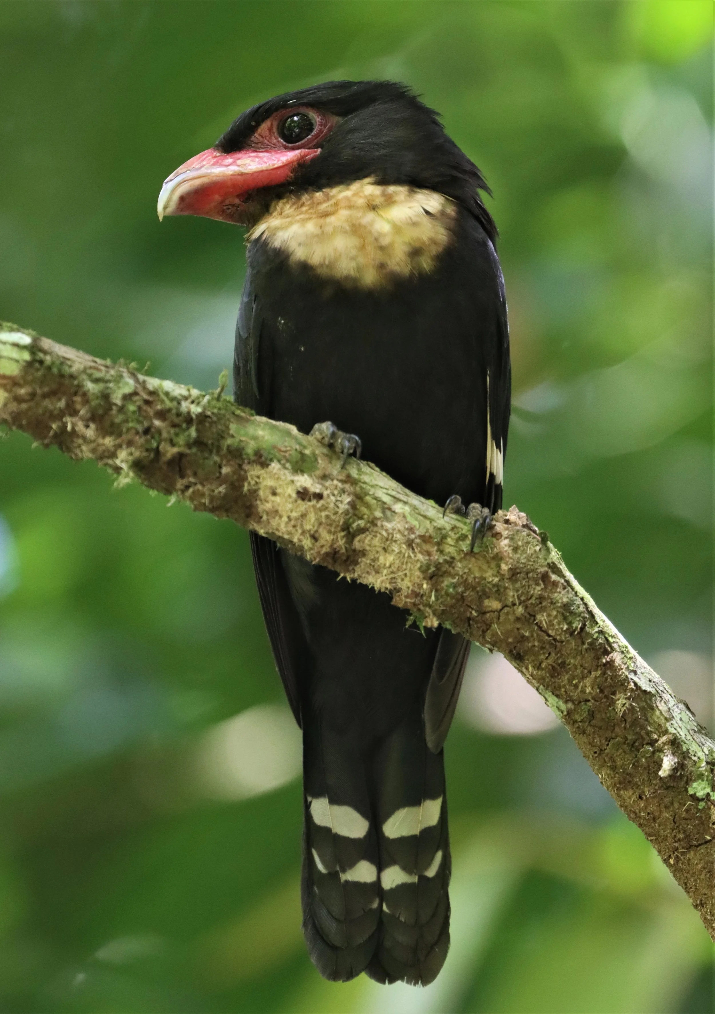
Dusky Broadbill (Corydon sumatranus)
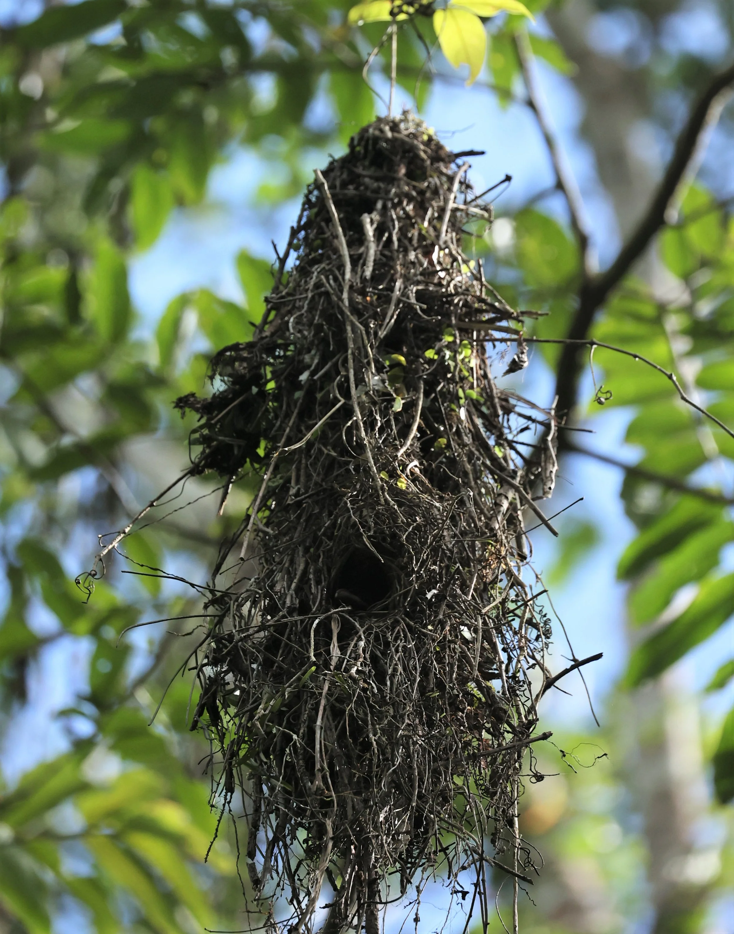
Nest of the Long-tailed Broadbill at Kaeng Krachan
Silver-breasted Broadbill (Serilophus lunatus)

Silver-breasted Broadbill (Serilophus lunatus)
Baker's Bulbul (Iole cinnamomeoventris)
Black-crested Bulbul (Pycnonotus melanicterus)

Black-crested Bulbul (Pycnonotus melanicterus)
Black-headed Bulbul (Pycnonotus atriceps)

Baker's Bulbul (Iole cinnamomeoventris)

Stripe-throated Bulbul (Pycnonotus finlaysoni)

Cotton Pygmy Goose (Nettapus coromandelianus)
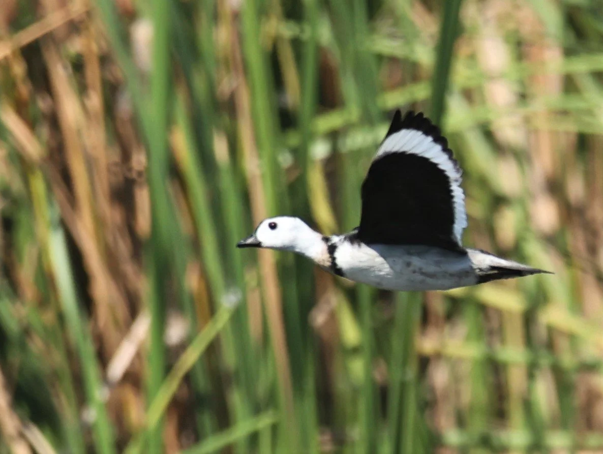
Cotton Pygmy Goose (Nettapus coromandelianus)

Cotton Pygmy Goose (Nettapus coromandelianus)
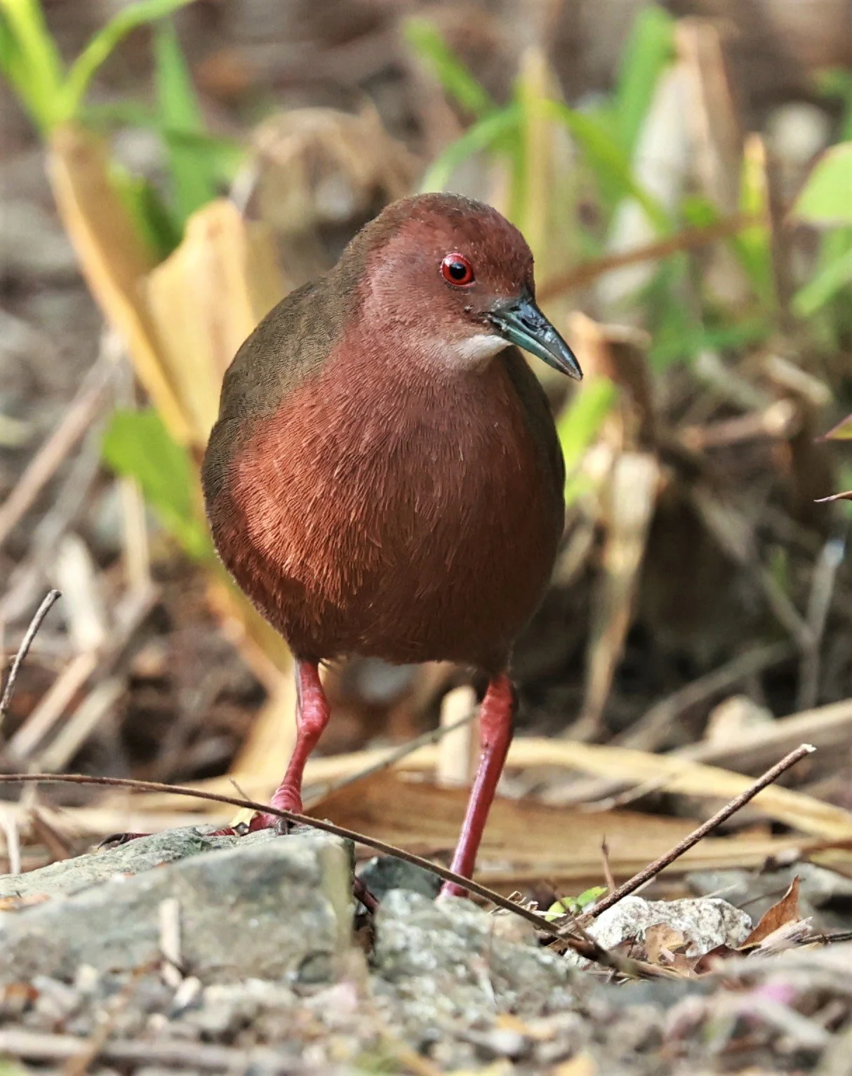
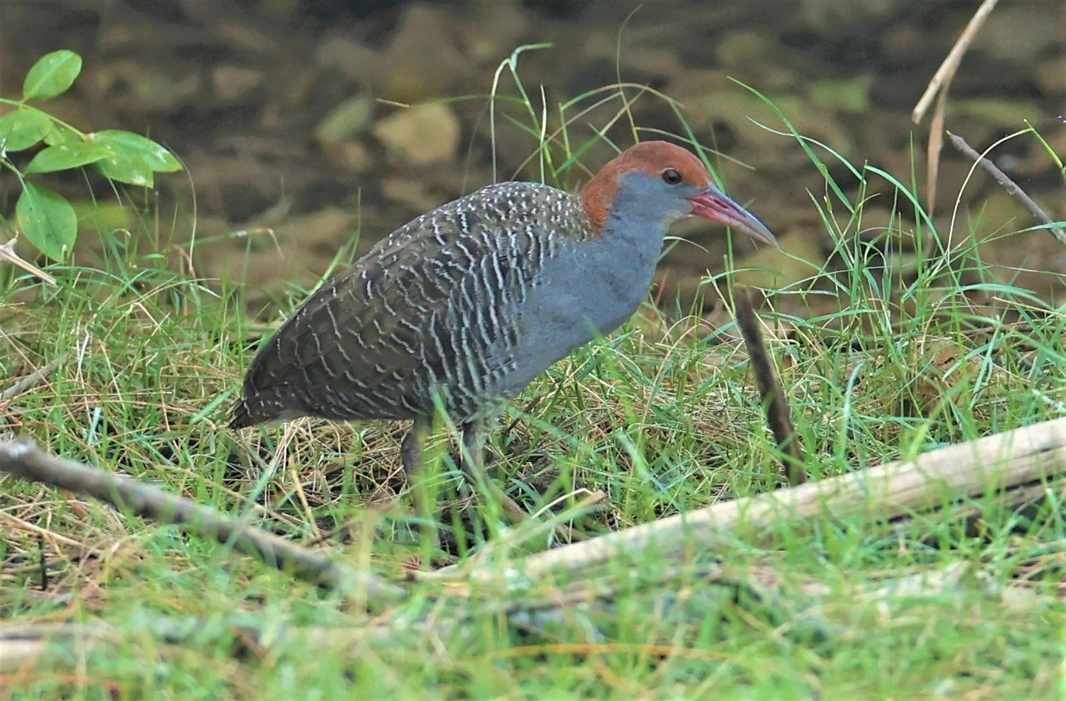
Ruddy-breasted Crake (Porzana fusca) Kaeng Krachan

Ruddy-breasted Crake (Porzana fusca) Kaeng Krachan

Indian Cuckoo (Cuculus micropterus)
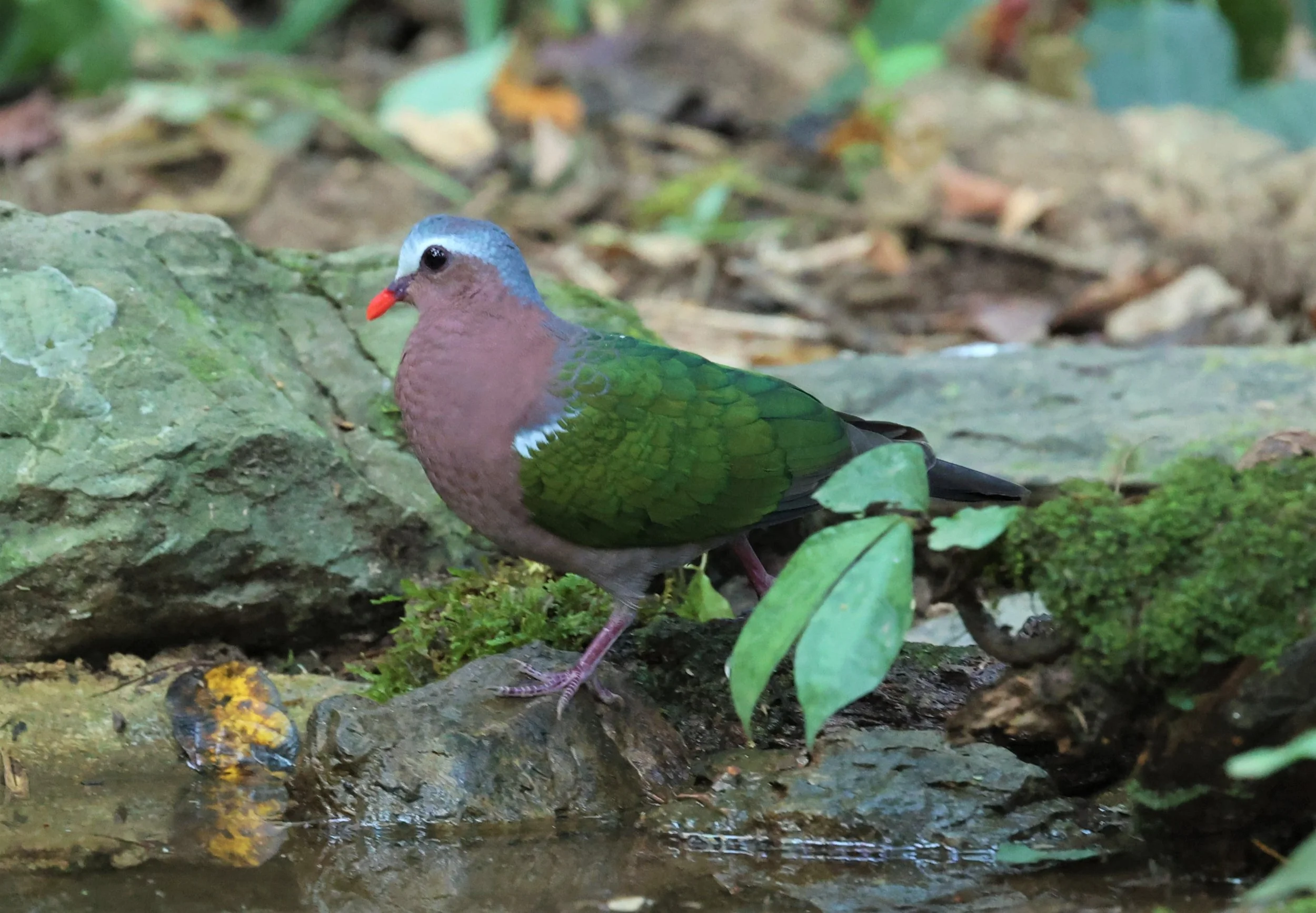
Emerald Dove (Chalcophaps indica)

Spotted Dove (Streptopelia chinensis)

Ashy Drongo (Dicrurus leucophaeus)
Black Drongo (Dicrurus macrocercus)

Bronzed Drongo (Dicrurus aeneus)
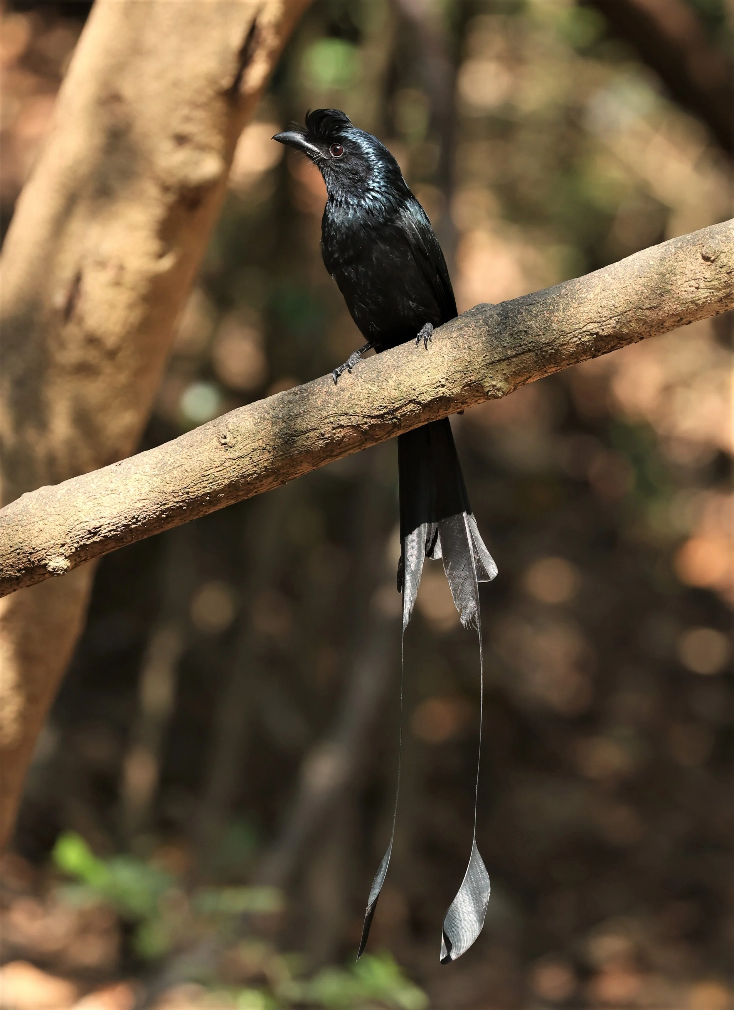
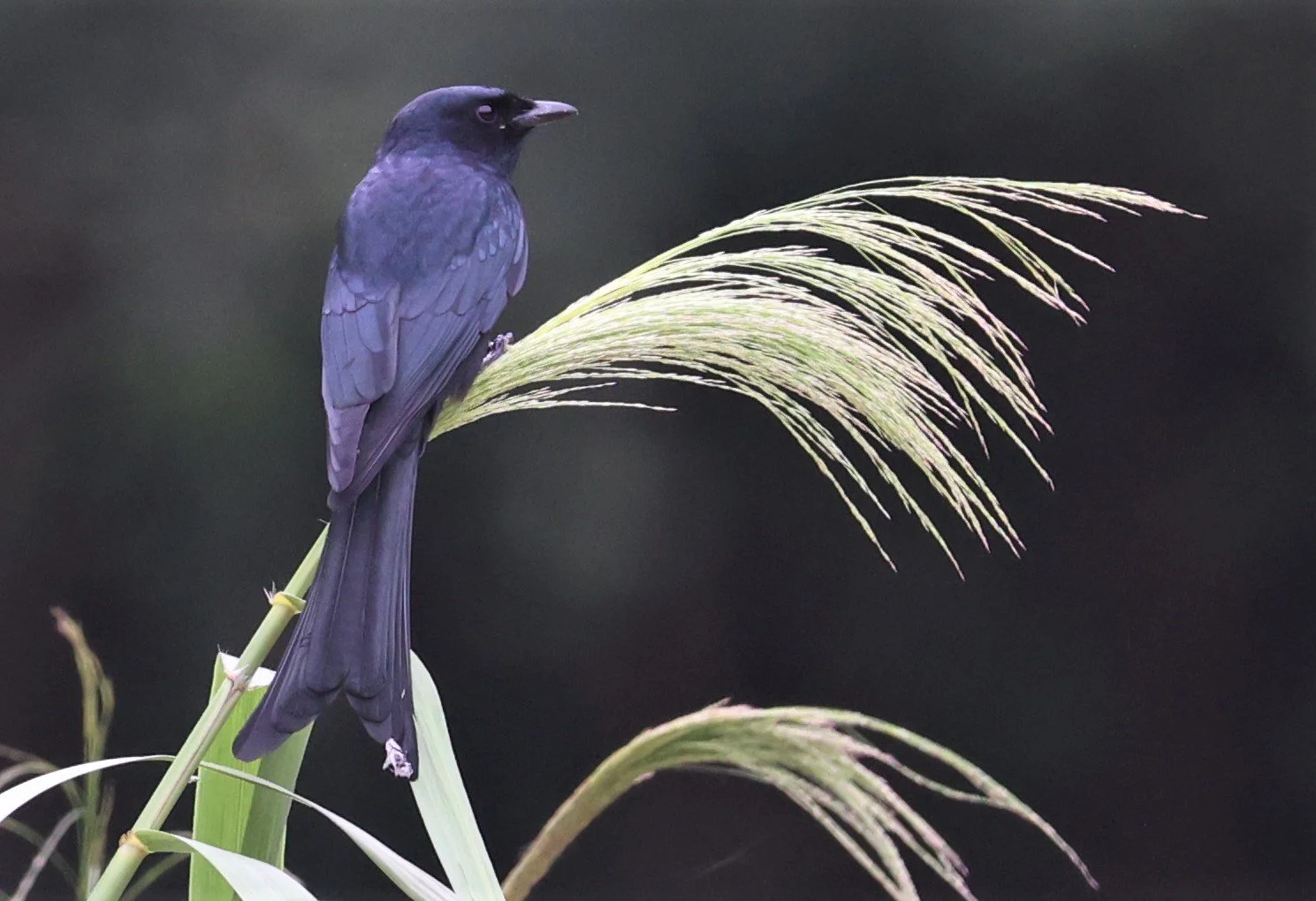
Greater Racket-tailed Drongo (Dicrurus paradiseus)

Greater Racket-tailed Drongo (Dicrurus paradiseus)

Lesser Whistling Duck (Dendrocygna javanica)

Crested Serpent Eagle (Spilornis cheela)

Pied Fantail (Rhipidura javanica)

Pied Fantail (Rhipidura javanica)

Flavescent bulbul (Pycnonotus flavescens) Kaeng Krachan National Park Thailand

Flavescent bulbul (Pycnonotus flavescens) Kaeng Krachan National Park Thailand

Yellow-vented Flowerpecker (Dicaeum chrysorrheum)
Yellow-vented Flowerpecker (Dicaeum chrysorrheum)

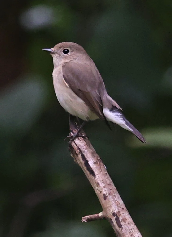
Asian Brown Flycatcher (Muscicapa dauurica)

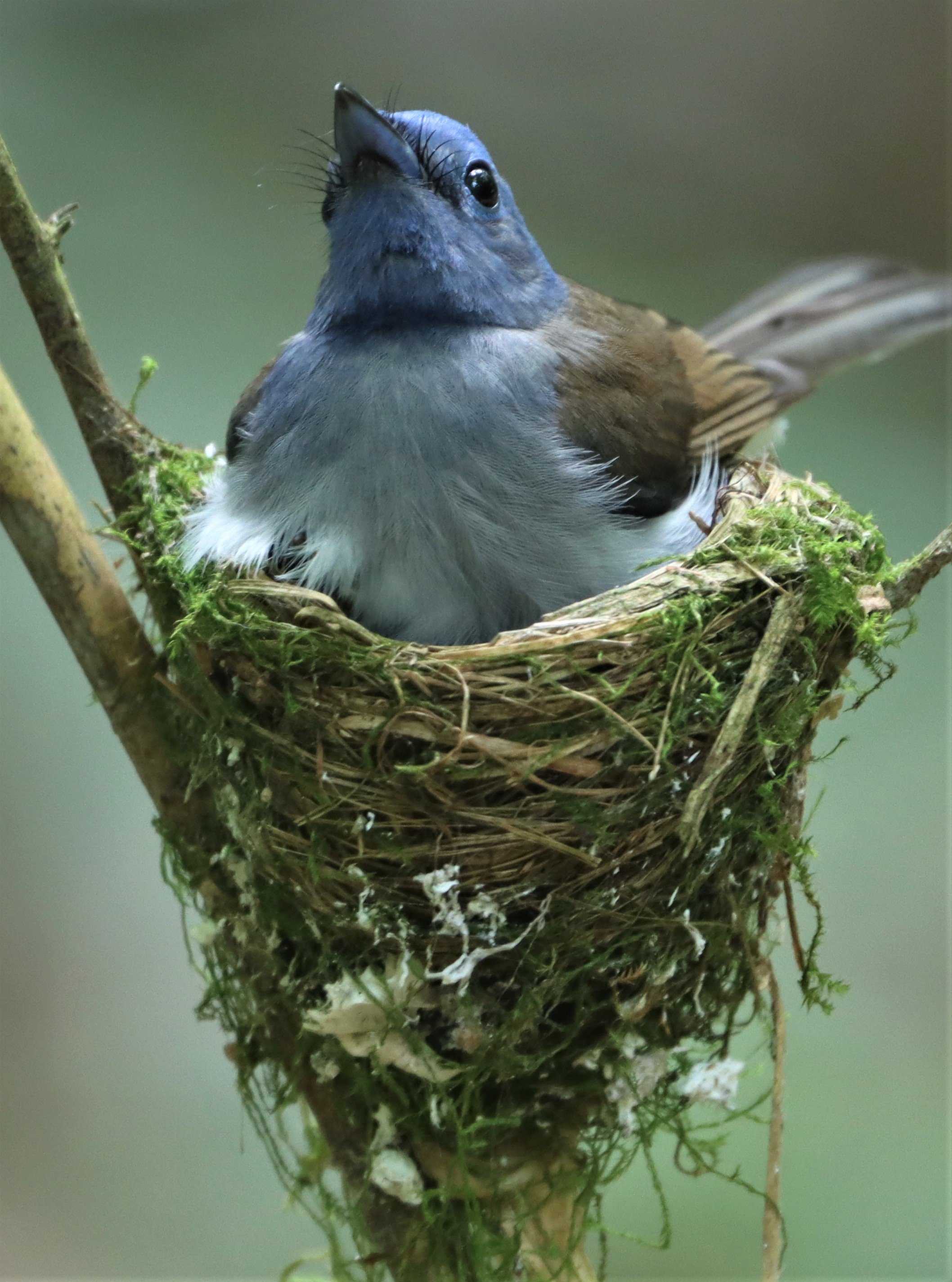
Chinese Blue Flycatcher (Cyornis glaucicomans)


Chinese Blue Flycatcher (Cyornis glaucicomans)
Chinese Blue Flycatcher (Cyornis glaucicomans)

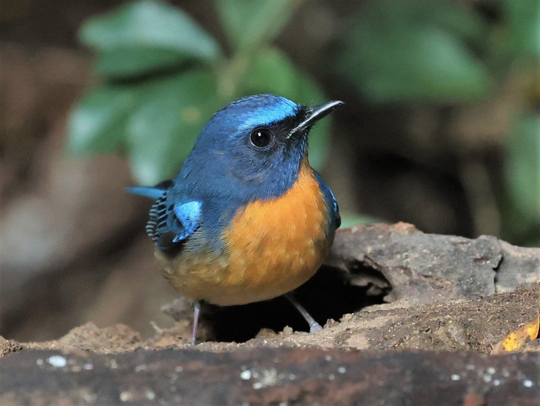
Indochinese Blue Flycatcher (Cyornis sumatrensis)

Indochinese Blue Flycatcher (Cyornis sumatrensis)

Indochinese Blue Flycatcher (Cyornis sumatrensis)
Taiga Flycatcher (Ficedula albicilla)

Forest Wagtail (Dendronanthus indicus)

Verditer Flycatcher (Eumyias thalassina)

Bar-winged Flycatcher Shrike (Hemipus picatus)

Brown-cheeked Fulvetta (Alcippe poioicephala)

Greater Coucal (Centropus sinensis) Lung Sin Hide

Grey Wagtail (Motacilla cinerea)

Brown-headed Gull (Larus brunnicephalus)

Chinese Pond Heron
Chinese Pond Heron
Little Heron (Butorides striatus)
Malaysian Night Heron (Gorsachius melanolophus)

Malaysian Night Heron (Gorsachius melanolophus)

Purple Heron (Ardea purpurea)

Rufous-bellied Eagle (Hieraaetus kienerii)

Rufous-bellied Eagle (Hieraaetus kienerii)

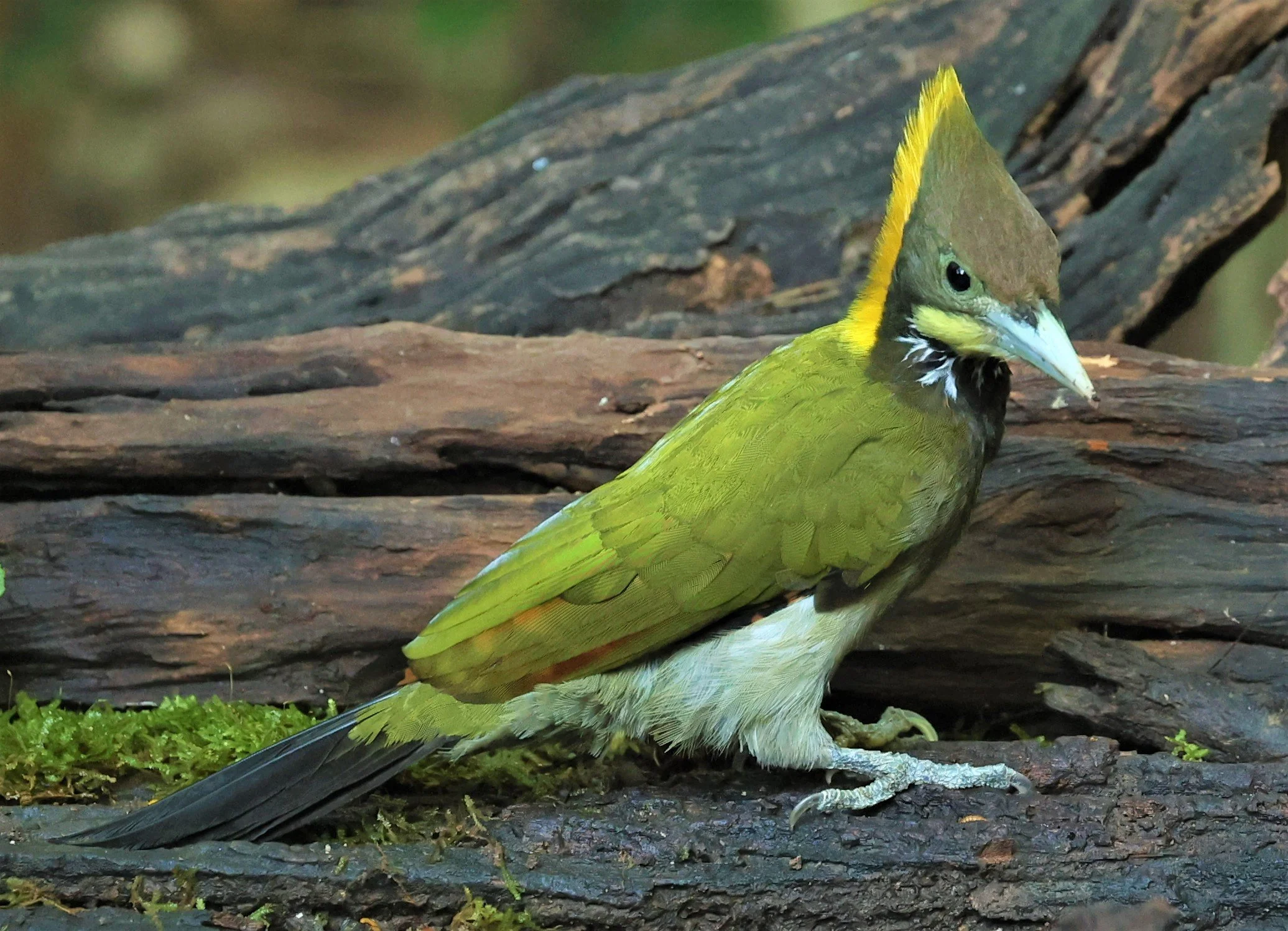
Great hornbill (Buceros bicornis)

Great hornbill (Buceros bicornis)

Great hornbill (Buceros bicornis)

Great hornbill (Buceros bicornis)

Great hornbill (Buceros bicornis)

Great hornbill (Buceros bicornis)
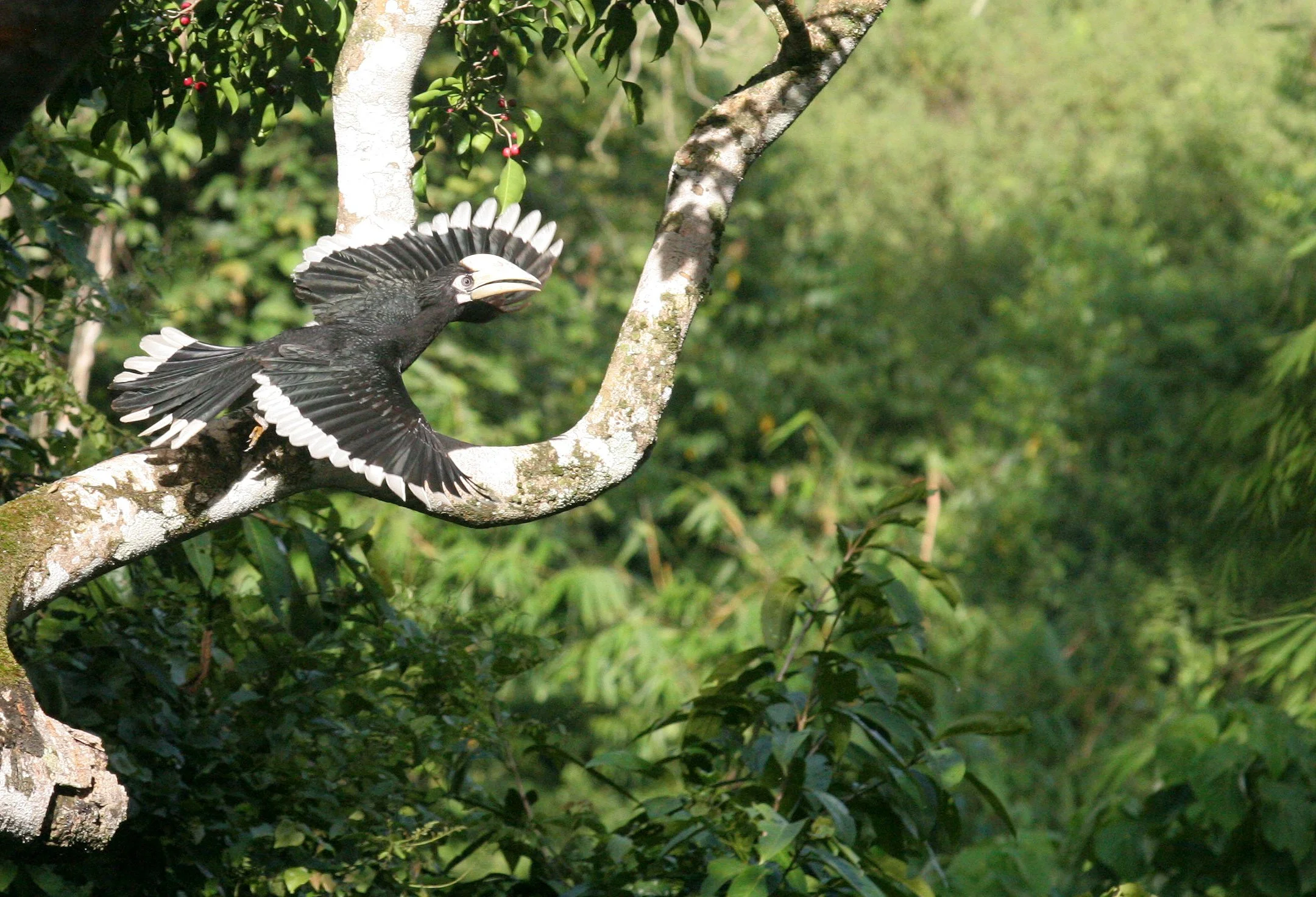
Oriental pied hornbill (Anthracoceros albirostris)
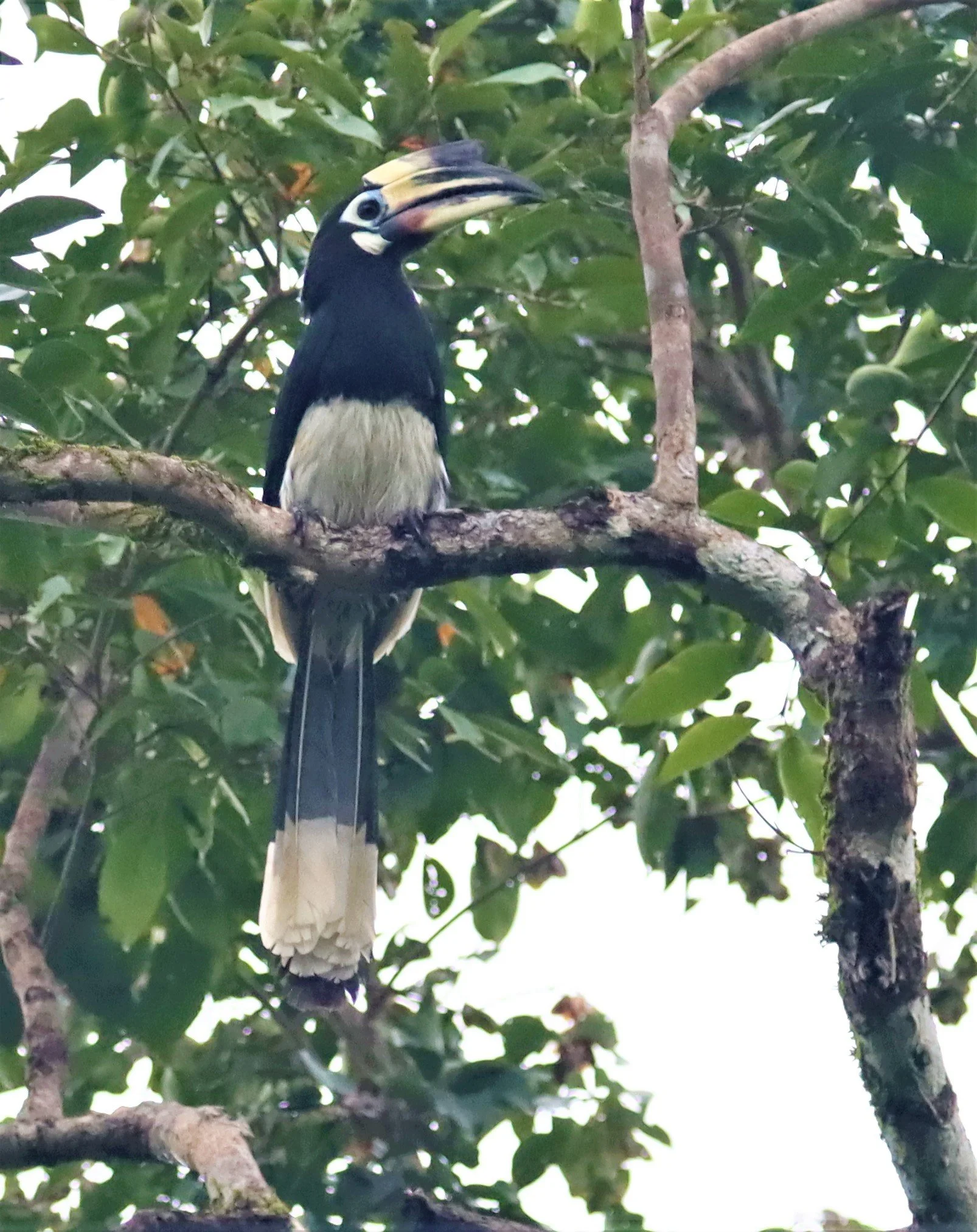
Oriental pied hornbill (Anthracoceros albirostris)

Oriental pied hornbill (Anthracoceros albirostris)
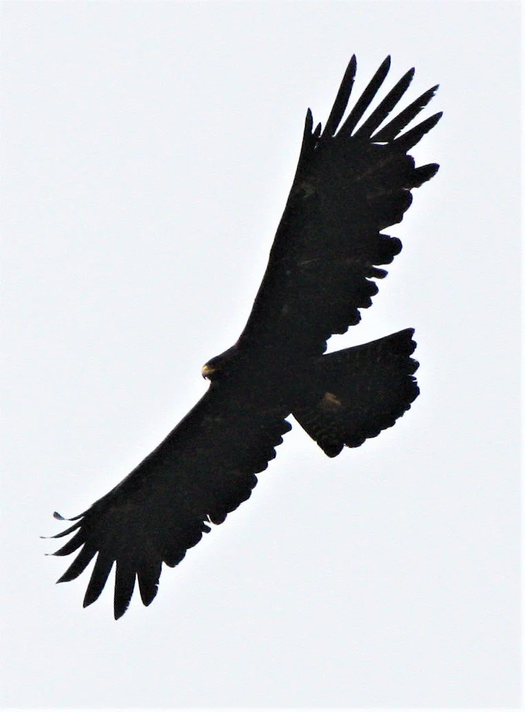
Black Eagle (Ictinaetus malaiensis)

Indochinese Bushlark (Mirafra erythrocephala) Petchaburi Grassland near Baan Maka
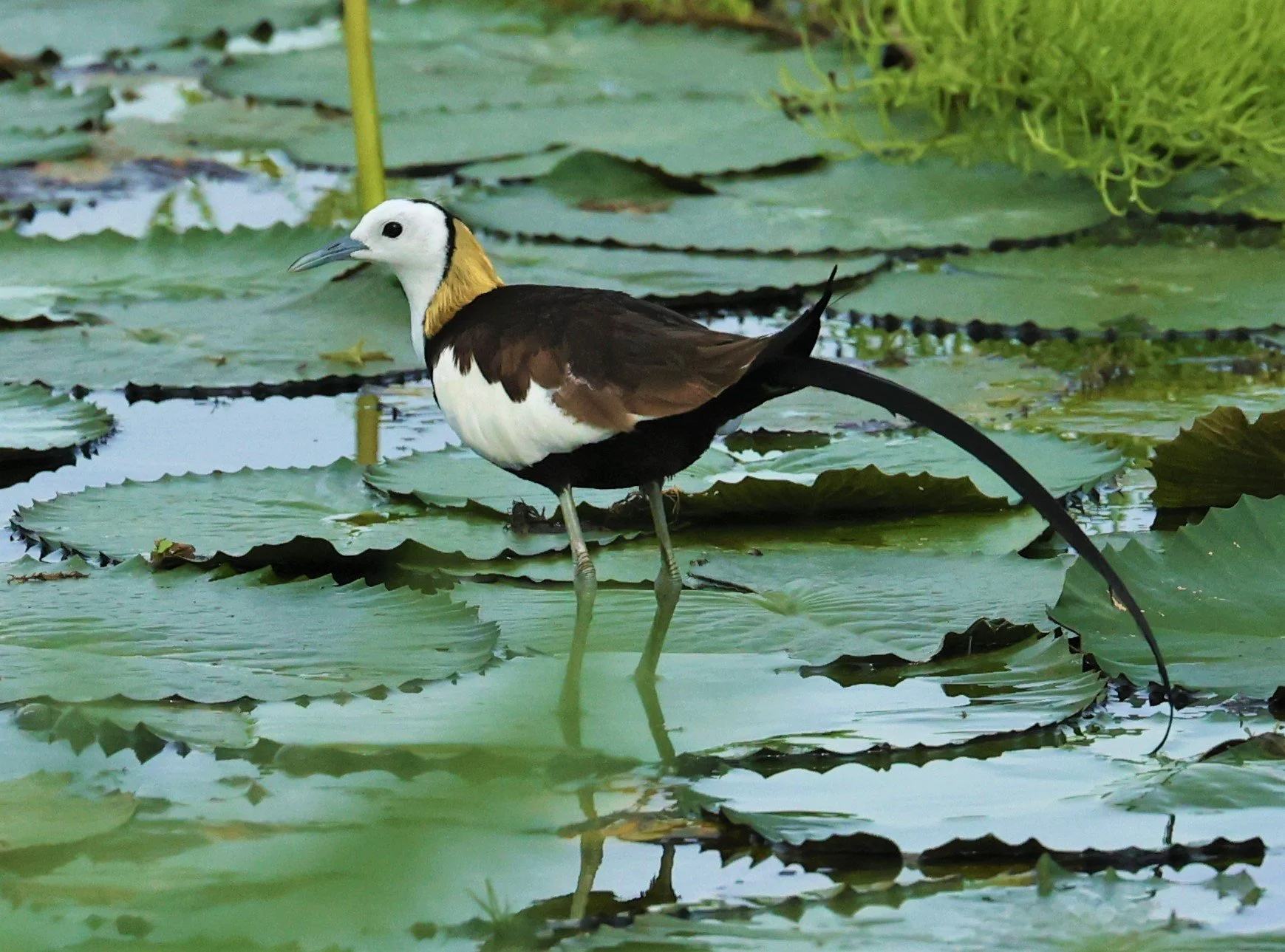
Pheasant-tailed Jacana (Hydrophasianus chirurgus)

Burmese Red Junglefowl Gallus gallus ssp. spadiceus)

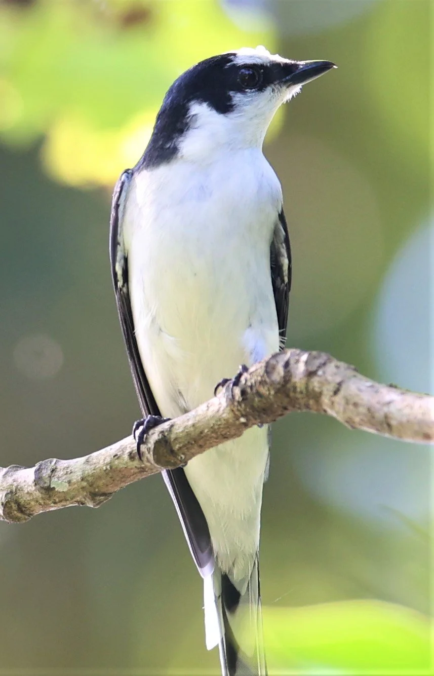
Banded Kingfisher (Lacedo pulchella amabilis) female

Banded Kingfisher (Lacedo pulchella amabilis) male
Black-capped Kingfisher (Halcyon pileata)

Malaysian blue-banded kingfisher (Alcedo peninsulae) male
Malaysian blue-banded kingfisher (Alcedo peninsulae) male

Malaysian blue-banded kingfisher (Alcedo peninsulae) female

Malaysian blue-banded kingfisher (Alcedo peninsulae) female

Black-backed Dwarf Kingfisher (Ceyx erithaca)

Greater Necklaced Laughingthrush Pterorhinus pectoralis)

Lesser Necklaced Laughingthrush (Garrulax monileger)

Greater Necklaced Laughingthrush Pterorhinus pectoralis)

Greater Necklaced Laughingthrush Pterorhinus pectoralis)

Lesser Necklaced Laughingthrush (Garrulax monileger)

White-crested Laughingthrush (Garrulax leucolophus)

White-crested Laughingthrush (Garrulax leucolophus)

White-crested Laughingthrush (Garrulax leucolophus)

Eastern Great Egret Ardea alba ssp. modesta

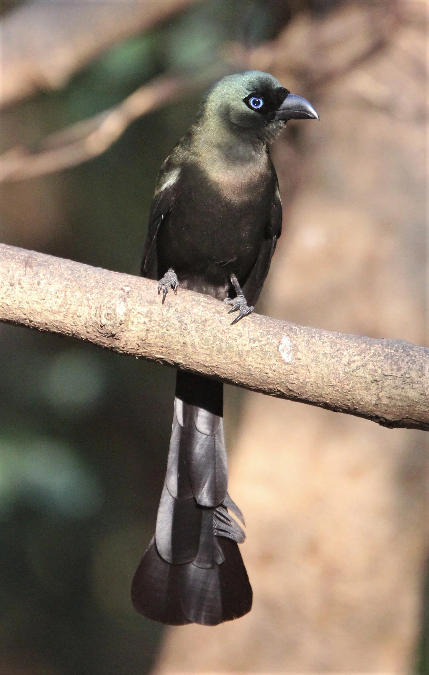
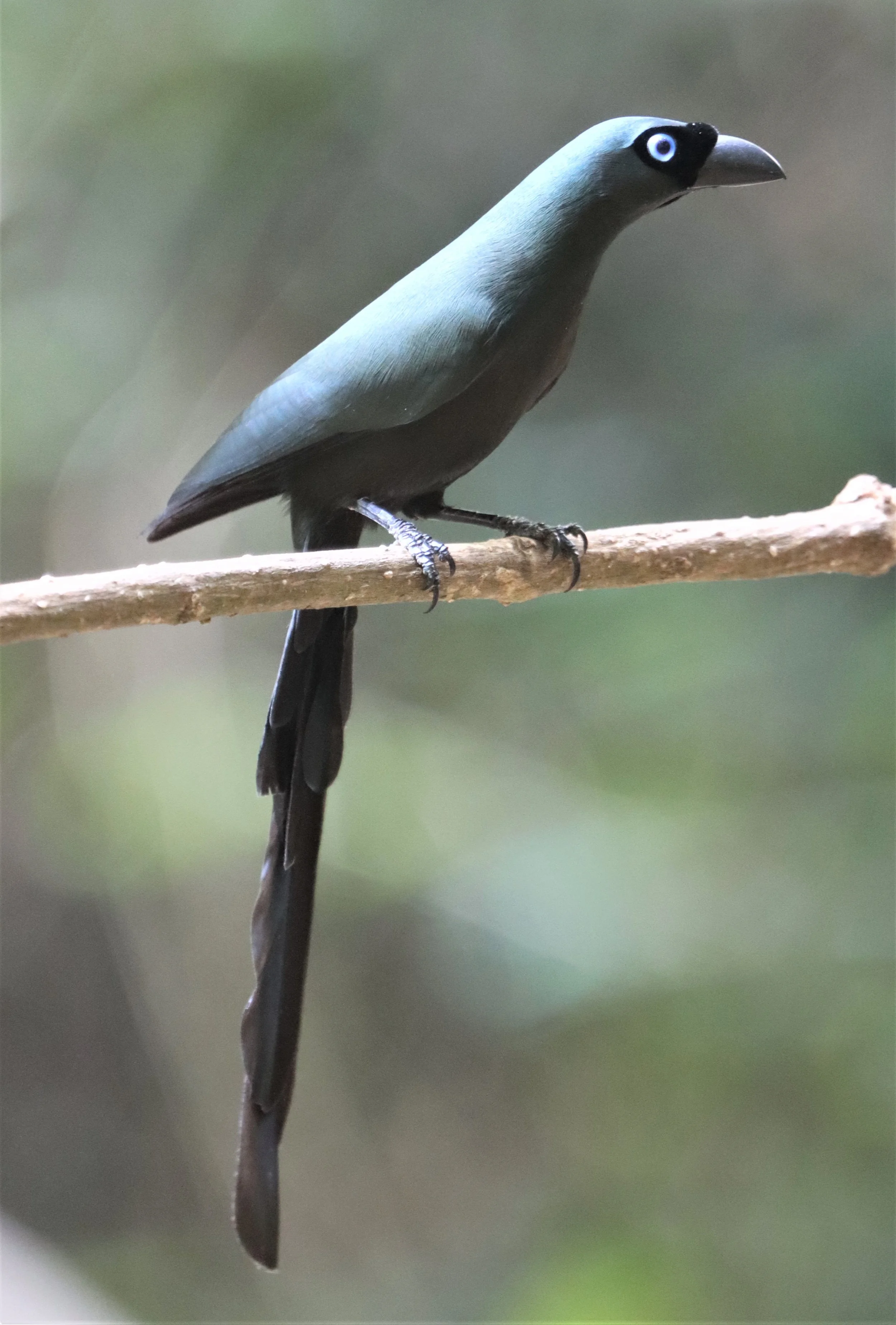
Indochinese Green-Magpie (Cissa hypoleuca)
Indochinese Green-Magpie (Cissa hypoleuca)

Indochinese Green-Magpie (Cissa hypoleuca)

Indochinese Green-Magpie (Cissa hypoleuca)
Little Cormorant (Microcarbo niger) Khao Sam Roi Yod Wetlands

Black-naped Monarch (Hypothymis azurea) male
Black-naped Monarch (Hypothymis azurea) female

Black-naped Monarch (Hypothymis azurea)

Mountain bulbul (Ixos mcclellandii) Kaeng Krachan National Park
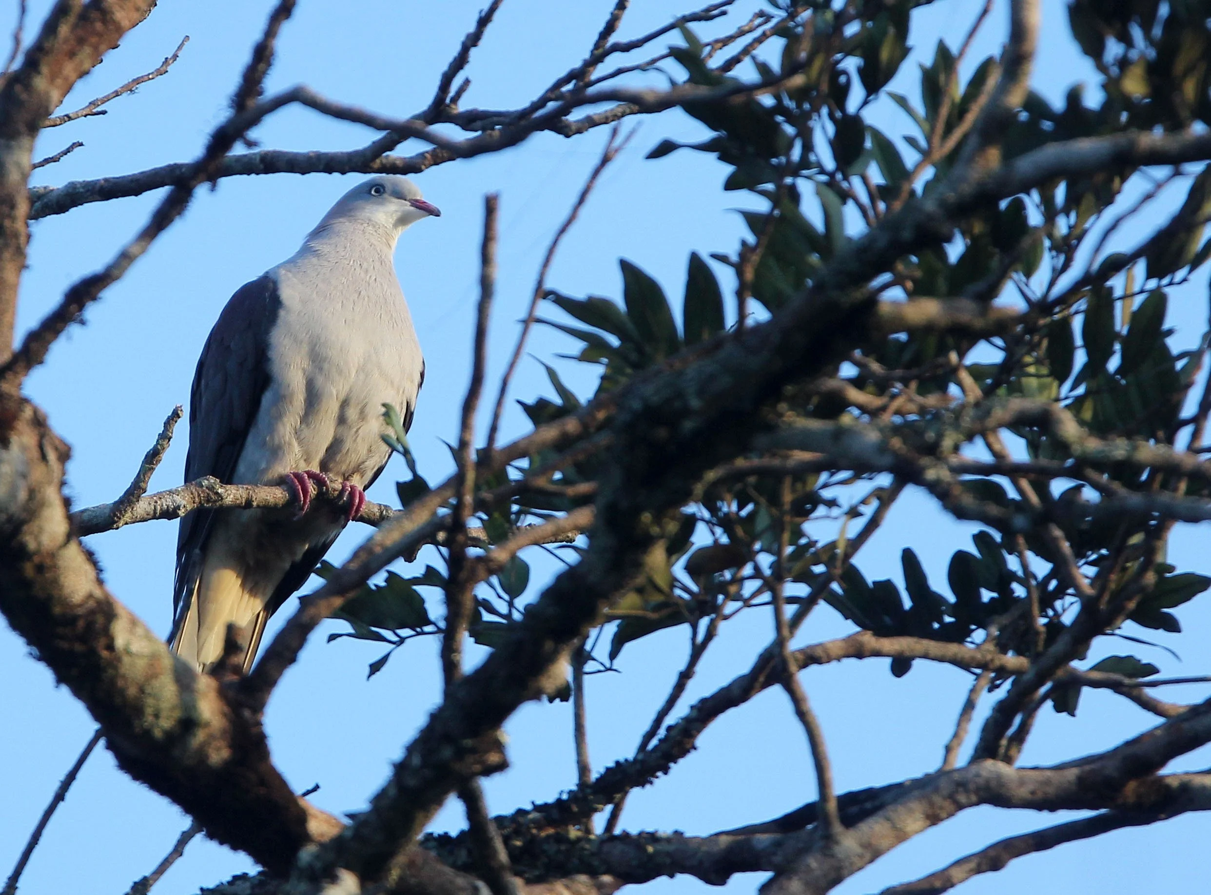
Mountain Imperial-Pigeon (Ducula badia) Kaeng Krachan Phanoen Thung

Hill Myna (Gracula religiosa)

Large-tailed Nightjar (Caprimulgus macrurus)

Ochraceous Bulbul (Alophoixus ochraceus) Kaeng Krachan National Park
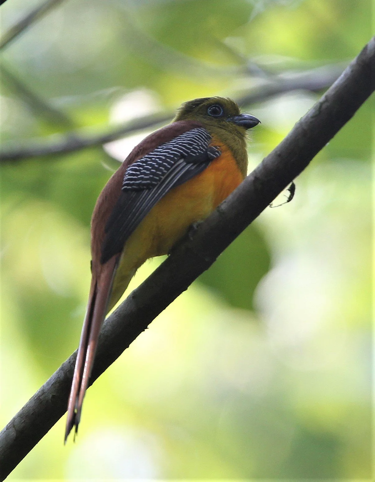
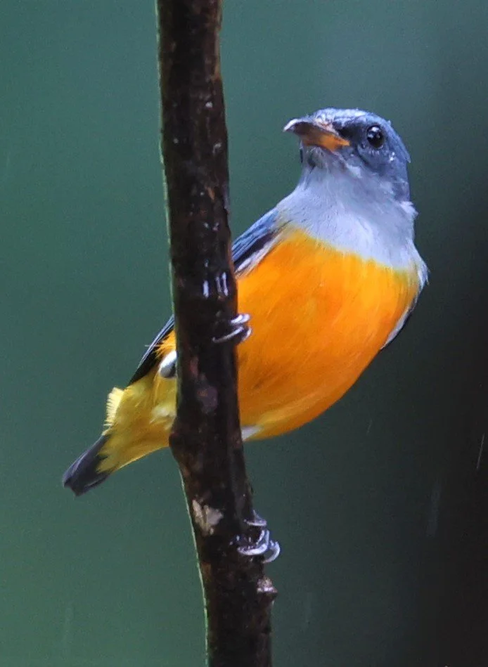
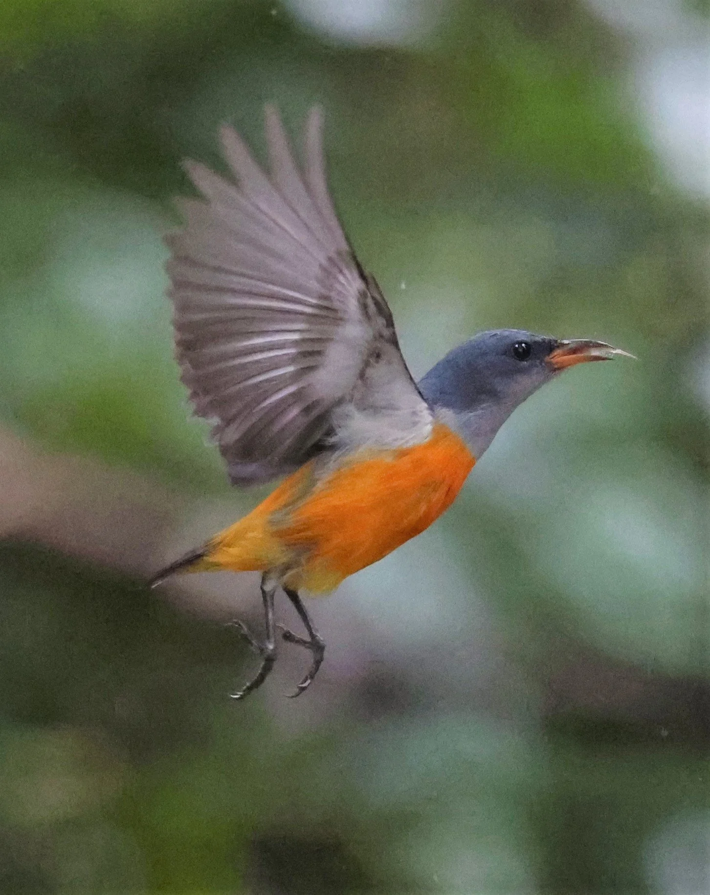
Orange-breasted Trogon (Harpactes oreskios) Kaeng Krachan NP

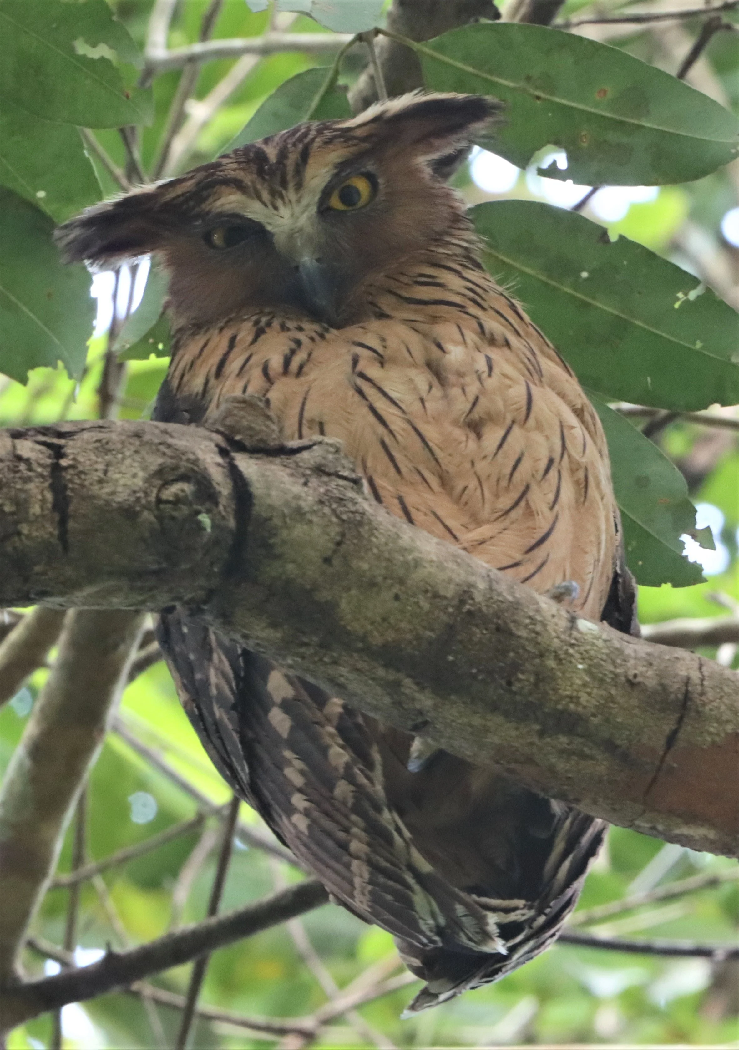
Buffy Fish Owl (Ketupa ketupu)
Buffy Fish Owl (Ketupa ketupu)

Buffy Fish Owl (Ketupa ketupu)
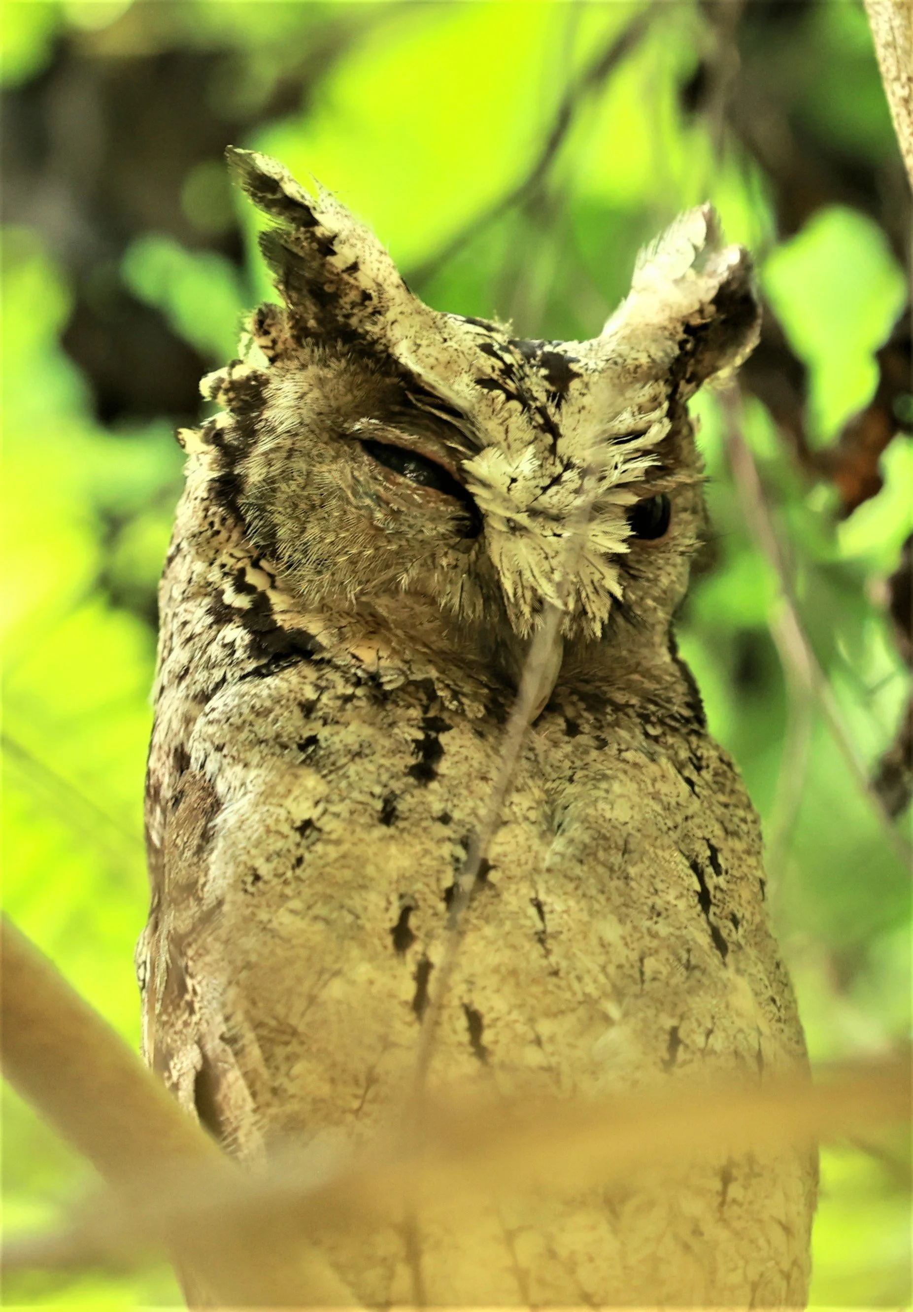
Collared Scops Owl (Otus lettia)

Collared Scops Owl (Otus lettia)

Collared Scops Owl (Otus lettia)

Paddyfield Pipit (Anthus rufulus)

Vernal Hanging Parrot (Loriculus vernalis)
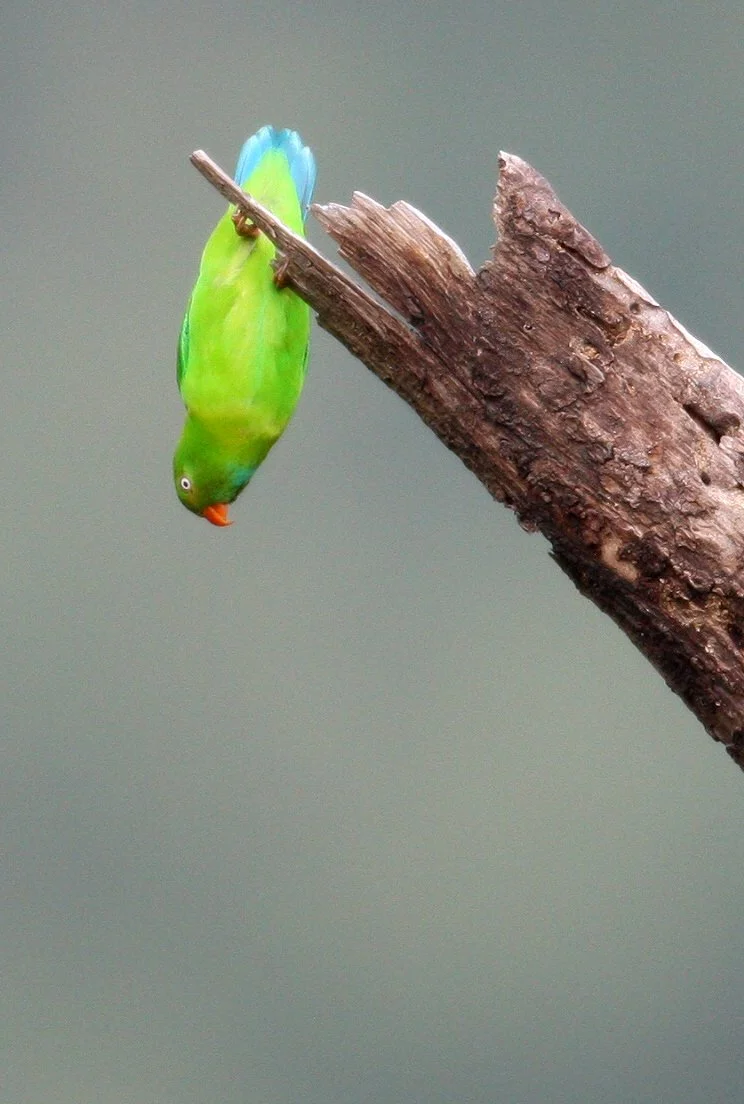
Vernal Hanging Parrot (Loriculus vernalis)

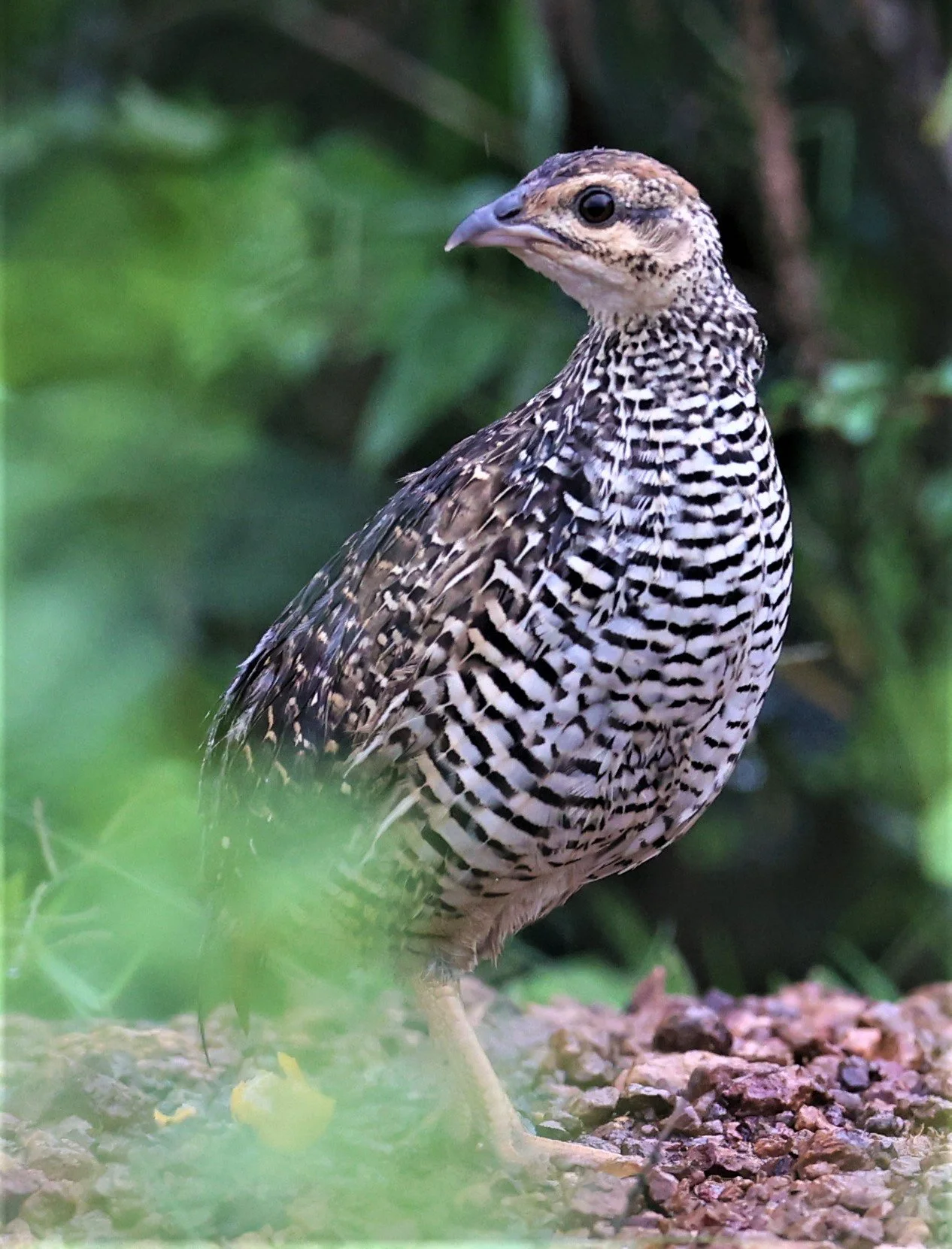
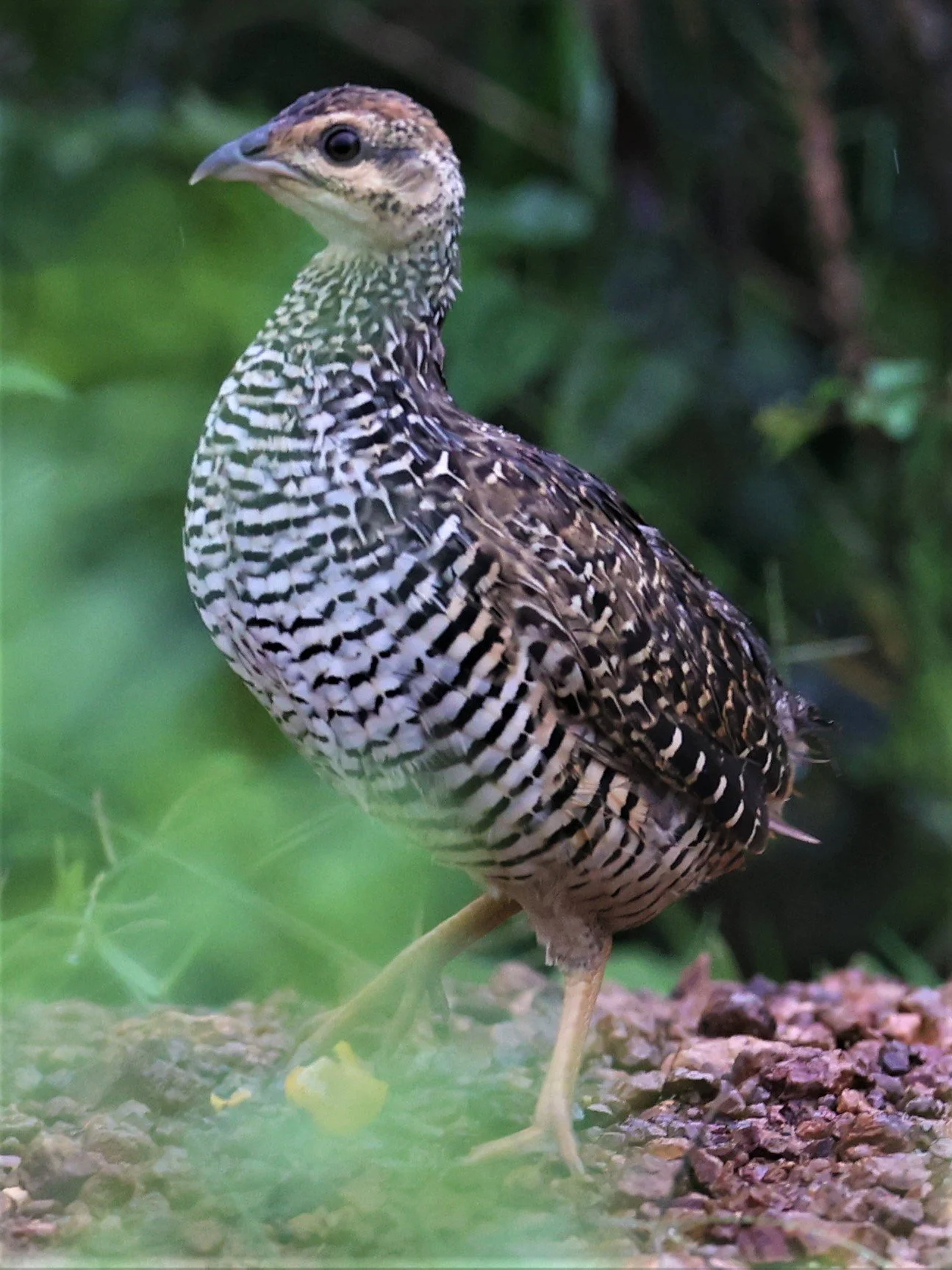
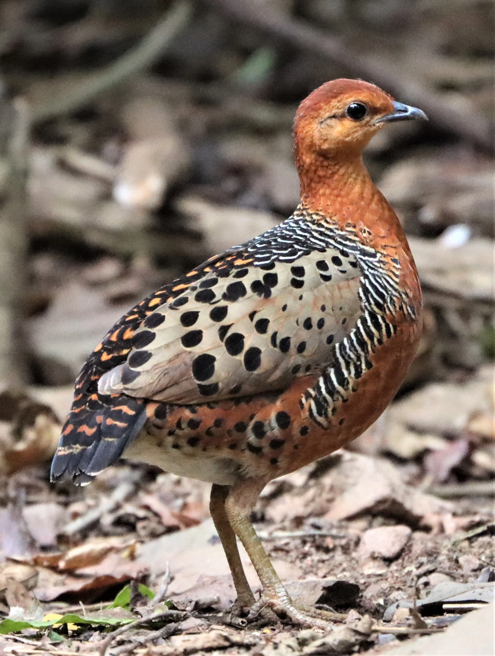
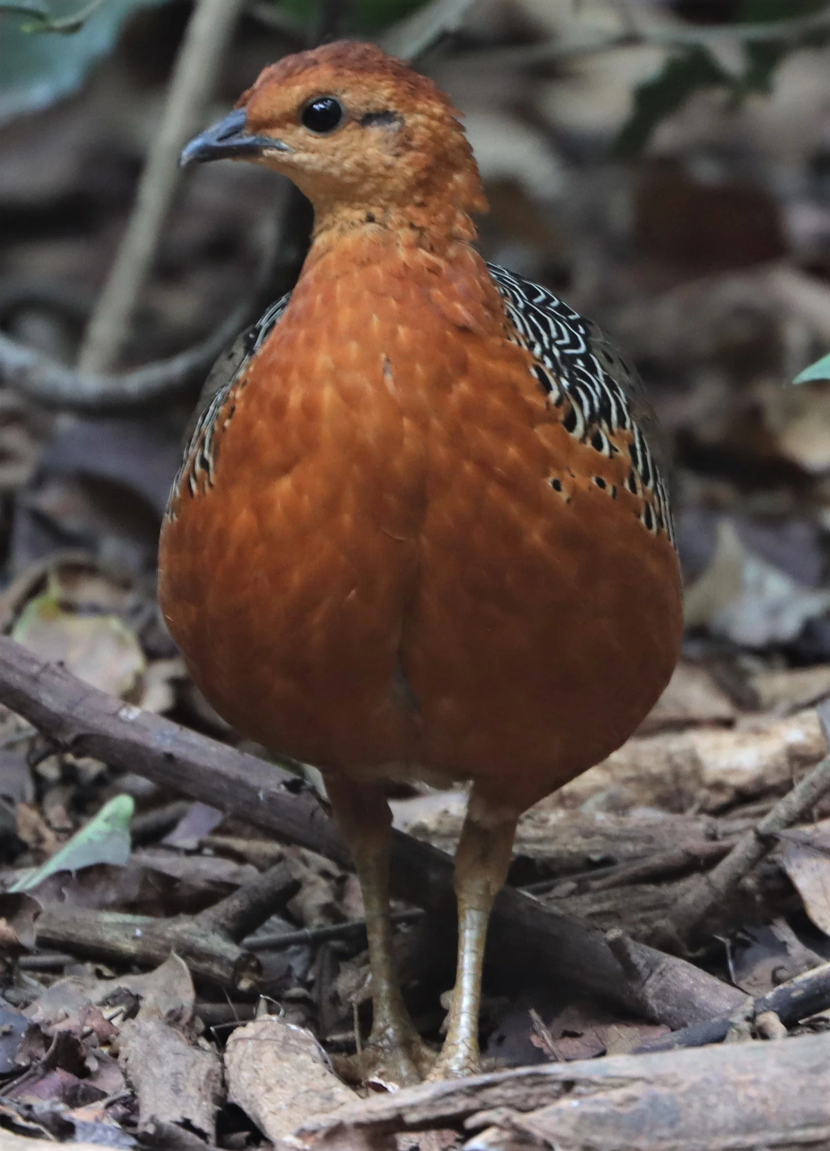
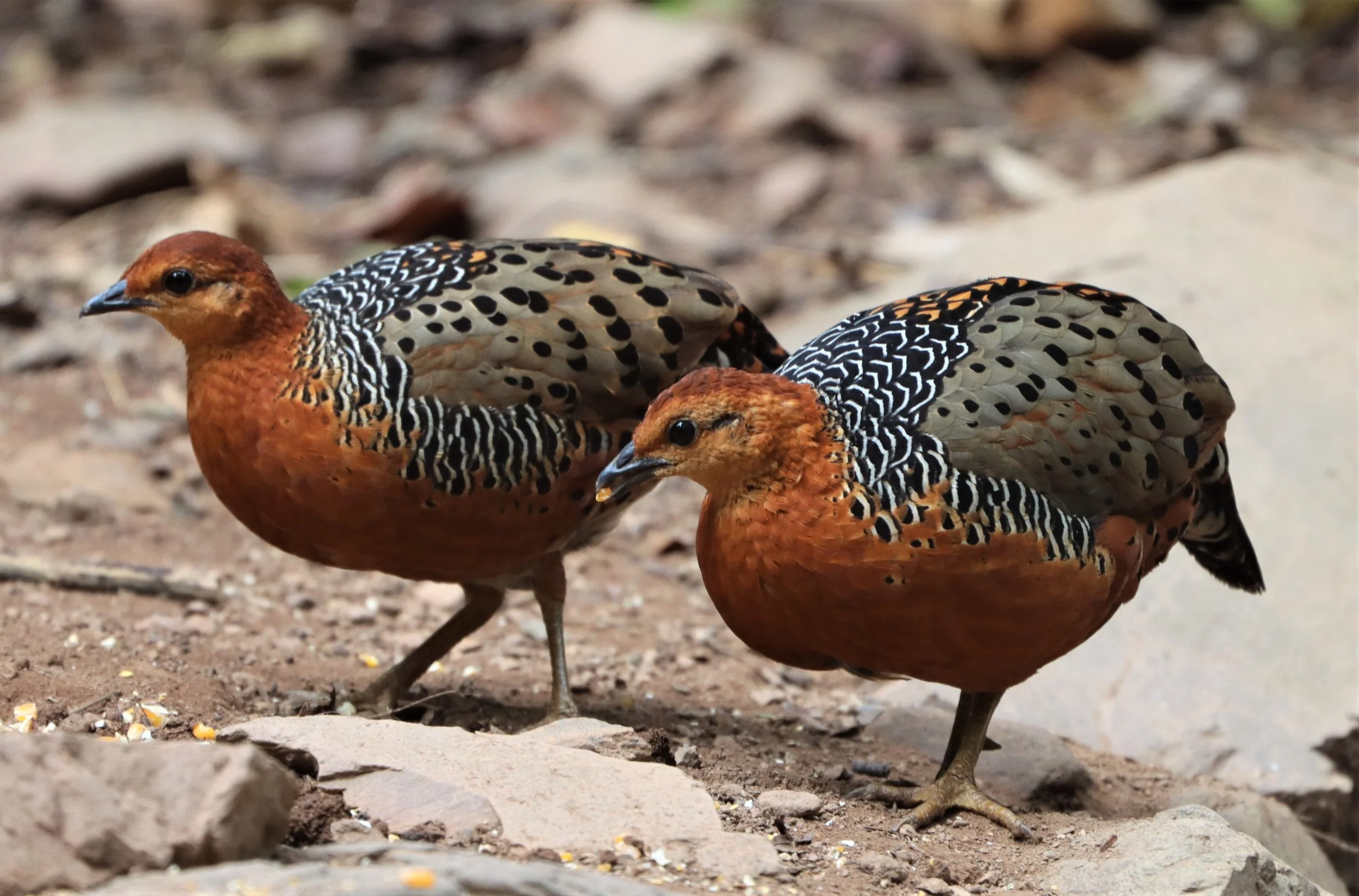
Bar-backed Partridge (Arborophila brunneopectus)
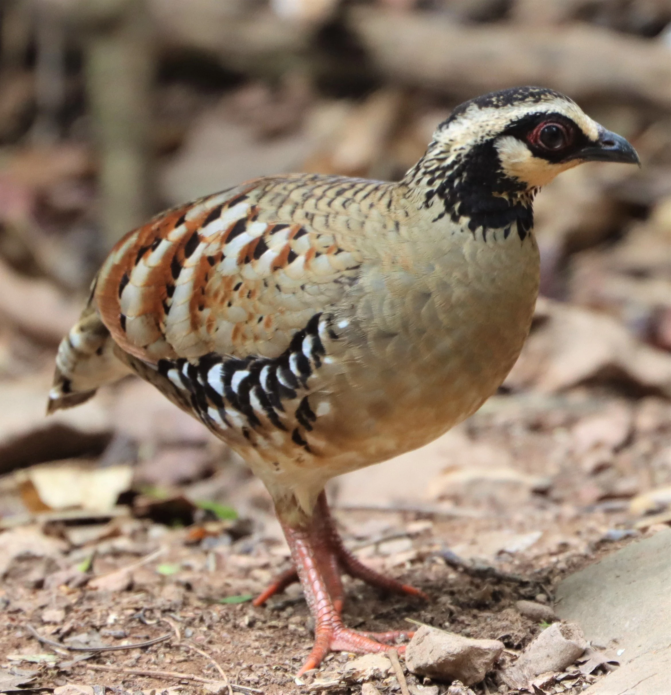
Bar-backed Partridge (Arborophila brunneopectus)

Bar-backed Partridge (Arborophila brunneopectus)

Bar-backed Partridge (Arborophila brunneopectus)
Ferruginous Partridge (Caloperdix oculea)

Ferruginous Partridge (Caloperdix oculea)
Ferruginous Partridge (Caloperdix oculea)
Ferruginous Partridge (Caloperdix oculea)

Scaly-breasted or Green-legged Partridge (Arborophila chloropus)

Scaly-breasted or Green-legged Partridge (Arborophila chloropus)
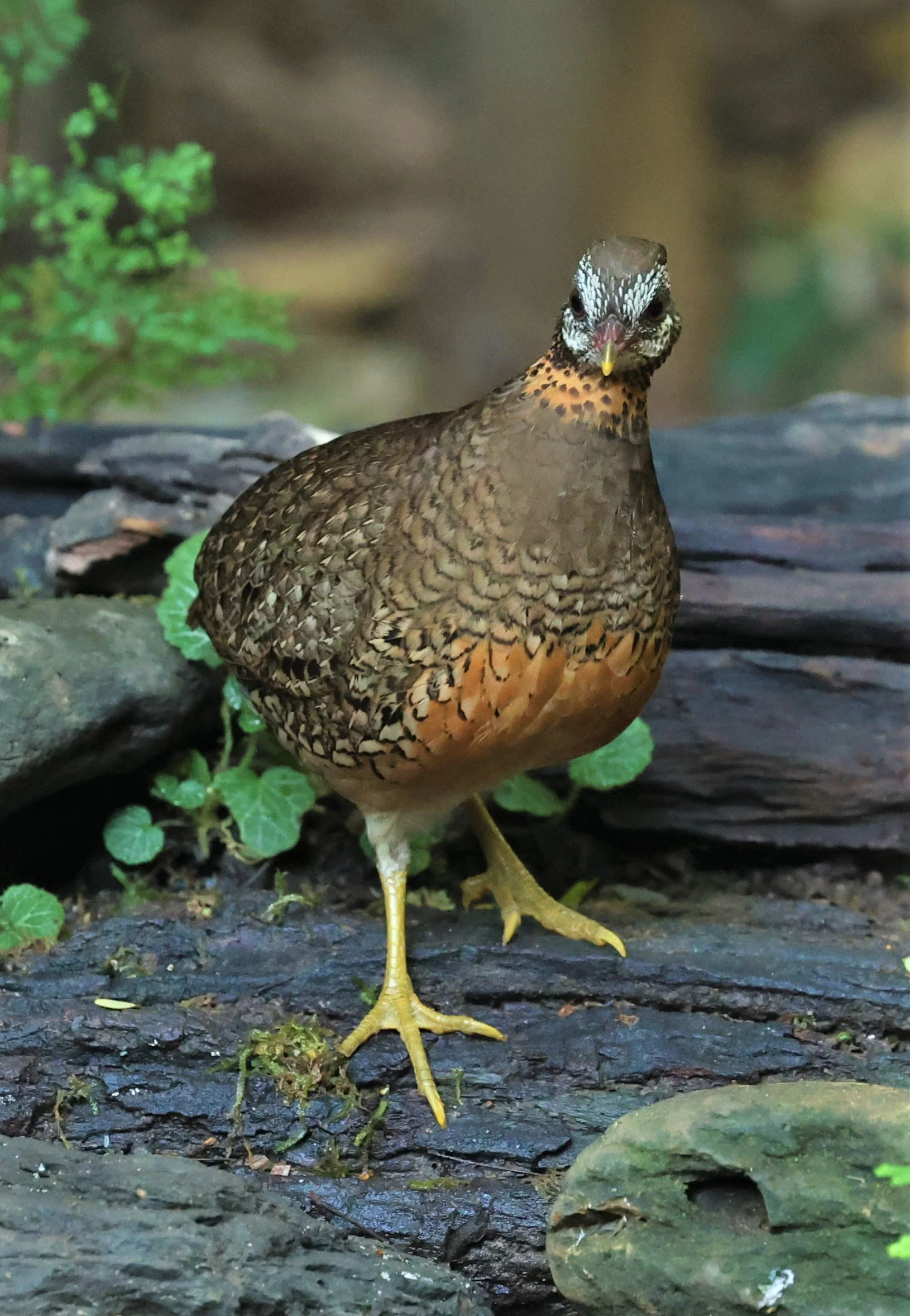
Scaly-breasted or Green-legged Partridge (Arborophila chloropus)

Scaly-breasted or Green-legged Partridge (Arborophila chloropus)

Kalij Pheasant (Lophura nycthemura crawfurdii) female

Kalij Pheasant (Lophura nycthemura crawfurdii)

Kalij Pheasant (Lophura nycthemura crawfurdii)

Kalij Pheasant (Lophura nycthemura crawfurdii)

Kalij Pheasant (Lophura nycthemura crawfurdii)

Grey Peacock Pheasant (Polyplectron bicalcaratum)
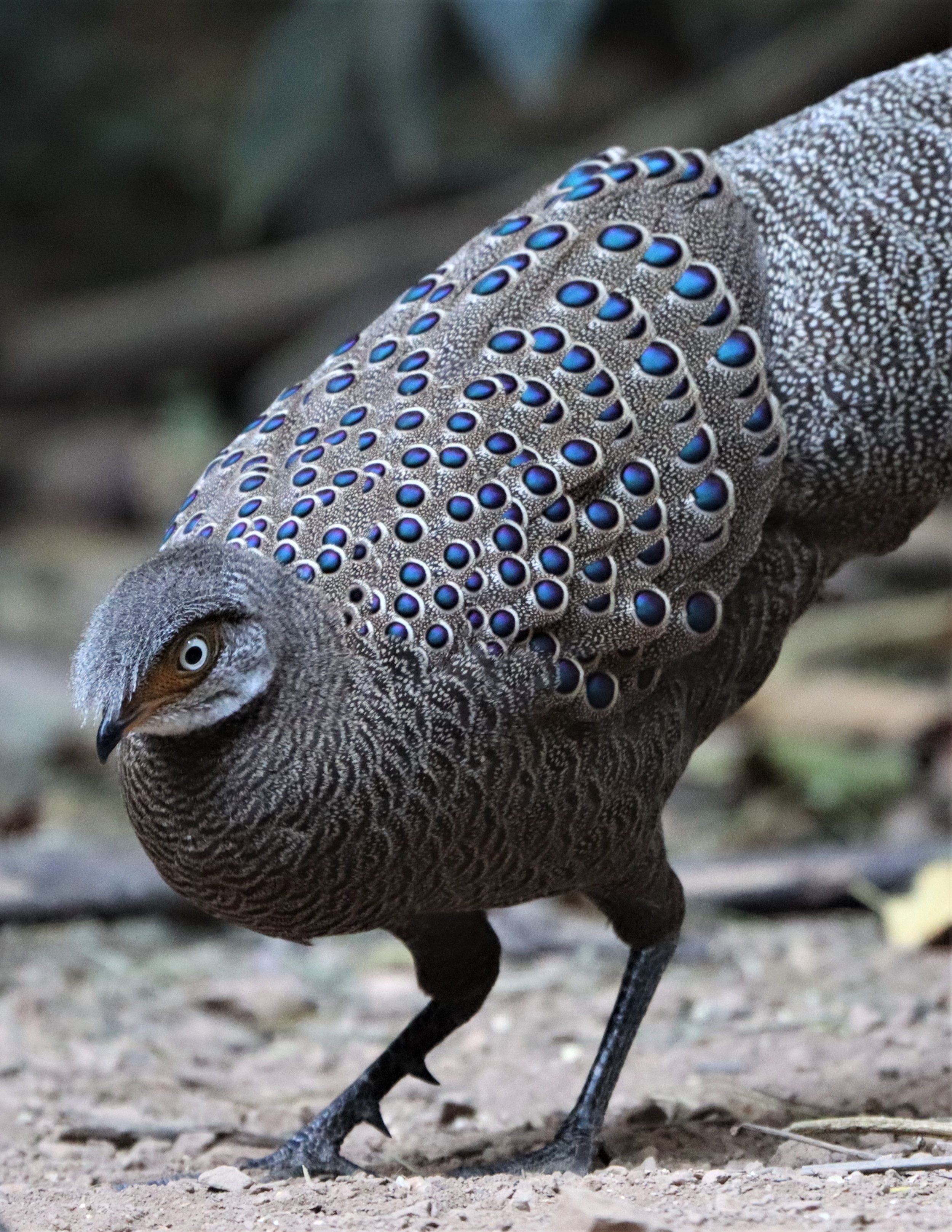
Grey Peacock Pheasant (Polyplectron bicalcaratum)

Grey Peacock Pheasant (Polyplectron bicalcaratum)

Grey Peacock Pheasant (Polyplectron bicalcaratum)

Thick-billed Green Pigeon (Treron curvirostra)
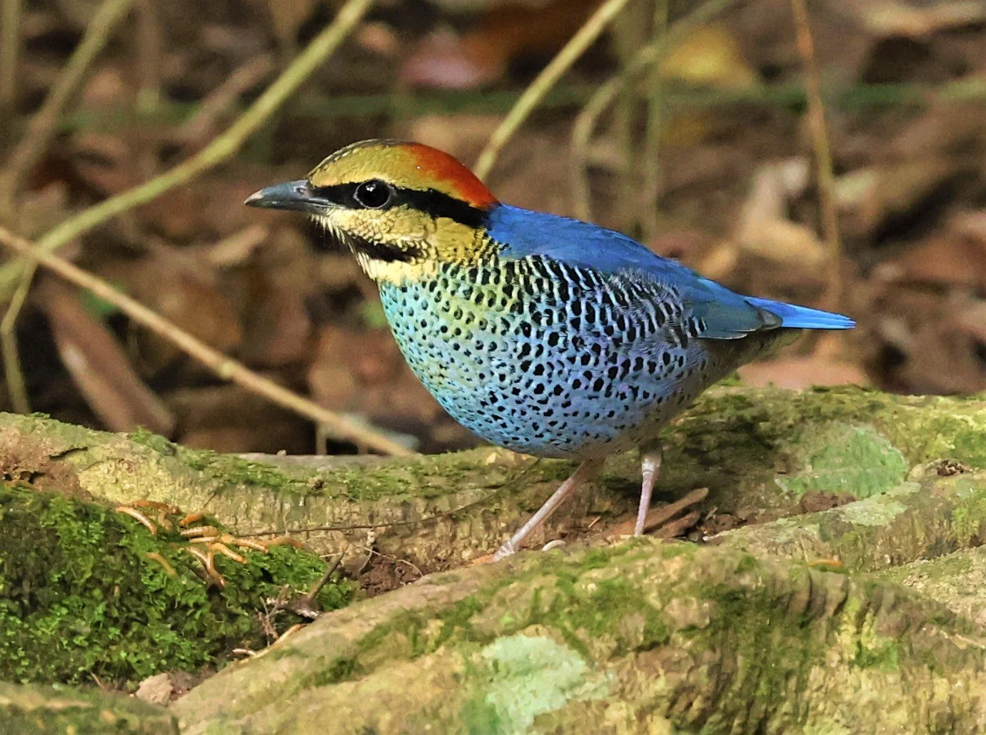
Blue Pitta (Hydrornis cyaneus)

Blue Pitta (Hydrornis cyaneus) male

Blue Pitta (Hydrornis cyaneus) female
Blue Pitta (Hydrornis cyaneus)

Blue Pitta (Hydrornis cyaneus)

Blue Pitta (Hydrornis cyaneus)
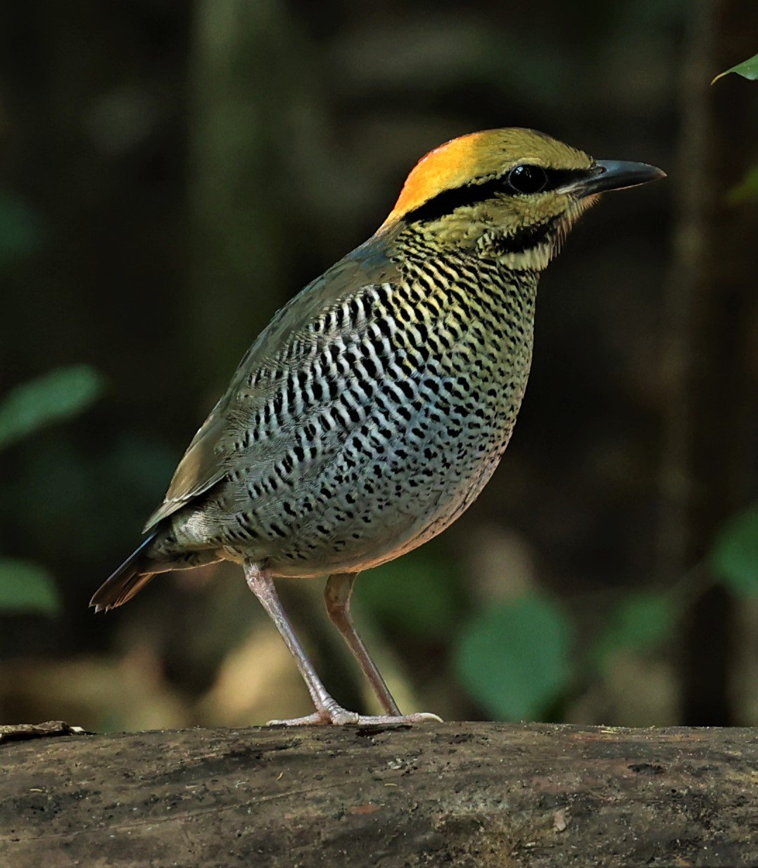
Blue-winged Pitta (Pitta moluccensi)

Blue-winged Pitta (Pitta moluccensi)

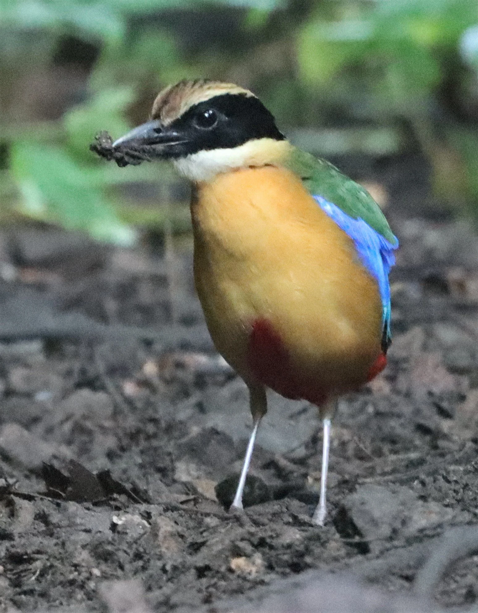
Hooded Pitta (Pitta sordida)
Hooded Pitta (Pitta sordida)

Eared Pitta (Hydrornis phayrei)

Eared Pitta (Hydrornis phayrei)
Puff-throated Babbler (Pellorneum ruficeps)
Slaty-breasted Rail (Gallirallus striatus) Khao Sam Roi Yod Wetlands
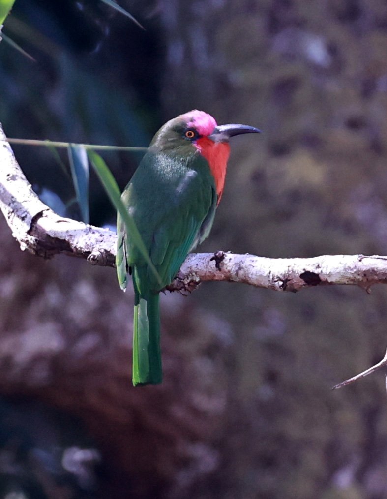
Red-bearded Bee-eater (Nyctyornis amictus) Kaeng Krachan
Red-bearded Bee-eater (Nyctyornis amictus) Kaeng Krachan

Red-collared Dove (Streptopelia tranquebarica) Khao Sam Roi Yod

Spotted Redshank (Tringa erythropus) and mixed wadders at KSRY

Indochinese Roller (Coracias affinis)

Indochinese Roller (Coracias affinis)
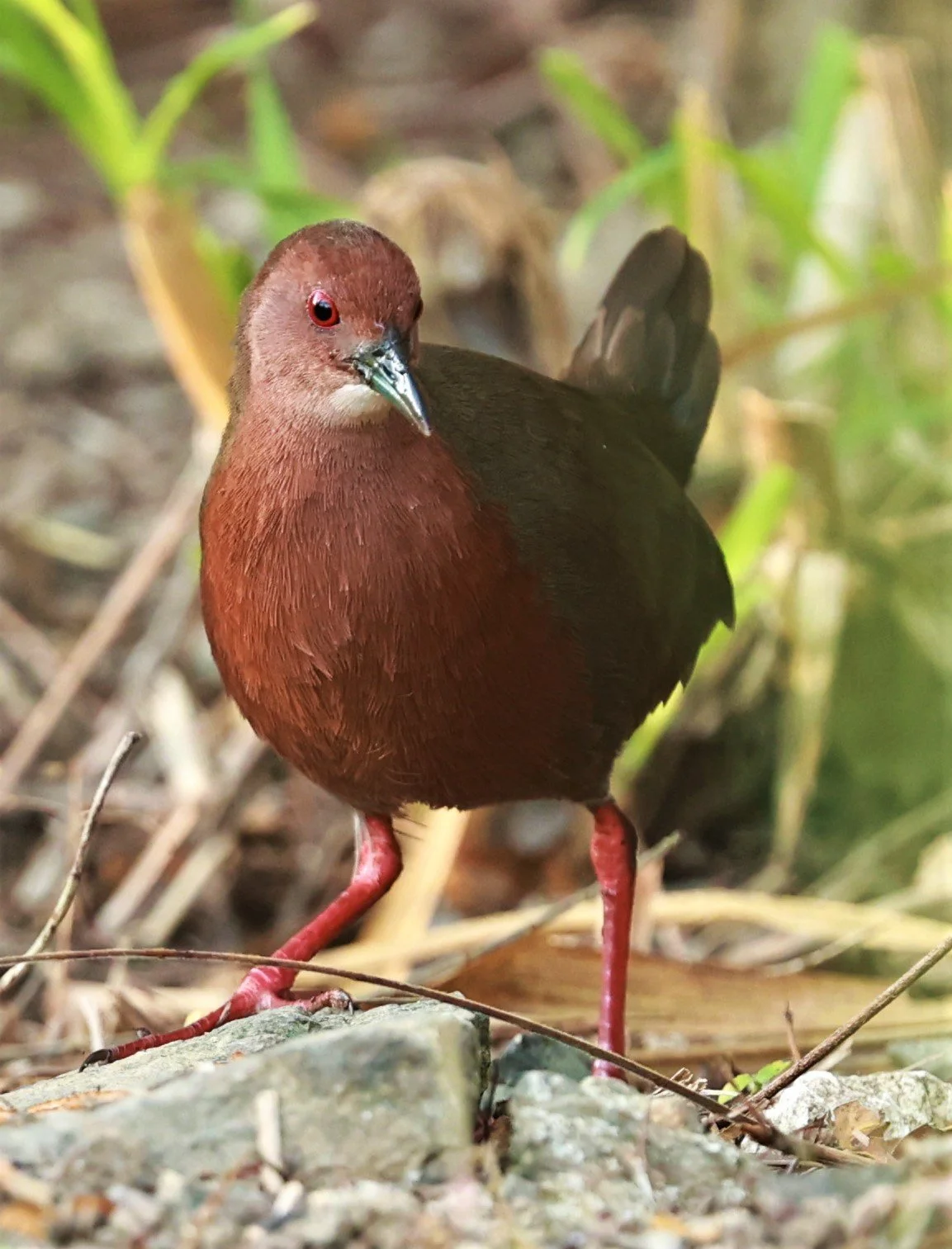
Ruddy-breasted Crake (Porzana fusca) Kaeng Krachan

Large Scimitar Babbler (Erythrogenys hypoleucos)

Large Scimitar Babbler (Erythrogenys hypoleucos)
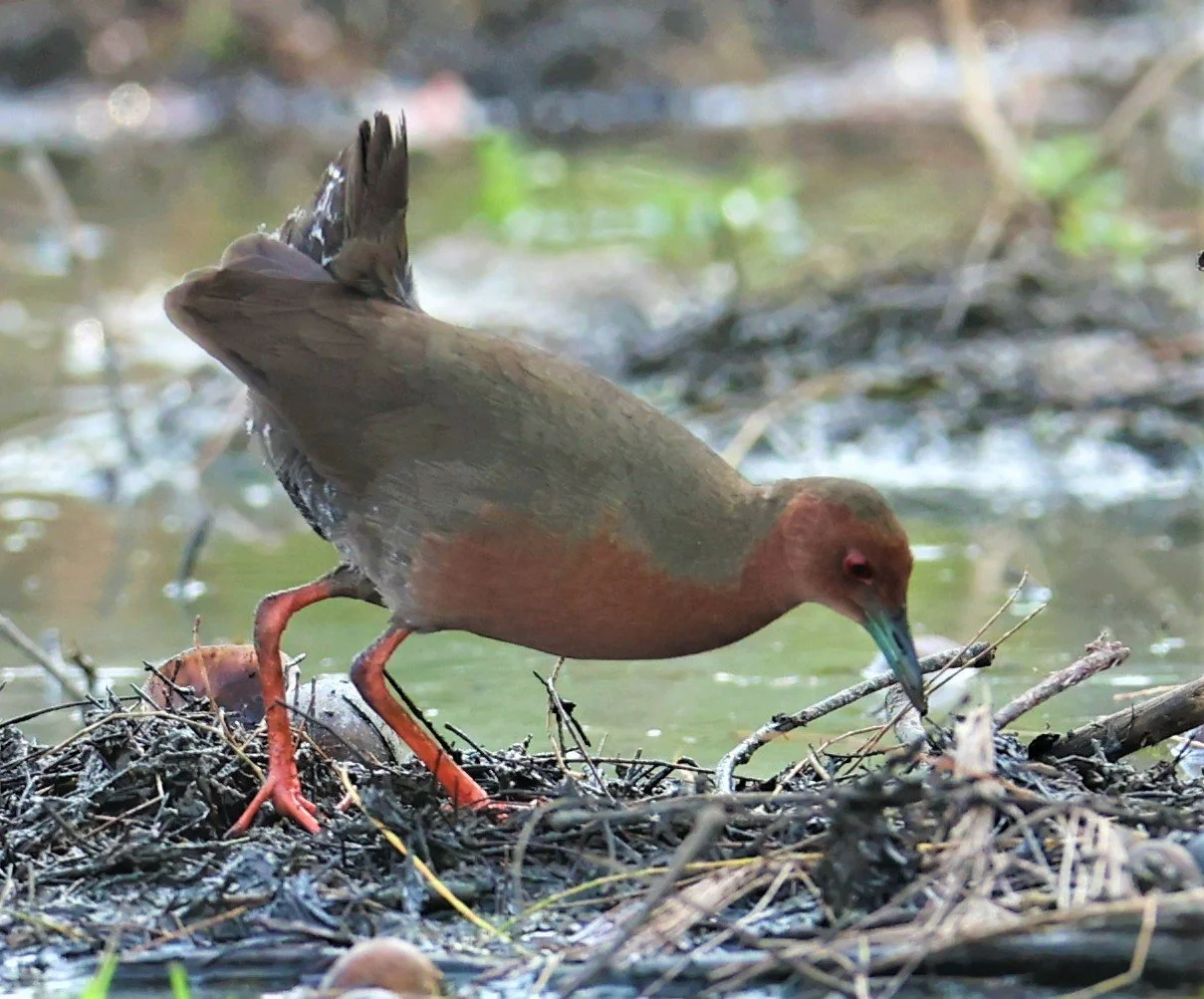
Ruddy-breasted Crake (Porzana fusca) Kaeng Krachan

White-rumped Shama (Copsychus malabaricus)

White-rumped Shama (Copsychus malabaricus)

Siberian Blue Robin (Luscinia cyane) Lung Sin Hide Kaeng Krachan NP
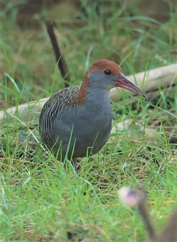
Slaty-breasted Rail (Gallirallus striatus) Khao Sam Roi Yod Wetlands

Slaty-breasted Rail (Gallirallus striatus) Khao Sam Roi Yod Wetlands

Greater Painted Snipe (Rostratula benghalensis)

Greater Painted Snipe (Rostratula benghalensis)

Plain-backed Sparrow (Passer flaveolus)


Little Spiderhunter (Arachnothera longirostra)

Streaked Spiderhunter (Arachnothera magma)
Yellow-eared Spiderhunter (Arachnothera chrysogenys)

Crested Serpent Eagle (Spilornis cheela)

Crested Serpent Eagle (Spilornis cheela)

Crested Serpent Eagle (Spilornis cheela)

Spotted Dove (Spilopelia chinensis) Kaeng Krachan Lung Sin Hide

Asian Pied Starling (Sturnus contra)

Crested Serpent Eagle (Spilornis cheela)

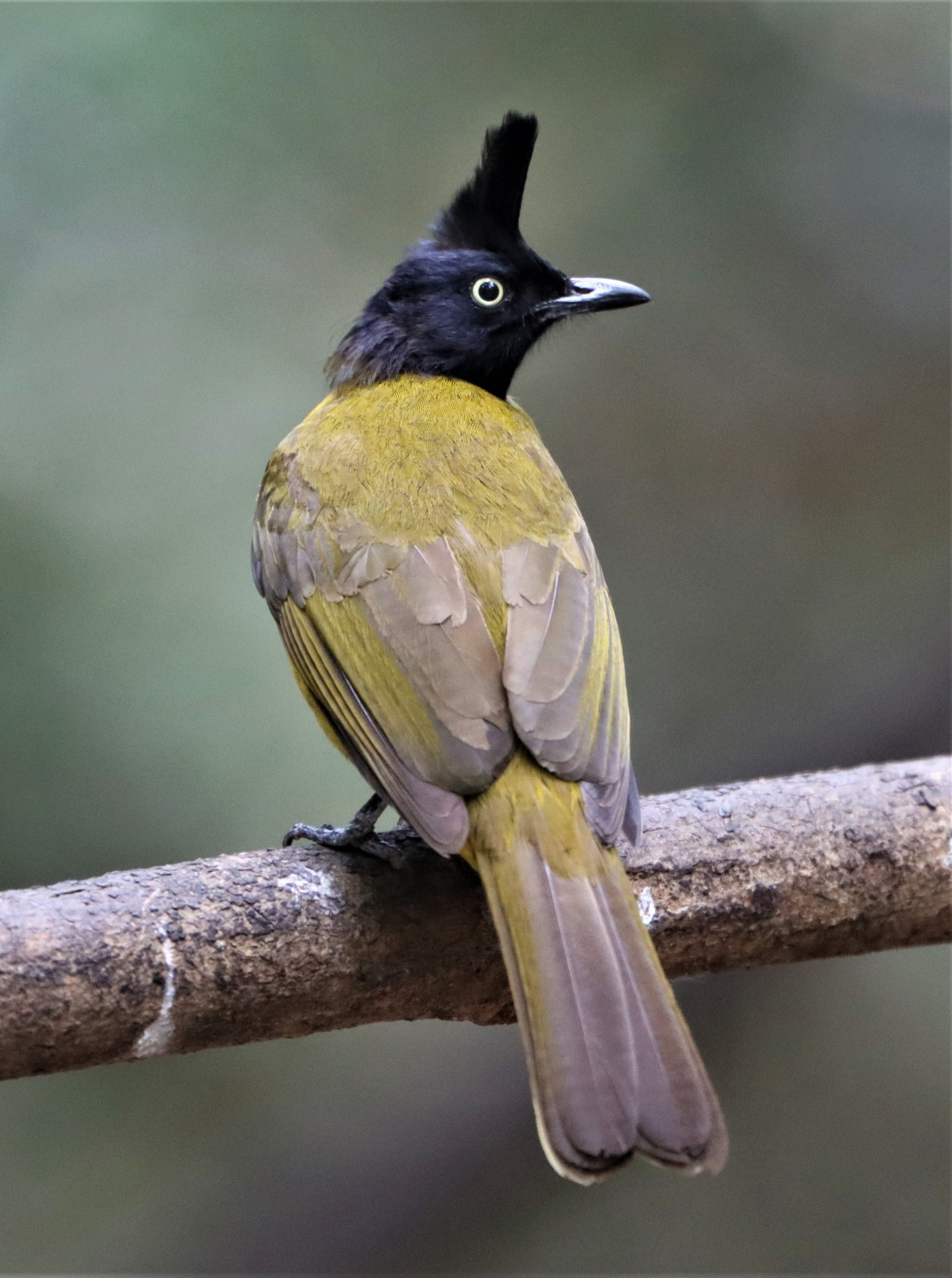
Sultan Tit (Melanochlora sultanea) Kaeng Krachan National Park ESS Expedition 2026

Sultan Tit (Melanochlora sultanea) Kaeng Krachan National Park ESS Expedition 2026

Crimson Sunbird (Aethopyga siparaja)

Ornate Sunbird (Cinnyris ornatus)

Ornate Sunbird (Cinnyris ornatus)

Crimson Sunbird (Aethopyga siparaja)

Ornate Sunbird (Cinnyris ornatus)

Grey-headed Swamphen (Porphyrio poliocephalus)

Dark-necked Tailorbird (Orthotomus atrogularis)
Little Tern (Sterna albifrons)

Indian Thick-knee ( Burhinus indicus)

Indian Thick-knee ( Burhinus indicus)

Blue Rock Thrush (Monticola solitarius)
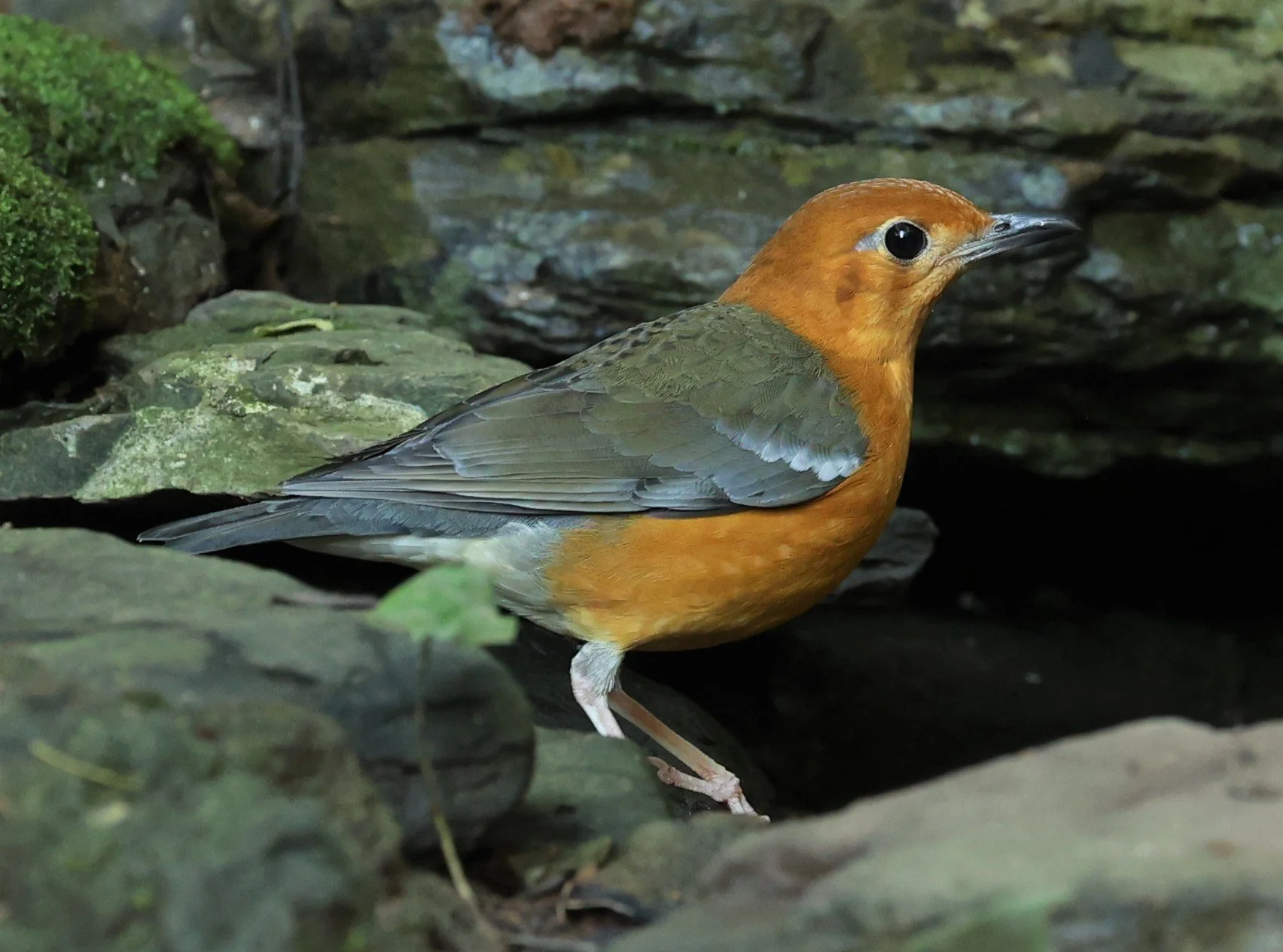
Orange-headed Thrush (Zoothera citrina)
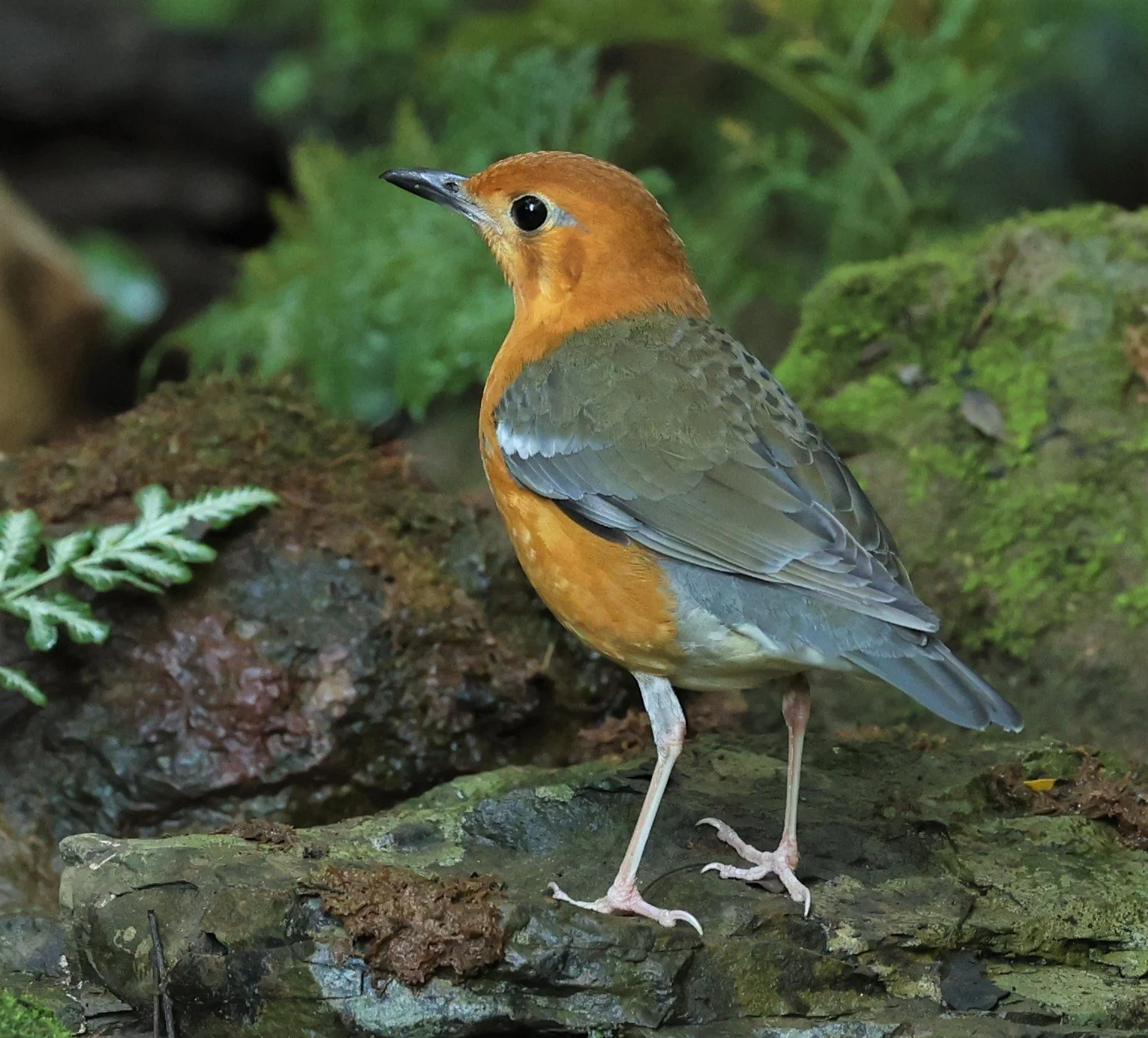
Orange-headed Thrush (Zoothera citrina)

Racket-tailed Treepie (Crypsirina temia)
Racket-tailed Treepie (Crypsirina temia)
Racket-tailed Treepie (Crypsirina temia)

Yellow-Browed Warbler (Phylloscopus inornatus)

Pale-legged or Sakhalin Leaf Warbler (Phylloscopus tenellipes)

Radde's Leaf Warbler (Phylloscopus schwarzi) Possibly Dusky

Buff-rumped Woodpecker (Meiglyptes tristis)

Buff-rumped Woodpecker (Meiglyptes tristis)

Common Flameback (Dinopium javenense)

Grey-headed Woodpecker (Picus canus)
Greater Yellownape (Chrysophlegma flavinucha)
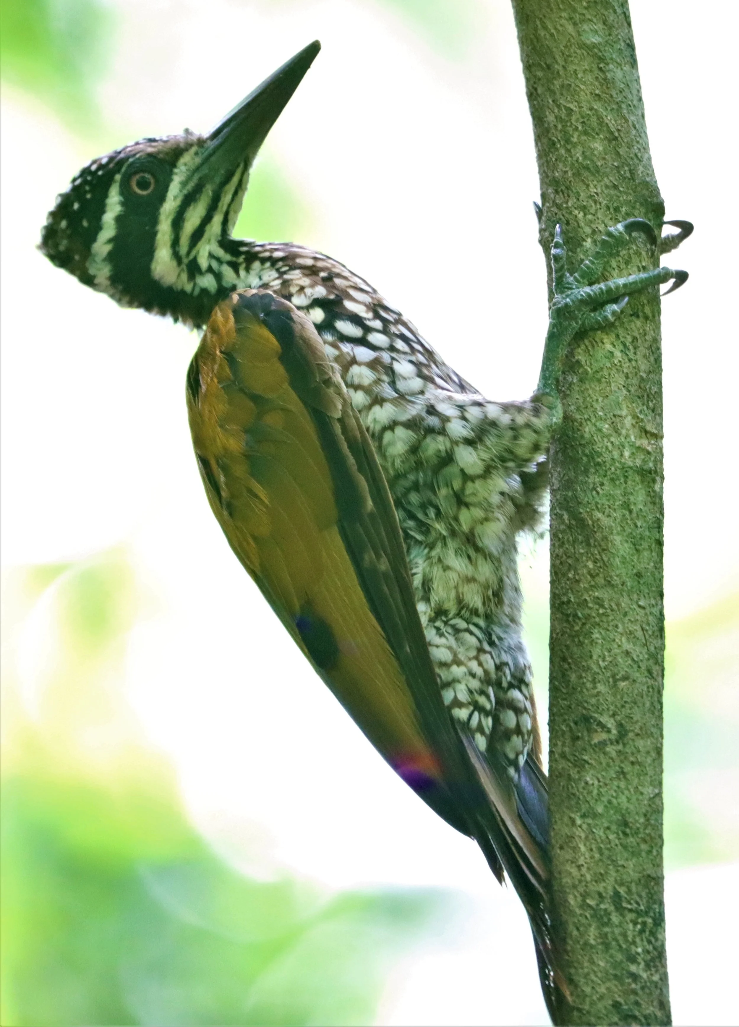
Greater Flameback (Chrysocolaptes lucidus)

Greater Flameback (Chrysocolaptes lucidus)

Common Flameback (Dinopium javenense)

Greater Yellownape (Chrysophlegma flavinucha)

Greater Yellownape (Chrysophlegma flavinucha)
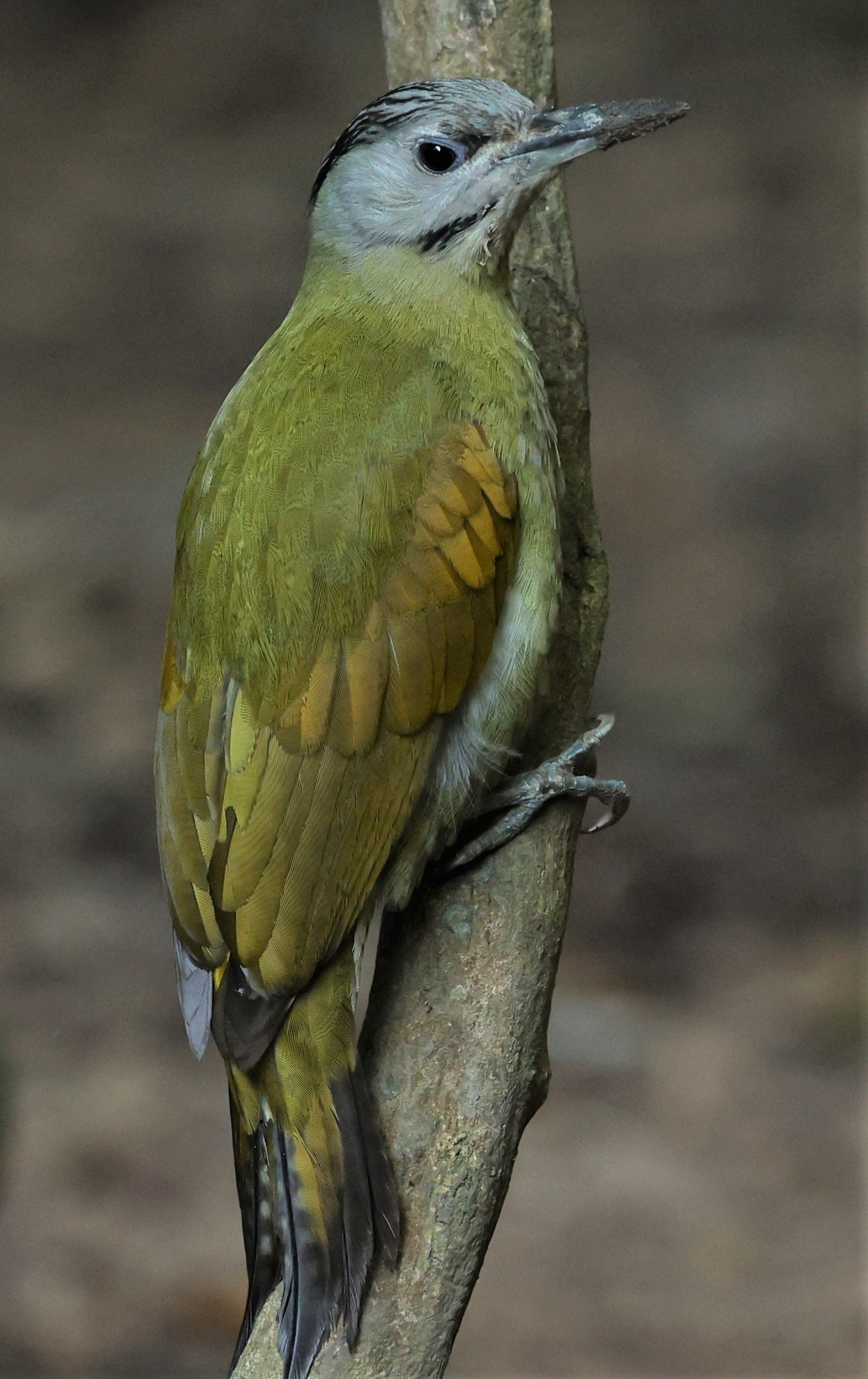
Grey-headed Woodpecker (Picus canus)

Grey-headed Woodpecker (Picus canus)

Ashy Woodswallow (Artamus fuscus)

Great Slaty Woodpecker (Mulleripicus pulverulentus)
Rain Quail (Coturnix coromandelica) from the Pu Plu Scrublands in the lower elevations outside of the KKFC. Now there habitat has been destroyed tragically to make room for corn.

Rain Quail (Coturnix coromandelica)

Barred Buttonquail (Turnix suscitator) are a common yet rarely seen species. These were from Nong Ya Plong in the norther lowlands of the KKFC
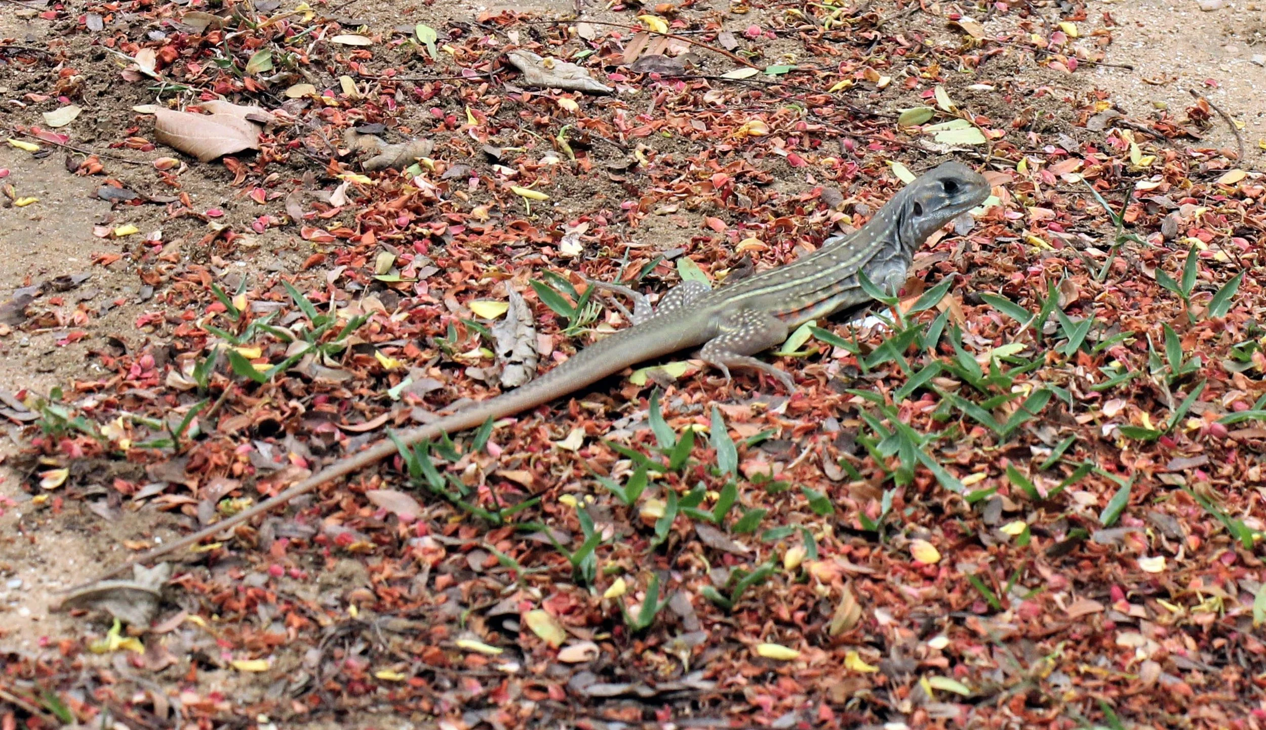
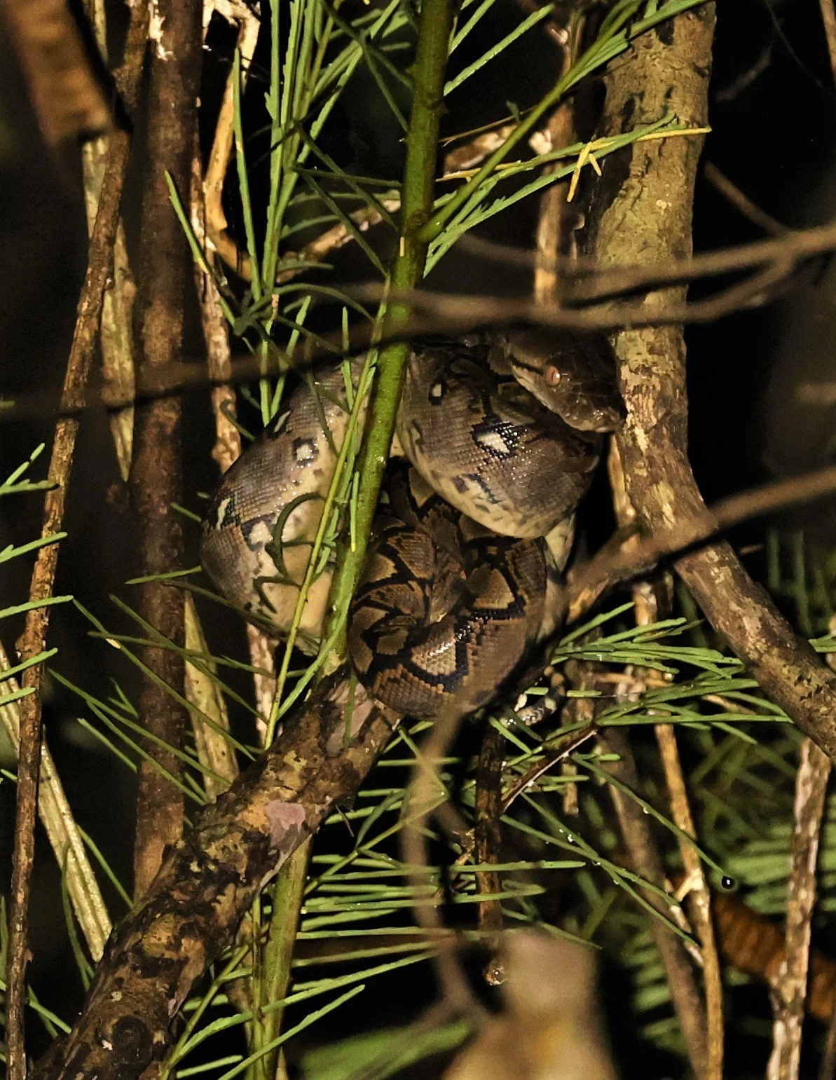
Reptiles, Amphibians, and Other Wildlife
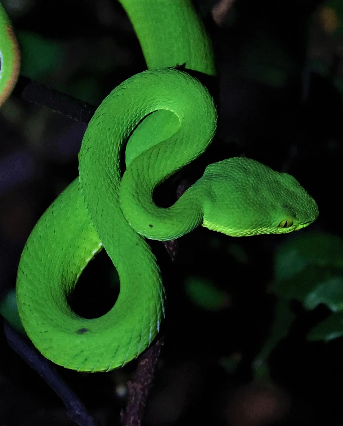
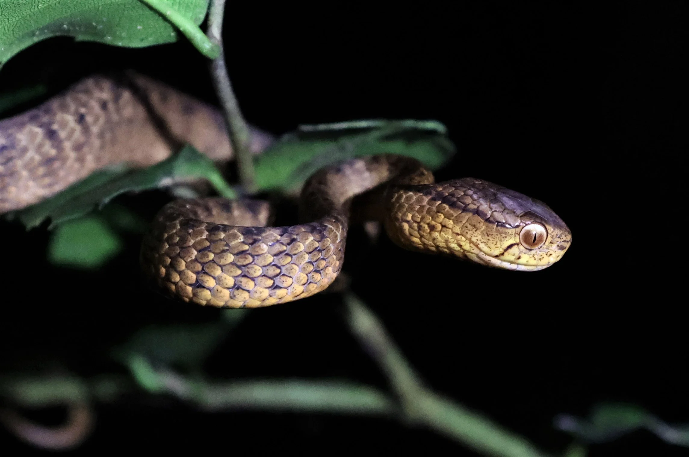
Beyond its mammals and birds, Kaeng Krachan shelters a rich community of reptiles and amphibians, buoyed by stable humidity, diverse forest types, and healthy river systems. Among its most globally significant species are the critically endangered Siamese crocodile (Crocodylus siamensis) and the endangered Asian giant tortoise (Manouria emys). Other notable reptiles include the yellow/elongated tortoise and a variety of snakes and lizards typical of intact evergreen forests. The presence of these species—many of which require pristine wetland or riverine habitats—underscores the ecological integrity of the region’s watersheds. [whc.unesco.org]
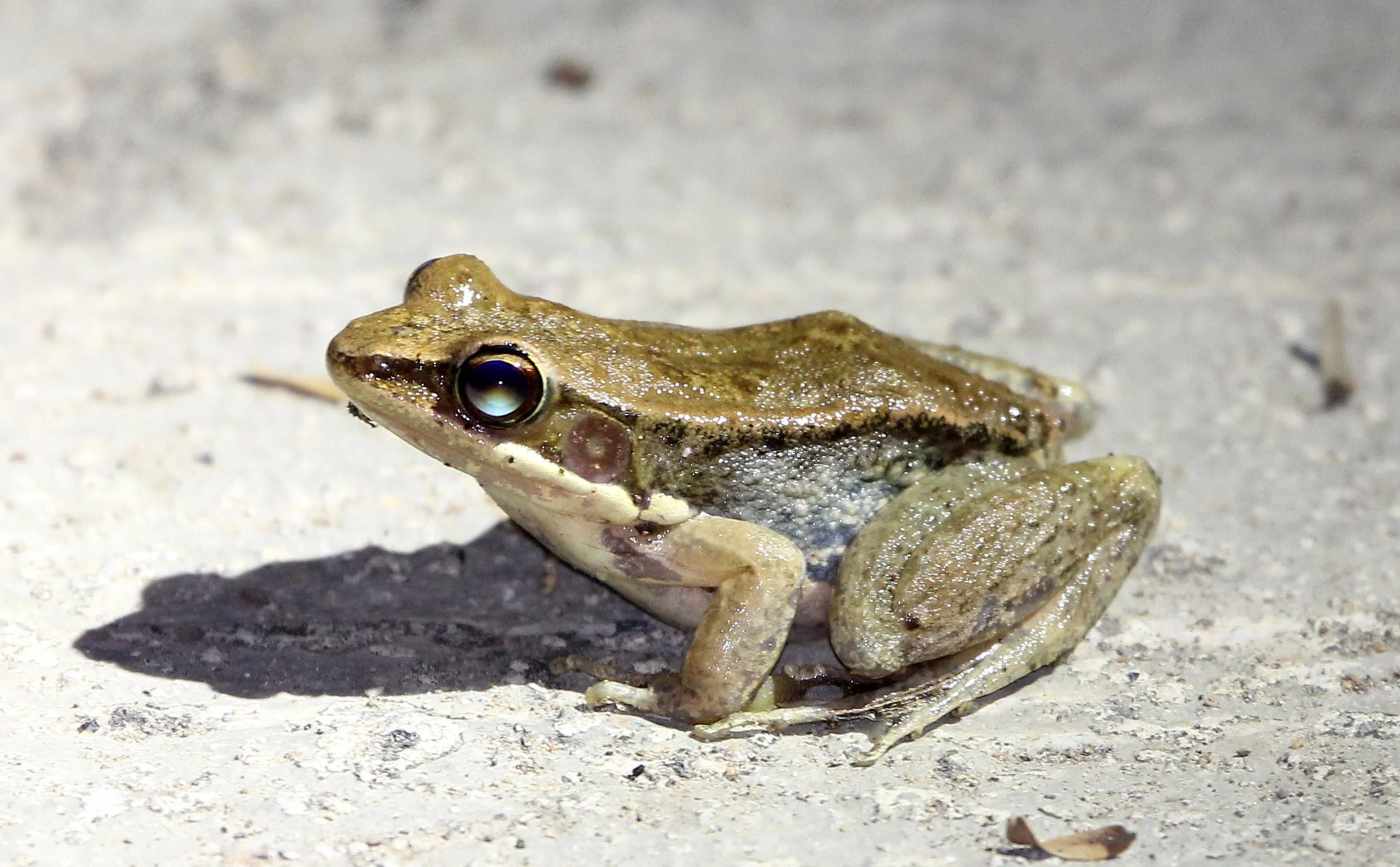
Amphibians thrive in the park's moist undergrowth, riparian corridors, and high‑rainfall cloud forests. While specific species names are not listed in the retrieved results, the abundance of streams and permanent waterways, as well as the forest’s structural complexity, indicates a strong amphibian presence, particularly among tree frogs and stream‑breeding species. This contributes to the area’s recognition as a hotspot of herpetofaunal diversity.
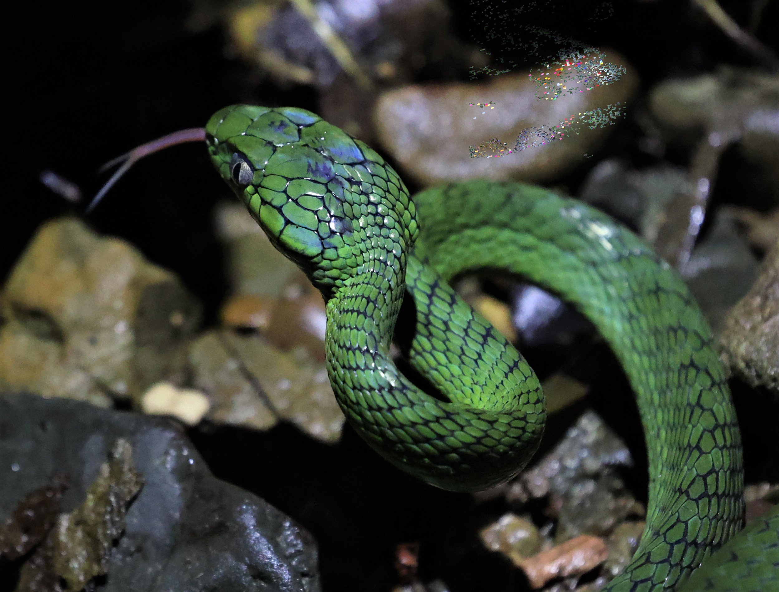
White-lipped Pit Viper (Trimeresurus albolabris)
Keeled Slug Snake (Pareas carinatus)
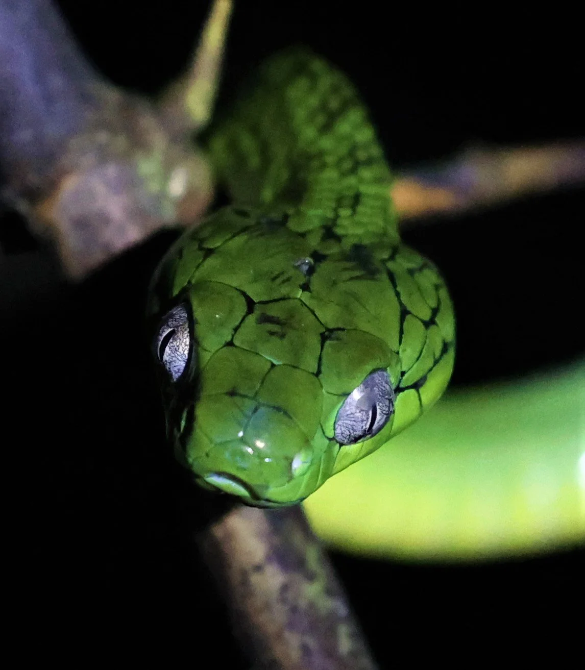
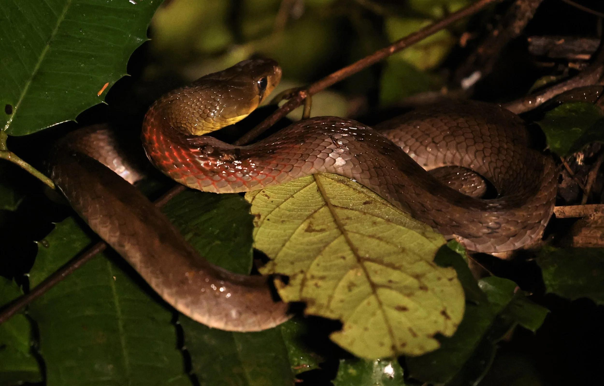
Green Cat Snake (Boiga cyanea)
Green Cat Snake (Boiga cyanea)
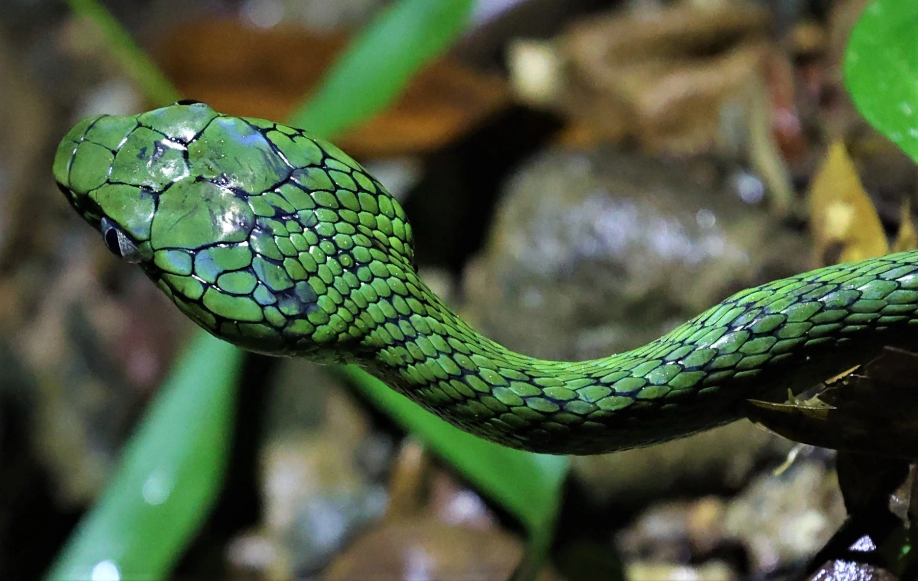
Sawtooth-necked Bronzeback (Dendrelaphis nigroserratus)
Keeled Slug Snake (Pareas carinatus)
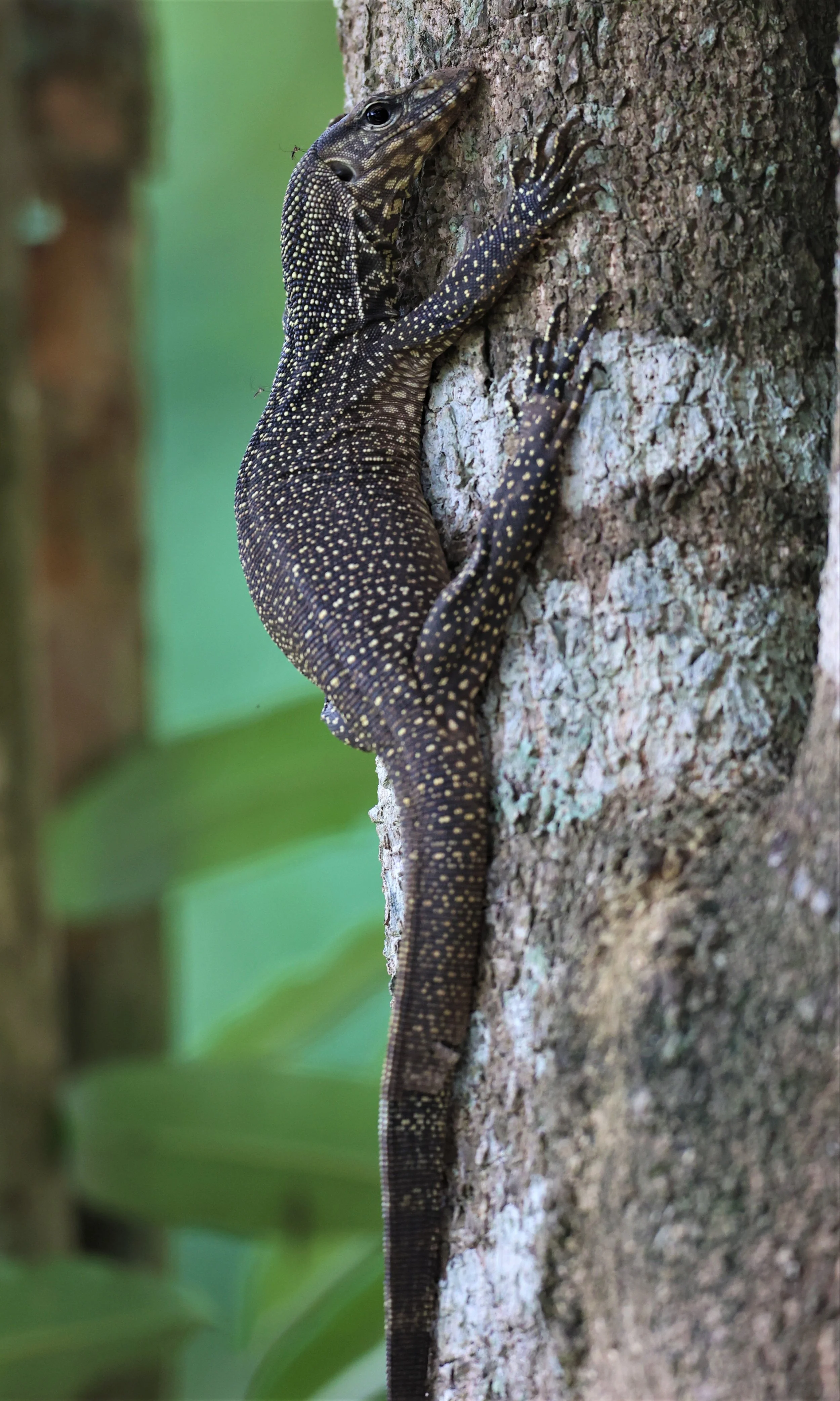
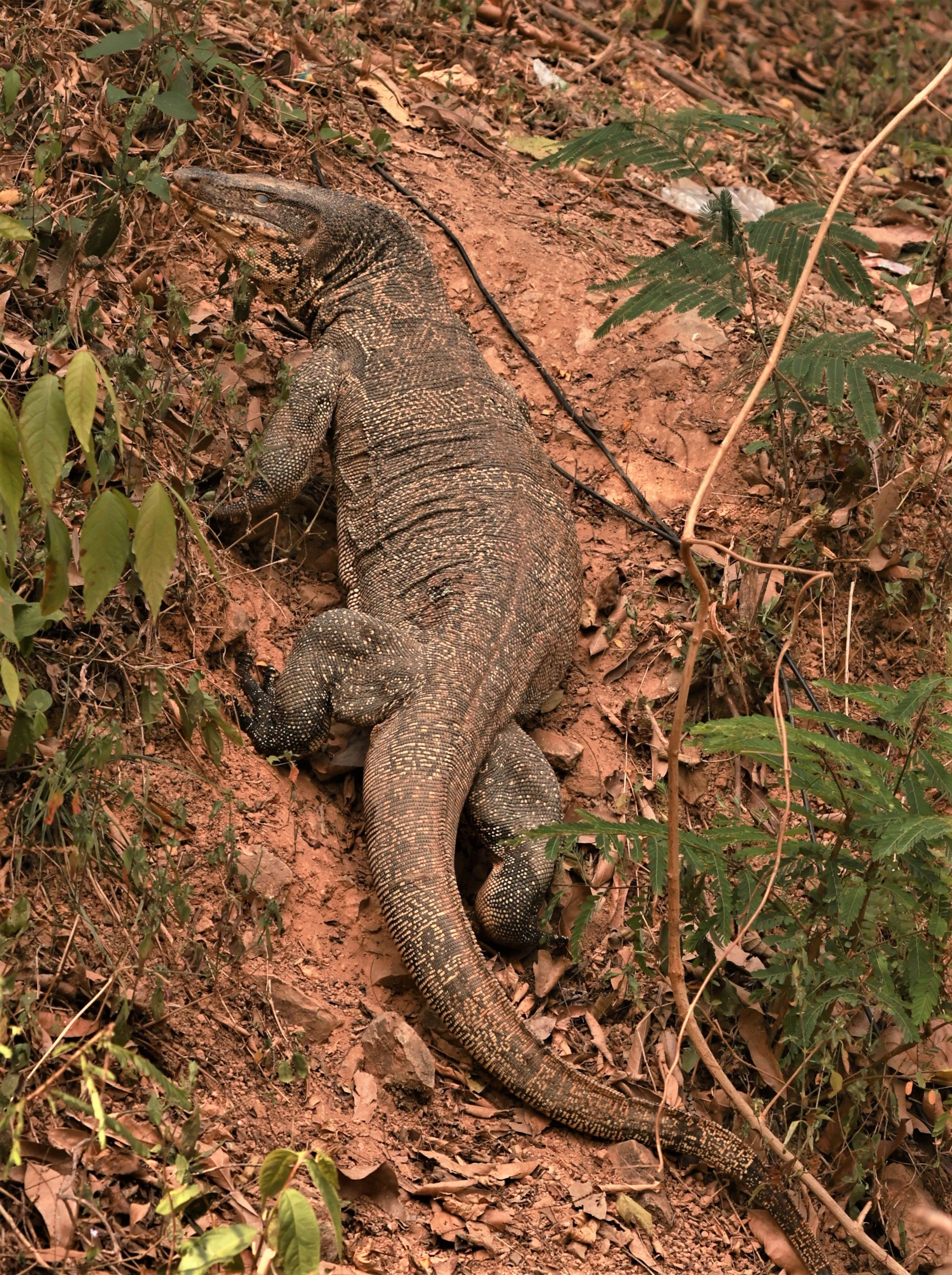
Clouded Monitor (Varanus nebulosus)
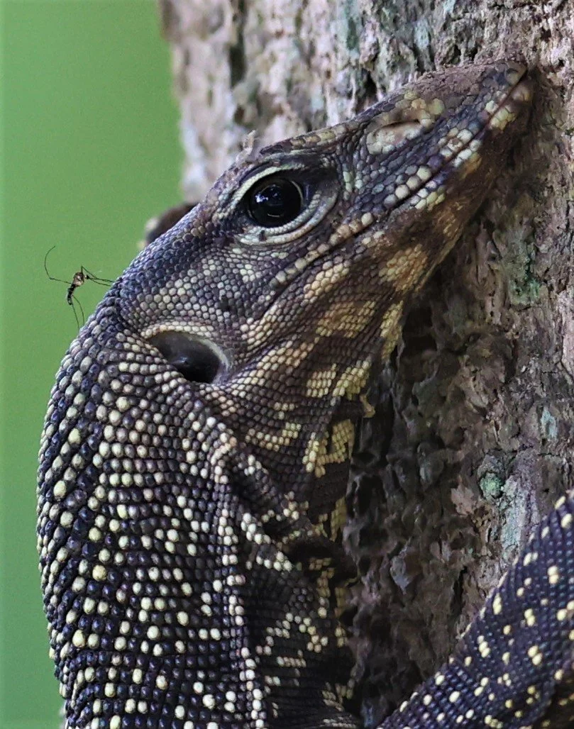
Clouded Monitor (Varanus nebulosus)
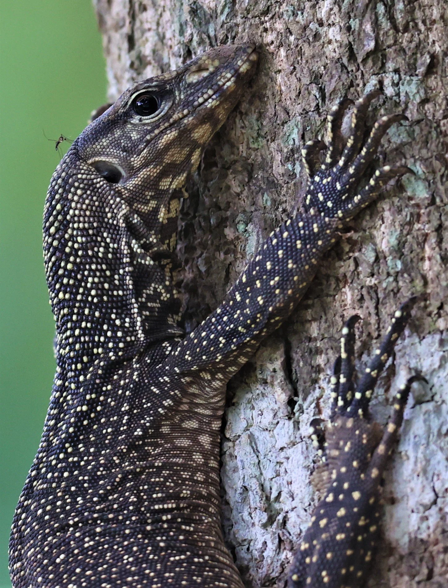
Clouded Monitor (Varanus nebulosus)

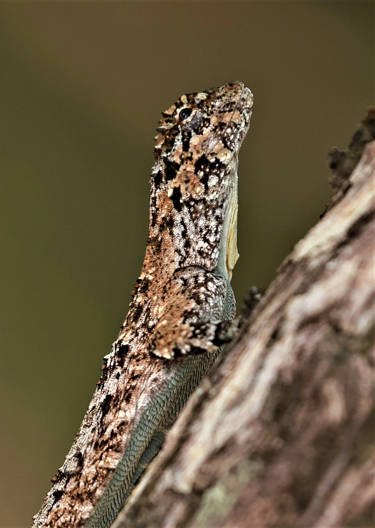
Boulenger’s Pricklenape (Acanthosaura crucigera)

Needs ID
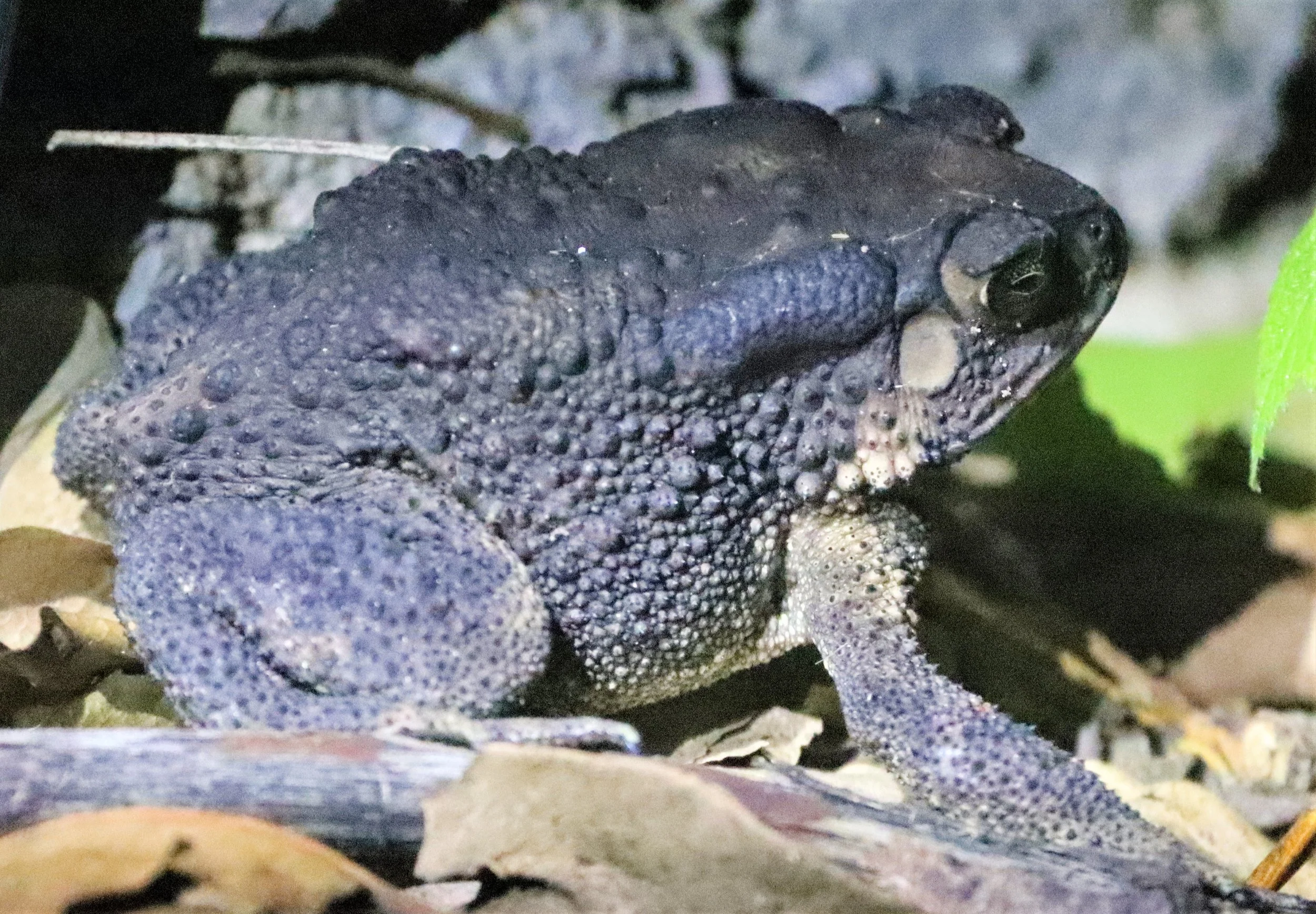

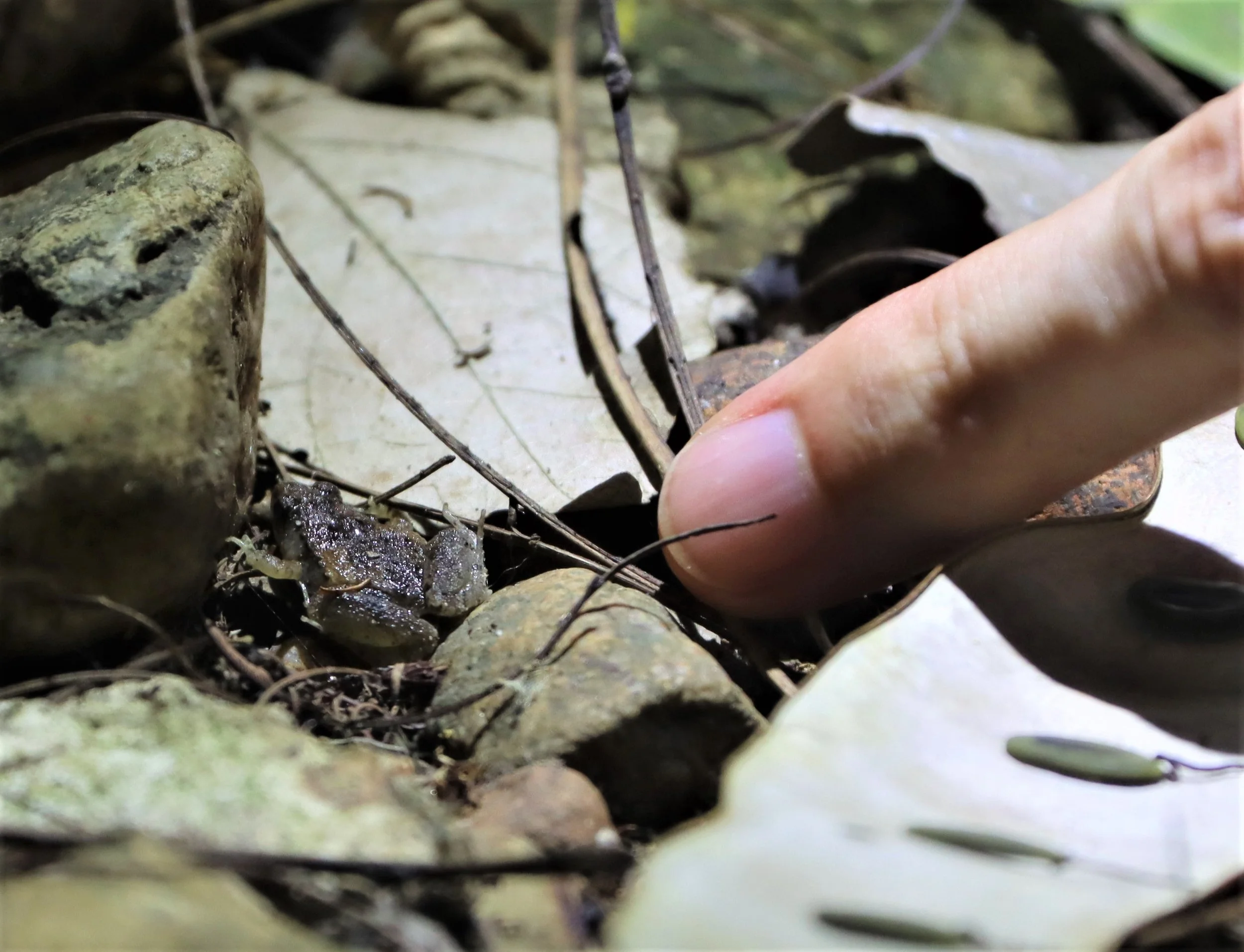
Banded Toad

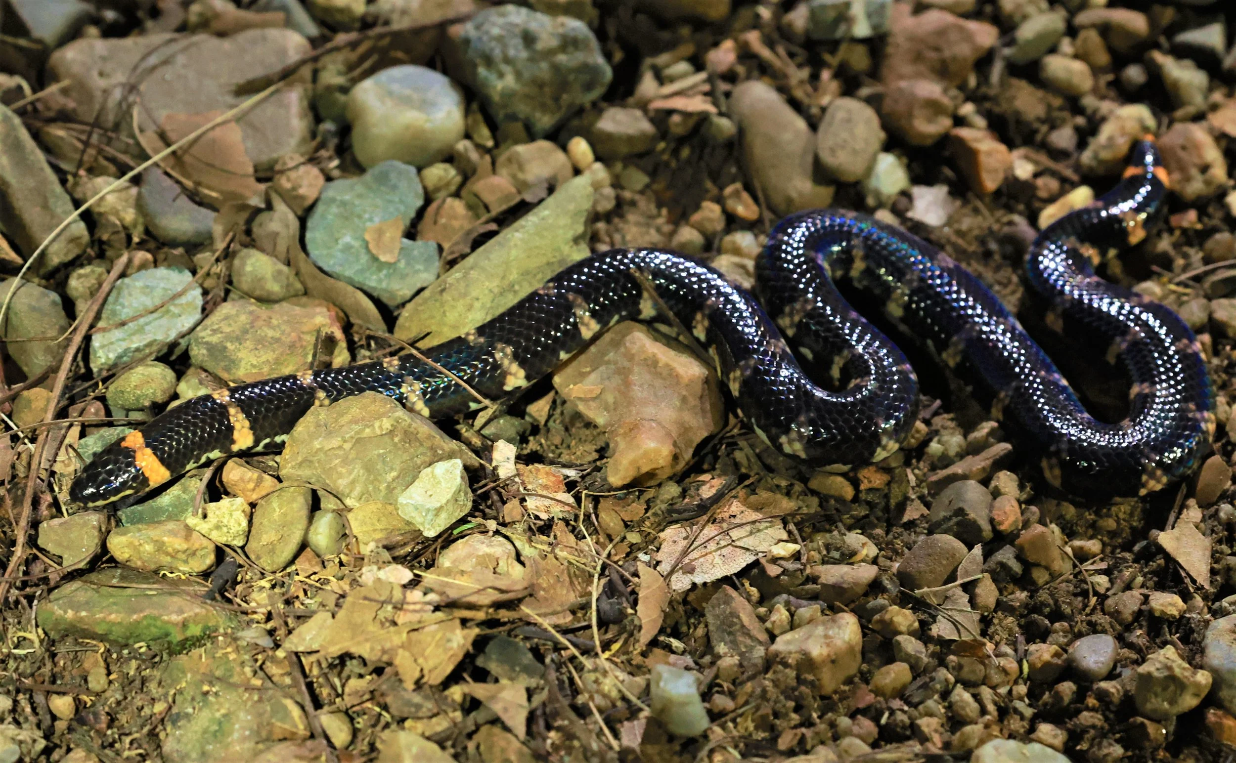
Small-spotted coral snake (Calliophis maculiceps) Baan Maka Petchaburi Thailand
Small-spotted coral snake (Calliophis maculiceps) Baan Maka Petchaburi Thailand

Emma Gray's Forest Lizard (Calotes emma)

Common Sun Skink (Eutropis multifasciata) Kaeng Krachan
Jodi's Pipe Snake (Cylindrophis jodiae - Jodi's Pipe Snake - Baan Maka Nature Resort Thailand (17)

Phetchaburi bent-toed gecko (Cyrtodactylus phetchaburiensis) Pha Nam Yod Waterfal

Phetchaburi bent-toed gecko (Cyrtodactylus phetchaburiensis) Pha Nam Yod Waterfal

Olive Tree Skink (Dasia olivacea)
Draco flying lizard

Draco flying lizard

The Tokay Gecko's bifurcated tail is a result of a process called autotomy, which is a natural evolutionary trait shared by many lizards. This process involves the shedding of the tail to avoid predation or as a distraction technique. The tail can be shed under different situations, with the frequency and tendency varying between species. Tokay Geckos shed their tails under two different circumstances: during embryonic growth and after shedding. The shedding process is complex and involves distinct pathways, genes, and origin cells. The tail bud during embryonic growth is small, and all growth during tail regeneration is from a blastema, a group of cells capable of growth and regeneration. The Tokay Gecko's tail regenerates in approximately three weeks, although it typically does not grow as long as the original.

Tokay (Gekko gecko)

Tokay (Gekko gecko)

Tokay (Gekko gecko)
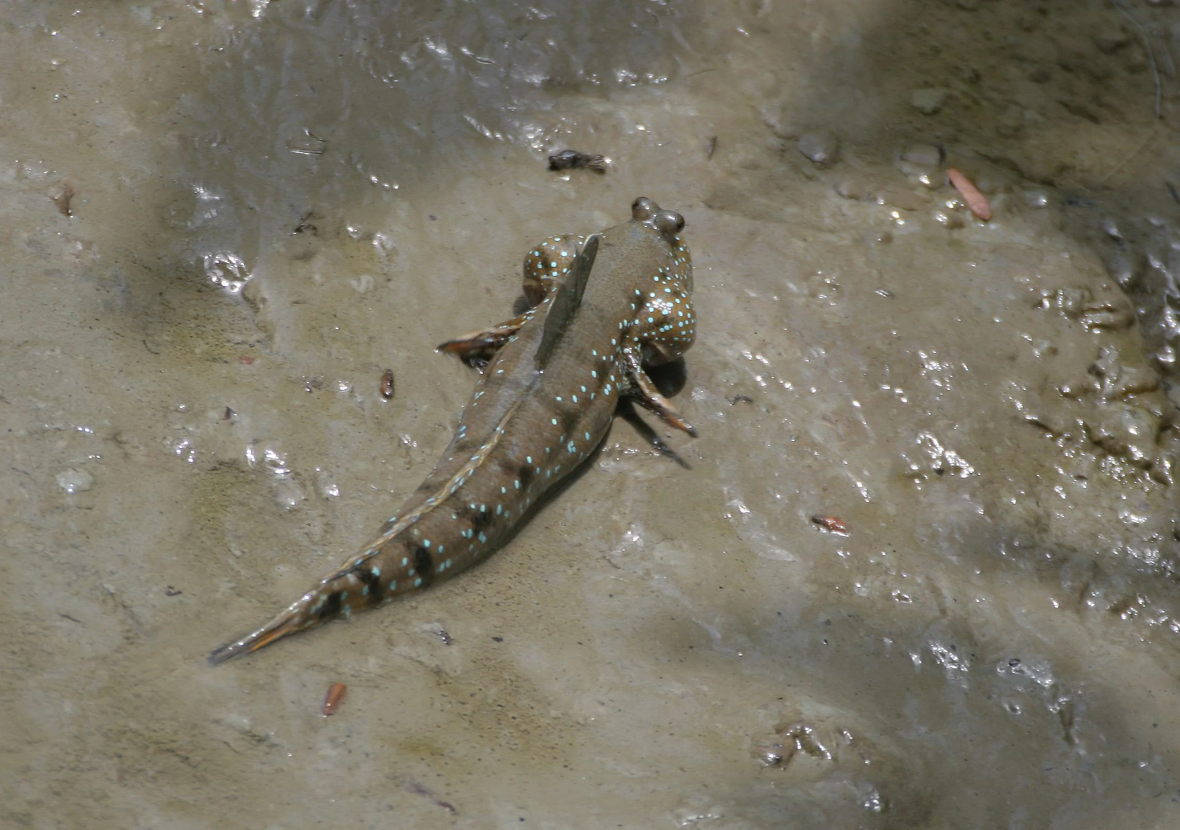
Gobiidae - Boleophthalmus boddarti - Blue-spotted or Goggle-eyed Mudskipper - Khao Sam Roi Yod
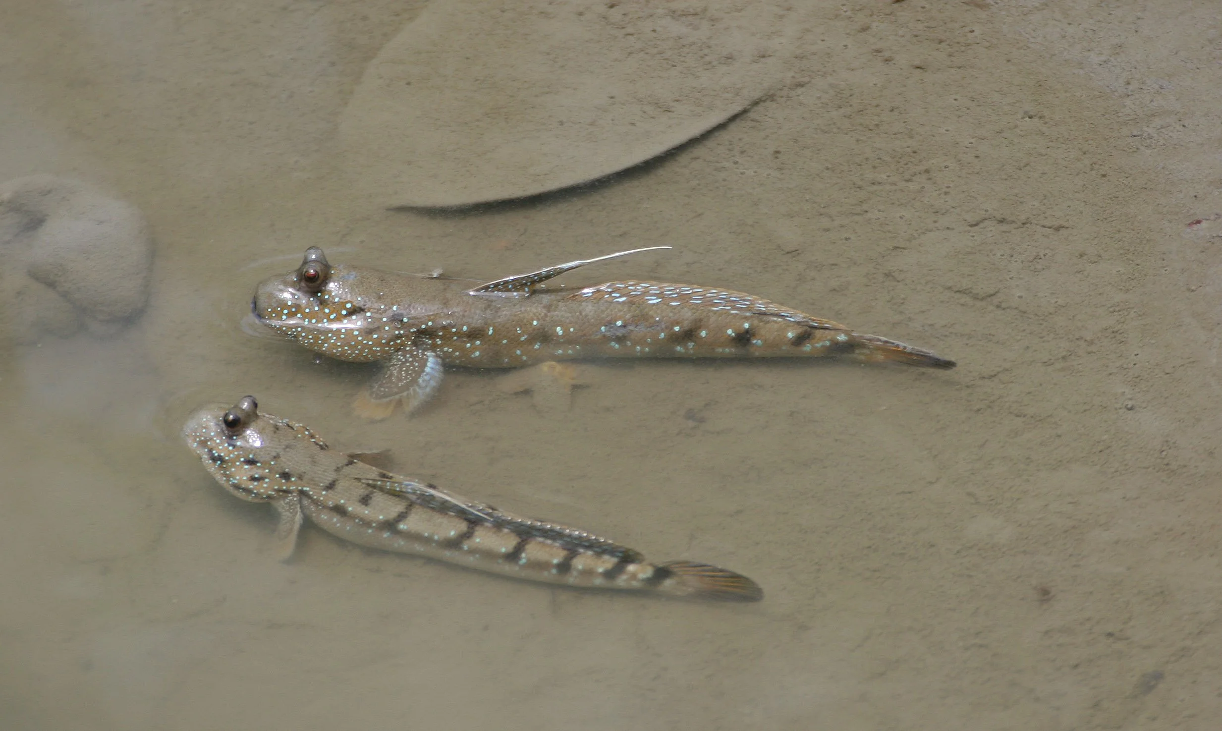
Gobiidae - Boleophthalmus boddarti - Blue-spotted or Goggle-eyed Mudskipper - Khao Sam Roi Yod

Gobiidae - Periophthalmodon schlosseri - Giant Mudskipper - Khao Sam Roi Yod

Bell's Butterfly Lizard (Leiolepis belliana)
Bell's Butterfly Lizard (Leiolepis belliana)
Reticulated Python (Malayopython reticulatus) Baan Maka

Asian Forest Tortoise (Manouria emys)

Asian Forest Tortoise (Manouria emys)

Asian Forest Tortoise (Manouria emys)
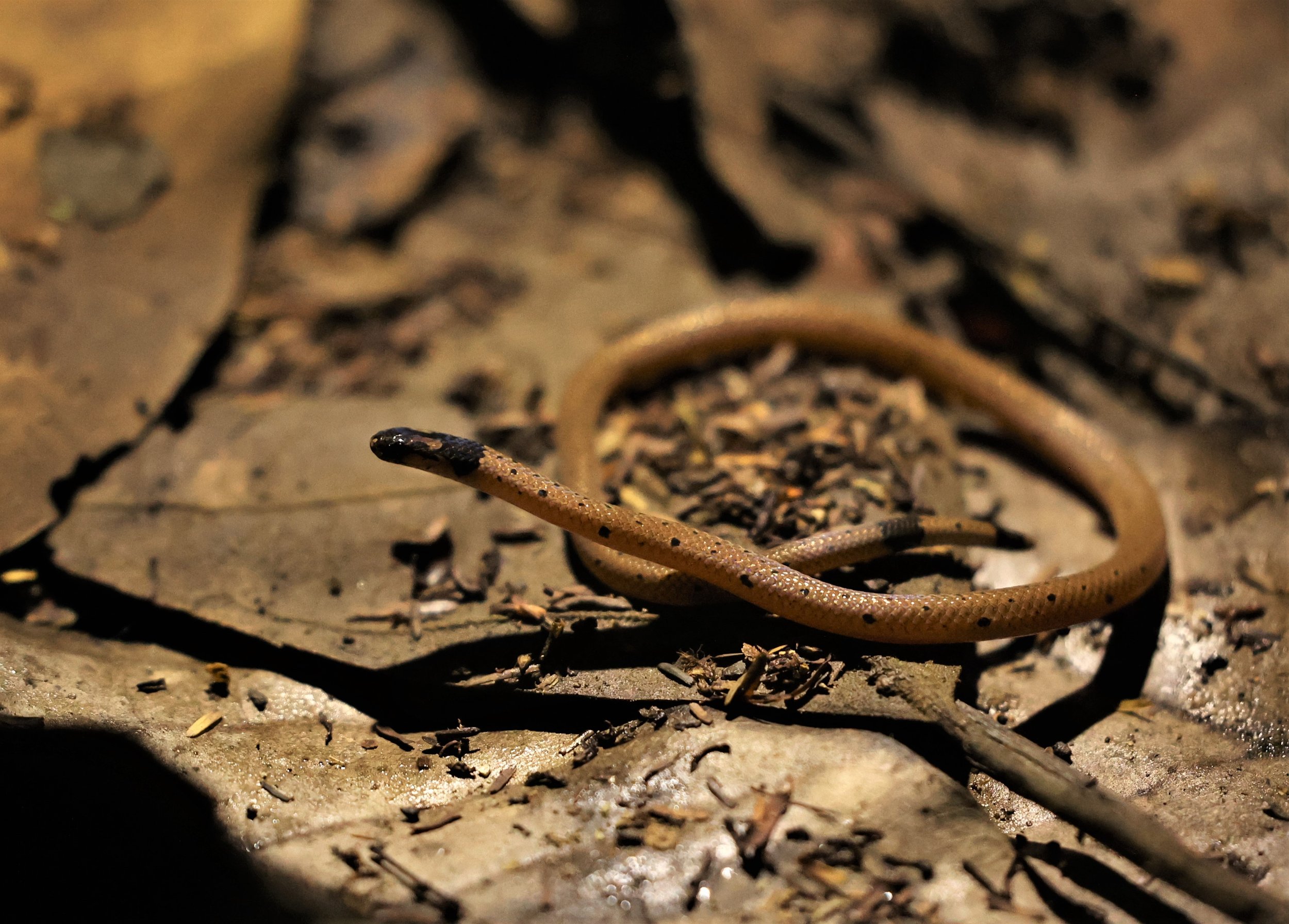
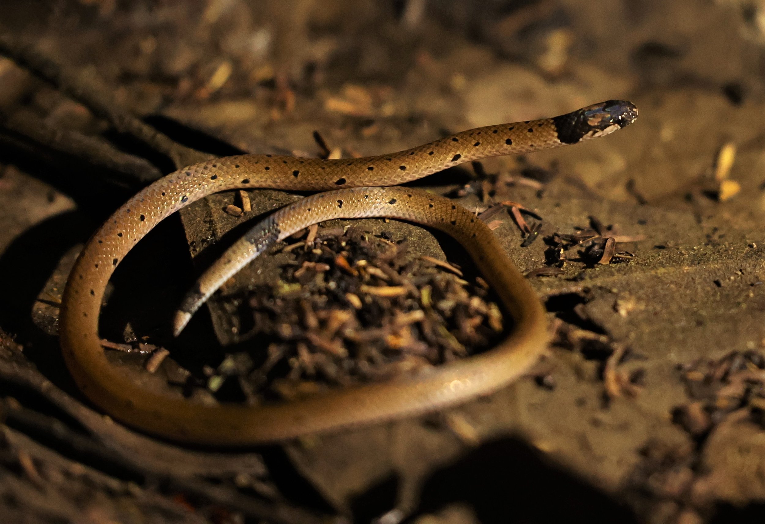
Red-necked Keelback (Rhabdophis subminiatus)

Red-necked Keelback (Rhabdophis subminiatus)

White-lipped Pit Viper (Trimeresurus albolabris)
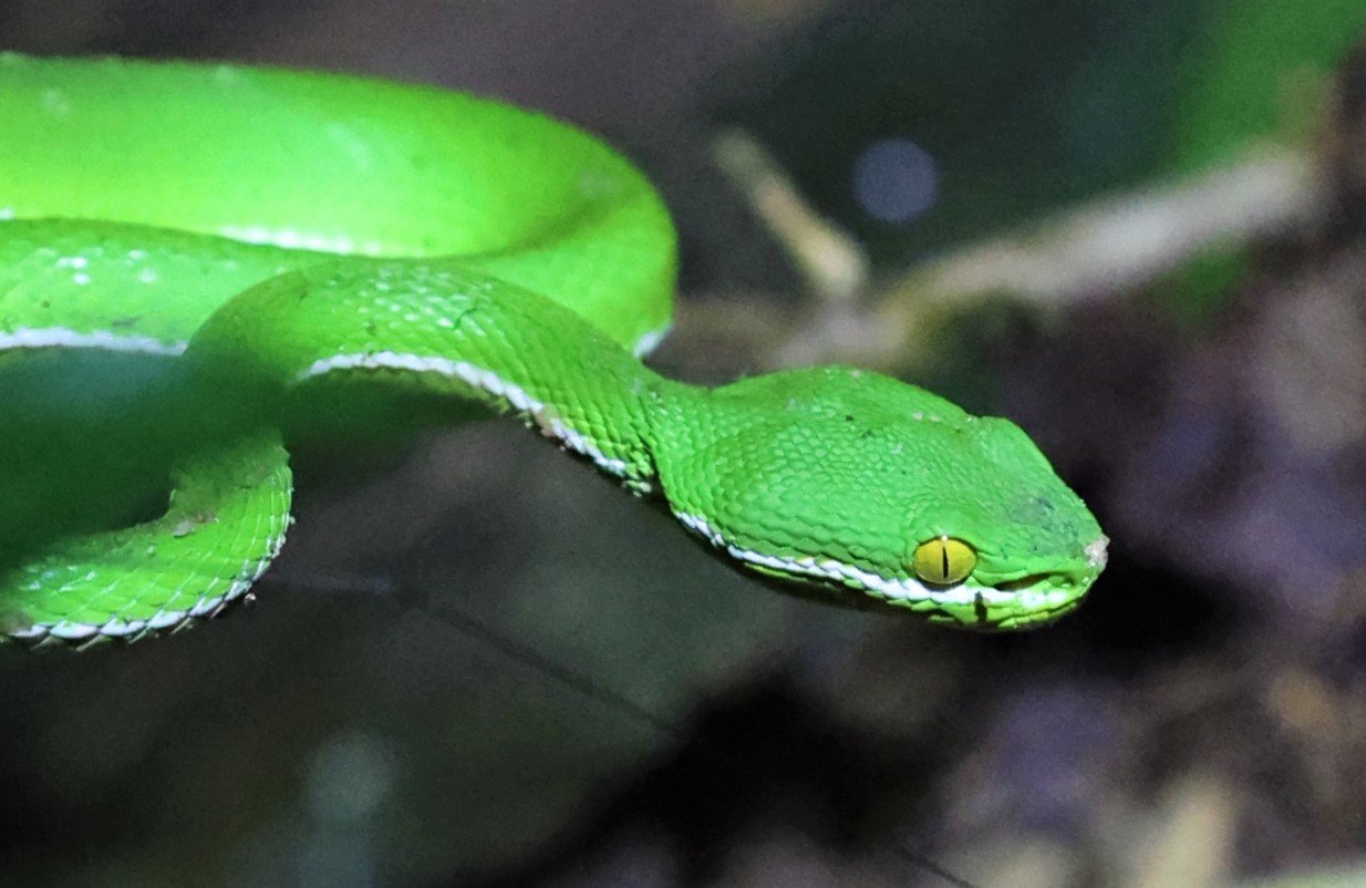
White-lipped Pit Viper (Trimeresurus albolabris)

White-lipped Pit Viper (Trimeresurus albolabris)

Varanus nebulosus - Clouded Monitor Lizard

Water Monitor (Varanus salvator)
Water Monitor (Varanus salvator)

Oldham's Leaf Turtle (Cyclemys oldhamii)

Oldham's Leaf Turtle (Cyclemys oldhamii)

Oldham's Leaf Turtle (Cyclemys oldhamii)
Mukhlesur's Narrow-mouthed Frog (Microhyla mukhlesuri)
Invertebrates
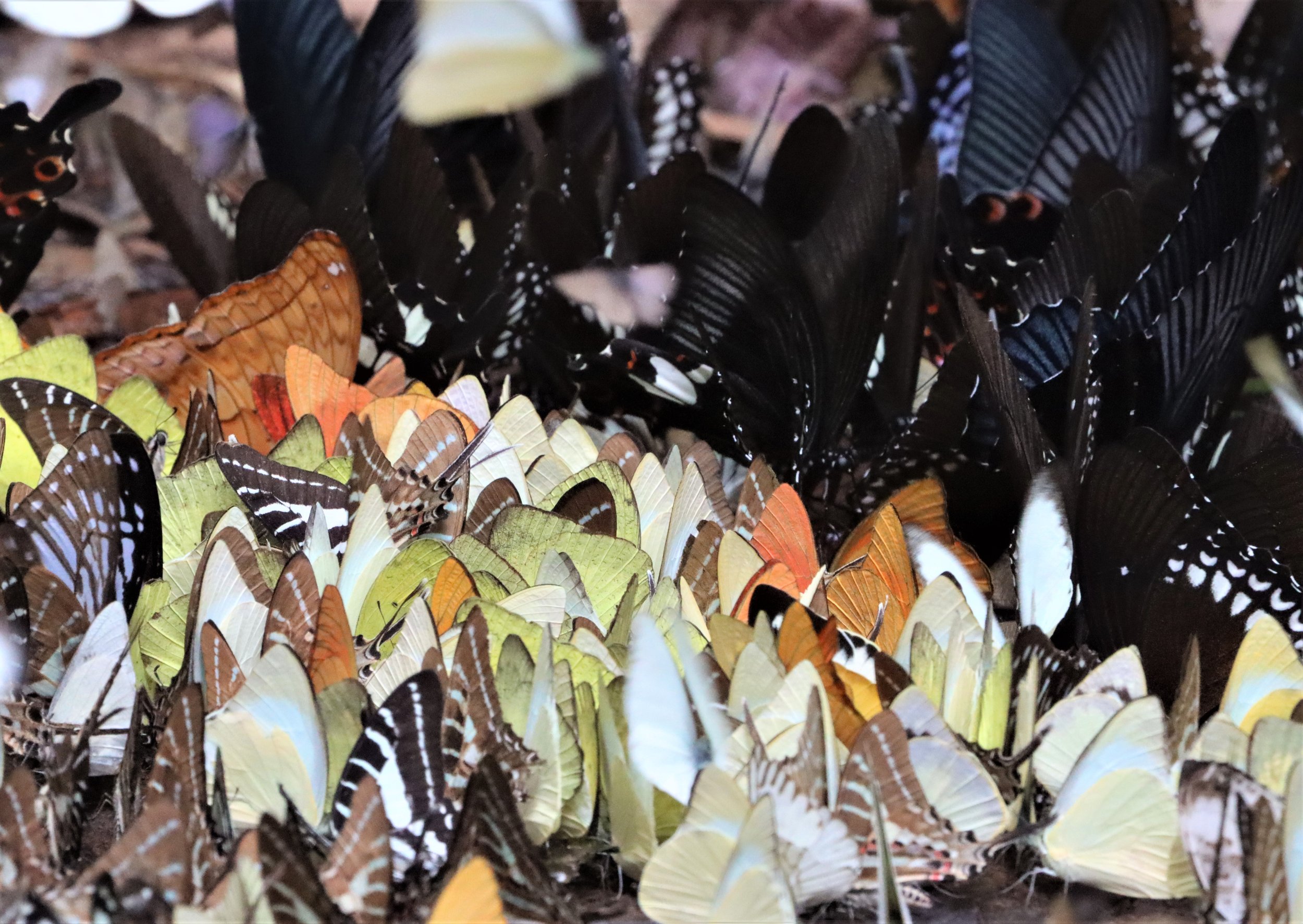
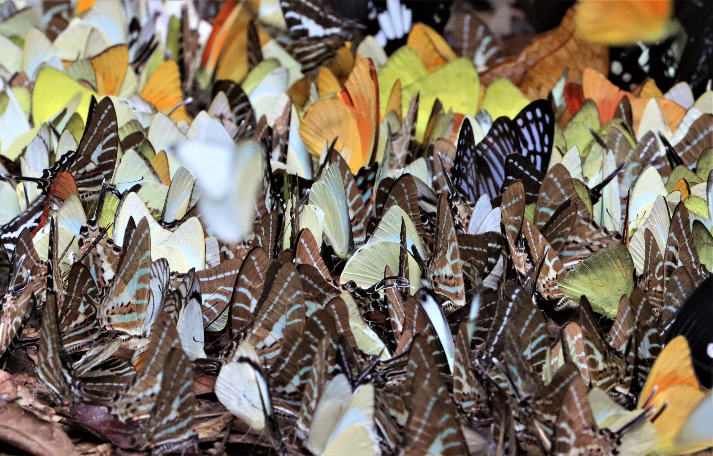
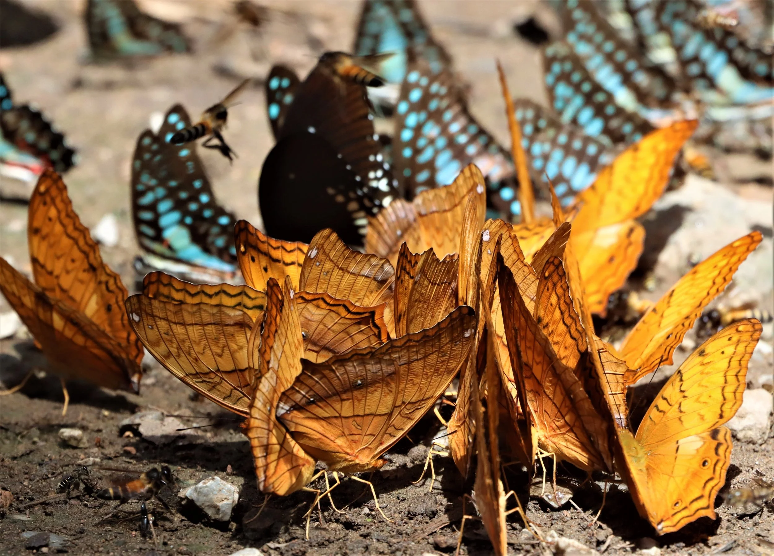
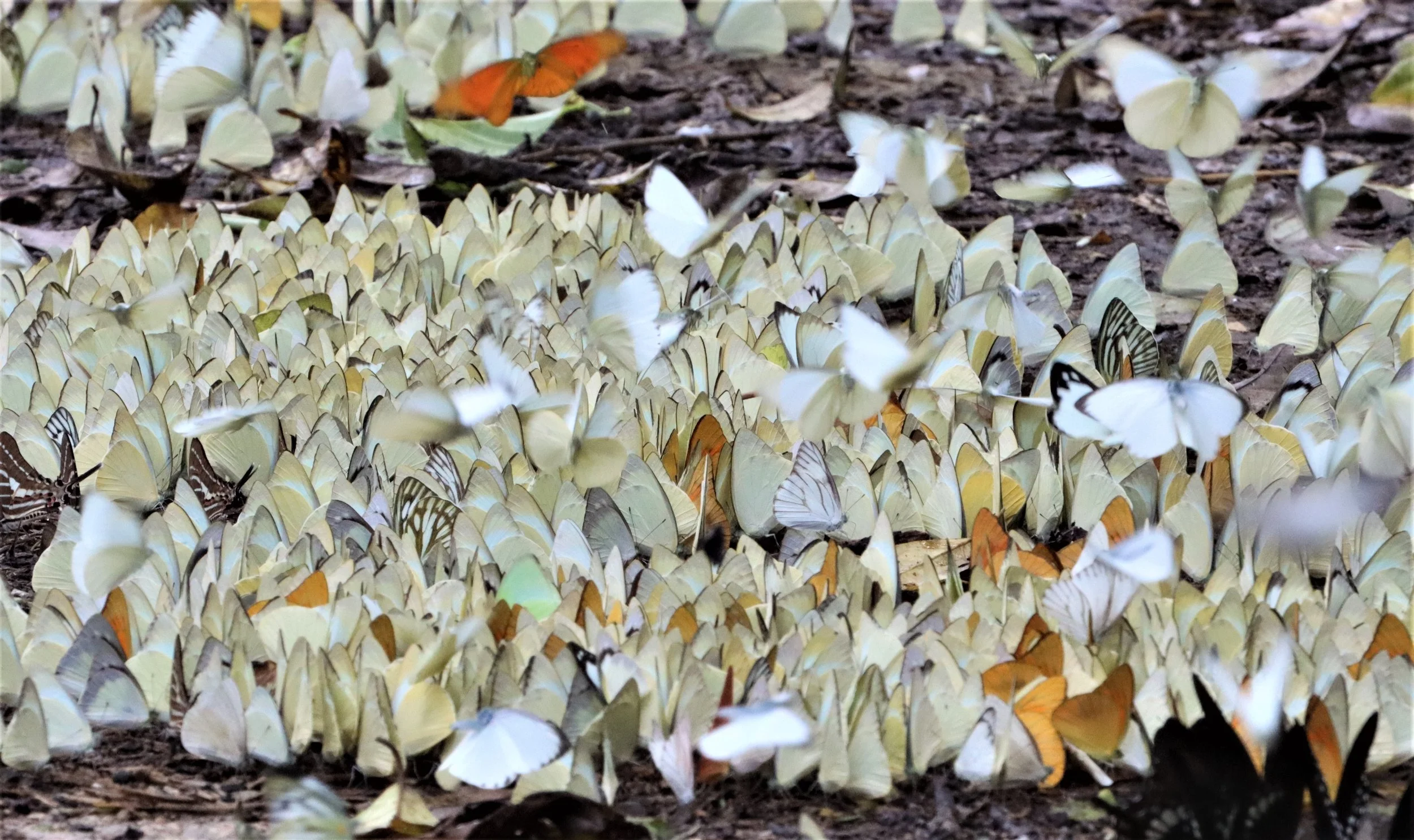
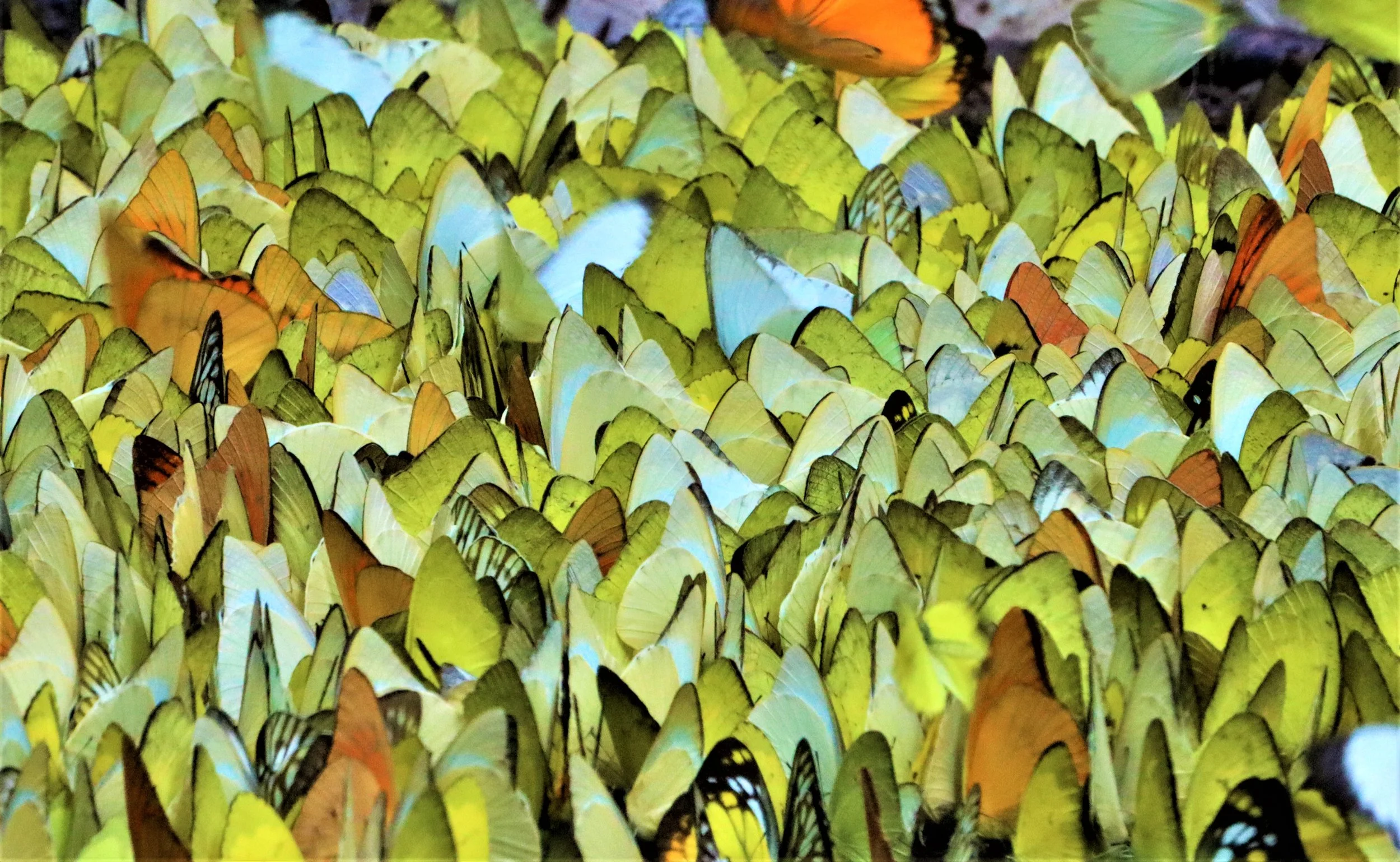
Kaeng Krachan National Park hosts an exceptionally rich invertebrate community, owing to its vast size, diverse forest types, and humid microclimates. Visitors frequently remark on the abundance of insects, especially during peak seasons when the forest becomes alive with color and movement. The park is particularly renowned for its butterfly diversity, with nearly 300 species recorded, making it one of Thailand’s premier butterfly‑watching destinations. These butterflies thrive along stream edges, salt licks, and sunlit clearings where they gather in large congregations, especially during the warm months. In addition to butterflies, the park supports a wide variety of other insects—including beetles, ants, dragonflies, and moths—whose diversity reflects the park’s position at the ecological crossroads of continental and peninsular Southeast Asia.
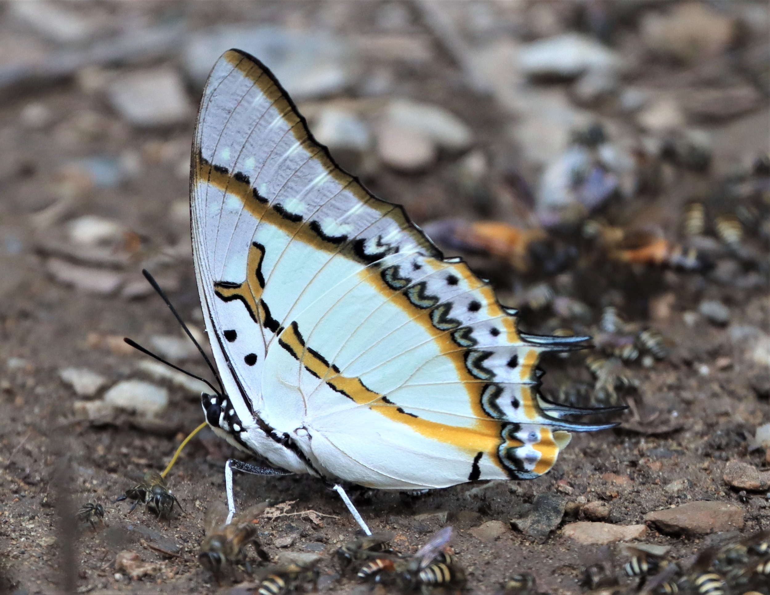
Without question, the most impressive insect displays in the KKFC is the annual explosion of butterflies that happens from March to May, near the end of the dry season and beginning of the rains. The display cannot be over stated. Imagine seeing millions of leps, flying between water puddles and moist zones along the main road of the park from Bang Krang Camp to stream three. Clouds of these amazing creatures form to the point where the park will often need to close the road to protect these insects.
Common Lepidoptera of the KKFC: Pieridae (Whites and Yellows): Common Grass Yellow (Eurema), Orange Gull (Cepora judith), Striped Albatross (Appias libythea), and Common Gull. Swallowtails (Papilionidae): Common Bluebottle (Graphium sarpedon), Fivebar Swordtail (Graphium antiphates), Chain Swordtail (Graphium aristeus), Fourbar Swordtail (Graphium agetes), and Lesser Zebra (Graphium macareus). Nymphalidae (Brush-footed): Common Cruiser (Vidula erota), Great Nawab (Polyura eudamippus), Marbled Map (Cyrestis cocles), and Common Castor (Ariadne merione). Others: Common Mormon (Papilio memnon).

Twig Spider possibly Poltys species Orb Weaver group.

Dark Earth Tiger Tarantula (Chilobrachys dyscolus)
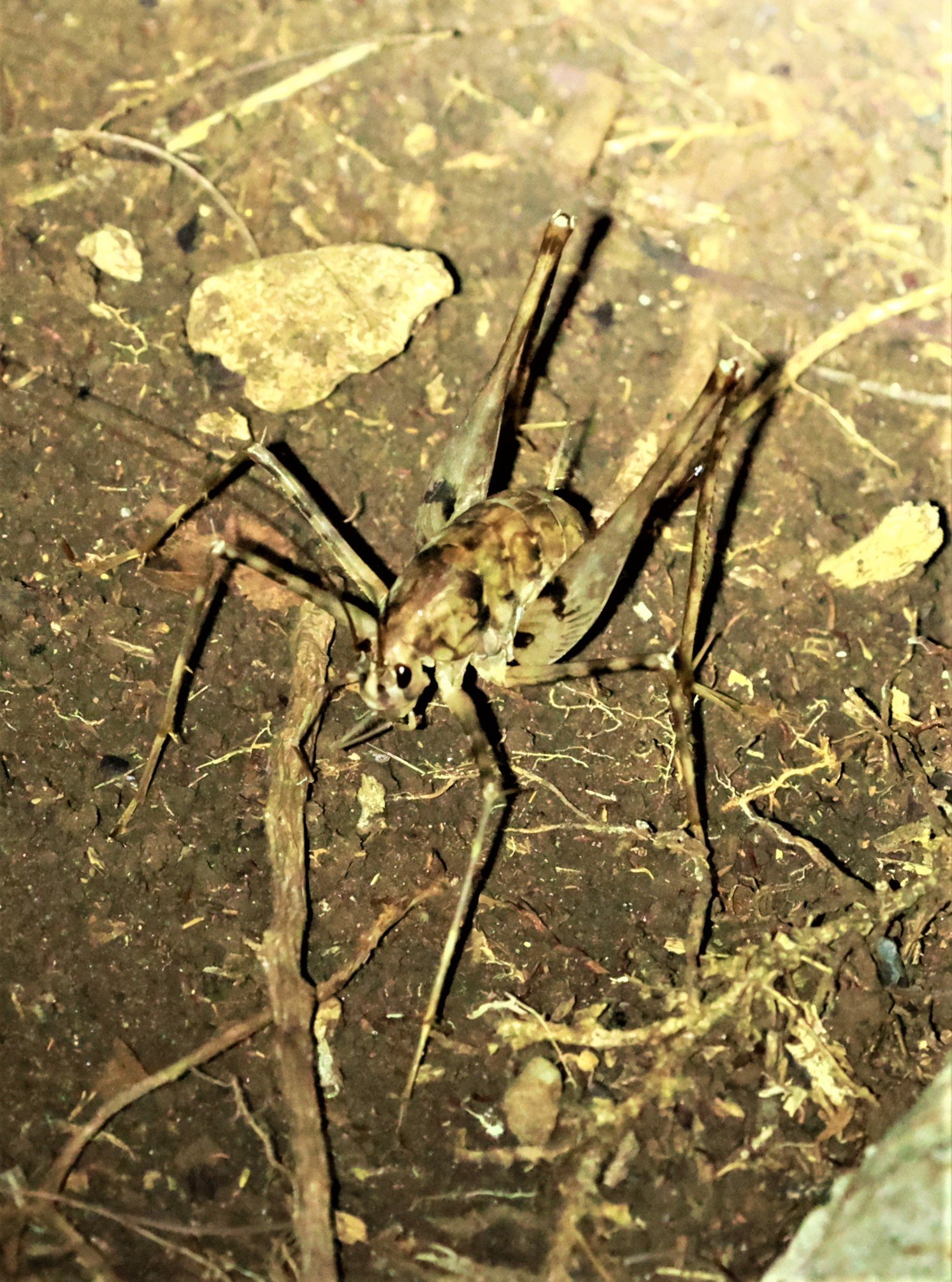
Camel or Horned Cricket from family Rhaphidophoridae
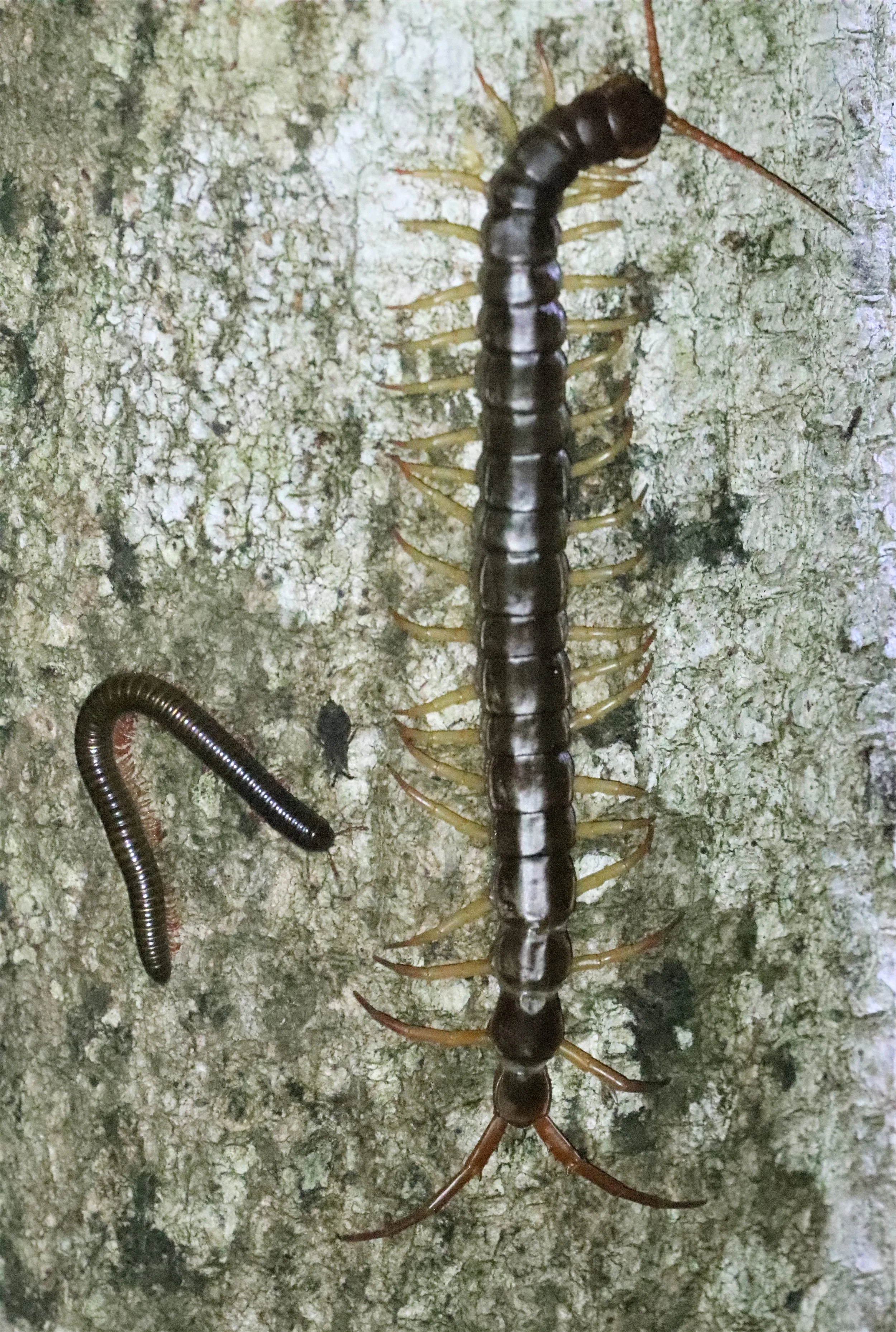
Giant Asian Centipede (Scolopendra dehaani)
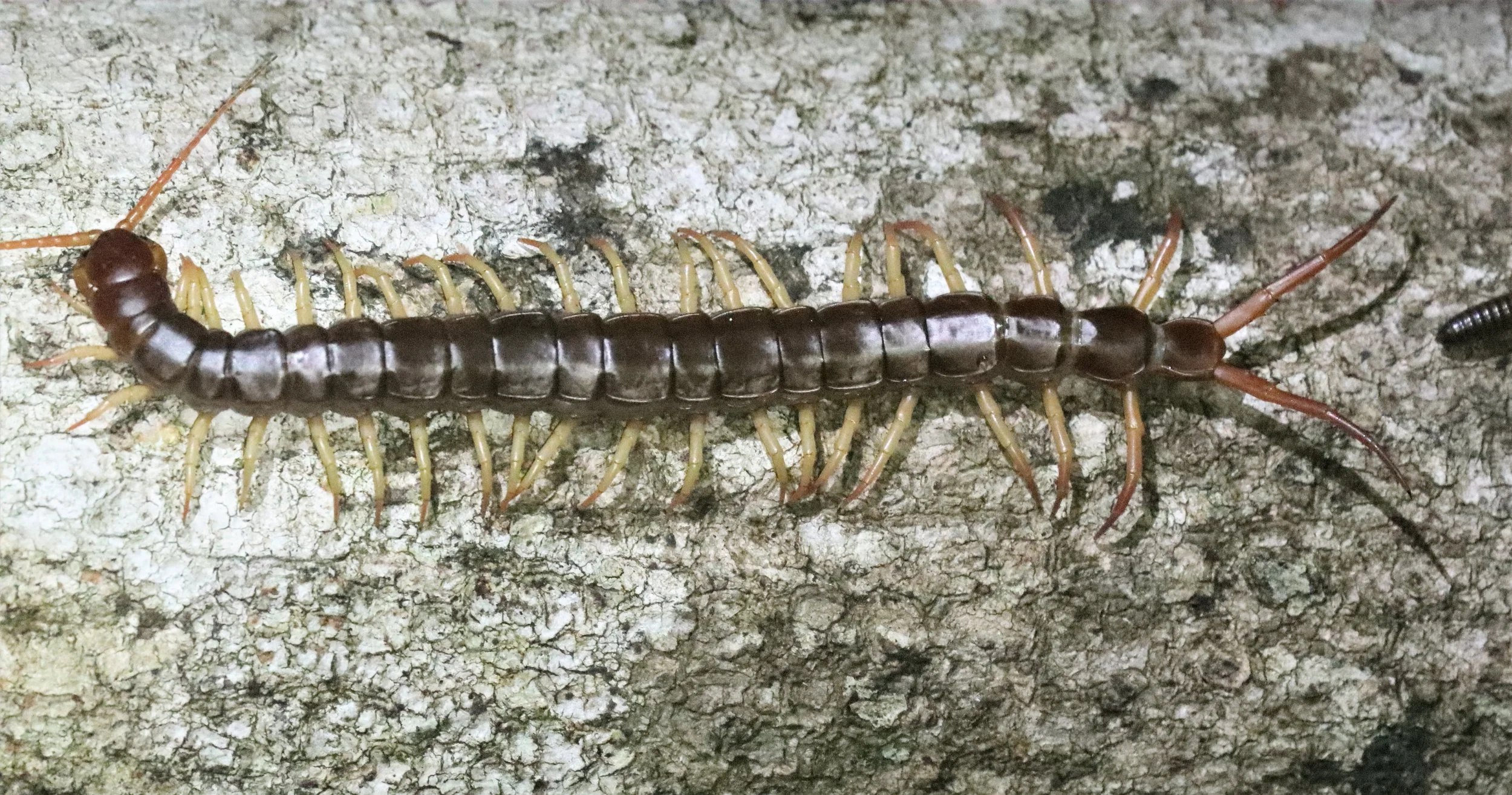
Giant Asian Centipede (Scolopendra dehaani) produces one of the most painful bites in the animal kingdom.

Lampetis affinis is the possible identification of this Buprestid beetle
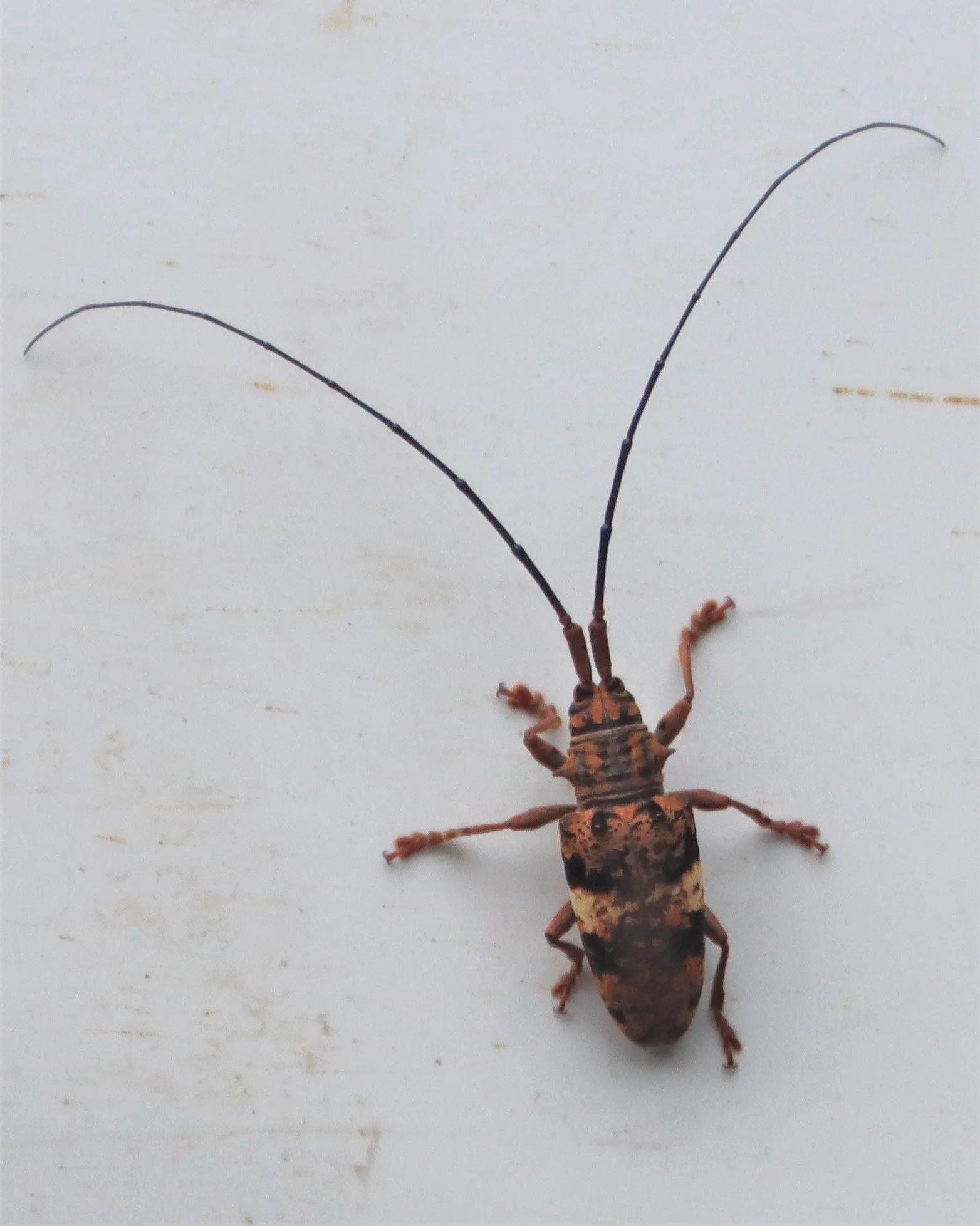
Lamiinae species - Pharsalia pulchra.

Giant Asian Centipede (Scolopendra dehaani). These creep me out!

Princess Crab or Golden Silk Purple Crab (Thaiphusa sphaeridium) is a commonly encountered terrestrial/fresh water crab seen in the KKFC.

Spirobolida species
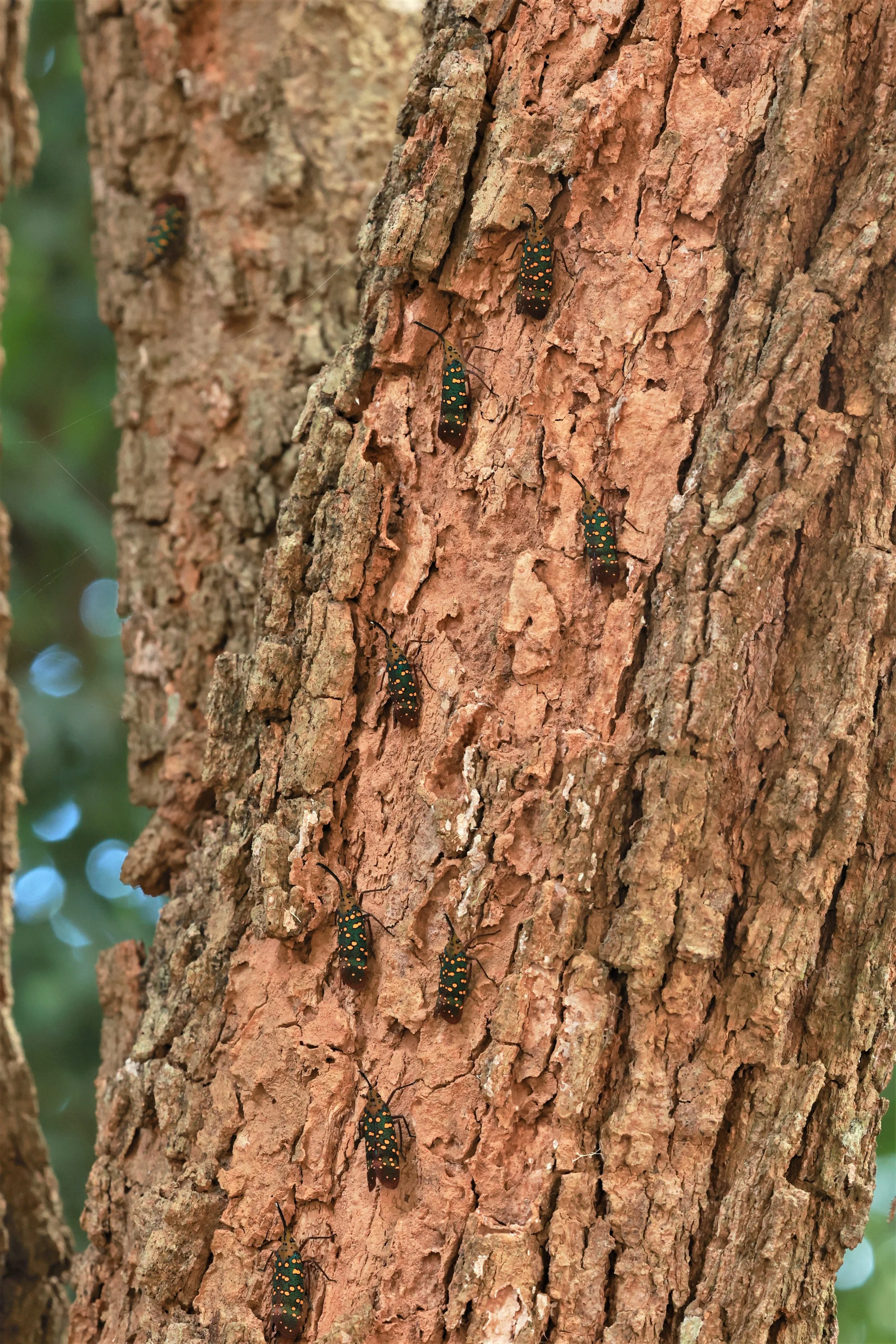
Lantern Bug (Saiva gemmata)

Lantern Bug (Saiva gemmata)

Pyrops spinolae (dark-horned lanternfly)

Penthicodes pulchella is a Fulgoridae species

Carpenter Bee
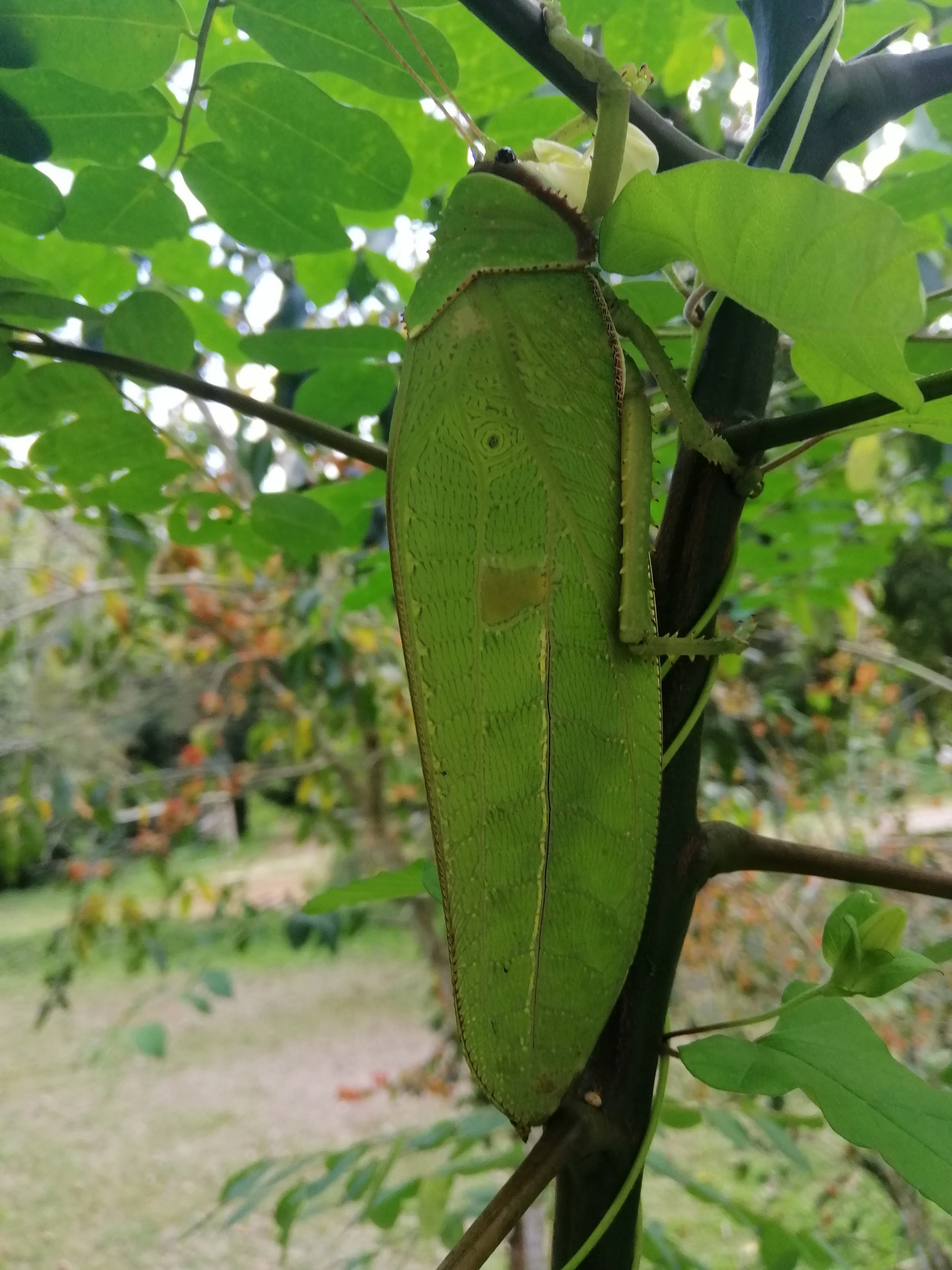
Leaf-mimic katydid, likely from the subfamily Pseudophyllinae.

Long-horned Orb-weaver spider (Macracantha arcuata)
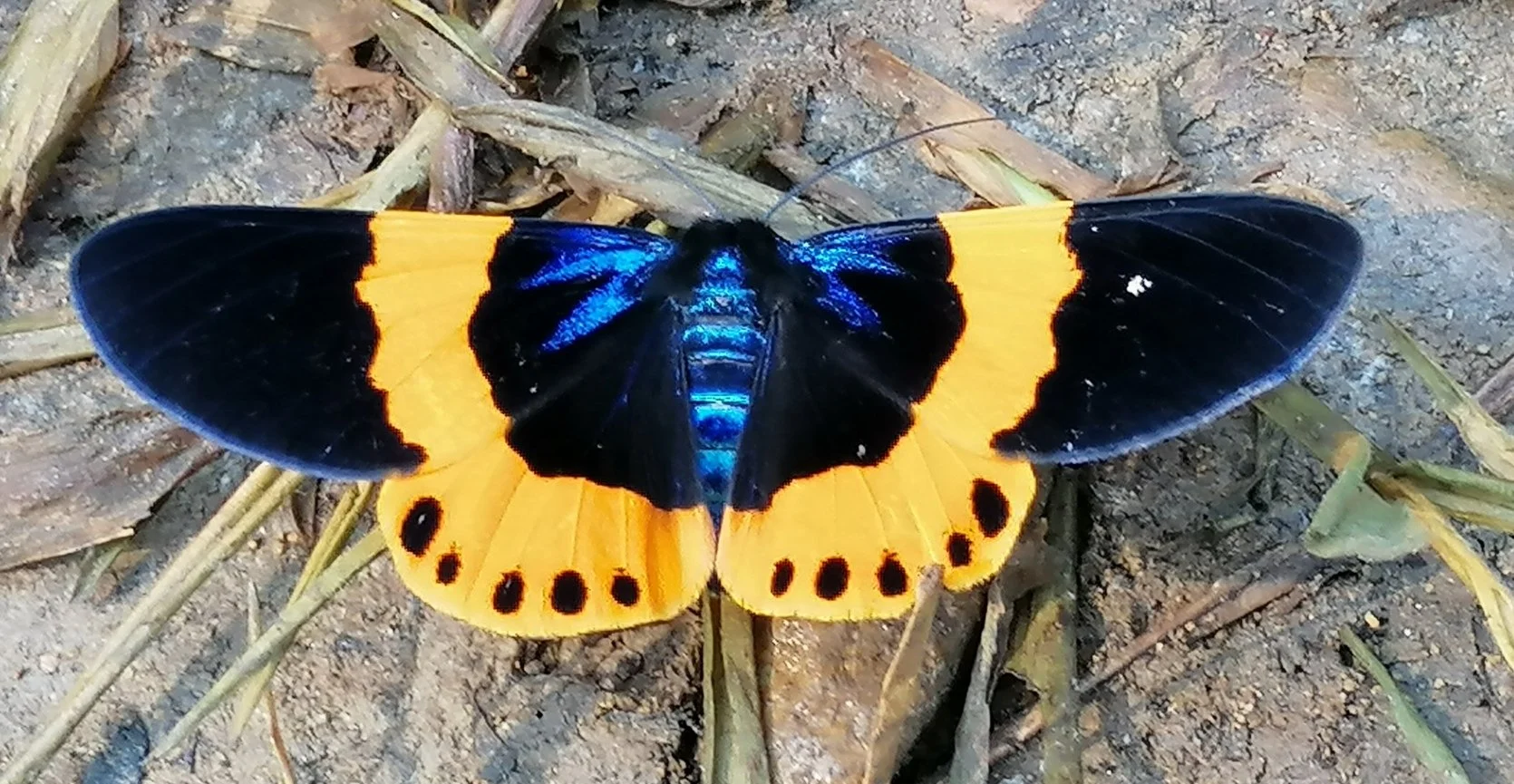
Milionia basalis, commonly known as the Orange-banded Pine Moth.
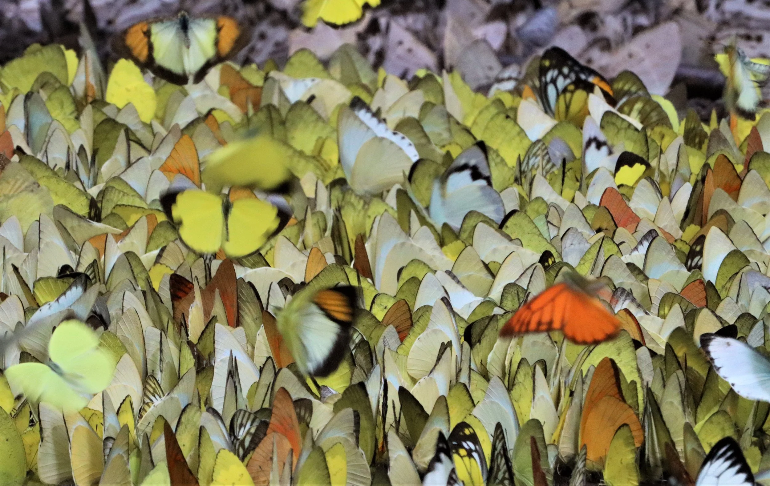
Puddling Butterflies at Kaeng Krachan. Pieridae (Whites and Yellows): Common Grass Yellow (Eurema), Orange Gull (Cepora judith), Striped Albatross (Appias libythea), and Common Gull. Swallowtails (Papilionidae): Common Bluebottle (Graphium sarpedon), Fivebar Swordtail (Graphium antiphates), Chain Swordtail (Graphium aristeus), Fourbar Swordtail (Graphium agetes), and Lesser Zebra (Graphium macareus). Nymphalidae (Brush-footed): Common Cruiser (Vidula erota), Great Nawab (Polyura eudamippus), Marbled Map (Cyrestis cocles), and Common Castor (Ariadne merione). Others: Common Mormon (Papilio memnon).
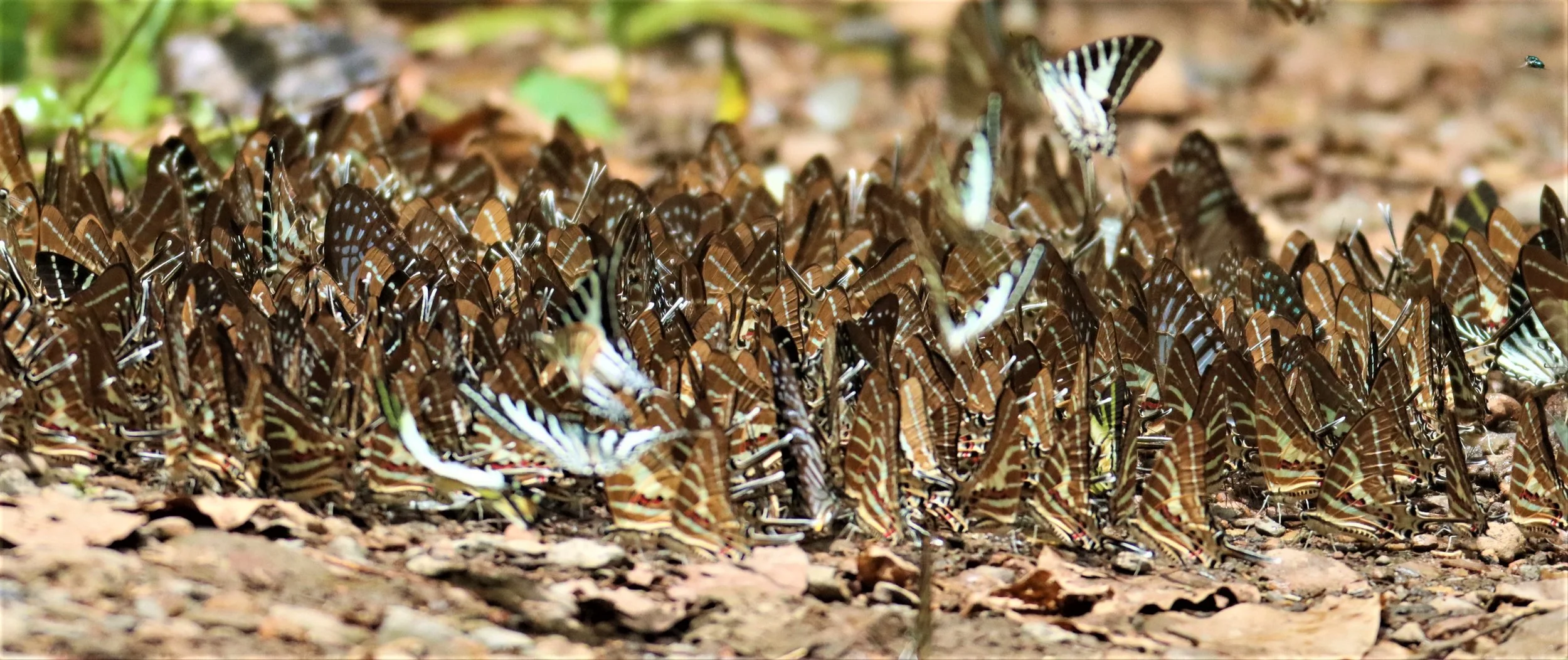
Many species of lepidoptera can be seen "puddling" in the complex.
Pieridae (Whites and Yellows): Common Grass Yellow (Eurema), Orange Gull (Cepora judith), Striped Albatross (Appias libythea), and Common Gull.
Great Nawab butterfly (Polyura eudamippus)
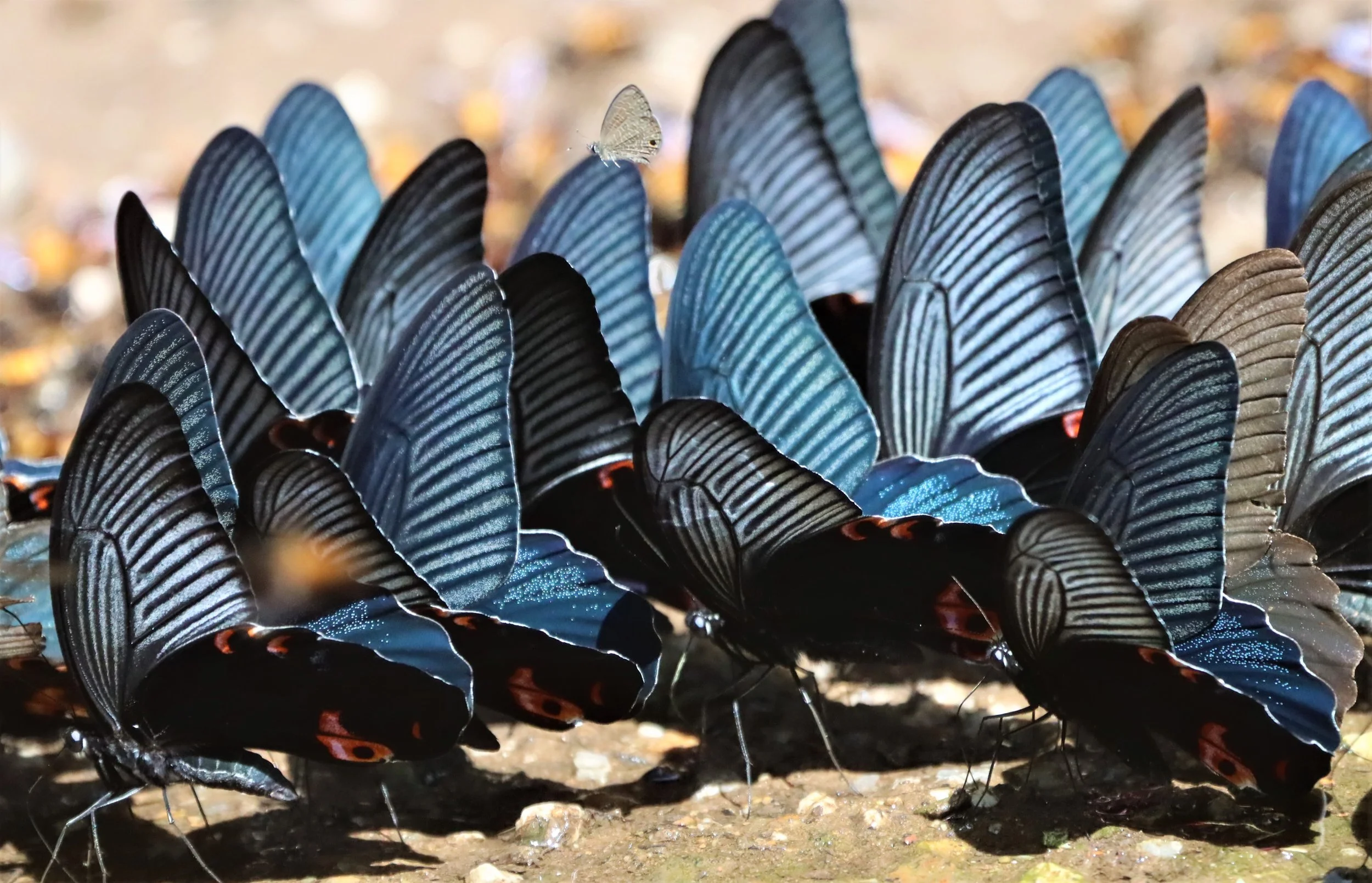
Great Mormon butterflies (Papilio memnon)
Common Cruiser (Vindula erota)

Red grasshawk dragonfly, also known as a common parasol (Neurothemis fluctuans).
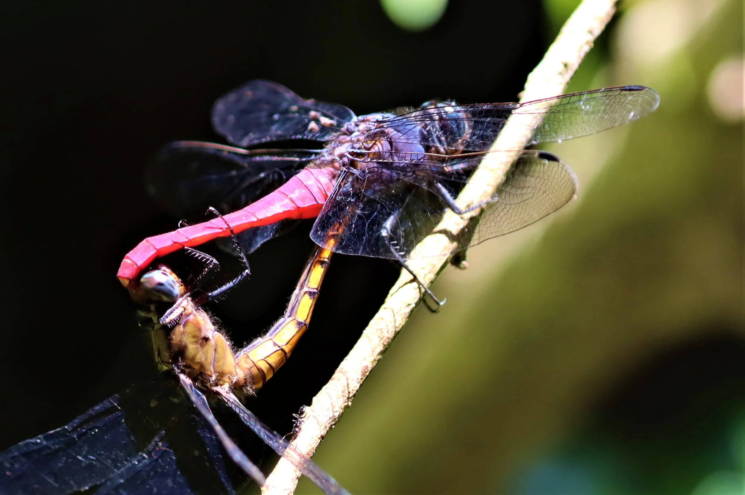
Likely Crimson-tailed Marsh Hawks (Orthetrum pruinosum) or a very similar species like the Brown-backed Red Marsh Hawk (Orthetrum chrysis) in what is known as a "mating wheel".
Pieridae (Whites and Yellows): Common Grass Yellow (Eurema), Orange Gull (Cepora judith), Striped Albatross (Appias libythea), and Common Gull.
Pieridae (Whites and Yellows): Common Grass Yellow (Eurema), Orange Gull (Cepora judith), Striped Albatross (Appias libythea), and Common Gull.

Never ending color!
Geological Framework of the Kaeng Krachan Region
The geology of Kaeng Krachan and adjacent areas is dominated by the Tenasserim Mountain Range, a north–south–oriented structural backbone composed primarily of Permian to Triassic granites and limestones. These mountains form the eastern slope of the Kaeng Krachan National Park area and act as a major orographic barrier between Thailand and Myanmar. The range is part of the broader Indo‑Malayan mountain system, predating the Himalayas, and consists of long belts of granite intrusives and extensive carbonate units, reflecting a complex tectonic history tied to continental margin processes and later uplift phases. [en.wikipedia.org], [everything...ined.today]
Within this mountainous setting lies the Kaeng Krachan Group, an Early Permian succession that plays a central role in understanding the geological evolution of western Thailand. The group is composed mainly of siliciclastic rocks with distinct glacial influences, indicating deposition in a cool, clastic‑dominant shelf environment during the Early Permian. The lithology includes pebbly mudstones, diamictites, greywackes, and fine sandstones, representing varied depositional energies and sources. Stratigraphic subdivisions recognized in the Kaeng Krachan Group include formations such as the Spillway, Ko He, Khao Phra, Khao Chao, and Laem Mai Phai formations, each marking different depositional regimes and sediment supply changes through time. [thailex.geolex.org]
Recent paleontological discoveries further refine this geological picture. Early Permian ammonoid faunas—such as Agathiceras girtyi, Neocrimites sp., and Miklukhoceras sp.—have been found in the uppermost units of the Kaeng Krachan Group. These fossils indicate a Bolorian (Kungurian) age, slightly younger than previously recognized, and reveal a significant environmental shift during this time. Sedimentary records suggest that as the Sibumasu Block rifted northward from Gondwanaland, the depositional environment transitioned from glacially influenced, clastic‑dominated systems to warmer, temperate‑to‑subtropical carbonate platform settings, marking the onset of large‑scale paleogeographic reorganization across the region. [academia.edu]
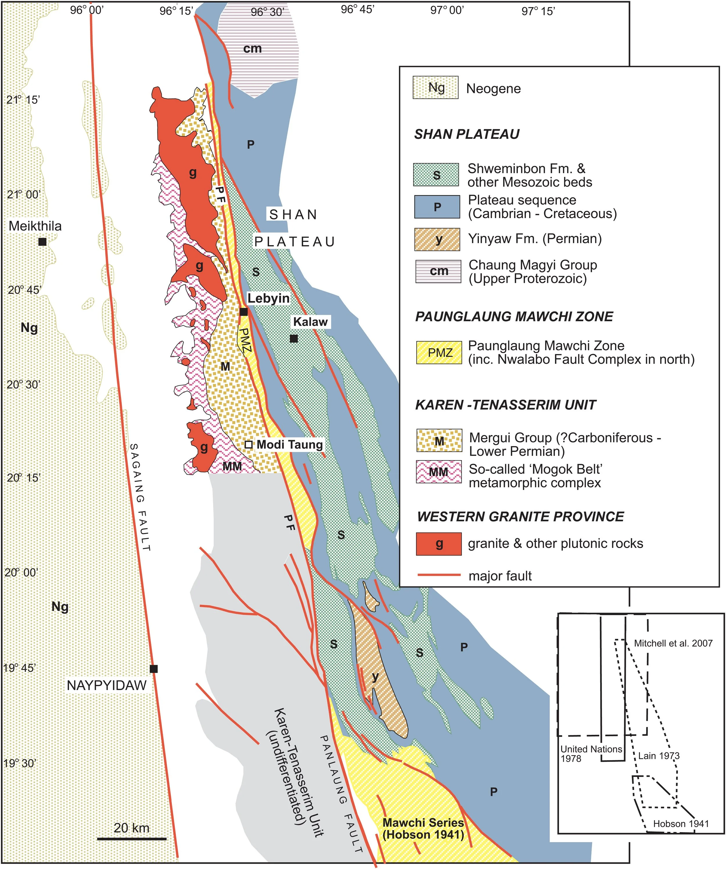
The broader Kaeng Krachan–Tenasserim region today reflects these long geological processes in its rugged topography and hydrological patterns. Numerous rivers—including the Phetchaburi and Pranburi rivers—originate in these uplifted granitic and limestone terrains, carving narrow valleys and feeding lowland basins to the east. The alternating ridges and valleys, often only a few kilometers across, highlight the differential erosion of resistant granites versus more soluble limestones. This geomorphology supports extensive evergreen and mixed deciduous forests, and its persistence over geological time has helped maintain the rich biodiversity for which the Kaeng Krachan Forest Complex is now internationally recognized. [en.wikipedia.org], [whc.unesco.org]
In summary, the geology of Kaeng Krachan and its surroundings is a product of ancient continental margin sedimentation, Permian glacial influences, Mesozoic intrusions, and long‑term orogenic uplift. Together, these features have produced a landscape of steep mountains, complex stratigraphy, and ecologically crucial river systems—an area where geological history and biological diversity are deeply intertwined.
The geology of Khao Sam Roi Yod will be presented at the end of this case study below.
https://www.lyellcollection.org/doi/full/10.1144/M48.16err
Ecological Importance and Conservation Significance
Kaeng Krachan Reservoir is a man-made water feature that is often the only place visited by the general public who think this is the “real Kaeng Krachan”.
The animal communities of Kaeng Krachan illustrate the region’s role as a continental biogeographic bridge and a stronghold for endangered Southeast Asian wildlife. Its intact predator‑prey relationships, viable large‑mammal populations, and rich bird and reptile assemblages are increasingly rare across mainland Asia. The protected status of the Kaeng Krachan Forest Complex—recognized by UNESCO for its outstanding biodiversity—helps ensure continued ecological functioning across transboundary landscapes extending into Myanmar’s Tenasserim forests. [whc.unesco.org]
Moreover, the diversity of wildlife reflects the health of the region’s forest biomes: evergreen forests support frugivorous primates and birds; mixed deciduous and dipterocarp forests shelter elephants, ungulates, and carnivores; and montane zones protect species adapted to cooler, moisture‑rich habitats. The continued conservation of these faunal communities is critical not only for Thailand’s natural heritage but also for maintaining ecological connectivity throughout the Indo‑Burma biodiversity hotspot.
History and Controversies of Kaeng Krachan and Its Surrounding Region
******
Early Protection Efforts and National Park Establishment
The area now known as Kaeng Krachan National Park began receiving formal protection in the mid‑20th century as Thailand expanded its system of forest reserves. It was first declared a protected reserve in 1964, reflecting early recognition of the ecological importance of the forests, watersheds, and wildlife along the Tenasserim mountain system. This initial designation laid the groundwork for further protection as human activities—particularly logging and hunting—were still widespread in the region at the time. [en.wikipedia.org]
On 12 June 1981, Kaeng Krachan was officially established as Thailand’s 28th national park, initially covering about 2,478 square kilometers. The boundaries were subsequently expanded in December 1984, adding another 437 square kilometers to include border regions between Phetchaburi and Prachuap Khiri Khan. These additions helped secure larger contiguous landscapes along the Thai‑Myanmar frontier, incorporating critical watersheds and habitats supporting elephants, big cats, and numerous bird species. [en.wikipedia.org]
Today, the park forms the core of the larger Kaeng Krachan Forest Complex, which spans multiple protected areas totaling over 4,373 square kilometers. This landscape now serves as an internationally recognized conservation corridor linking Thailand’s western forests with those of Myanmar’s Tanintharyi region. [aseanbiodi...ersity.org]
Poaching in the Kaeng Krachan Forest Complex
Poaching remains one of the most serious threats to wildlife within Kaeng Krachan National Park, driven by demand for bushmeat, illegal wildlife trade, and financially backed hunting networks. Recent law‑enforcement operations have uncovered extensive evidence of organized poaching, including high‑powered rifles, snares, traps, and carcasses of protected species such as gaur, deer, civets, and even small tiger species. In one notable 2025 case, authorities dismantled a poaching gang hired by an external financier, seizing rifle casings, cooked and uncooked gaur meat, and remains of other protected animals—underscoring the organized and well‑equipped nature of these activities. Camera‑trap surveys and field patrols have also revealed illegal armed activity, with park officers documenting individuals carrying weapons at night and discovering dismantled cameras likely removed to destroy evidence. These incidents highlight both the persistence of wildlife crime and the challenges faced in monitoring the park’s rugged terrain. [huahintoday.com][thailandtribune.com]

Two Cokes and Alan Rabinowitz during a stay in Bangkok some years ago. This afternoon could be a movie rivaling “My Dinner with Andre” in the topics covered during our five hour lunch together.
In response, Kaeng Krachan authorities have intensified anti‑poaching efforts through multi‑agency crackdowns, expanded patrols, and targeted operations aimed at dismantling trafficking networks. Initiatives such as Operation Huai Khom Krit deploy dozens of rangers to poaching hotspots, focusing on species at greatest risk—including tigers, leopards, and elephants—within this UNESCO World Heritage Site. Despite stronger enforcement, threats remain significant along the park’s periphery, where poaching pressure continues to endanger small, vulnerable populations of apex predators and other rare fauna. Conservation agencies emphasize that sustained patrols, community involvement, and cross‑border cooperation are essential to safeguarding Kaeng Krachan’s biodiversity as illegal hunting persists, particularly during seasons when enforcement is more difficult
Alan Rabinowitz appeared in the 2001 PBS documentary series Evolution, specifically featuring in Episode 3, titled "Extinction!". In this episode, Rabinowitz is featured in a segment titled "Studying a Remote Forest," where he works in a national park west of Bangkok, Thailand, to study the "empty forest syndrome" and the impact of human-relatedactivities on ecosystems. He highlights how habitat destruction is the primary cause of extinction and the threat to evolutionary processes. In this episode, Alan found that Kaeng Krachan in fact had many tigers and leopards in the study area thereby showing that the ecosystem of this region of the complex was complete in that all levels of the trophic pyramid were present. However, I learned from personal communication with Alan (a dear friend of mine) that after the showing of the documentary, there was a wave of poaching in the park wiping out most of not all of the felids documented in the episode showing the techniques and methods poachers will use to accomplish their goals and how maintaining secrecy regarding sightings of sought after species.
UNESCO World Heritage Nominations and Delays
Another class of ESS students after finishing an amazing week in the UNESCO World Heritage Site, Kaeng Krachan.
Thailand began lobbying for international recognition of the Kaeng Krachan Forest Complex in the early 2010s. Despite repeated nominations starting in 2011, the site faced prolonged delays in achieving World Heritage status. The primary obstacles were not environmental but rather political, social, and human‑rights‑related concerns raised by the international community. At UNESCO’s 2019 World Heritage Committee meeting, the nomination was rejected due to outdated boundary information and, critically, because of insufficient involvement of local communities—particularly the Indigenous Karen people whose lives are intertwined with the forest. [en.wikipedia.org]
A revised nomination was submitted, and after years of debate, the site was finally inscribed as a UNESCO World Heritage Site on 26 July 2021. The vote, however, was contentious: the committee approved the listing by a narrow margin of 12–9, illustrating ongoing international concern over social justice issues within the park. [en.wikipedia.org]
Indigenous Rights Controversies: The Karen Community

Karen & indigenous peoples’ rights activist, Porlajee "Billy" Rakchongcharoen was allegedly killed as a result of his efforts to give land-use rights to the Karen people who occupied regions inside the KKFC. (Link to article here)
At the center of the controversy surrounding Kaeng Krachan is the long‑standing conflict between Thai authorities and the S’gaw Karen Indigenous communities living inside and around the park. These communities have inhabited the Kaeng Krachan forests for generations, practicing rotational agriculture, maintaining cultural sites, and stewarding forest resources. However, park management and government agencies have frequently considered their presence incompatible with conservation goals.
Concerns escalated due to reports of forced displacement of Karen families, particularly from the Ban Kloi area inside the national park. Rights groups and UN bodies documented allegations of forced evictions, destruction of homes, and restrictions on traditional livelihoods. The most notorious incident was the 2014 disappearance and murder of Karen activist Porlajee “Billy” Rakchongcharoen, who had been advocating for community land rights before his death. UNESCO delegates cited this case as a major ethical barrier to granting World Heritage status. [en.wikipedia.org]
Despite the eventual inscription, these controversies remain highly significant. Human‑rights observers and local advocates continue to argue that unresolved grievances, land‑use disputes, and a lack of fully recognized Indigenous land rights compromise both conservation integrity and social justice in the region.

Governance, Border Dynamics, and Ongoing Issues
Beyond Indigenous rights, the governance of the Kaeng Krachan region is complicated by its shared border with Myanmar, an area marked by difficult terrain, limited cross‑border access points, and various security concerns. The Tenasserim Range has long served as a natural barrier, shaping trade, migration, and political interactions between the two countries. There are ongoing efforts to improve transboundary conservation, but the region’s geopolitical sensitivities have slowed progress. [whc.unesco.org]
Thailand’s 2024 State of Conservation Report to UNESCO noted attempts to remedy longstanding issues: revising management plans, enhancing collaboration with Myanmar, and establishing Protected Area Committees (PACs) that include representatives from multiple stakeholder groups. The report claims increased participation from local communities in decision‑making processes and new legal frameworks allowing limited subsistence use of resources under the 2019 National Park Act. However, observers emphasize that the gap between policy and actual on‑the‑ground practice remains significant. [whc.unesco.org]
A Landscape Where Conservation and Human Rights Intersect
The history of Kaeng Krachan is one of both remarkable ecological protection and deep social complexity. On one hand, the region has earned international acclaim for its biodiversity, extensive intact forests, and vital role in regional connectivity. On the other, its conservation efforts have repeatedly raised questions about human rights, the treatment of Indigenous peoples, and the balance between environmental protection and cultural preservation.
The continuing controversies surrounding land rights, community participation, and transboundary management underscore that Kaeng Krachan’s story is far from over. Its history illustrates a broader challenge faced worldwide: how to protect globally significant ecosystems while also upholding justice, autonomy, and dignity for the people who call these landscapes home.
Threats and Issues Facing Kaeng Krachan and the Surrounding Region

Location where “Billy’s” body was found in the Kaeng Krachan Reservoir (Link to article here)
1. Human Rights Controversies and Indigenous Displacement
One of the most significant and widely recognized threats facing Kaeng Krachan concerns the treatment of the Indigenous S’gaw Karen communities who have lived in the forest for generations. Numerous reports document forced displacement, destruction of homes, and longstanding disputes over land rights. The most prominent case is the 2014 disappearance and murder of Karen activist Porlajee “Billy” Rakchongcharoen, who had been advocating for the community's rights before he was abducted and killed. This incident became a major point of international criticism and was cited by UNESCO as a reason for delaying World Heritage status in earlier nomination rounds. [en.wikipedia.org]
These concerns continue to shape the park’s global reputation. Human‑rights organizations, local activists, and international bodies argue that unresolved grievances create an unstable foundation for conservation. Despite the eventual 2021 World Heritage inscription, the underlying issues remain a central and ongoing threat—not only to the well‑being of Indigenous residents but also to the legitimacy and effectiveness of conservation initiatives in the region. [en.wikipedia.org]
2. Governance Challenges and Management Controversies
The governance of Kaeng Krachan is further complicated by institutional and administrative challenges, many of which were highlighted in UNESCO’s conservation assessments. Issues include incomplete or outdated boundary information, concerns over the conditions for ecological integrity, and weaknesses in management planning. Earlier World Heritage Committee evaluations noted that Thailand’s 2019 nomination lacked clarity regarding boundaries and did not adequately include community participation—factors that directly affect enforcement, stewardship, and the equitable distribution of conservation responsibilities. [en.wikipedia.org]
In addition, UNESCO’s 2025 State of Conservation report identified several ongoing governance pressures. These included the need to ensure proper implementation of advisory mission recommendations, to improve cross‑border collaboration with Myanmar, and to address concerns related to local rights and livelihoods. While Thailand reported steps toward improving participatory processes through the Protected Area Committee (PAC) and updated national park legislation, the gap between policy and practice remains a core challenge. Weak governance undermines effective conservation and fuels conflict between authorities and communities, ultimately posing a systemic threat to long‑term ecological protection. [whc.unesco.org]
3. Borderland Complexities and Transboundary Pressures
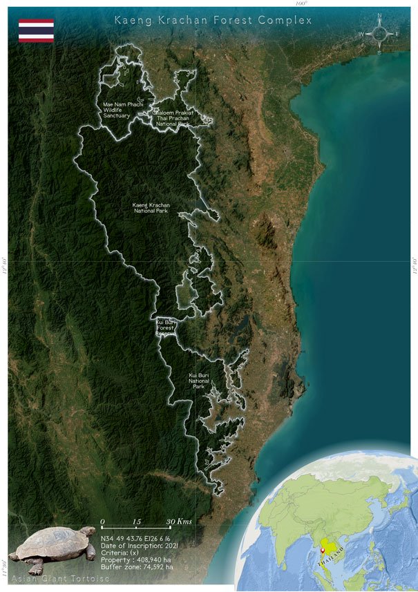
Kaeng Krachan lies along the Thai–Myanmar border, a region characterized by rugged terrain, limited access, and longstanding political sensitivity. The Tenasserim Range forms a natural barrier, and this geography complicates conservation enforcement, anti‑poaching patrols, and habitat monitoring. UNESCO notes that transboundary management remains an unresolved issue, despite efforts to strengthen cooperation between Thai agencies and Myanmar authorities. [whc.unesco.org]
Unclear border demarcations and differing national policies can inhibit coordinated conservation responses. Issues such as illegal logging, wildlife trafficking, or cross‑border exploitation often require binational strategies, which are difficult to implement without strong diplomatic and logistical frameworks. UNESCO explicitly identified these governance and border‑related uncertainties as risk factors threatening the ecological integrity and management effectiveness of the Kaeng Krachan Forest Complex. [whc.unesco.org]
4. Community Rights, Livelihood Pressures, and Legal Limitations
Even when not involving forced displacement, the daily livelihoods of local communities remain a major area of tension. Traditional subsistence activities—such as rotational farming, forest foraging, and small‑scale resource use—have been limited under the 2019 National Park Act and related conservation laws. Although the law allows some subsistence use under regulated conditions, Indigenous groups argue that implementation often restricts rather than protects their traditional lifeways. UNESCO notes that community participation has formally increased, yet discrepancies between legal frameworks and on‑the‑ground experiences continue to generate mistrust. [whc.unesco.org]
This tension between conservation policy and traditional land use is a persistent challenge. When communities perceive conservation as an external imposition rather than a shared stewardship effort, compliance decreases, conflicts grow, and conservation outcomes weaken. Thus, livelihood-related constraints represent both a human rights concern and a practical threat to long-term ecological stability.
5. International Scrutiny and Reputational Risks
The controversies surrounding Kaeng Krachan have been significant enough to draw repeated attention from UNESCO, OHCHR, and international NGOs. Early rejection of the site’s World Heritage nomination in 2019, as well as the narrow and contentious approval vote in 2021, underscore the high level of international concern. Reputational risk affects funding, scientific collaboration, and global support for the park. It may also hinder the implementation of broader conservation strategies if Thailand is perceived as failing to address fundamental human rights and governance problems. [en.wikipedia.org], [en.wikipedia.org]
While reputational issues may seem indirect compared to habitat loss or poaching, they have real consequences. International scrutiny shapes policy priorities, influences tourism, and affects the political will to engage in deep structural reforms—making global perception an important and ongoing issue facing the region.
A Conservation Landscape at a Crossroads
Kaeng Krachan’s threats cannot be reduced to purely ecological pressures; instead, they are deeply interconnected with human rights, governance, border politics, and community relations. Although the region contains some of Thailand’s most pristine and biodiverse forests, the social and political challenges surrounding Indigenous rights, park management, and transboundary coordination pose significant—sometimes existential—risks to its long‑term stability.
Addressing these issues requires sustained cooperation between government agencies, Indigenous residents, international partners, and neighboring Myanmar. Only by resolving underlying social and political tensions can the ecological integrity of Kaeng Krachan be secured for future generations.
Forest Encroachment: Large‑Scale Land Grabs and Habitat Destruction
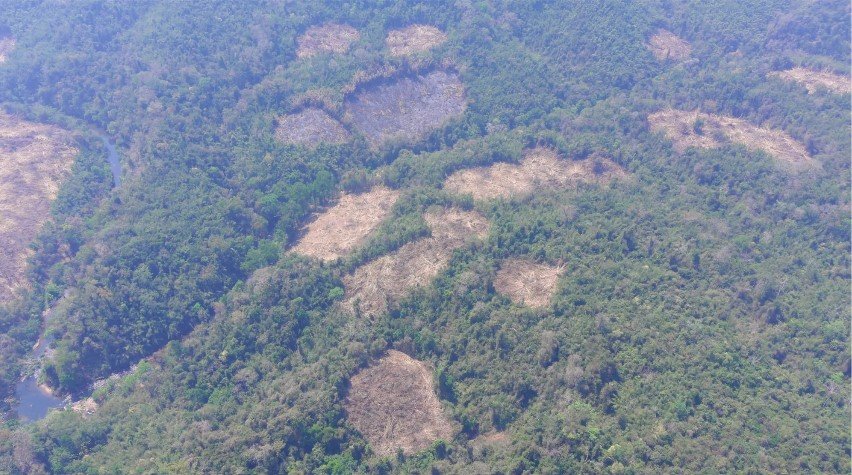
Land encroachment evidence in the core area of Kaeng Krachan by Karen hilltribes (Link to article here)
Forest encroachment has become one of the most serious and expanding threats to Kaeng Krachan National Park. Over the past several years, multiple large‑scale cases have revealed extensive habitat destruction, fraudulent land claims, and coordinated commercial development occurring deep inside protected areas. These incidents demonstrate that the pressures facing the park come not from small‑scale subsistence activities, but from organized, well‑funded actors capable of reshaping the landscape on an industrial scale.
One major example emerged in 2025 when a Bangkok Post investigation uncovered more than 4,000 rai of illegally encroached land. Authorities reported that 1,224 rai lay inside Kaeng Krachan National Park, while an additional 2,850 rai extended onto state land outside the boundaries. Heavy machinery, including large excavators, had been used to clear vegetation and disturb topsoil, revealing the industrial nature of the operation. Investigators also raised concerns that the title deeds associated with the land had been improperly issued, further indicating potential corruption behind the encroachment.
Another significant case was documented the same year by Nation Thailand, which reported 3,162 rai of illegally occupied land held under Nor Sor 3 Gor titles. This included 2,016 rai on state land and 1,146 rai located directly inside the national park. Beyond these fraudulent claims, an additional 914 rai had been cleared without any legal documentation—81 rai inside the park and 833 rai on state land. Entire mountainsides had been excavated, leaving behind barren slopes and disrupted waterways. This level of environmental degradation poses a direct threat to watershed stability and long‑term ecological resilience.
A third major incident, exposed through an investigation by Hua Hin Localplus, revealed a coordinated network of illegal expansion connected to a large commercial mango‑orchard enterprise. Authorities uncovered 3,952 rai involved in the operation, including 1,143 rai within the national park under NS.3 Gor titles, 167 rai under M.64 documents, and 81 rai lacking legal status entirely. Another 2,016 rai belonged to Crown Property Bureau land. The investigation also found evidence of illegal infrastructure—roads, utility lines, and extensive land leveling—suggesting a long‑term, clandestine development strategy.
Across these cases, officials from multiple agencies have highlighted the involvement of influential investors and commercial actors. Both the Bangkok Post and Nation Thailand reported indications of corruption networks facilitating the acquisition of fraudulent land documents. Such findings challenge the misconception that encroachment is driven mainly by marginalized local communities. Instead, the evidence points toward organized land grabs motivated by profit and backed by significant financial and political resources.
The ecological consequences of these encroachment activities are severe. Large‑scale clearing, particularly when done with heavy machinery, fragments critical habitats and disrupts wildlife movement. Elephant migration corridors, predator hunting ranges, and watershed forests that feed the Phetchaburi and Pranburi rivers are among the areas most affected. As hillsides are stripped of vegetation and waterways become obstructed, the park’s ecological integrity—and the services it provides to surrounding communities—faces escalating risk.
Climate Change Threats Facing Kaeng Krachan
Intensifying Climate Hazards: Droughts, Floods, and Fire Risk
Recent ecological risk assessments confirm that Kaeng Krachan National Park is highly prone to climate‑driven hazards, particularly floods, droughts, extreme temperatures, and forest fires. A 2025–2026 spatial risk analysis found that climate factors such as temperature spikes, precipitation anomalies, humidity changes, and wildfire frequency are among the leading contributors to ecological risk in the park. These variables were identified as the main natural drivers of risk through analytic hierarchy process (AHP) weighting, exceeding even direct human pressures in significance. High‑risk zones were concentrated particularly in administrative areas 2 and 4, where climate variability interacts with topography and land‑use patterns to make ecosystems more vulnerable. [link.springer.com]
Droughts and floods—both intensified by climate change—are especially disruptive. The study notes that these hazards have already impacted ecosystems, community livelihoods, and biodiversity hotspots within the park between 2018 and 2022, with projected increases in severity in coming years. Given that many forest types in Kaeng Krachan rely on stable moisture regimes, prolonged drought events dry out leaf litter and canopy layers, elevating wildfire risk. At the same time, erratic heavy rainfall can trigger destructive flash floods in steep Tenasserim mountain valleys. These impacts threaten species dependent on humid evergreen habitats and destabilize ecosystem services relied upon by both wildlife and Indigenous communities. [link.springer.com]
Rising Temperatures and Shifting Rainfall Patterns
Climate models for Kaeng Krachan show clear warming trends over the past 40 years, with mean annual temperatures rising steadily according to ERA5 reanalysis data. Temperature “warming stripes” for the region—developed through meteoblue’s climate‑change tracker—indicate a marked shift towards hotter conditions, particularly since the late 1990s. These rising temperatures contribute to:
Increased evaporative stress on vegetation
Higher frequency of extreme heat days
Elevated nighttime temperatures that stress wildlife
[meteoblue.com]
Similarly, precipitation trend analyses show changes in timing and total annual rainfall, with risks of both oversaturated wet seasons and prolonged dry intervals. When precipitation patterns deviate from long‑term averages, sensitive biomes—such as moist evergreen rainforest—experience reductions in plant productivity, declines in fruiting events, and altered microclimates that affect amphibians, reptiles, and invertebrates. These combined shifts erode ecological stability across the park. [meteoblue.com]
Short‑term climate data from Weather Spark corroborate these findings, describing Kaeng Krachan as hot year‑round, with the hottest period now reaching daily highs above 92–93°F (33–34°C) in April–May. Warmer temperatures extend the dry season’s intensity and shorten recovery periods for heat‑stressed forests. Such trends increase susceptibility to pest outbreaks, reduce water yield from headwater forests, and contribute to die‑offs of heat‑sensitive plant and animal species. [weatherspark.com]
Cottage Industries and Nature‑Based Tourism Enterprises Around Kaeng Krachan
The area surrounding Kaeng Krachan has seen the growth of numerous small‑to‑medium‑scale eco‑resorts and lodges that form one of the region’s most significant cottage‑industry sectors. Many of these businesses cater specifically to nature‑oriented visitors—birders, photographers, hikers, and urban travellers seeking quiet forest settings.
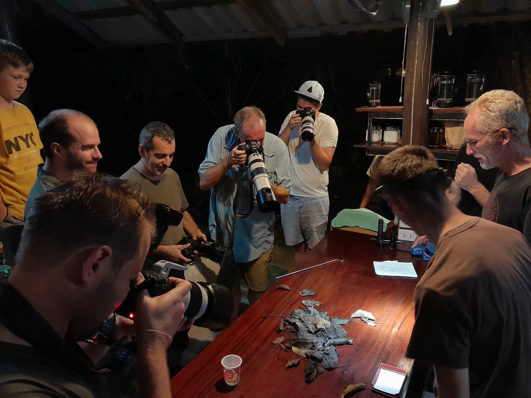
A bunch of my buddies and me photographing a herp species while sharing a great weekend at Baan Maka.
Around Kaeng Krachan one can find a group of birding‑focused lodges, particularly Baan Maka Nature Lodge, located on forested land just outside the national park. Baan Maka is run “by nature lovers for nature lovers” and has become a base for birdwatchers worldwide. It maintains bird‑friendly gardens, lotus ponds, and fruiting trees to attract avian biodiversity, and it offers guiding services, home‑grown produce, and simple accommodations that integrate hospitality with nature conservation. This model has inspired similar bird‑oriented homestays, including Samarn Bird Camp, which provides inexpensive rooms, community‑style dining, and birding transport for travellers who need simple lodging close to park entrance zones. [Baan Maka...ture Lodge][travelfish.org]
Together, these eco‑resorts and nature lodges form an essential rural economy: they employ local residents, purchase local produce, and diversify revenue sources beyond farming.
Bird Hides, Wildlife Blinds, and Photographic Micro‑Industries
One of Kaeng Krachan’s most distinctive cottage industries is the development of bird hides (bird blinds), many of which are privately operated by local families. These hides provide structured wildlife‑watching spaces in small forest clearings or near waterholes, often originally dug or maintained by villagers.
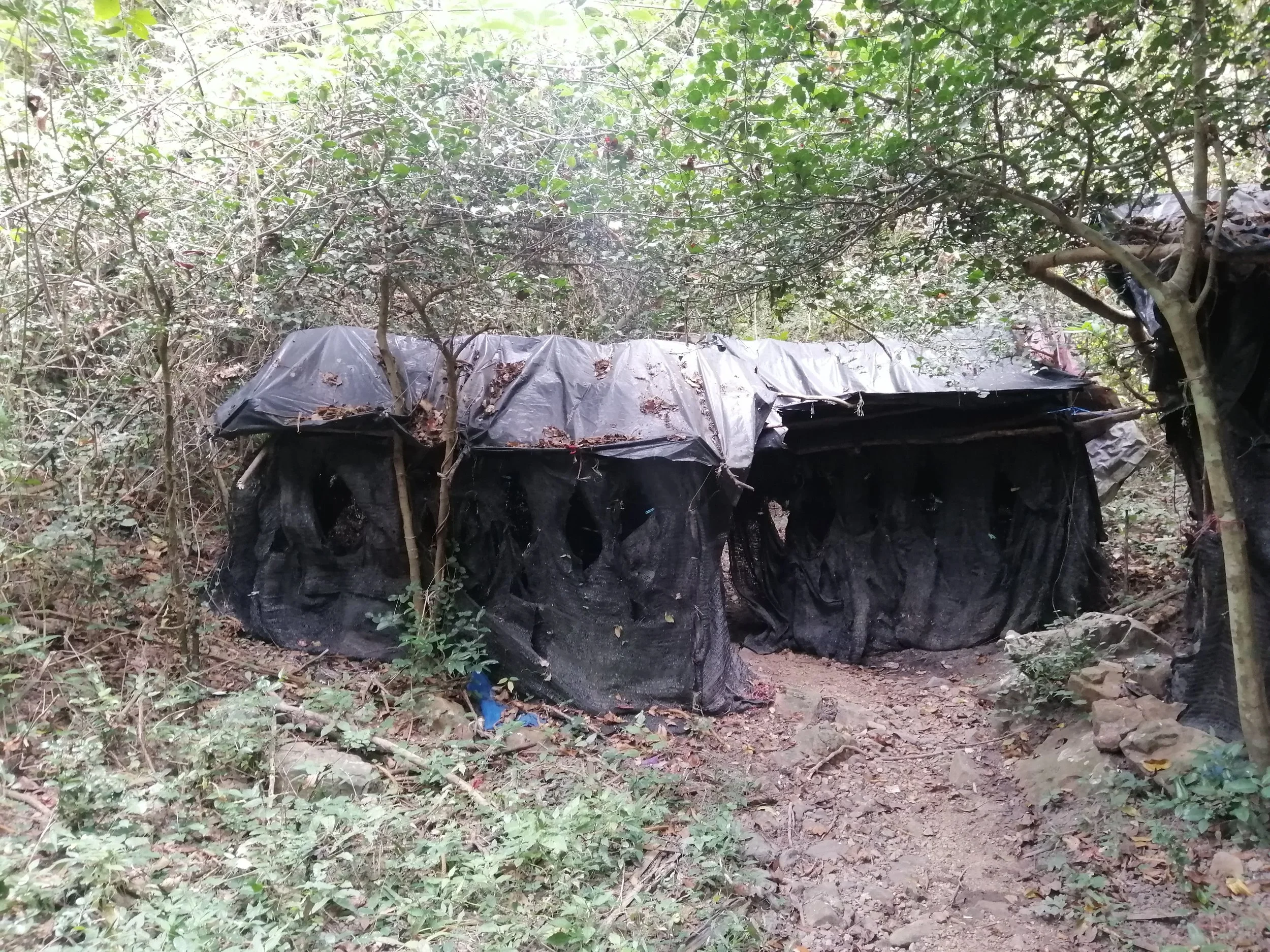
A notable example is Mr. Bird’s Hide, widely regarded by bird photographers as one of the best hides in the area, frequently attracting pheasants, partridges, Red Junglefowl, and Grey Peacock‑pheasants. Visitors pay landowners to sit for half‑ or full‑day photography sessions, generating direct income for residents who maintain the hides, manage feeding stations, and ensure site cleanliness. Bird hides have become so well‑established that some birdwatching tours include full‑morning or full‑day hide sessions as formal components of their itineraries. These local enterprises thus integrate seamlessly into the regional tourism economy. [10000birds.com][birdwatch.info]
Beyond commercial blinds, a conservation effort in 2008 encouraged local poachers to convert waterhole sites into legal wildlife hides—turning previous illegal hunting locations into community‑managed ecotourism assets. This shift allowed former hunters to earn income legally and sustainably, while providing bird photographers with close‑range visual access to rare forest species. [phototravelasia.com]
Altogether, the bird‑hide model demonstrates how small, land‑based micro‑enterprises can support both local livelihoods and biodiversity conservation, forming a uniquely Kaeng Krachan cottage industry.
Birding Tourism
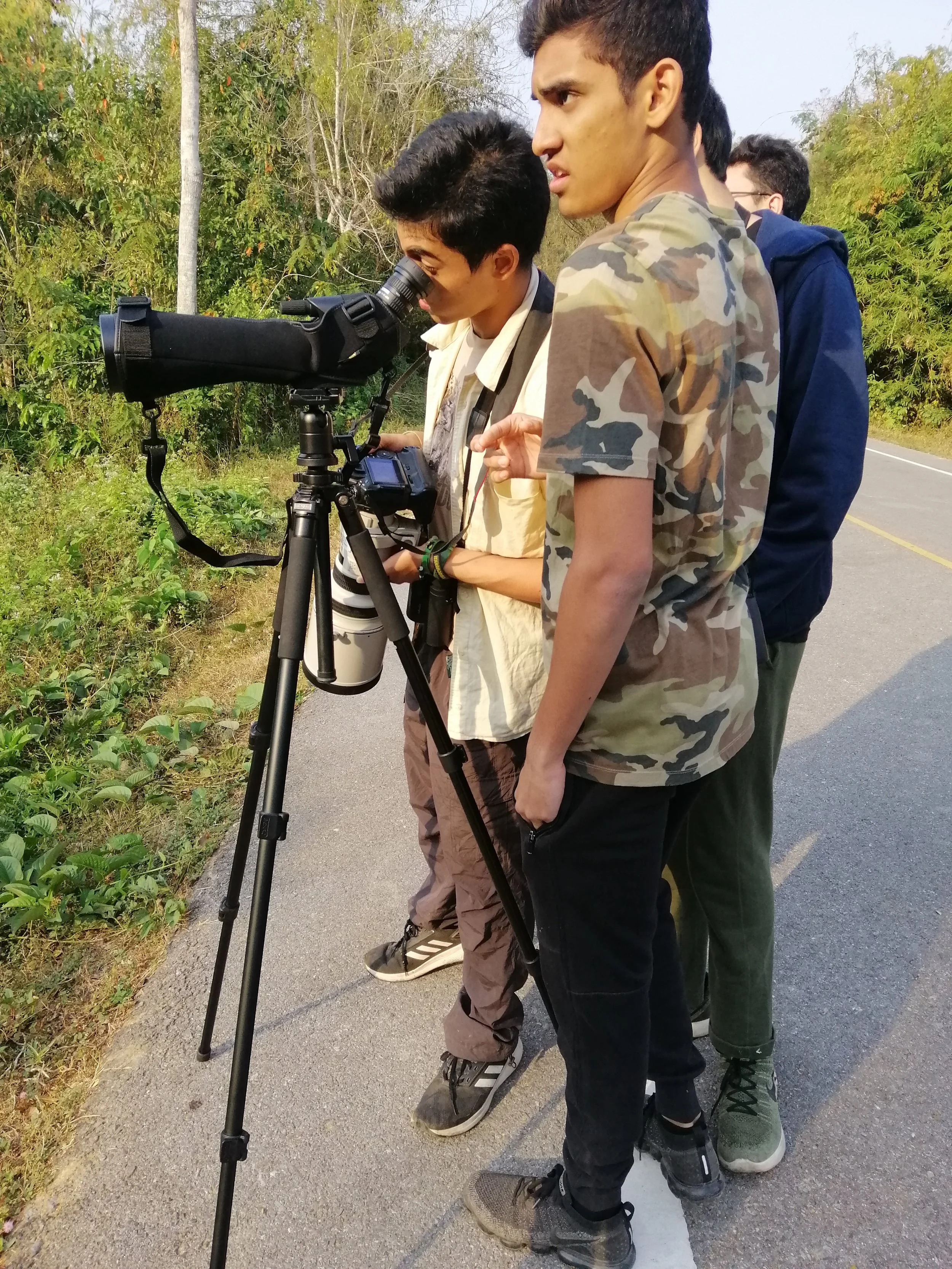
Birdwatching plays a major role in sustaining many of these cottage industries. Kaeng Krachan is recognized as one of Thailand’s premier forest birding destinations, with over 400 species documented in the area. The volume of birders staying in lodges such as Baan Maka or Samarn Bird Camp directly sustains guiding services, transportation providers, bird‑hide operators, cafés, and small shops.
Several businesses exist almost entirely because international and domestic birders return seasonally—bringing stable, recurring income. As birding reports emphasize, many travellers choose accommodations specifically for proximity to hides, gatherings of other birders, or easy access to forest roads where rare species occur. [birdforum.net]
Thus, birding creates an interconnected cottage‑industry ecosystem where even small guesthouses can thrive by supporting specialized activities.
The cottage industries around Kaeng Krachan—eco‑lodges, bird hides, cafés, riverside recreation operators, homestays, and birding‑focused micro‑businesses—showcase a rural economy built directly from the region’s natural assets. These enterprises are often small, family‑owned, environmentally compatible, and sustainable, providing livelihoods that encourage forest stewardship while offering visitors intimate, immersive nature experiences. In many ways, Kaeng Krachan represents a model of how protected areas can support diverse local economies when tourism is grounded in community‑level creativity, conservation, and ecological appreciation.

Fellow nature-enthusiasts working on "field photography" at the best eco-resort in the complex - Baan Maka.View fullsize Fellow nature-enthusiasts working on "field photography" at the best eco-resort in the complex - Baan Maka.
An awesome place for future generations to learn and experience nature, Kaeng Krachan welcomes student groups and maintains a strong educational component of their mission.
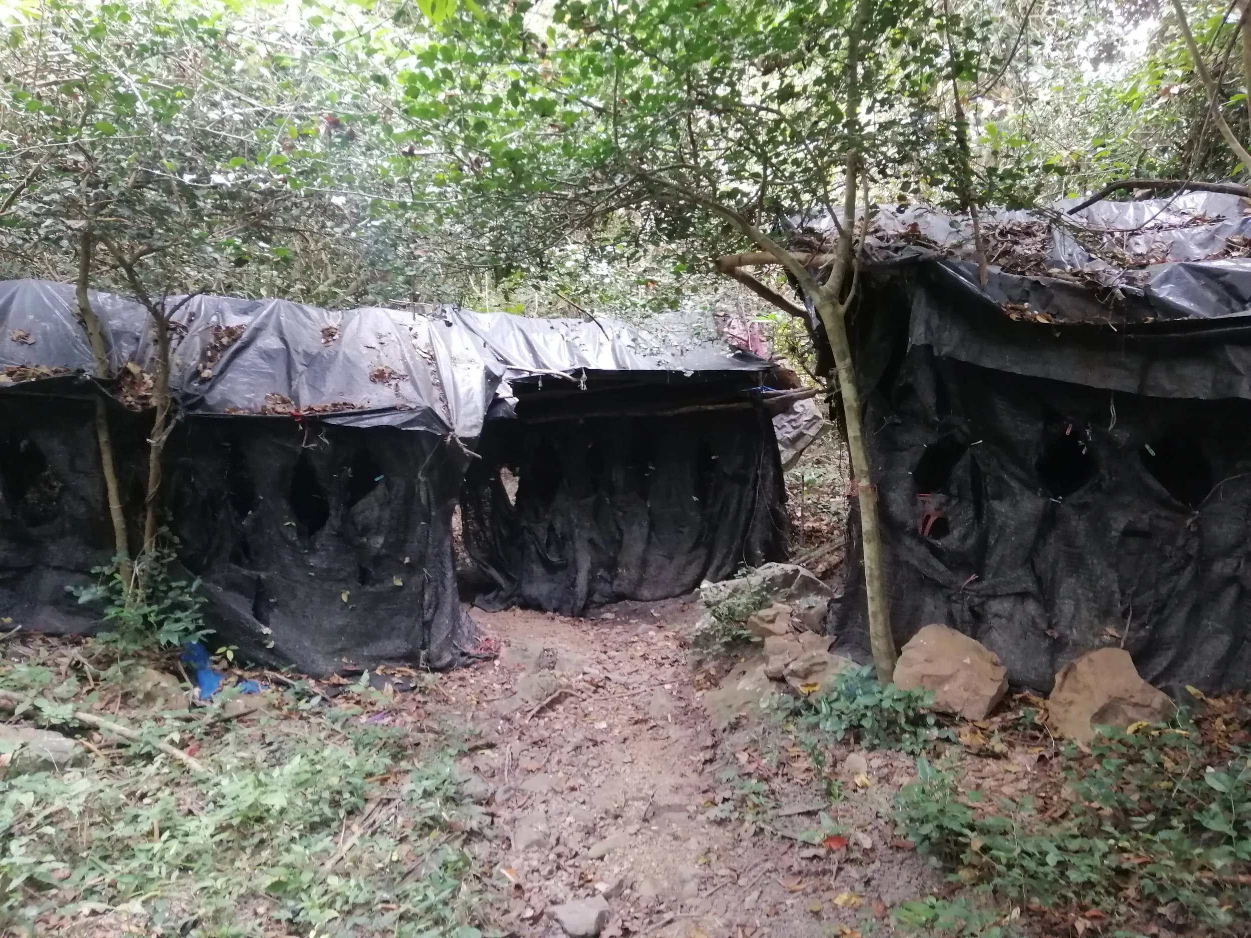
One of the many "Bor Naam" or bird blind/waterholes used as a cottage industry for locals around the park's perimeter.

These bird blinds allow people to see up close and inobtrusively some of the rarest and hardest to see species in Thailand.

The species lists at these bird blinds is impressive. Many of the images on this page were snapped in these over the years.

A highpoint for me every year is taking my ESS (Environmental Systems & Societies) classes for a full week in the forest studying the complex from top to bottom!
I've always found camping in Thailand's national parks to be rather nightmarish...
The camping may be a bit much for me these days but I guarantee the situation is much better these days compared to 20+ years ago - o...m...g
Khao Sam Roi Yot National Park: Geology, Wetlands, Flora, Fauna & Threats
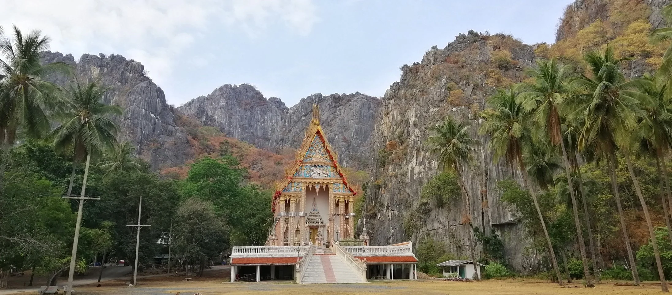
Wat Khao Daeng, a Buddhist temple situated in Khao Sam Roi Yot National Park, Prachuap Khiri Khan Province
Khao Sam Roi Yot National Park, established in 1966 as Thailand’s first coastal national park, occupies roughly 98 km² in Prachuap Khiri Khan Province and forms a striking landscape where the Tenasserim Hills meet the Gulf of Thailand. The park’s name—meaning “Mountain of Three Hundred Peaks”—refers to the dramatic limestone karst mountains that rise steeply to 605 meters at Khao Krachom, forming a rugged sub‑range along the coast. These limestone pinnacles, caves, and cliffs are characteristic of tropical karst systems shaped over millions of years through dissolution, uplift, and coastal erosion. Among the most famous geological features is Phraya Nakhon Cave, a collapsed sinkhole with a natural skylight illuminating the Kuha Karuhas Pavilion below—one of the most photographed symbols of Thailand’s protected areas. [en.wikipedia.org], [detailedpedia.com][en.wikipedia.org]
At the foot of these mountains stretches one of the park’s most ecologically critical elements: its freshwater and brackish wetlands. Khao Sam Roi Yot contains Thailand’s largest remaining freshwater marsh, nearly 7,000 hectares of reedswamp dominated by Phragmites and other emergent vegetation. This vast matrix of marshes, lotus beds (Nelumbo nucifera), open water, seasonal mudflats, rice paddies, and grazing marshes has been recognized as a Ramsar Wetland of International Importance since 2008. The wetland complex is biologically rich, providing habitat for amphibians, reptiles, fish, and migratory birds moving along the East Asian–Australasian Flyway. Narrow belts of mangrove forest fringe the river mouths, while estuarine mudflats and sandy beaches complete a mosaic that blends freshwater, marine, and terrestrial ecosystems in one compact coastal landscape. [grokipedia.com], [keybiodive...yareas.org][en.wikipedia.org][keybiodive...yareas.org]
Khao Sam Roi Yot’s flora reflects its diverse habitats. The freshwater marshes are dominated by tall reeds and wetland vegetation, while the limestone mountains support patches of mixed deciduous woodland with drought‑tolerant shrubs and hardwoods adapted to thin soils and steep slopes. Mangroves—crucial for shoreline stability and fish nurseries—line the Khao Daeng Canal and estuarine areas. On the beaches and dunes grow salt‑tolerant coastal plants, completing a gradient from sea to summit. This variety of plant communities underpins the park’s designation as a Key Biodiversity Area, with high ecological intactness despite its relatively small size. [keybiodive...yareas.org]

The park’s fauna is equally remarkable, particularly its birds. Over 300 species have been recorded, making the park one of Thailand’s premier birdwatching destinations. The freshwater marsh is the most important known wintering site in Thailand for the globally threatened Manchurian Reed Warbler (Acrocephalus tangorum), a species of international conservation concern. The wetlands also host near‑threatened species such as the Malaysian Plover, for which the site holds more than 1% of the Asian population. Historical records include rare visitors such as the Pale‑capped Pigeon, Spot‑billed Pelican, and Greater Adjutant, highlighting the site’s long‑term ornithological significance. Beyond birds, the park supports mammals such as dusky langurs, crab‑eating macaques, small Indian civets, and numerous reptiles and amphibians associated with mangrove and brackish ecosystems. [nationalpa...iation.org][keybiodive...yareas.org]
Despite its beauty, Khao Sam Roi Yot faces a number of environmental threats. Historically, much of the freshwater marshland was converted into shrimp farms, leaving only ~35 km² of the original 69 km² marsh inside the park’s boundaries, with the remainder heavily modified. Habitat degradation from unregulated tourism—especially around Phraya Nakhon Cave, beaches, and mangrove boat routes—poses ongoing pressure. Conservation assessments note that the park has been affected by aquaculture expansion, encroachment, and unmanaged visitor impacts, and these cumulative stresses were serious enough that the area was once listed among the world’s most endangered protected areas due to ecological decline. Climate‑related threats, including altered freshwater inflow, sea‑level rise, and extreme weather events, further compound vulnerability in the wetland zones. [en.wikipedia.org], [detailedpedia.com][grokipedia.com]
Nonetheless, restoration and protection efforts continue. Expansion of Ramsar protections, mangrove rehabilitation, and stricter park management have improved conditions in recent years. Khao Sam Roi Yot remains one of the most visually stunning and ecologically valuable protected landscapes in Thailand—a meeting point of mountains, marshes, and sea where the country’s natural heritage endures despite persistent challenges.

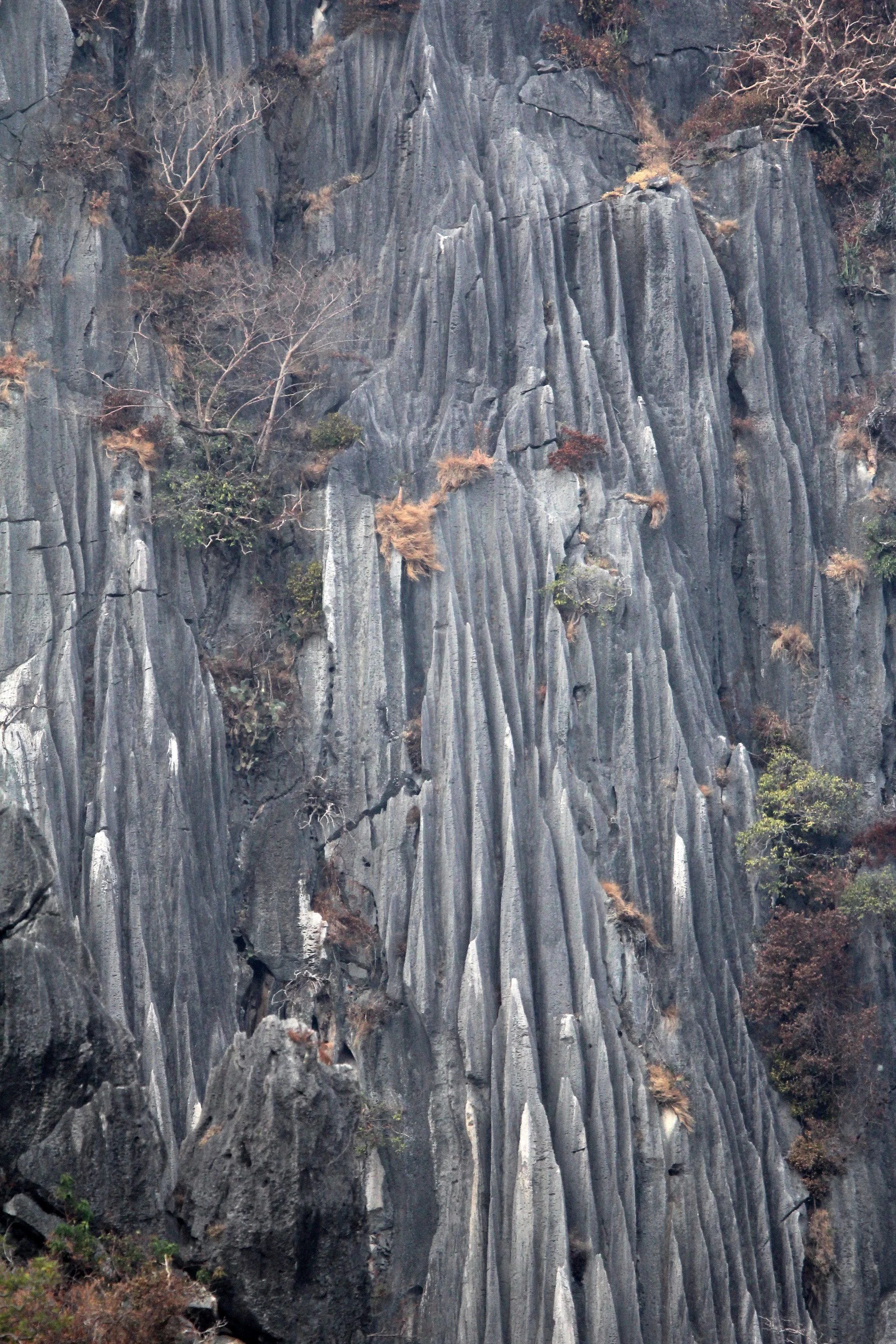
Khao Sam Roi Yod is a dramatic karst landscape featuring steep limestone mountains, sea cliffs, and caves formed 6,500–6,000 years ago.


Fishing fleet moored in one of the khlongs near Khao Sam Roi Yod
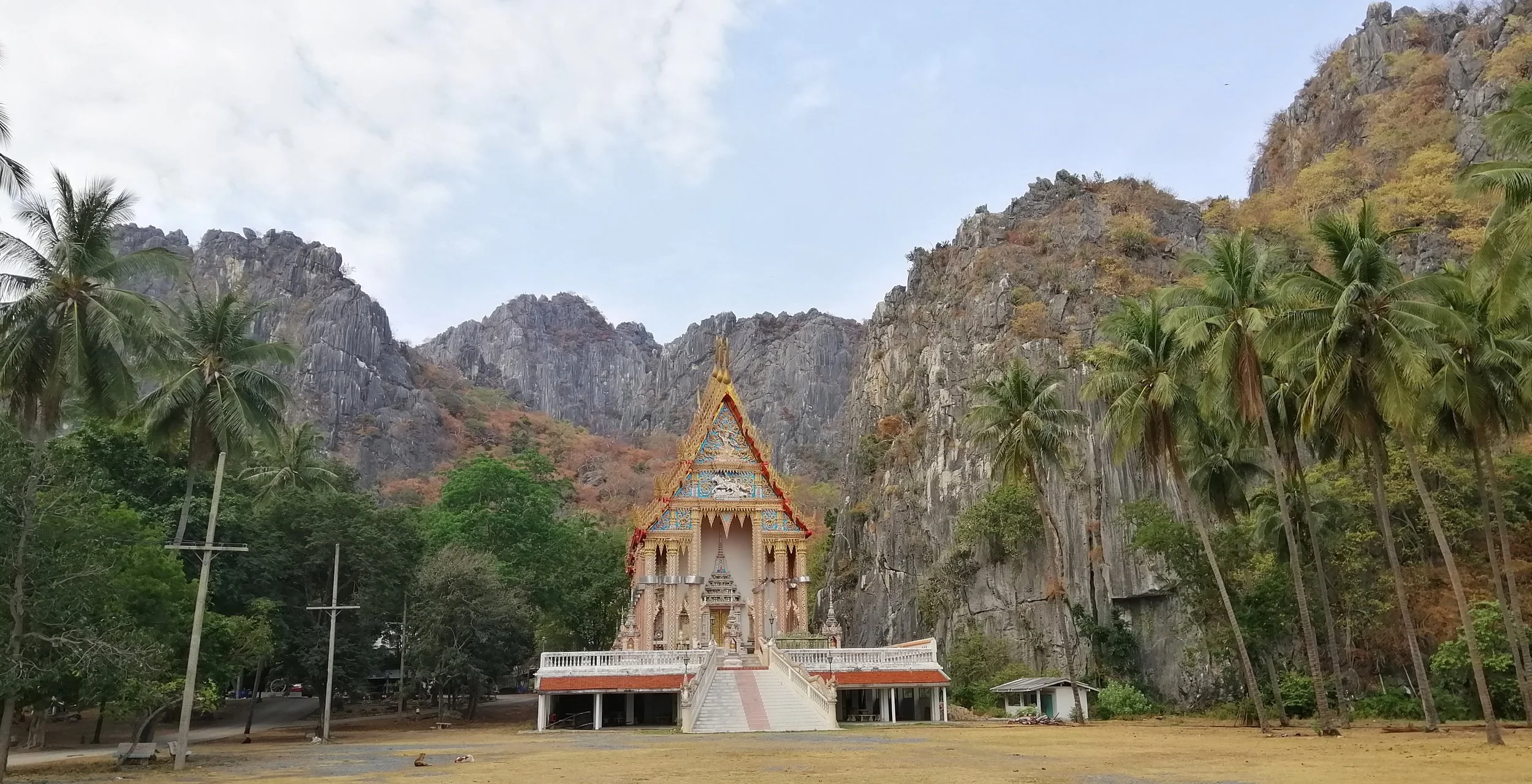
Wat Khao Daeng

Wat Khao Daeng

Wat Khao Daeng
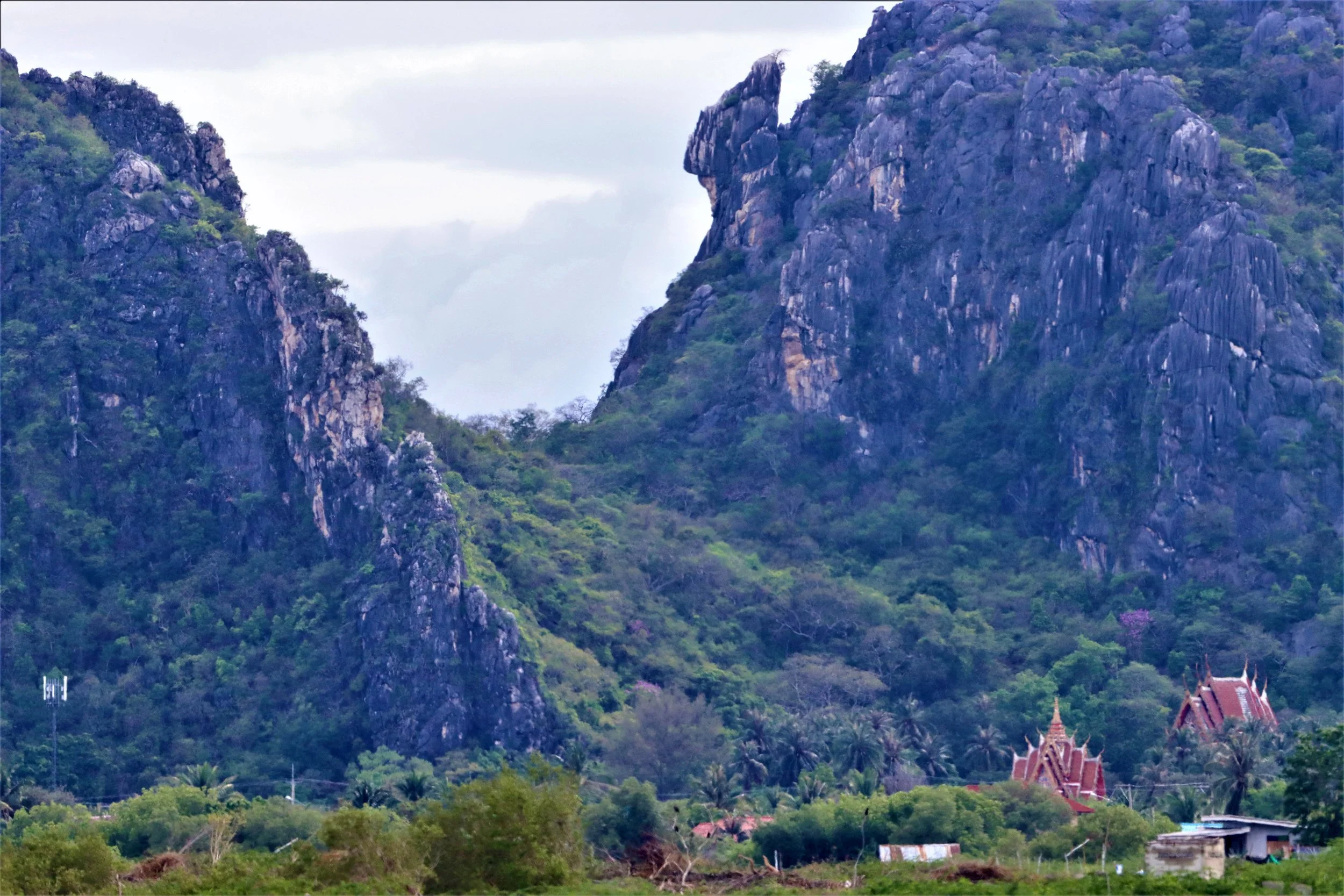
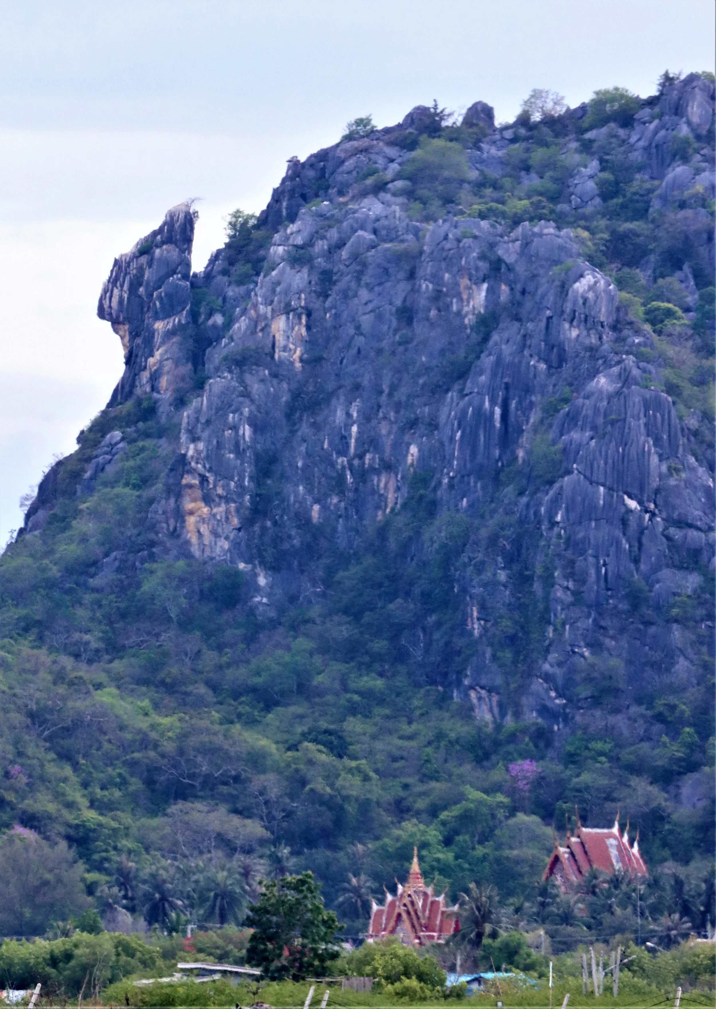
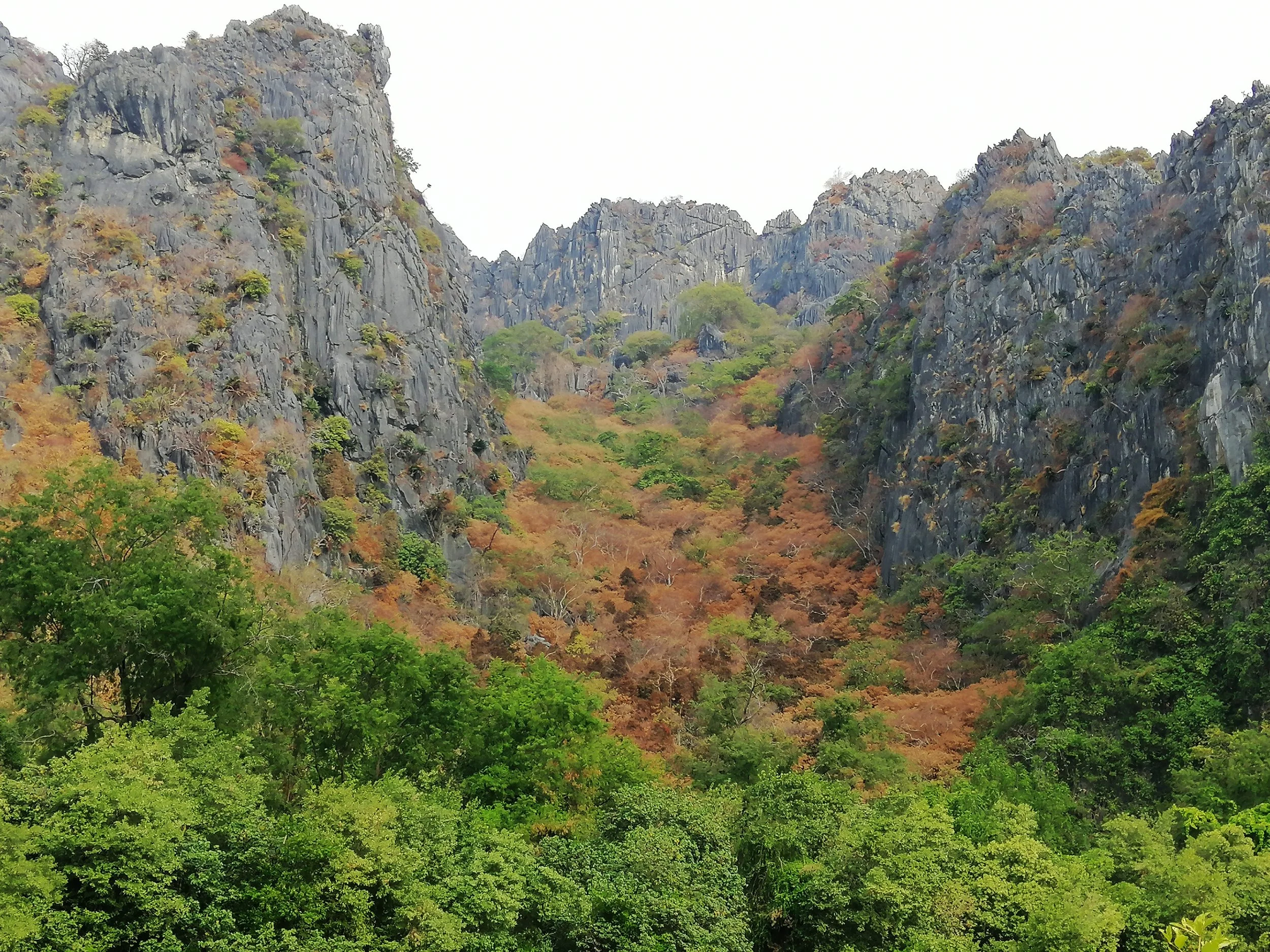
In Khao Sam Roi Yod’s dry deciduous and mixed deciduous forests, trees turn vibrant shades of brown, yellow, and red before shedding leaves during the dry season (roughly November to April) to conserve water.
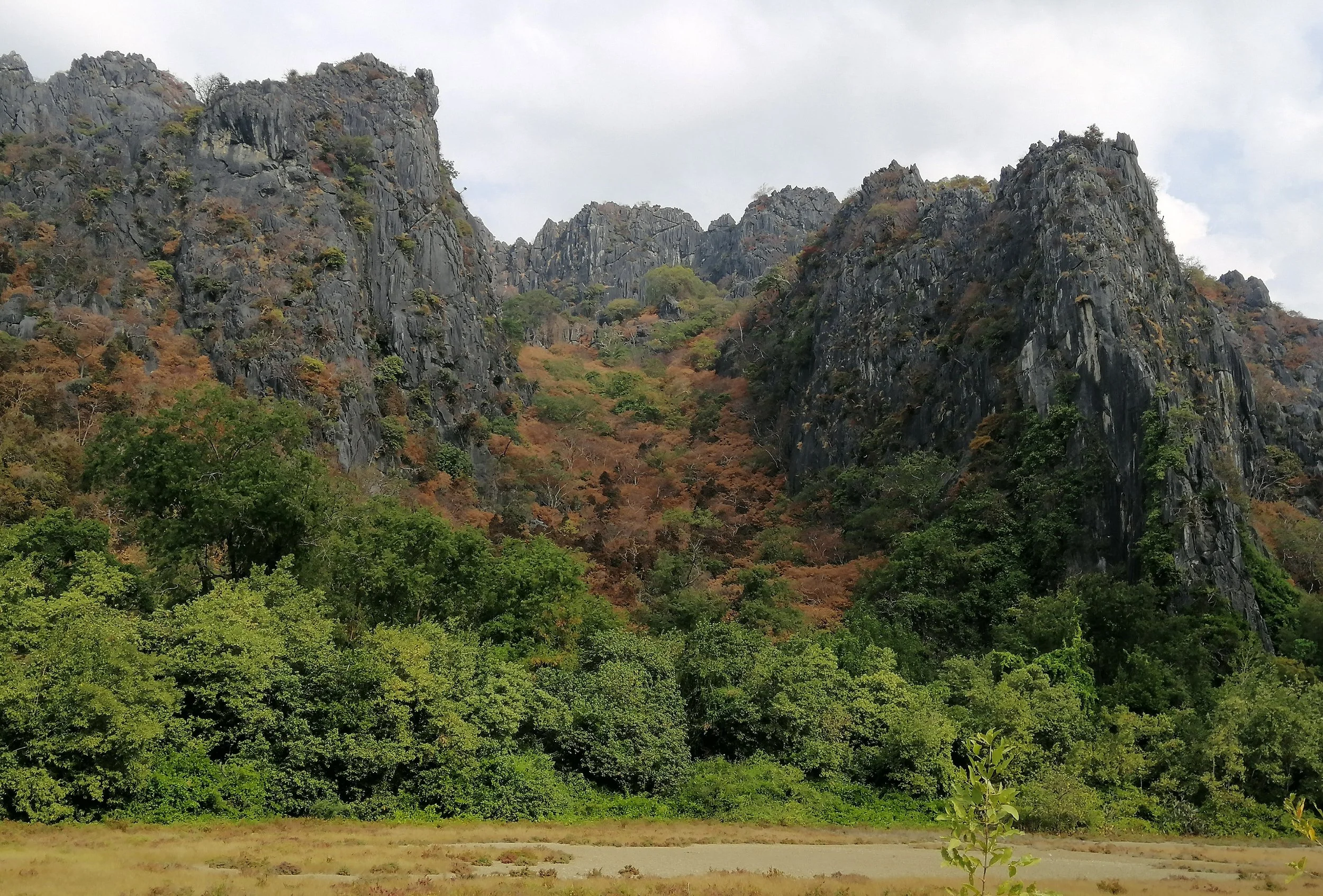
Dipterocarpus tuberculatus (Hae-yong): Known for changing to a distinct rusty-brown or brownish-red color before dropping leaves. Shorea obtusa (Teng): Leaves frequently turn a deep, vibrant brown or reddish-brown. Gluta usitata (Rak-luk): Often shows red pigments in its leaves before they fall.
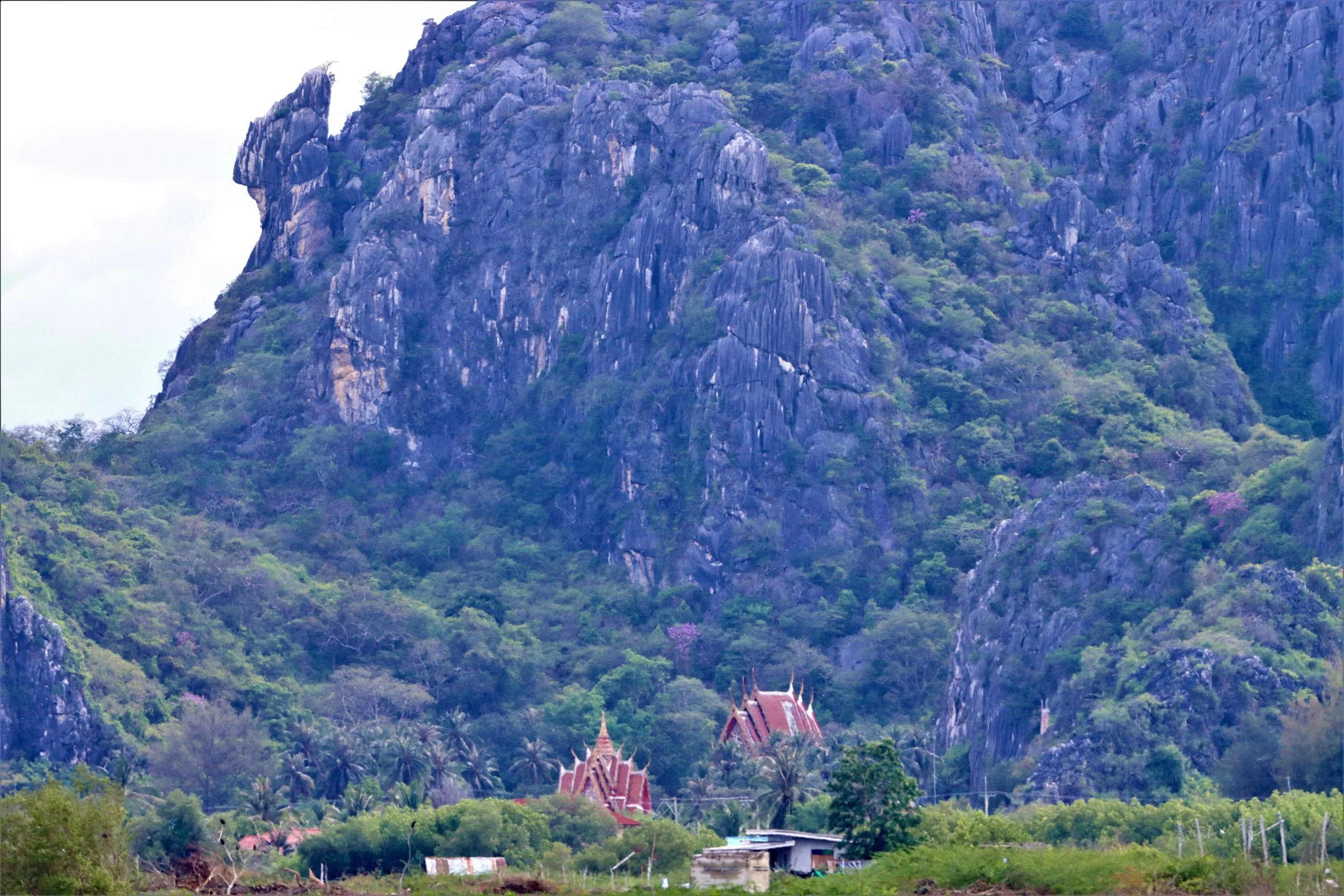
Key species, including deciduous dipterocarps, often transition to rusty-brown or golden hues, with many species displaying new, green, or red leaves shortly before or after leaf fall.
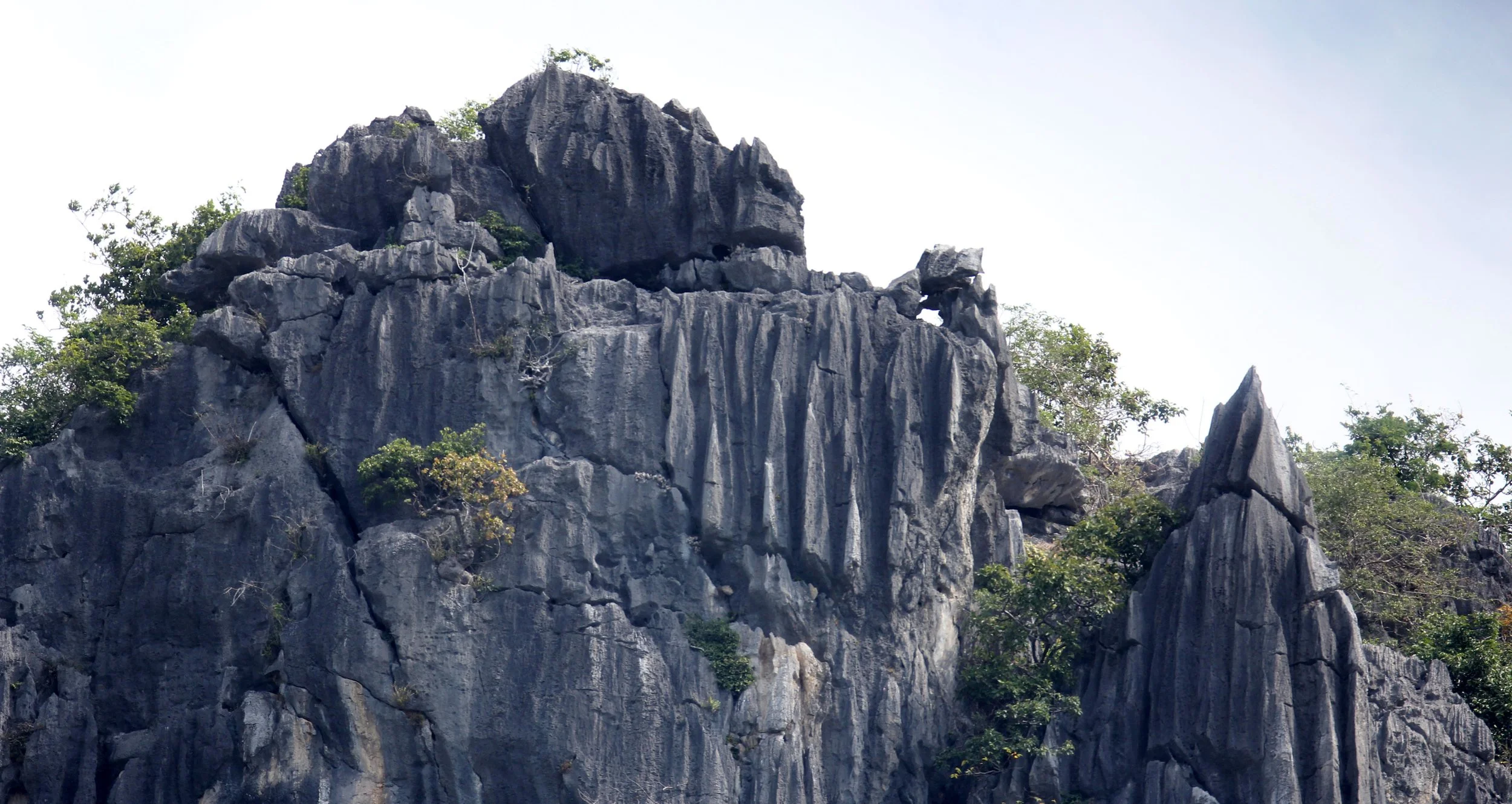
The area is dominated by Carboniferous-Permian limestone, part of a former coastal bay that transformed into tidal flats and beach ridges through sea-level changes and Holocene marine regressions.
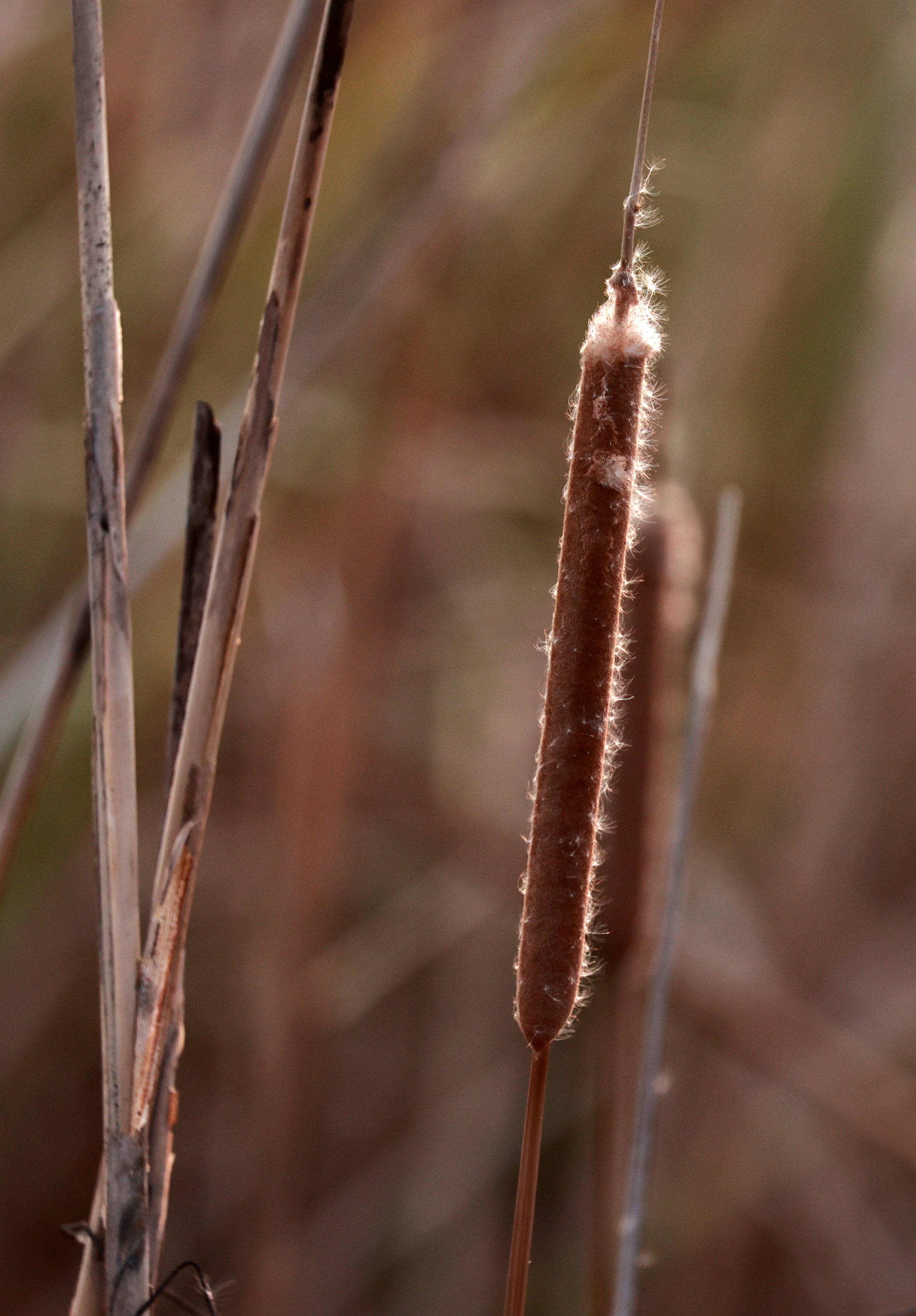

The northwest area, Thung Sam Roi Yot, is a large freshwater marsh and tidal flat covering 37% of the park
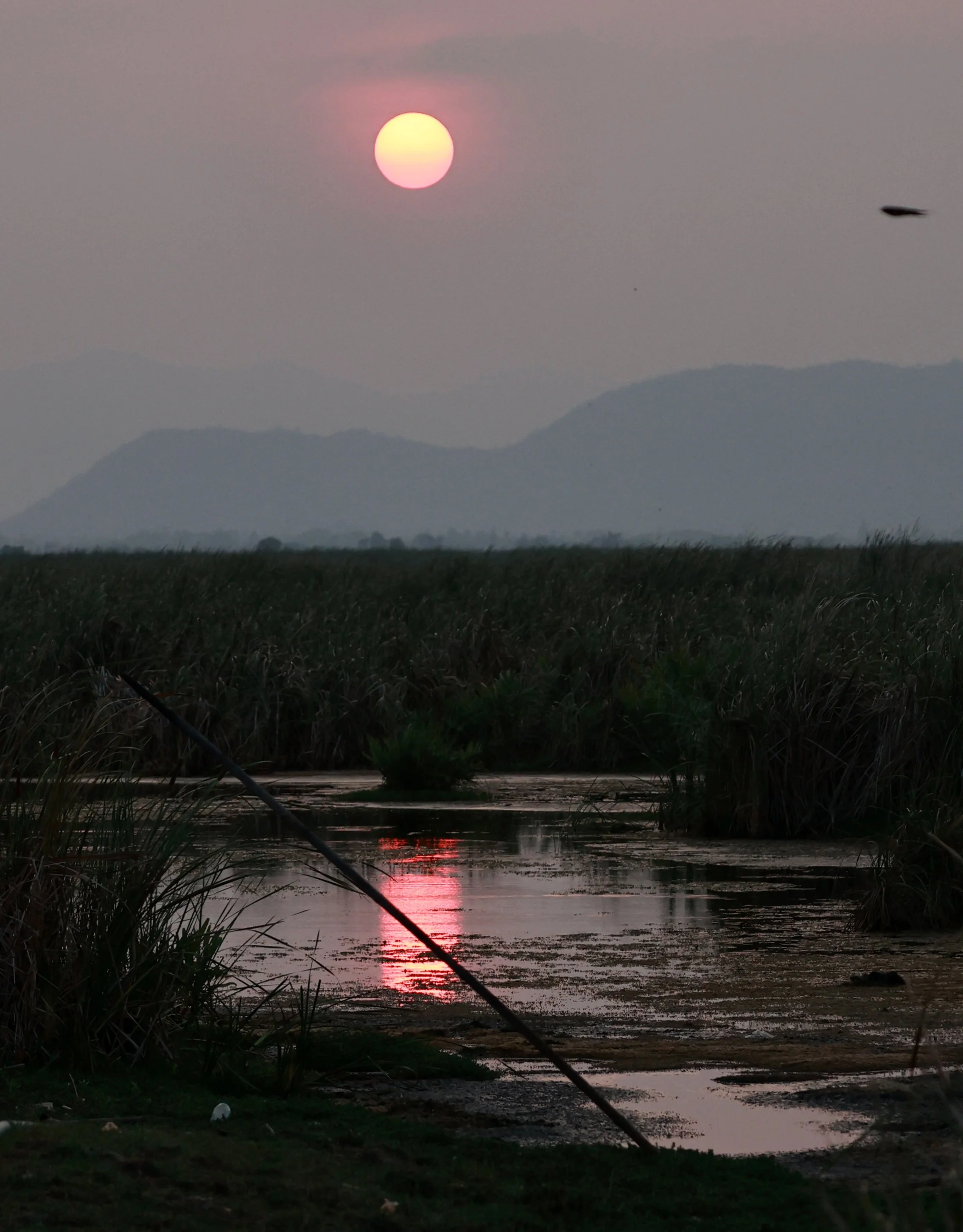
Smoky haze over the Khao Sam Roi Yod wetlands.
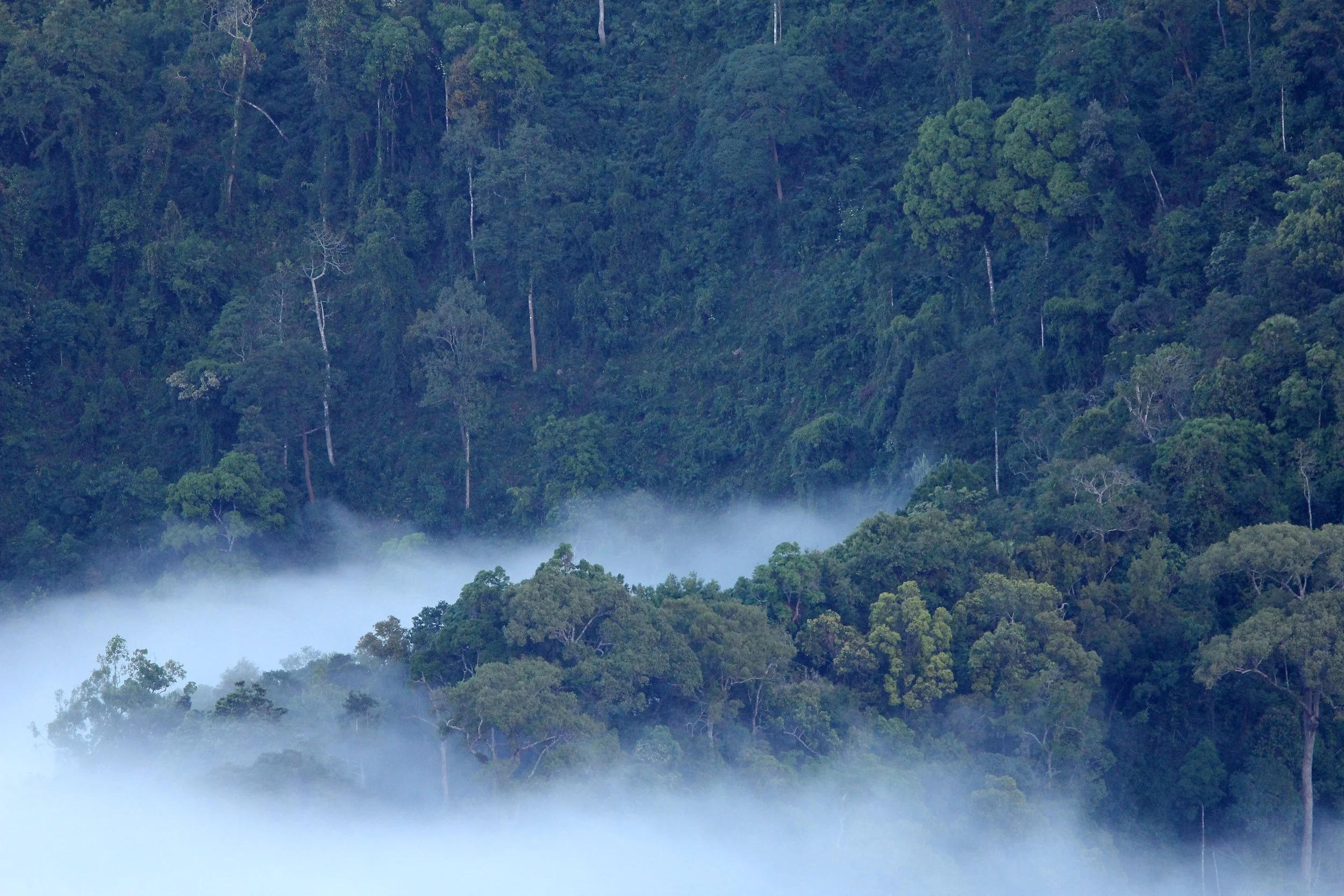
“In Kaeng Krachan, conservation is not just the protection of a forest—it's the safeguarding of an entire living system, where every elephant, every bird, and every silent invertebrate threads together the future of Thailand’s wild heritage.
IB ESS HL QUESTIONS
Case Study: Kaeng Krachan Forest Complex (Thailand)**
1‑mark questions (knowledge/recall)
Define the term biodiversity hotspot in the context of tropical forest ecosystems.
State one reason why the Kaeng Krachan Forest Complex is considered important for regional conservation efforts.
Identify one globally endangered species found within the Kaeng Krachan landscape.
2‑mark questions (simple application)
Outline two factors that contribute to high species richness in the Kaeng Krachan region.
Explain how elevation changes within the Kaeng Krachan Forest Complex influence vegetation zones.
3‑mark questions (short analysis/application)
Describe how the location of Kaeng Krachan—at the intersection of multiple biogeographical realms—affects species diversity.
Explain the ecological significance of maintaining large, continuous forest areas such as Kaeng Krachan.
Suggest reasons why monitoring elusive species (e.g., big cats or pangolins) is challenging in dense evergreen forest systems like Kaeng Krachan.
4‑mark questions (data‑based reasoning / mid‑level analysis)
Discuss how the presence of multiple forest types (semi‑evergreen, dry evergreen, mixed deciduous, montane, etc.) contributes to niche diversity in the Kaeng Krachan Forest Complex.
Explain how human activities at the boundaries of Kaeng Krachan National Park may influence wildlife movement and population dynamics.
5‑mark questions (applied analysis / processes)
Analyse how conservation strategies such as SMART patrols or transect‑based monitoring could reduce threats to endangered species in Kaeng Krachan.
Discuss the implications of ecotourism (e.g., mammal watching, birdwatching) for both conservation and disturbance in the Kaeng Krachan region.
6‑mark questions (higher‑level analysis)
Explain, using systems thinking, how feedback loops might develop between local communities, forest resources, and wildlife populations in the Kaeng Krachan Forest Complex.
Evaluate the role of regional collaborations (e.g., between Thailand and Myanmar) in ensuring effective conservation for transboundary species in the Tenasserim Range.
7‑mark questions (extended reasoning)
Discuss how the presence of multiple apex predators (e.g., tigers, leopards, clouded leopards) influences trophic structure and ecosystem stability in Kaeng Krachan.
Evaluate the potential ecological consequences if one major forest type (e.g., moist evergreen forest) were significantly reduced due to climate‑related shifts.
8‑mark questions (HL depth, strong evaluation)
Evaluate the effectiveness of protected‑area designation (e.g., UNESCO World Heritage status) as a long‑term conservation strategy for the Kaeng Krachan Forest Complex, considering both ecological and socio‑political factors.
Examine the relationship between indigenous community rights and biodiversity conservation, using Kaeng Krachan as an example of complex human–environment interactions.
9‑mark questions (full HL essay‑style)
To what extent can integrated conservation approaches—combining scientific monitoring, community engagement, law enforcement, and transboundary cooperation—ensure the long‑term ecological integrity of the Kaeng Krachan Forest Complex?
Assess the vulnerability of the Kaeng Krachan ecosystem to climate change, focusing on projected impacts on forest structure, species distributions, and ecosystem services
Marking Scheme: Kaeng Krachan Forest Complex Questions
1‑mark questions (knowledge/recall)
Q1–3 Markscheme
Award 1 mark for each:
A precise definition or correct single fact.
No elaboration needed.
Examples of acceptable answers:
Biodiversity hotspot: an area with high species richness and high levels of threat.
Any valid conservation reason (e.g., presence of endangered species).
Any correctly named endangered species (e.g., tiger, Siamese crocodile, Asian elephant).
2‑mark questions (simple application)
Q4–5 Markscheme
Award 1 mark per relevant point, up to 2 marks total.
Q4: Factors leading to high species richness:
Intersection of biogeographical zones
Wide range of forest types
Altitudinal variation
Large, continuous habitat
Q5: Influence of elevation on vegetation:
Changes in temperature/moisture with altitude
Transition from evergreen lowland forest to montane vegetation
3‑mark questions (short analysis/application)
Q6–8 Markscheme
Award 1 mark per developed point, up to 3 marks.
Answers should show cause–effect reasoning.
Q6: Influence of biogeographical intersection
Meets Himalayan, Indochinese, and Sundaic realms
Brings species from multiple evolutionary lineages
Increases overlap and hybrid diversity zones
Q7: Significance of continuous forest
Supports genetic flow
Allows wide‑ranging species (e.g., big cats) to survive
Reduces edge effects and fragmentation
Q8: Challenges of monitoring elusive species
Dense vegetation reduces visibility
Nocturnal/solitary behaviour
Low population density makes encounters rare
4‑mark questions (mid‑analysis / explanation)
Q9–10 Markscheme
Award up to 4 marks:
2–3 developed, accurate explanations, and
Logical linking to ecological concepts.
Q9: Multiple forest types → niche diversity
Different forest structures provide microhabitats
Vertical stratification supports arboreal vs terrestrial species
Mixed deciduous vs evergreen offers seasonal resource variation
Montane zones support specialised species
Q10: Human influence at park boundaries
Habitat encroachment disrupts migration routes
Increased human–wildlife conflict (e.g., elephants)
Road/settlement development causes fragmentation
Disturbance reduces breeding success or pushes species deeper into forest
5‑mark questions (applied analysis)
Q11–12 Markscheme
Award 5 marks for:
Clear structure
Detailed analysis
Use of ESS concepts (monitoring, sustainability, conservation strategies)
Q11: Conservation strategies such as SMART patrols
Reduce poaching through deterrence/presence
Improve data collection on species distribution
Early detection of illegal logging
Supports adaptive management
Builds long‑term datasets for trend analysis
Q12: Implications of ecotourism
Positive: funding, awareness, local income, incentives for conservation
Negative: disturbance to sensitive species, trail erosion, noise pollution
Balanced perspective required for full marks
6‑mark questions (HL analytical depth)
Q13–14 Markscheme
Award up to 6 marks for:
Systems thinking (inputs, outputs, feedback loops)
Complex reasoning
Clear link to case study dynamics
Q13: Feedback loops with communities
Positive loops: sustainable harvesting → stable wildlife → community benefit
Negative loops: overharvesting → population decline → increased pressure
Socioeconomic drivers affecting conservation behaviours
Q14: Regional collaboration evaluation
Shared species (elephants, big cats) require cross-border protection
Benefits: reduced poaching corridors, combined patrols, knowledge exchange
Challenges: political tension, inconsistent enforcement
Must include evaluative judgement
7‑mark questions (extended reasoning)
Q15–16 Markscheme
Award up to 7 marks for:
Deep ecological reasoning
Multiple linked ideas
Clear evaluative elements
Q15: Impact of multiple apex predators
Regulate herbivore populations
Reduce mesopredator release
Increase trophic complexity
Promote ecosystem resilience
Evaluation: risk of imbalance if one predator declines
Q16: Consequences of forest‑type reduction
Loss of specialist species
Altered hydrological cycles
Reduction in carbon storage
Increased vulnerability to invasive species
Must include assessment of severity/likelihood
8‑mark questions (high-level evaluation)
Q17–18 Markscheme
Award up to 8 marks for:
Balanced evaluation
Multiple perspectives (ecological, political, social)
Well‑structured argument
Q17: Effectiveness of protected‑area designation
Strengths: funding, global oversight, enforcement pressure
Weaknesses: may not prevent local conflict, limited staff/resources
Needs strong evaluative conclusion.
Q18: Indigenous rights vs conservation
Role of traditional knowledge
Land‑use conflict risks
Ethical dimension
Co‑management strategies
Evaluation of trade‑offs required
9‑mark questions (full HL mini‑essay)
Q19–20 Markscheme
Award up to 9 marks for:
Holistic, coherent essay‑style answer
Strong structure (intro → argument → conclusion)
Critical evaluation, not just description
Use of ESS frameworks (biodiversity, resilience, sustainability, governance)
Q19: Integrated conservation approaches
Must discuss all major components: scientific monitoring, community engagement, law enforcement, transboundary cooperation
Evaluate synergies and limitations
Conclude on overall effectiveness
Q20: Climate‑change vulnerability
Effects on forest composition
Species range shifts (altitudinal migration)
Changing rainfall patterns
Impacts on ecosystem services
Final judgement: extent of vulnerability + uncertainties